nj2va
-
Posts
13,693 -
Joined
-
Last visited
Content Type
Profiles
Blogs
Forums
American Weather
Media Demo
Store
Gallery
Everything posted by nj2va
-
Intern needs to relearn how to paint inside the lines.
-
Yup, I don’t really care that it’s an OP at range. It shows the progression that completely makes sense based on Ens and pattern evolvement. I also love the 50/50 low on the OP.
-
I wanted to see the next 24 hours after the 6z ended. We were ready to ring in 2024 with a bang.
-
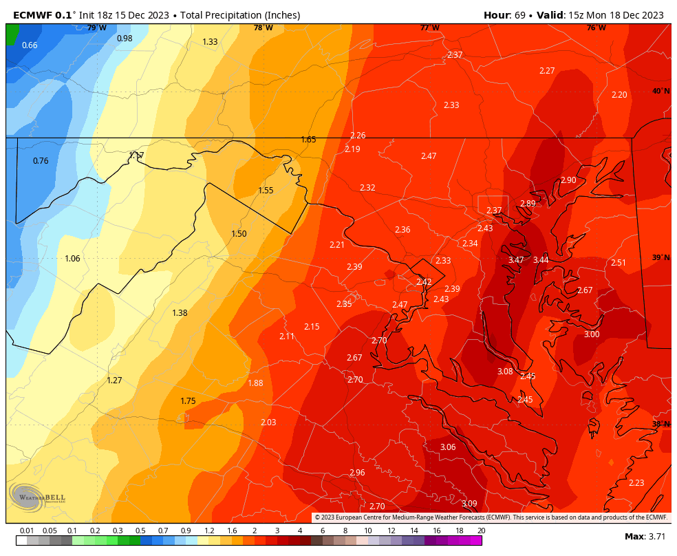
18z Euro QPF

-
Just got home from the office and made a margarita. Getting ready for my 75 degree Christmas apparently!
-
Wow, so basically this "can kicking its time to punt all of January" is turning out to be like 48 hours of "can kicking." I hope the debs can handle it.
-
Using an ensemble at 330 hours to look at 850mb temps? Not sure I would look that hard at this stage. I don't think ensembles would key in on things like that at this point.
-
That upper level feature helps to enhance upslope for the mountains at the very least. I'm not smart enough to say what it means for east of the mountains.
-
Nice to see Hs and Ls in the right place for that window on the 6z GFS OP.
-
You must be a hit at parties
-
Are people still punting through the end of January? I won’t sleep until I hear what osfan says
-
GFS with quite the rain maker starting Sunday. Basically occludes and stalls over the Mid Atlantic. 2-4”+ area wide. Gotta think with this active STJ, we’ll score with a significant snowstorm once we get some help from the pac and atl.
-
With the way this STJ is flexing, I find it hard to believe we don’t see at least one big coastal.
-
This is why the overreactions and fly by shit posts of “I guess we’re punting through the end of January” not only do nothing for the thread, but we’ve seen things flip regularly on the models.
-
Someone remind osfan that this thread exists.
-
28, frosty!
-

Mid-Atlantic Snow Totals Thread - Winter 2023-2024
nj2va replied to mattie g's topic in Mid Atlantic
12/11/2023: 0.3” Season Total: 0.3” -
Nice to see us get on the board!
-
Just woke up and looked outside. Have a coating on the mulch/grass.
-
Pouring here again. Temp down to 40.
-
Dropped another degree to 42. Impressive on the temp drops.
-
Down to 43.
-
Dude, bring it home.
-
Looks like 850 line about to pass through Leesburg on SPC analysis.
-
24-6!