nj2va
-
Posts
13,693 -
Joined
-
Last visited
Content Type
Profiles
Blogs
Forums
American Weather
Media Demo
Store
Gallery
Everything posted by nj2va
-
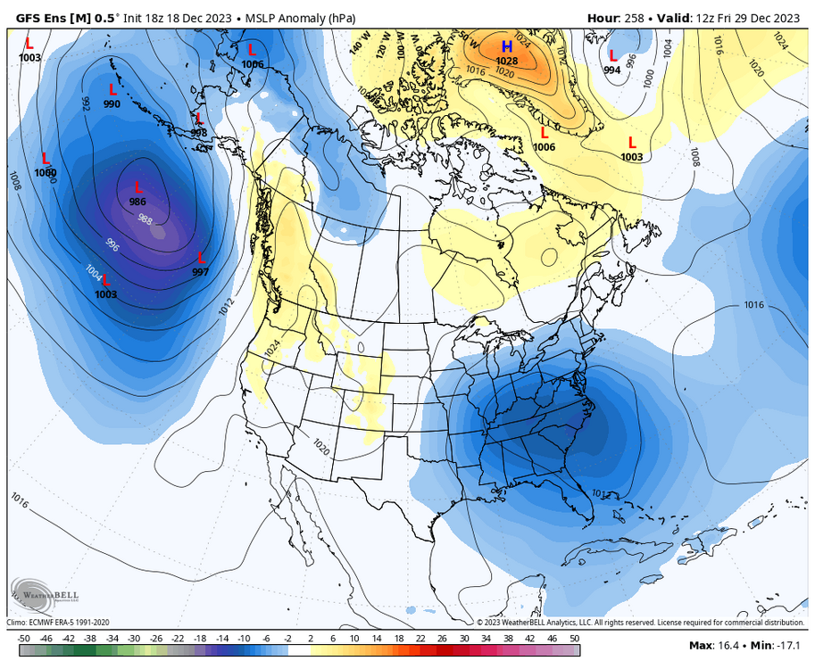
Pretty good signal on the surface map with high pressure anomalies north of the area and LP in the SE.
-
I love Nubble. We were in Ogunquit for a week in July - is that ice cream place down the street from Nubble open in the offseason? Used to be called Browns years ago but it changed its name in the last two years or so.
-
Ski resorts are loving the 18z GFS for next Friday's threat.
-
Wisp cam is rocking.
-
More ridging poking into Greenland too.
-
I'll look for you on the slopes. Mountain Report + Cams - Wisp (wispresort.com) - snow coming down at Wisp
-
NWS upped totals for the mountains. Wisp and Canaan cams will be fun later today.

-
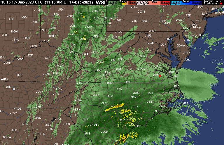
Heavy rain, local PWS are all over the place but seems to be about 2”.
-
Closest PWS are between 1.2-1.4”. Heavy rain.
-
Absolutely pouring. 0.6”
-
We’ll be in Deep Creek then before heading up to northern NH to celebrate New Year’s / turning 40. But if Deep Creek looks to get more snow before/after New Years, I’ll cancel the trip. Snow is serious business.
-
Signal on the GEFS between Christmas and NYE for a possible threat to track. We probably want to see a weaker wave slide south of us but I’ll let the smarter folks weigh in.
-
The Bills finally look like the team they should have been all season.
-
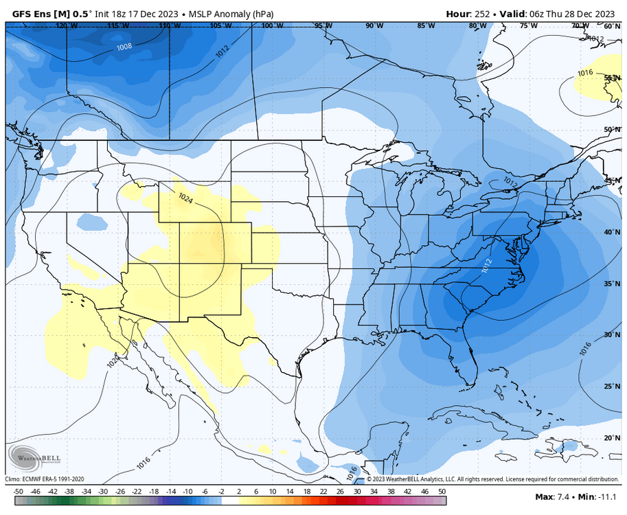
It’s only a matter of time when one of those exit the coast, becomes a 50/50 low, locks in a H over Quebec - while the next is strengthening in the TN valley. And well, we know what’s next.
-
Steady light rain.
-
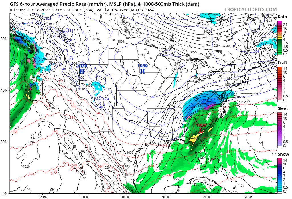
I forget what these maps have looked like. My goodness.
-
Here she comes:
-
HRRR has precip arriving between 1p and 2p. And brings in waves of very heavy rain later tonight.
-
That’s a really sweet look on the EPS. With the Pacific looking that like, we don’t need a perfect Atlantic. But saying that, roll that forward a few more days, and the Atlantic would be even better. You’ve got to like where we’re going in early January. And I still think the few days leading up to New Years will present an opportunity especially for areas west of 95.
-
Got some light fog this morning. It’s nice to see another healthy QPF system .
-
I have to think Osfan does it for attention, right?
-
I dunno dude, looks like we should just start planting our gardens for the year. Wall to wall spring is in store. Just punt it all.
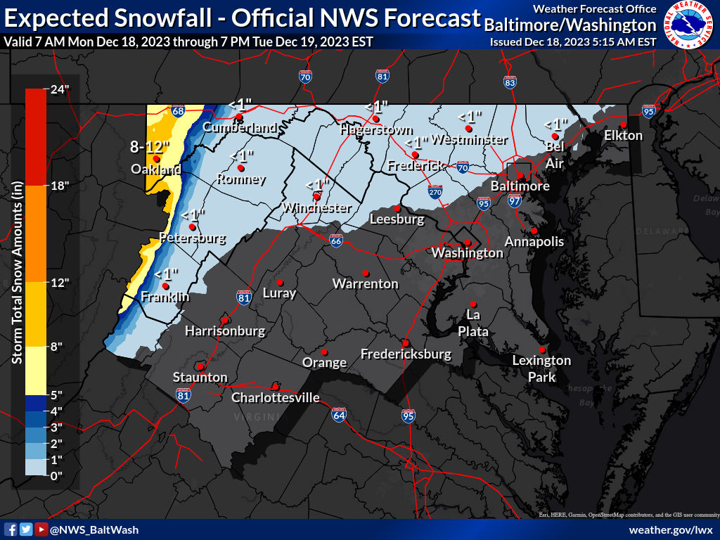
-
Winter Storm Watch for the mountains. 6-12”, highest totals above 2500’ URGENT - WINTER WEATHER MESSAGE National Weather Service Baltimore MD/Washington DC 251 PM EST Sat Dec 16 2023 MDZ001-VAZ503-WVZ501-505-170400- /O.NEW.KLWX.WS.A.0003.231218T1800Z-231219T1500Z/ Garrett-Western Highland-Western Grant-Western Pendleton- 251 PM EST Sat Dec 16 2023 ...WINTER STORM WATCH IN EFFECT FROM MONDAY AFTERNOON THROUGH TUESDAY MORNING... * WHAT...Heavy snow possible. Total snow accumulations around 6 to as much as 12 inches possible. The highest accumulations will be along/west of the Allegheny Front for elevations above 2,500 feet. West to northwest wind gusts around 40 to 50 mph are possible as well. * WHERE...In Maryland, Garrett County. In Virginia, Western Highland County. In West Virginia, Western Grant and Western Pendleton Counties. * WHEN...From Monday afternoon through Tuesday morning. The heaviest snow is most likely late Monday afternoon through Monday night. * IMPACTS...Travel could be very difficult. The hazardous conditions could impact the Monday evening commute and the Tuesday morning commute. * ADDITIONAL DETAILS...The combination of snow and blowing snow will cause visibility to be reduced to below one-half mile at times with near blizzard conditions possible.
-
I dunno. Ers weather guy said it definitely won’t snow this winter. And Mets are never wrong.