nj2va
-
Posts
15,347 -
Joined
-
Last visited
Content Type
Profiles
Blogs
Forums
American Weather
Media Demo
Store
Gallery
Everything posted by nj2va
-
Getting out of dinner and it’s a dendrite snow globe. 14 cold degrees.
- 776 replies
-
- 16
-

-

-
Indiana is carving up Alabama, what a half
-

12/31-1/1 Possible Snow Showers/Squalls to Start 2026
nj2va replied to bncho's topic in Mid Atlantic
Glad to read the reports of the squall! Currently 9 degrees and a bluebird day with 8-9” of fresh powder. Happy 2026 yall!- 161 replies
-
- 19
-
-
-
Happy new year weenies! What a great forum we have
-
12/31-1/1 Possible Snow Showers/Squalls to Start 2026
nj2va replied to bncho's topic in Mid Atlantic
Thanks! It’s easily 1-2”/hr rates right now, just dumping fatties. Heavy snow and college football - can life get better? Ha. (My partner would say otherwise but he doesn’t have a choice on my BD lol) -
12/31-1/1 Possible Snow Showers/Squalls to Start 2026
nj2va replied to bncho's topic in Mid Atlantic
Adding a quick video from a few minutes ago. Now about 75/25 dendrites- 161 replies
-
- 12
-
-
-

-
12/31-1/1 Possible Snow Showers/Squalls to Start 2026
nj2va replied to bncho's topic in Mid Atlantic
Yeah, that doesn’t even do it justice. It’s puking snow -
12/31-1/1 Possible Snow Showers/Squalls to Start 2026
nj2va replied to bncho's topic in Mid Atlantic
Mixture of everything and hard to capture on camera with the wind. It’s been about 50-50 dendrites and smaller flakes on average. Absolutely ripping -
12/31-1/1 Possible Snow Showers/Squalls to Start 2026
nj2va replied to bncho's topic in Mid Atlantic
Winds really picking up with gusts in the mid 30s and it’s dumping. Can’t ask for a better birthday treat!- 161 replies
-
- 15
-
-

-
The lit up Washington Monument for America’s 250th is neat
-
12/31-1/1 Possible Snow Showers/Squalls to Start 2026
nj2va replied to bncho's topic in Mid Atlantic
Snow has started -
12/31-1/1 Possible Snow Showers/Squalls to Start 2026
nj2va replied to bncho's topic in Mid Atlantic
8-12”, gimme gimme. SN- and freezing drizzle here — got a glaze of ice. -
12/31-1/1 Possible Snow Showers/Squalls to Start 2026
nj2va replied to bncho's topic in Mid Atlantic
I haven’t been diligent this time especially with the wind making measuring almost impossible. Wisp is reporting 3” overnight so I’ll just go with that. I’ll try to measure tonight/tomorrow’s storm so you can keep your tally going. LWX point and click says 1-3” today and 5-9” tonight - it feels like we’ll end up on the higher end of those ranges based on how this first wave over performed. The lift is impressive on the models and the trajectory of the wave will really enhance upslope — that coupled with the ratios of upper teens/low 20s:1 and I’m excited for tonight. Hope your chase is epic! -
12/31-1/1 Possible Snow Showers/Squalls to Start 2026
nj2va replied to bncho's topic in Mid Atlantic
Nice! Even a broken clock is right twice -
12/31-1/1 Possible Snow Showers/Squalls to Start 2026
nj2va replied to bncho's topic in Mid Atlantic
Overperformed overnight with this initial disturbance. I drove out to Morgantown at 630a for a workout class at Orangetheory which wasn’t the best idea. White knuckle driving the whole way on 68. Roads were not in good shape between the falling and blowing snow. We had about 1.5” when I left the house, time to head back. -
12/31-1/1 Possible Snow Showers/Squalls to Start 2026
nj2va replied to bncho's topic in Mid Atlantic
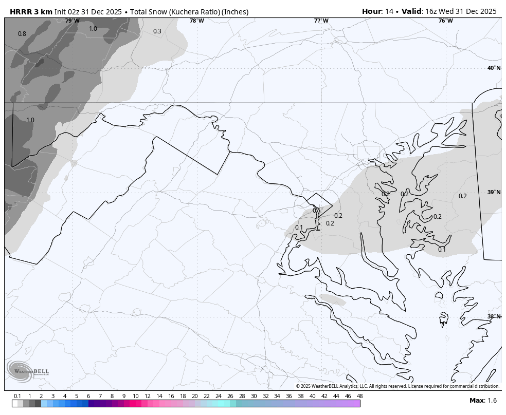
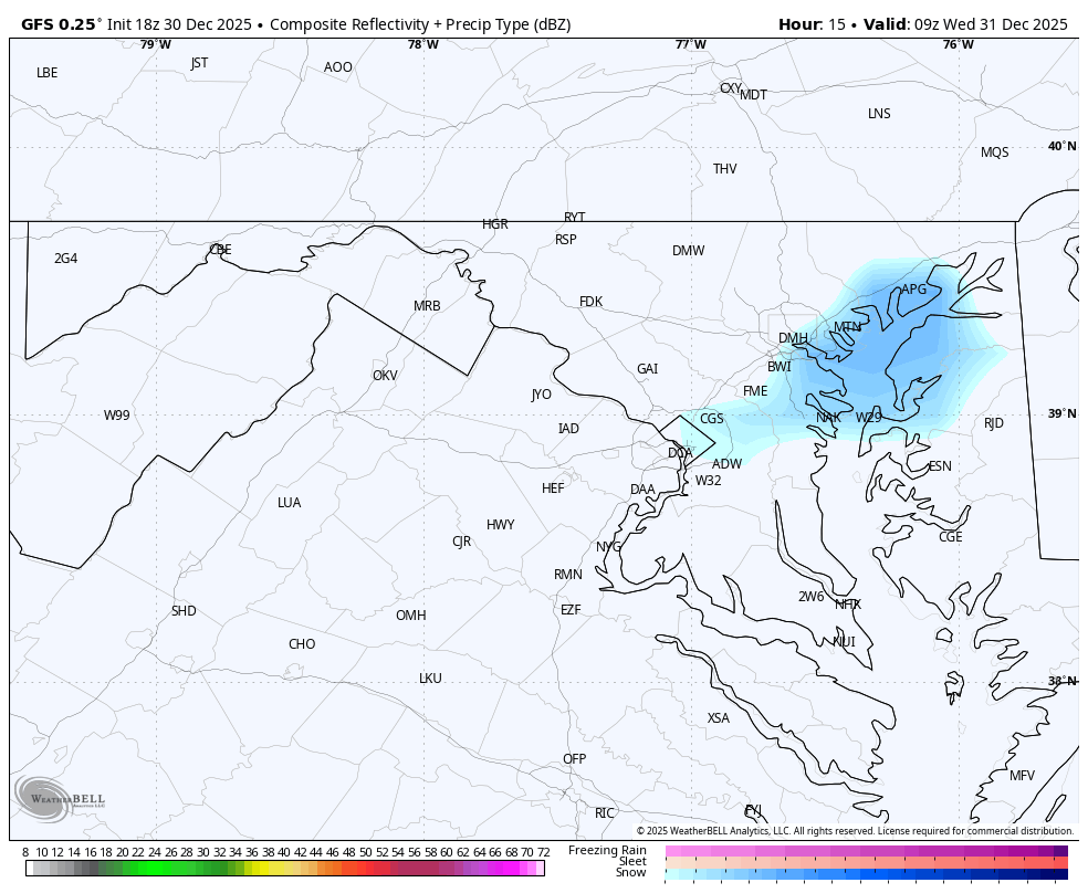
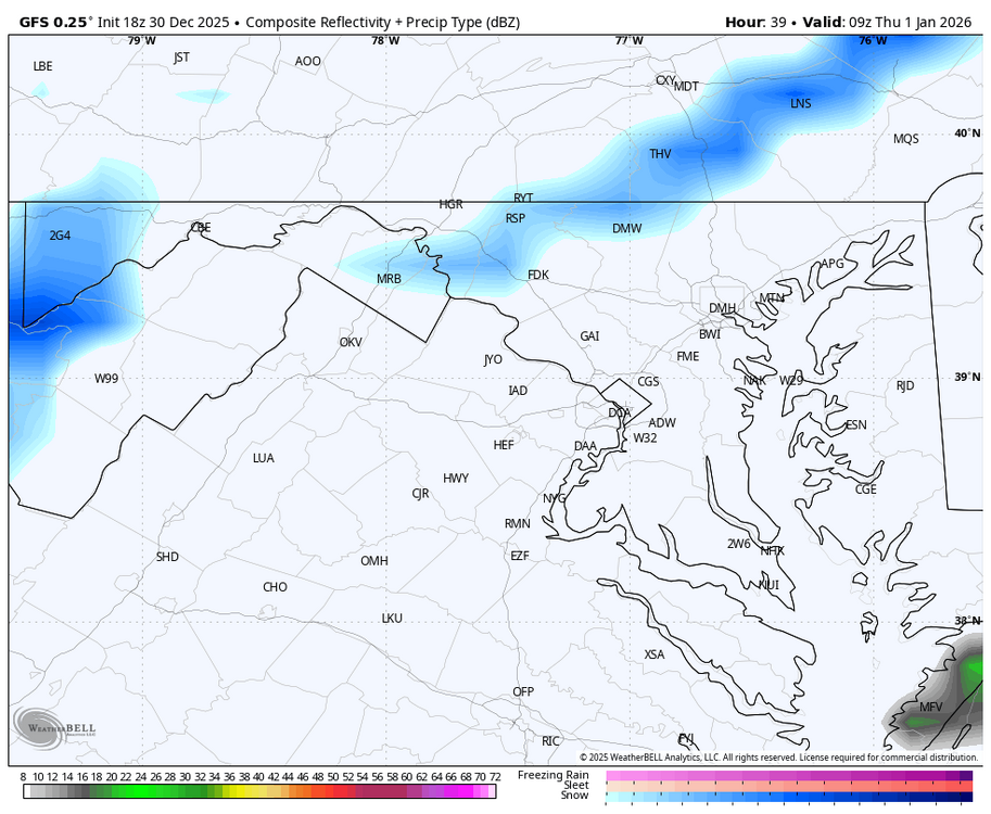
HRRR continues to show parts of the Eastern Shore into DC/Alexandria see snow overnight.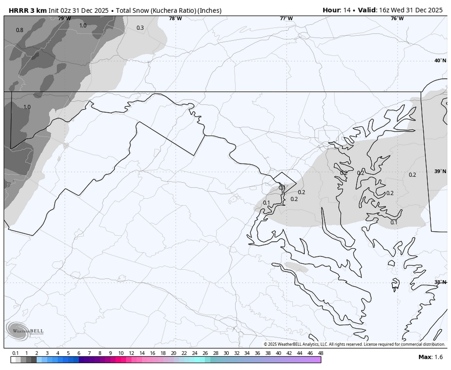
-
12/31-1/1 Possible Snow Showers/Squalls to Start 2026
nj2va replied to bncho's topic in Mid Atlantic
HH has started (continuing) here. Currently making homemade ravioli — pasta dough is resting and making the filling now. Happy New Years Eve Eve! -
12/31-1/1 Possible Snow Showers/Squalls to Start 2026
nj2va replied to bncho's topic in Mid Atlantic
Not much on the snow maps but simulated radar shows possible flakes both tomorrow morning and NYD in parts of the area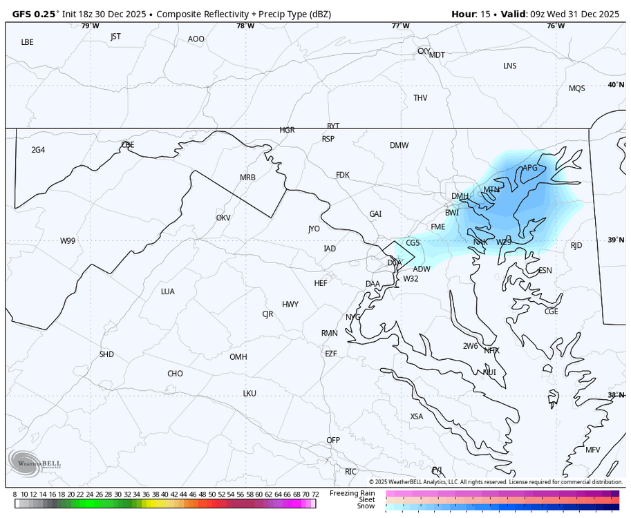
-
LFG ...WINTER STORM WARNING IN EFFECT FROM 4 PM WEDNESDAY TO 10 AM EST THURSDAY... * WHAT...Heavy snow expected. Total snow accumulations between 5 and 9 inches. Winds gusting as high as 50 mph. * WHERE...In Maryland, Eastern Garrett and Western Garrett Counties. In West Virginia, Western Grant, Western Mineral, and Western Pendleton Counties. * WHEN...From 4 PM Wednesday to 10 AM EST Thursday. * IMPACTS...Visibilities may drop below 1/4 mile due to falling and blowing snow. Near-blizzard conditions are expected at times, and will make travel treacherous and potentially life-threatening. Travel will be very difficult. The hazardous conditions could impact the Wednesday evening and Thursday morning commutes. The combination of gusty winds and heavy snowfall could bring down trees and powerlines, potentially resulting in numerous power outages. * ADDITIONAL DETAILS...The onset of near-blizzard conditions could be just before midnight on New Year`s Eve and continue into the early morning hours of New Year`s Day. Make preparations now to avoid travel during this time.
-
Lunch with a view…15 degrees and snow showers.
- 604 replies
-
- 10
-
-
-
-
"a model run comes in, people rejoice. a model run comes in, people jump off a cliff" - he must browse this forum.
-
Good rates, wind relentless.
-
15 degrees with SN. Looking at the deck and you’d think it wasn’t snowing because the wind is blowing it all over but it looks like a snow globe. Gusts to the 40s right now.
-
It’s snowing outside, I’m on my 2nd cocktail, and I just finished cleaning up dishes after making braised short ribs and roasted garlic mashed potatoes for dinner. Even Will’s 24H downer maps won’t impact my mood
-
Ralph just go full on weenie, LFG