

nj2va
-
Posts
15,349 -
Joined
-
Last visited
Content Type
Profiles
Blogs
Forums
American Weather
Media Demo
Store
Gallery
Everything posted by nj2va
-
lol, love the boo birds from the world’s best fans
-
Steelers have no business being in the playoffs lol
-
He’s a stud, he made play after play in the game when he needed to. 3 of the losses were to ref favorite KC/Mahomes including the epic OT game which finally led the NFL to changing their playoff rules.
-
NFL is 3 for 3 with amazing wild card games this weekend. Josh Allen is an absolute beast.
-
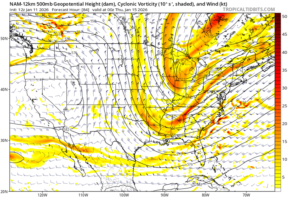
Yeah, its better but wouldn’t do it if it went beyond 84 is my weenie guess.
-
I like the look of the NAM at 69…digging pretty good.
-
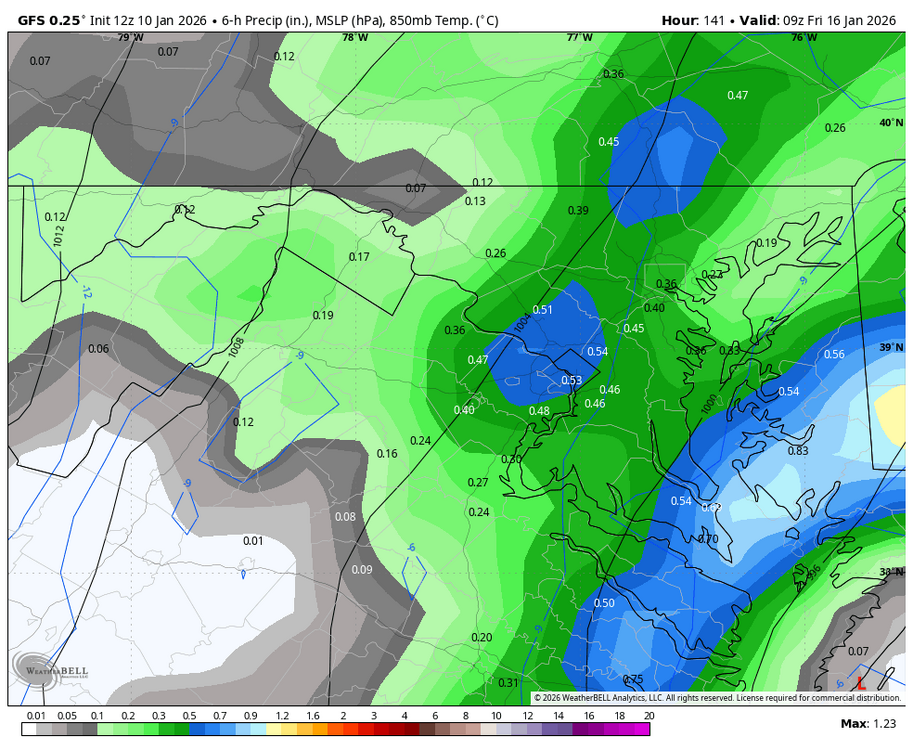
HoCo death band back…getting you ready for Thursday.
-
Very cool, great shot!
-
Sunny here!
-
Euro’s got it but better for north. Signal’s there.
-
Gettin’ diggy with it
-
But what do the snow map probabilities show?
-
A bit over an 1”, nice event and much needed rain.
-
Fun game, Stafford so good
-
Snow showers in the forecast for the Bears game tonight. I love snow football games.
-
Check out this 6 hour precip panel on the GFS. Temps falling into the 20s and dumping. Blah blah, I know its the GFS 150 hrs out but fun to see.
-
That’s all I need to see and know its a banger.
-
I honestly missed that until watching last night’s game. Cignetti makes me laugh with how mad he always look even after a great play - but then in the post game interview on the field, told the reporter he needs a beer lol. It’s honestly such a great story and shows that programs can go from nothing to (almost) a national champion.
-
Rooting for IU over Miami. Way better story and I like Mendoza.
-
They look unstoppable. What a complete performance so far.
-
I’ve been interested in that aspect of this for sure, especially over the holiday weekend. Great timing for the ski resorts if that played out - but verbatim that’s a legit setup for upslope with the trough and energy.
-
61 at home, 75 in Dallas (work travel)
-
Yep, same here...out of school the whole week and literally remember the huge piles of snow everywhere that we turned into forts and caves. My friends and I hid behind one of them and threw snowballs at cars driving on the side street...oops.


