nj2va
-
Posts
14,446 -
Joined
-
Last visited
Content Type
Profiles
Blogs
Forums
American Weather
Media Demo
Store
Gallery
Everything posted by nj2va
-
Speak for yourself
-
Let’s lock it up just like a caps win with an ovi goal tonight
-
Can I do that here?
-
Yeah, you're right
-
This type of setup favors north of here to max out on snowfall totals in the east. If you get 25" of snow who cares that Boston (which averages significantly more snow) gets 40".
-
No ice even on metal railings or cars here. Got to my 610a fitness class fine.
-
Got down to 31.8 but have been steadily just above freezing all night. 32.5 with rain.
-
34.3/24
-
34.9 / 22
-
I honestly don’t even understand that reference. Hopefully a week from now, everyone is digging out from a forum wide MECS.
-
17 goals to go for Ovi!
-
And for 5,000 years before that, the north trend has always worked. In general, your area is always favored over southern/DC. Hopefully everyone in the forum is happy.
-
Looks great. That’s almost half of climo in MBY, lol
-
EZF gets ~20” of snow from both events.
-
I like how it looks…famous last words. Angle of the precip is great at 156.
-
Didn’t you hear DC averages 70” of snow/year so we scoff at 6-10” storms apparently
-
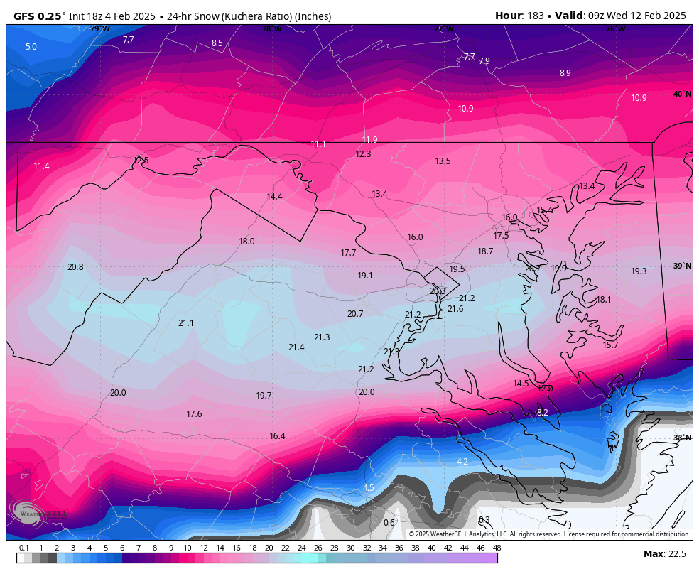
Another fun map. 18z gfs 24 hr snowfall. Basically averaging 1”/hour. Giddy.

-
Is this the thread to talk about what may happen after this pattern change when the about to be pattern change does another about to be pattern change and a SER takes over and we hit 75 on Feb 19?
-
why are we talking about a change in the pattern before the pattern changed?
-
Butter us up all you want but the eagles still suck
-
Is that a trend or one run?
-
Didn’t you just say you wanted a legit ice storm at 23 degrees in the other thread?
-
And to think, we’re getting into sun angle season
-
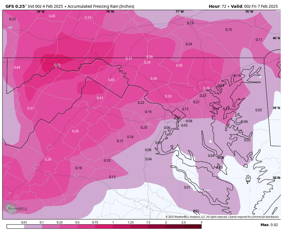
While I wouldn’t trust the GFS over the mesos at this range, it shows an icy morning Thursday across the area, especially favored N areas. A significant event for eastern Garrett / western Allegheny county.