MotoWeatherman
-
Posts
2,282 -
Joined
-
Last visited
Content Type
Profiles
Blogs
Forums
American Weather
Media Demo
Store
Gallery
Everything posted by MotoWeatherman
-

2019/2020 Mountains and Foothills Fall/Winter Thread.
MotoWeatherman replied to Tyler Penland's topic in Southeastern States
Solid dusting here on Beech with flakes flying -
2019/2020 Mountains and Foothills Fall/Winter Thread.
MotoWeatherman replied to Tyler Penland's topic in Southeastern States
11.4 at 4650 on Beech. Just about 1000 feet higher it's 7 on top of Beech. Frigid! -
2019/2020 Mountains and Foothills Fall/Winter Thread.
MotoWeatherman replied to Tyler Penland's topic in Southeastern States
Solid flakes still flying here on Beech. Frigid temp down to 11.6. -
2019/2020 Mountains and Foothills Fall/Winter Thread.
MotoWeatherman replied to Tyler Penland's topic in Southeastern States
Is the Elk Park store now your working location? -
2019/2020 Mountains and Foothills Fall/Winter Thread.
MotoWeatherman replied to Tyler Penland's topic in Southeastern States
Pouring snow here on Beech. Down to 27.6. So far the HRRR was spot on with timing. -
2019/2020 Mountains and Foothills Fall/Winter Thread.
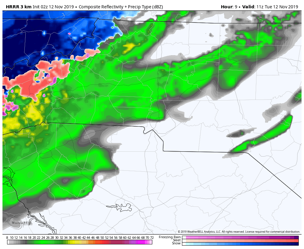
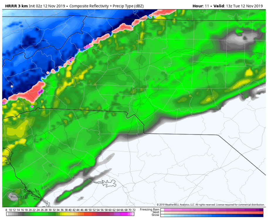
MotoWeatherman replied to Tyler Penland's topic in Southeastern States
I've found the HRRR to be pretty decent on this type of stuff in this short of a range (ie less than 12 hours out) And yeah ..TN line locations will do best with this type of setup. -
2019/2020 Mountains and Foothills Fall/Winter Thread.
MotoWeatherman replied to Tyler Penland's topic in Southeastern States
HRRR has been rock solid consistent in showing flip to snow along the TN border areas of NC by 6am with a rapid change over to the border counties by 9am. Then it's a quick few hours of snow before the flow sets up for the high peaks the rest of the day.
-
2019/2020 Mountains and Foothills Fall/Winter Thread.
MotoWeatherman replied to Tyler Penland's topic in Southeastern States
Got another dusting of snow here at 4650 on Beech. Sun is coming out now. -
2019/2020 Mountains and Foothills Fall/Winter Thread.
MotoWeatherman replied to Tyler Penland's topic in Southeastern States
28.9 with a coating on the ground here at 4650 on Beech.
-
2019/2020 Mountains and Foothills Fall/Winter Thread.
MotoWeatherman replied to Tyler Penland's topic in Southeastern States
Light snow here on Beech. 2nd flakes of the season. Temp is 32. Yes!!! -
2019 Mountains and Foothills Spring/Summer thread
MotoWeatherman replied to FlatLander48's topic in Southeastern States
Finally pouring snow at 4650 on Beech. Ground is starting to turn white just a bit. But temp is still 33.8. -
2019 Mountains and Foothills Spring/Summer thread
MotoWeatherman replied to FlatLander48's topic in Southeastern States
Flakes flying at 4650 on Beech. -
2019 Mountains and Foothills Spring/Summer thread
MotoWeatherman replied to FlatLander48's topic in Southeastern States
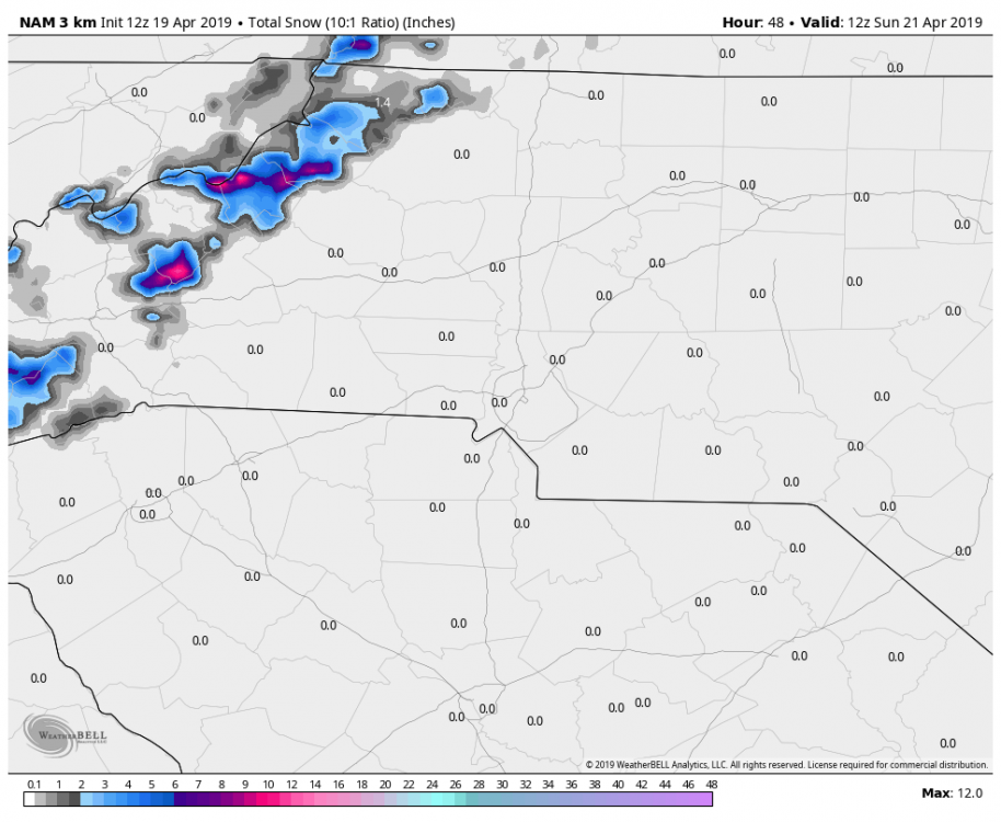
Here are the Kuchera and 10:1 maps. 3k Nam is very bullish on backside moisture swinging down through northern Al and then GA and then up through western NC. Basically around the base of the ULL. In my opinion I think elevations over 4k are good for 2+ inches while everyone else will struggle with surface temps for accumulations. We are getting closer to the wheel house range of the 3k NAM (inside 24hrs) so it can't be ignored despite the rest of the other models looking BLEH.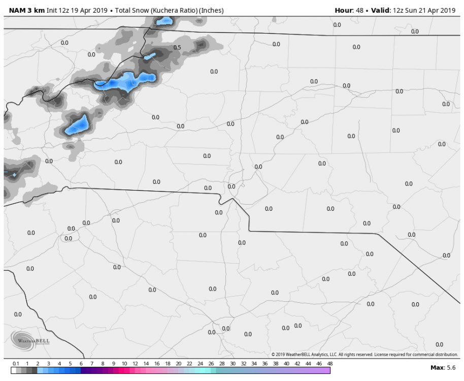
-
2019 Mountains and Foothills Spring/Summer thread
MotoWeatherman replied to FlatLander48's topic in Southeastern States
3.34 here in Dahlonega GA. 2.33 so far on Beech Mtn with a max wind gust of 52. 12z 3k NAM sure is bullish on the snow Saturday. -
2019 Mountains and Foothills Spring/Summer thread
MotoWeatherman replied to FlatLander48's topic in Southeastern States
Yes indeed. GFS, FV3 and Euro all trended further south and show some lee low development with prolonged snow Friday night through most of Saturday. If this trend holds I'll be making a drive up from GA for one more snow. -
2019 Mountains and Foothills Spring/Summer thread
MotoWeatherman replied to FlatLander48's topic in Southeastern States
Pouring fat flakes here at 4650 on Beech. Ground is turning white. -
December 8-10, 2018 Winter Storm
MotoWeatherman replied to Orangeburgwx's topic in Southeastern States
Perfect! -
December 8-10, 2018 Winter Storm
MotoWeatherman replied to Orangeburgwx's topic in Southeastern States
Can you please provide link for this? I'm coming up blanks looking for it. Thanks! -
Weather References and Newbie Information
MotoWeatherman replied to burgertime's topic in Southeastern States
Here is one........... Winter begins December 1st. Still counting Dec 20th as "fall" is a joke. Meteorological winter starts DECEMBER 1st.