
HighTechEE
-
Posts
567 -
Joined
-
Last visited
Content Type
Profiles
Blogs
Forums
American Weather
Media Demo
Store
Gallery
Everything posted by HighTechEE
-
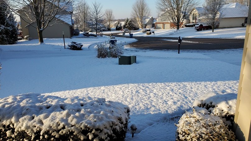
Update, snow became a little steadier about 11am IMBY, we have 1/3 to 1/2" on the grass and car tops now at 32.4 (coldest of the day so far).
-
First snow (storm) flakes of the season IMBY started about 8am this morning, radar looks like heavy snow down in Highland Co.
-
Haven't seen him recently.
-
November 30-December 2 *Potential* Winter Storm
HighTechEE replied to Hoosier's topic in Lakes/Ohio Valley
Very interesting article on the Nov 1950 storm, my dad said we got 3ft in our home town of Nelsonville, in NW Athens Co Ohio, this one had wicked artic air to work with and 100MPH winds blowing in from the Atlantic. Buffalo had mid 50's with Tstorms and the OV was in single digits!: https://www.wunderground.com/cat6/Great-Appalachian-Storm-Thanksgiving-Week-1950 -
Winter 2020-21 Medium/Long Range Discussion
HighTechEE replied to Hoosier's topic in Lakes/Ohio Valley
It happened once, Nov 1950! -
More often than not over the last 15yrs or so I usually put up my Xmas lights up wearing shorts around Thanksgiving AND take them down at New Years in shorts here in SW Ohio (also just before or after a round of golf).
-
I was staying at the Sandusky KOA walleye fishing over the weekend and yesterday morning was a b1tch trying to pack up and load the truck to head home, I bet 3" fell on us in the 3hr period starting at 5:30am! In contrast my yard on the SE of Dayton is burning up, only had more than a half inch in one day since the first of Aug!
-
This is an interesting ILN discussion, and colorful: https://forecast.weather.gov/product.php?site=NWS&issuedby=ILN&product=AFD&format=CI&version=1&glossary=1&highlight=off I posted this as my yard is drier than a popcorn fart!
-
From ILN's site: https://www.weather.gov/iln/20190527 The big one missed my office by a 1,000ft, I live 9 miles south of the Beavercreek path, stars were out at my house, looking north was solid/continuous lightning and thunder for 15mins! Never seen/heard that before in my life (I'm 60)! PS - I remember people posting they were seeing CAPS (spelling) during that out break that looked like what would occur in Oklahoma, what does that mean?
-
Sry for posting in Winter, but this is Ohio and Surrounding States. Close to 3.75" IMBY the past two days, still raining, eastern side of my town is FLOODED! One county west and one north has over 5"!
-
LOL, 12z GFS has Athens Co in SE Ohio getting over 6" Friday morning! We got 1" on May 8th back around 1990 (give or take a year), the reason I remember it as it was my dad's birthday and he wrote it in the snow on his car and took a pic!
-
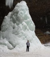
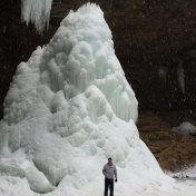
Agreed, my avatar pic is Feb '14 at Ash Cave in Hocking Hills, SE Ohio, that 85ft water fall was 5ft from being froze all the way to the top. The only time it froze all the way to the top was Jan/Feb of '78.
-
Has the first PDS this year been issued for the gulf coast states?
-
Nast rotation supercells rolled thru overnight tearing up northern Greene and southern Clark counties, blew street signs & trees down just north of Yellowsprings and a massive hail storm as well: https://www.whio.com/news/photos-severe/XAV3ZSAHTZAGDACDAMKPIMGW3Q/
-
I live in Sugarcreek Township so its not a road I normally take, but a buddy of mine lives on Fowler Dr a couple blocks away to the north, so it definitely has rerouted his runs to the south. City of Bellbrook is going to fix it as soon as they can, but will not see any state/federal relief until like July?
-
Picked up 4.33" the past three days IMBY on the SE side of Dayton, washed out this road last night in our town: https://www.whio.com/news/local/flood-waters-wash-away-bridge-bellbrook-neighborhood/yuBR77BKrslkPHI9N5ue1O/?icmp=cb_widget
-
Tornado Warning for the west side of Cincy! https://www.weather.gov/iln/ Well that was at 9:16, 5 mins later weakened: Tornado Warning Severe Weather Statement National Weather Service Wilmington OH 921 PM EDT Thu Mar 19 2020 KYC015-OHC061-200131- /O.EXP.KILN.TO.W.0002.000000T0000Z-200320T0130Z/ Boone KY-Hamilton OH- 921 PM EDT Thu Mar 19 2020 ...THE TORNADO WARNING FOR NORTHERN BOONE AND SOUTHWESTERN HAMILTON COUNTIES WILL EXPIRE AT 930 PM EDT... The storm which prompted the warning has weakened below severe limits, and no longer appears capable of producing a tornado. Therefore, the warning will be allowed to expire. However heavy rain is still possible with this thunderstorm. Please report previous tornadoes, wind damage or hail to the National Weather Service by going to our website at weather.gov/iln and submitting your report via social media. LAT...LON 3908 8486 3910 8483 3911 8482 3913 8482 3924 8469 3912 8456 3901 8480 TIME...MOT...LOC 0121Z 231DEG 37KT 3912 8475
-
This is interesting: https://noaa.maps.arcgis.com/apps/MapSeries/index.html?appid=7d42f4770dd640d1bd3ec6bd017666e7
-
Anyone near Dayton is celebrating as we might be getting the heaviest snow rates of the winter, I have pics, but geeze the skies have unzipped tonight! lol EDIT: As promised, we got attacked by a Flizzard, picked up 2" in one hour last night!
-
Got close to 2" at the office just south of WPAFB, just got home 9 miles south and next to nothing IMBY, pretty tight gradient on accums in SW Ohio.
-
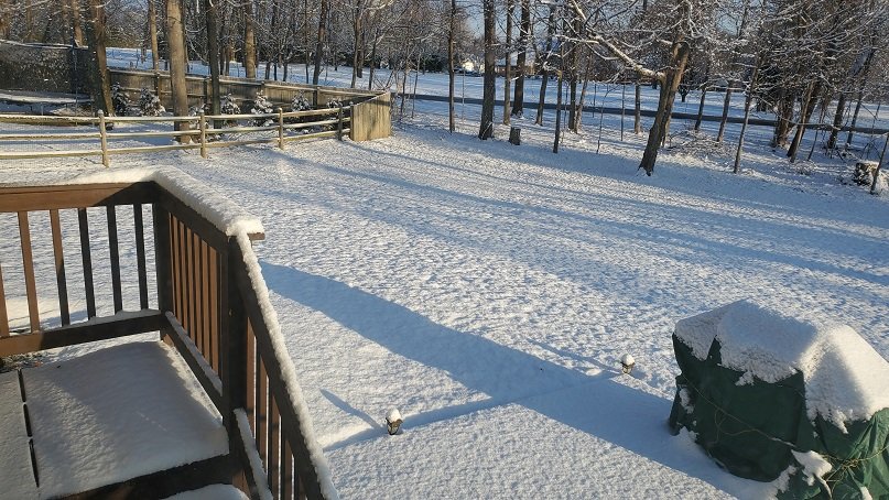
Still snowing fairly hard just south of WPAFB, about a 1/2 inch on grass and cars with the sun out!
-
Rain over to snow just south of WPAFB at 11am this morning.
-
Good luck on the new endeavors! Looootttssss of great seafood and BBQ in that town! I'm vacationing in Hilton Head in 2 weeks for my 60 BDay
-
Had a meeting in Cincy this morning no snow there, about 1" IMBY in Bellbrook, and near 3" at my office just south of WPAFB.
-
We had maybe a half inch, then the rain/sleet punched holes in it, now oddly back to all sleet with large snow flakes mixed in, temp IMBY has been holding steady at 32.2 w/dp at 31.5 for a little over an hour now. Update: all rain now at 7:30ish


