
HighTechEE
-
Posts
567 -
Joined
-
Last visited
Content Type
Profiles
Blogs
Forums
American Weather
Media Demo
Store
Gallery
Everything posted by HighTechEE
-
Let’s talk winter!! Ohio and surrounding states!! 24'-25'
HighTechEE replied to buckeye's topic in Lakes/Ohio Valley
Oh well for the south of I-70 & north of the Ohio River peps Tuesday is a swing and a miss to the south, Wednesday & Saturday look to be both swings & misses to the north. Welcome to southern Ohio. -
Let’s talk winter!! Ohio and surrounding states!! 24'-25'
HighTechEE replied to buckeye's topic in Lakes/Ohio Valley
2.5" new now in the past 4.5hrs, we had 1hr of heavy snow from 5 to 6pm where 1" fell, but moderate snow outside of that IMBY. -
Let’s talk winter!! Ohio and surrounding states!! 24'-25'
HighTechEE replied to buckeye's topic in Lakes/Ohio Valley
Moderate snow now, picked up a 1/2" of new snow so far IMBY. -
Let’s talk winter!! Ohio and surrounding states!! 24'-25'
HighTechEE replied to buckeye's topic in Lakes/Ohio Valley
If the the radar returns get any stronger I will have Thunder Virga! -
Let’s talk winter!! Ohio and surrounding states!! 24'-25'
HighTechEE replied to buckeye's topic in Lakes/Ohio Valley
I'm retired now and haven't went out to shovel yet, but just looking out the window looks like 8 to 10" for me as well (and almost noon and still snowing today)! -
LMFAO!
-
Let’s talk winter!! Ohio and surrounding states!! 24'-25'
HighTechEE replied to buckeye's topic in Lakes/Ohio Valley
4" of new snow IMBY, 1/4 mile visibility right now, I'm assuming heavy snow rates at 1" per hour! -
Let’s talk winter!! Ohio and surrounding states!! 24'-25'
HighTechEE replied to buckeye's topic in Lakes/Ohio Valley
I'm at 2 new inches of snow now, 3" total from 1" left over from the clipper last week. But the heaviest snow rates of the day are happening now IMBY, moderate snow now I'd say a half mile visibilty, with heavy snow not far away in Indiana! -
Let’s talk winter!! Ohio and surrounding states!! 24'-25'
HighTechEE replied to buckeye's topic in Lakes/Ohio Valley
Just reached 1" of new snow over the past 4hrs IMBY, ILN thinks in their updated discussion this will really increase in intensity tonight (like greater than 1"/hr rates)! -
Let’s talk winter!! Ohio and surrounding states!! 24'-25'
HighTechEE replied to buckeye's topic in Lakes/Ohio Valley
And so it begins, snow started right at noon IMBY here about 15 miles SE of Dayton. -
Let’s talk winter!! Ohio and surrounding states!! 24'-25'
HighTechEE replied to buckeye's topic in Lakes/Ohio Valley
12z GFS has 30" from Cincy all the way to Athens Ohio (basically SR32) over the next 16 days lol! Hope no freezing rain or sleet is in that total! -
Let’s talk winter!! Ohio and surrounding states!! 24'-25'
HighTechEE replied to buckeye's topic in Lakes/Ohio Valley
Agreed, the eye candy for this storm is toooooooo scary as us I-70 peeps get screwed on these 90% of the time! -
Let’s talk winter!! Ohio and surrounding states!! 24'-25'
HighTechEE replied to buckeye's topic in Lakes/Ohio Valley
Time to wake up boys, models are showing a potential big one for the south of I-70 folks for Sunday into Monday for the first time in many years! -
Let’s talk winter!! Ohio and surrounding states!! 24'-25'
HighTechEE replied to buckeye's topic in Lakes/Ohio Valley
We are approaching the great Christmas storm of Dec '04, IND has a link: https://www.weather.gov/ind/dec2004snow I (only) got about 12" IMBY but most areas around KDAY had 16 to 24"! SE of I-71 In Ohio had a monster ice storm! -
Let’s talk winter!! Ohio and surrounding states!! 24'-25'
HighTechEE replied to buckeye's topic in Lakes/Ohio Valley
I'm not sure but looked like just under an inch IMBY on grass & elevated surfacess, but melted quickly after 9am. Might get over 1" in the 2nd wave tonight in SW Ohio. PS - I saw north of Milwaulkee is just under 7" right now and should top that with a little more, but I doubt that much makes it into the Indiana/Ohio areas. -
4/1-4/2 severe threat (southern portion of subforum)
HighTechEE replied to largetornado's topic in Lakes/Ohio Valley
This is scary as not only its the 50th year since Xenia, but this coming Memorial Weekend will be the 5th aniversay of the terrible tornadoes that tore up the Dayton area again! This year with 2 waves of serious tornado out breaks before April in Ohio is NUTS! -
Let’s talk winter!! Ohio and surrounding states!!
HighTechEE replied to Steve's topic in Lakes/Ohio Valley
Topped out at 3.5" IMBY, with all of the ILN upped totals calling for 4-6" was yet another bust for me (original forecast of 2-4" was right on). My season total is now 7.5" which means I'm still in the running for the least snowiest winter since I moved to the Dayton area in '86, the actual least amount was 8" three times with a couple in the late 90s and one in the early 2000s. -
Let’s talk winter!! Ohio and surrounding states!!
HighTechEE replied to Steve's topic in Lakes/Ohio Valley
In the past 15 minutes the snow went heavy (close to 1"/hour rate looks like) and everything is white including all roads, visibility 1/4 mile tops IMBY. -
Let’s talk winter!! Ohio and surrounding states!!
HighTechEE replied to Steve's topic in Lakes/Ohio Valley
ILN just went with a Winter Storm Warning now, but didn't adjust any snow totals, about 1" now IMBY. -
Let’s talk winter!! Ohio and surrounding states!!
HighTechEE replied to Steve's topic in Lakes/Ohio Valley
Light snow here for the past hour, radar looks promising with thunder snow in S. Illinois! ILN just upped our totals again area wide to 4 to 6" now! Edit: At 5:15 picked up a half inch so far on elevated surfaces. -
Let’s talk winter!! Ohio and surrounding states!!
HighTechEE replied to Steve's topic in Lakes/Ohio Valley
ILN just updated their forecast and upped the I-70 corridor to 3 to 5", radar show virga over SW Greene county and I swear I heard thunder about 10mins ago? -
Let’s talk winter!! Ohio and surrounding states!!
HighTechEE replied to Steve's topic in Lakes/Ohio Valley
Sweet GFS 12z has a foot of snow for the Dayton area Monday night into Tuesday morning! Also piles another 8 inches over the next two weeks! You know you can lock that in for S. Ohio -
Let’s talk winter!! Ohio and surrounding states!!
HighTechEE replied to Steve's topic in Lakes/Ohio Valley
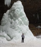
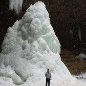
Was in Hocking Hills this weekend for the Old Man's Cave Annual Winter Hike, and for the first time since Jan'14 we had decent snow and well below freezing weather. As a matter of fact we got just under 6" of snow thru this morning about 2 miles north of Old Man's Cave in the center of Hocking Co. -
Let’s talk winter!! Ohio and surrounding states!!
HighTechEE replied to Steve's topic in Lakes/Ohio Valley
Well looks like Thurs/Friday this week we might break 1" IMBY, and maybe up to 8" of fluff along and south of I-70 when its all done. -
Let’s talk winter!! Ohio and surrounding states!!
HighTechEE replied to Steve's topic in Lakes/Ohio Valley
Damn the GFS eye candy has been impressive over the past week for the next 2 weeks! https://pivotalweather.com/model.php?rh=2024010612&fh=384&dpdt=&mc=&r=us_ov&p=snku_acc-imp&m=gfs


