ChescoWx
-
Posts
9,208 -
Joined
-
Last visited
Content Type
Profiles
Blogs
Forums
American Weather
Media Demo
Store
Gallery
Everything posted by ChescoWx
-

1/19/25 Eagles Playoff Winter Storm obs
ChescoWx replied to Ralph Wiggum's topic in Philadelphia Region
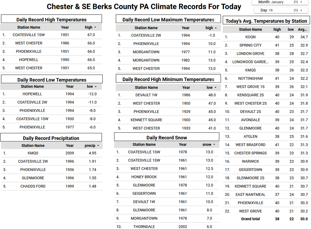
As of 7pm 4.3" if snow here in East Nantmeal....moderate snow still falling and 23.3 degrees,,,,,we are now at 13.5" of snow this season which is 25% above our normal snow through today! -
1/19/25 Eagles Playoff Winter Storm obs
ChescoWx replied to Ralph Wiggum's topic in Philadelphia Region
4.3" so far here in East Nantmeal still moderate snow and 23.7 degrees -
1/19/25 Eagles Playoff Winter Storm obs
ChescoWx replied to Ralph Wiggum's topic in Philadelphia Region
S+ again here in NW chesco might make low end of 4" snowfall! -
1/19/25 Eagles Playoff Winter Storm obs
ChescoWx replied to Ralph Wiggum's topic in Philadelphia Region
Snow Globe here in NW Chesco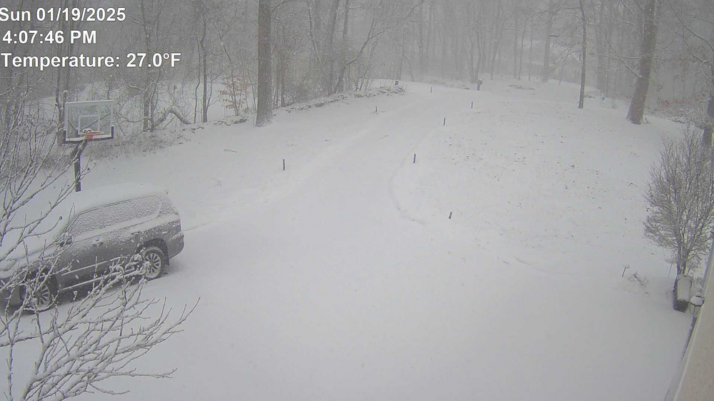
-
1/19/25 Eagles Playoff Winter Storm obs
ChescoWx replied to Ralph Wiggum's topic in Philadelphia Region
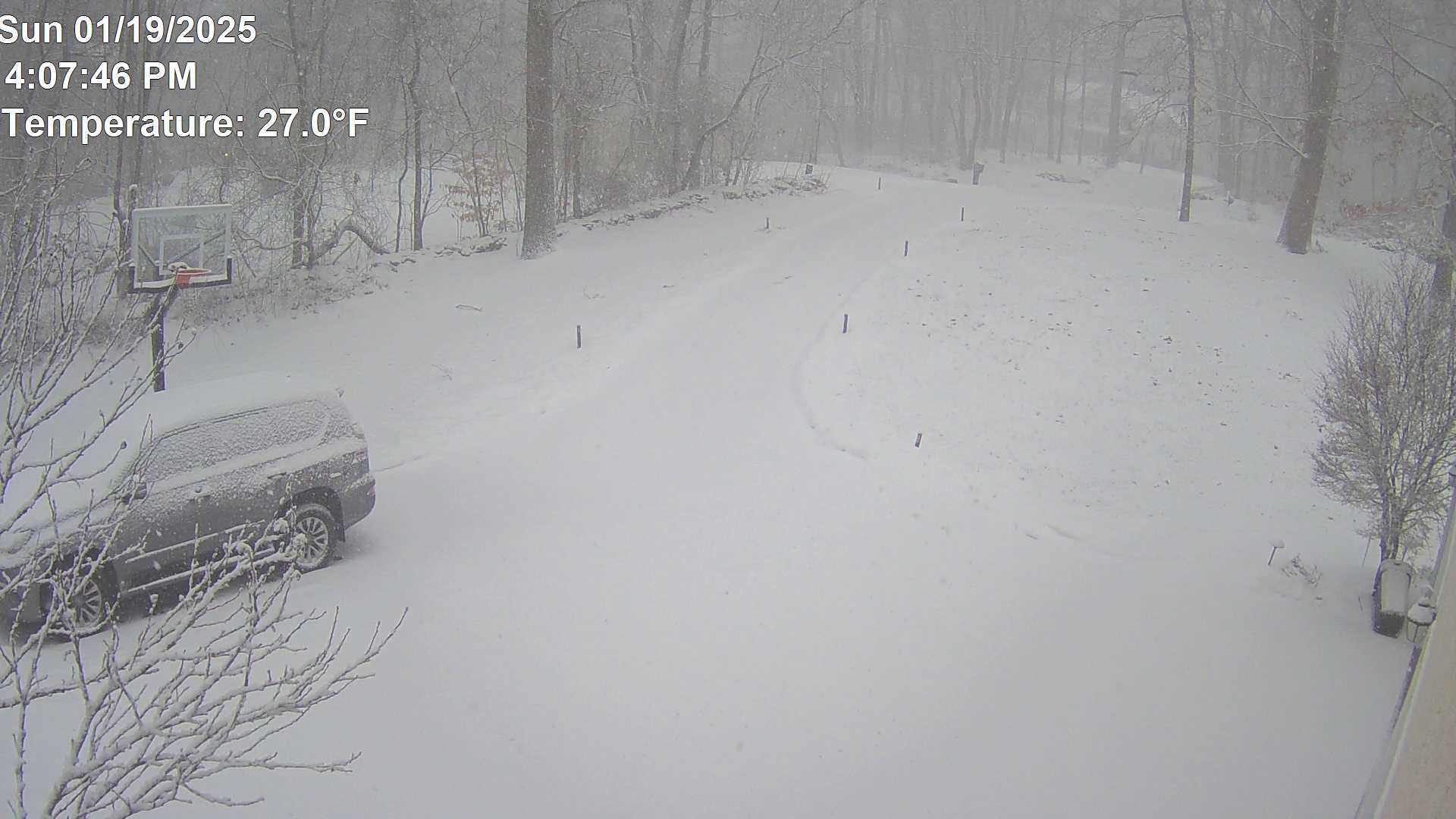
Heaviest snow I have seen in a few years here in Chester County just incredible! - wind increasing temp down to 27.5 -
1/19/25 Eagles Playoff Winter Storm obs
ChescoWx replied to Ralph Wiggum's topic in Philadelphia Region
S+ here in NW Chester County with more incoming....roads are totally snow covered temp down to 28.1 and winds are picking up -
1/19/25 Eagles Playoff Winter Storm obs
ChescoWx replied to Ralph Wiggum's topic in Philadelphia Region
Snowing moderately again all surfaces covered with next round temp down to 29.6. Looks like more gaps in the snow to our southwest. Will we get to low end of the forecast? -
1/19/25 Eagles Playoff Winter Storm obs
ChescoWx replied to Ralph Wiggum's topic in Philadelphia Region
Up to 0.5" so far here in East Nantmeal with dry slot approaching temp down to 30.5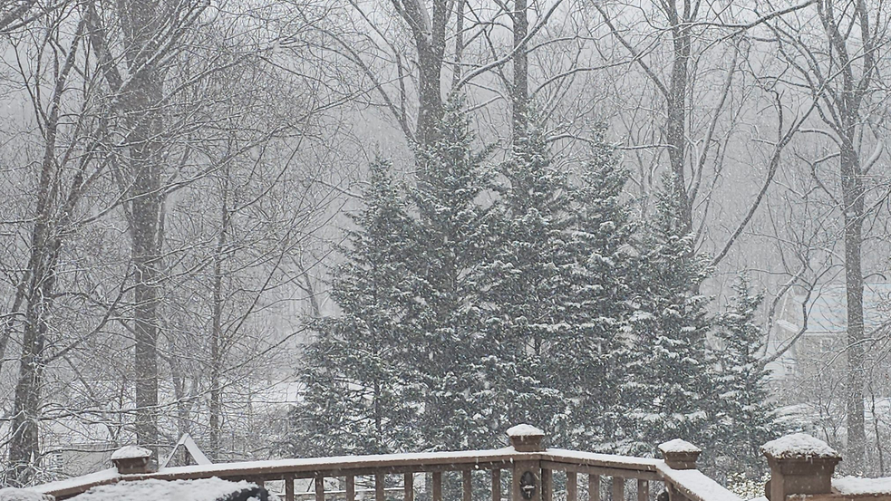
-
1/19/25 Eagles Playoff Winter Storm obs
ChescoWx replied to Ralph Wiggum's topic in Philadelphia Region
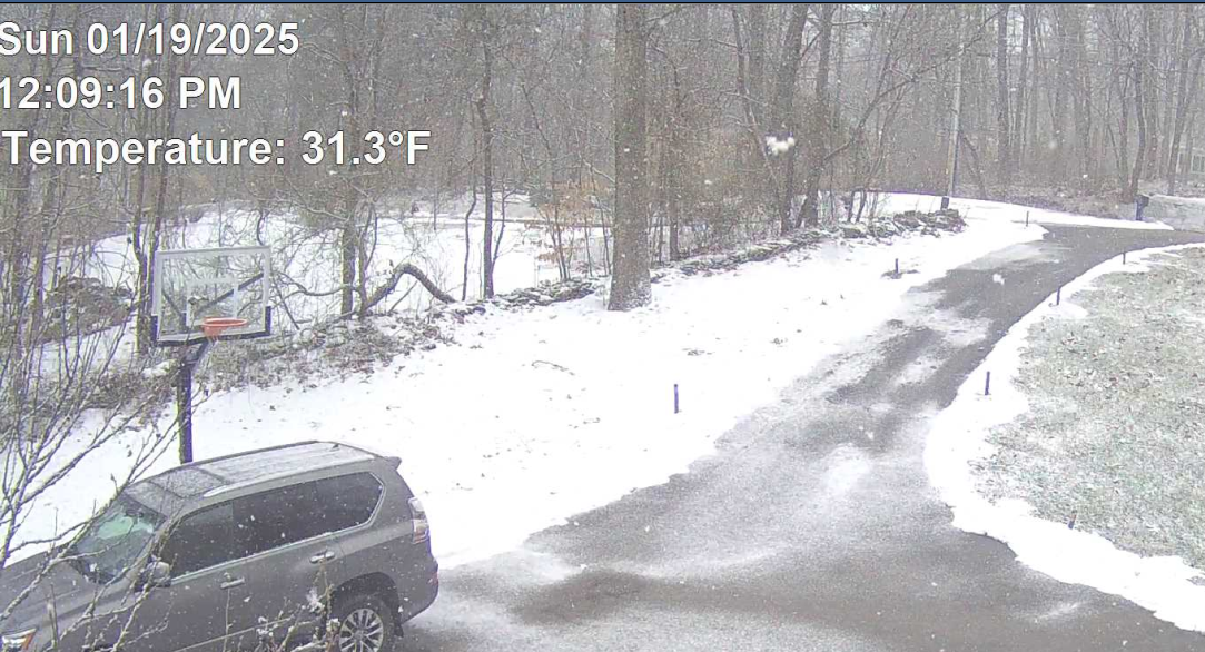
Coming down heavily now temp at 31.3 - driveway starting to cave
-
1/19/25 Eagles Playoff Winter Storm obs
ChescoWx replied to Ralph Wiggum's topic in Philadelphia Region
Snow has really picked up in intensity over last few minutes here in NW Chesco temp has slipped to 32.0 -
1/19/25 Eagles Playoff Winter Storm obs
ChescoWx replied to Ralph Wiggum's topic in Philadelphia Region
Some heavier snow starting to develop across the area 33.0 degrees here in EN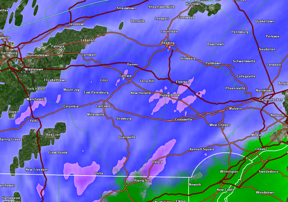
-
1/19/25 Eagles Playoff Winter Storm obs
ChescoWx replied to Ralph Wiggum's topic in Philadelphia Region
Couple flakes falling temp 34.0 RH 78% DP 28.0 -
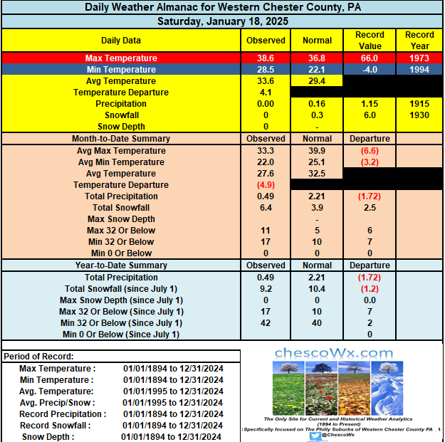
Following the general 4" to 8" of snow forecast today we will see very cold weather for the rest of the week. Watch for areas of blowing and drifting snow tonight and tomorrow across the many open fields etc. across our area. Temperatures till at least Thursday will not escape the teens for high temperatures. Morning lows will be within a couple of degrees above or below zero Tuesday through Thursday morning.
-
1/19/25 Eagles Playoff Winter Storm obs
ChescoWx replied to Ralph Wiggum's topic in Philadelphia Region
-
1/19/25 Eagles Playoff Winter Storm obs
ChescoWx replied to Ralph Wiggum's topic in Philadelphia Region
I am going with 3.5" to 4.5" for my area -
1/19/25 Eagles Playoff Winter Storm obs
ChescoWx replied to Ralph Wiggum's topic in Philadelphia Region
Cloudy with virga overspreading the area from SW to NE Temp 34.1 RH 88% / DP 30.9
-
Sunday 1/19 Eagles Game Snow and Stuff
ChescoWx replied to Ralph Wiggum's topic in Philadelphia Region
-
Sunday 1/19 Eagles Game Snow and Stuff
ChescoWx replied to Ralph Wiggum's topic in Philadelphia Region
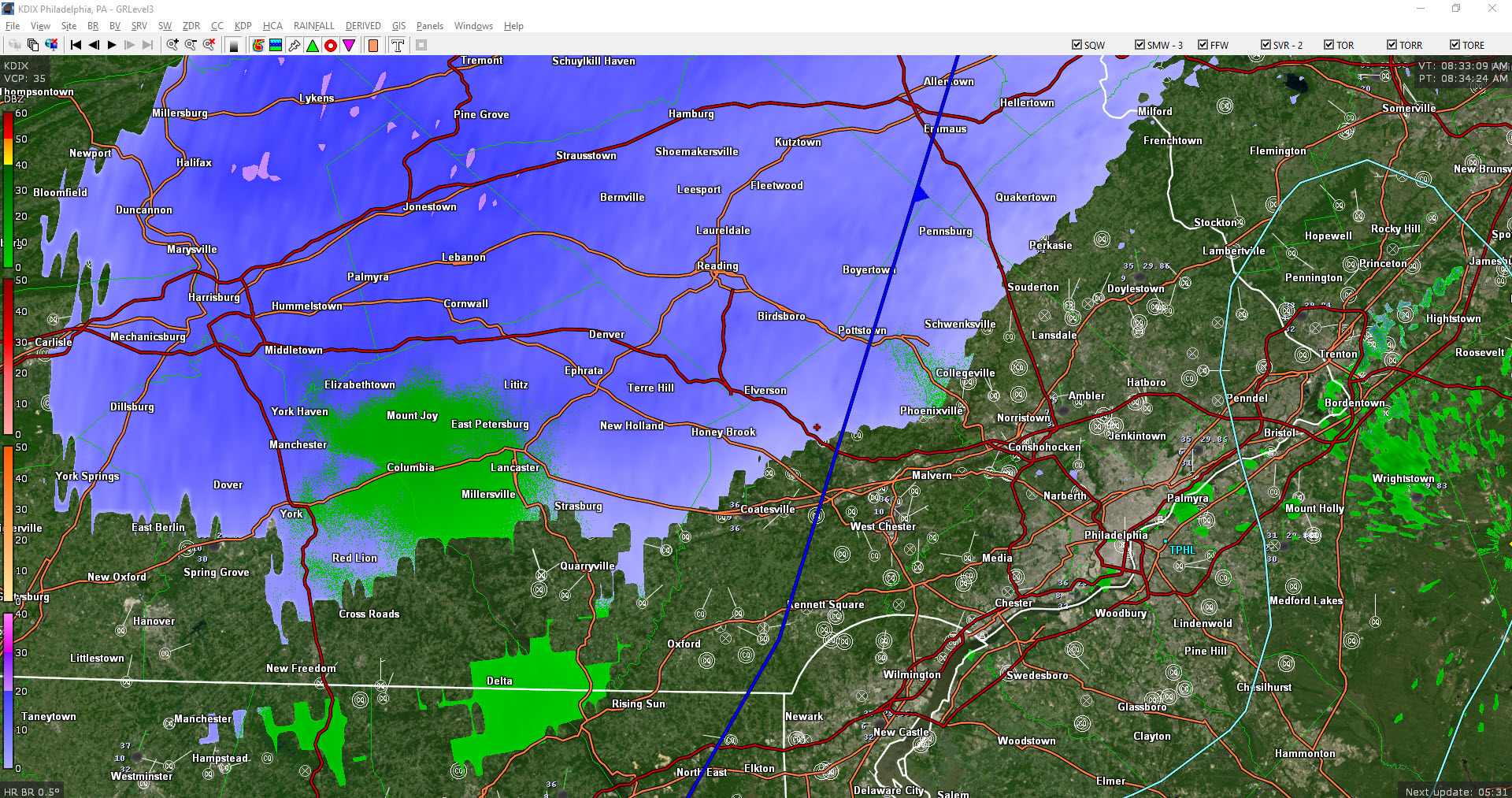
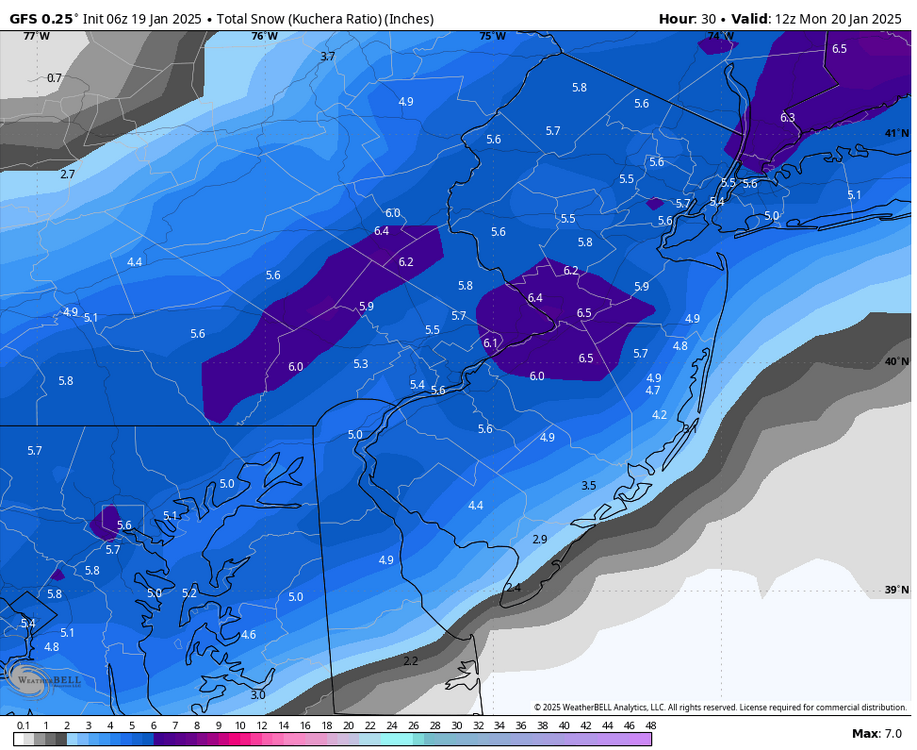
Overnight models before snow time / HRRR time and radar hallucinations! -
Sunday 1/19 Eagles Game Snow and Stuff
ChescoWx replied to Ralph Wiggum's topic in Philadelphia Region
Here in EN we are above any Freezing Fog only 35.2 degrees here.....now 2 miles from here and 300 feet lower it is 31.2 right now -
Sunday 1/19 Eagles Game Snow and Stuff
ChescoWx replied to Ralph Wiggum's topic in Philadelphia Region
Some official NWS forecasts for various towns across the area as of 8pm Saturday Elverson 4" to 10" East Nantmeal/ Honey Brook / Reading / Allentown 4" to 9" Exton/ Downingtown/West Chester 4" to 7" Chadds Ford 3" to 5" -
Sunday 1/19 Eagles Game Snow and Stuff
ChescoWx replied to Ralph Wiggum's topic in Philadelphia Region
Certainly a possibility! -
Sunday 1/19 Eagles Game Snow and Stuff
ChescoWx replied to Ralph Wiggum's topic in Philadelphia Region
K maps will work best in a case like this with maybe less than 10:1 for some folks to start with increasing ratios.... -
Sunday 1/19 Eagles Game Snow and Stuff
ChescoWx replied to Ralph Wiggum's topic in Philadelphia Region
How about some 18z maps....NAM the lowest and Oh Canada the highest....let the games begin! Personally I ride the Euro.... -
Sunday 1/19 Eagles Game Snow and Stuff
ChescoWx replied to Ralph Wiggum's topic in Philadelphia Region
Latest NWS Graphic....shaved a bit off Chesco with the exception of the far Northwest