north pgh
-
Posts
2,957 -
Joined
-
Last visited
Content Type
Profiles
Blogs
Forums
American Weather
Media Demo
Store
Gallery
Everything posted by north pgh
-

Western PA/Pittsburgh Winter 2021/22 Discussion
north pgh replied to meatwad's topic in Upstate New York/Pennsylvania
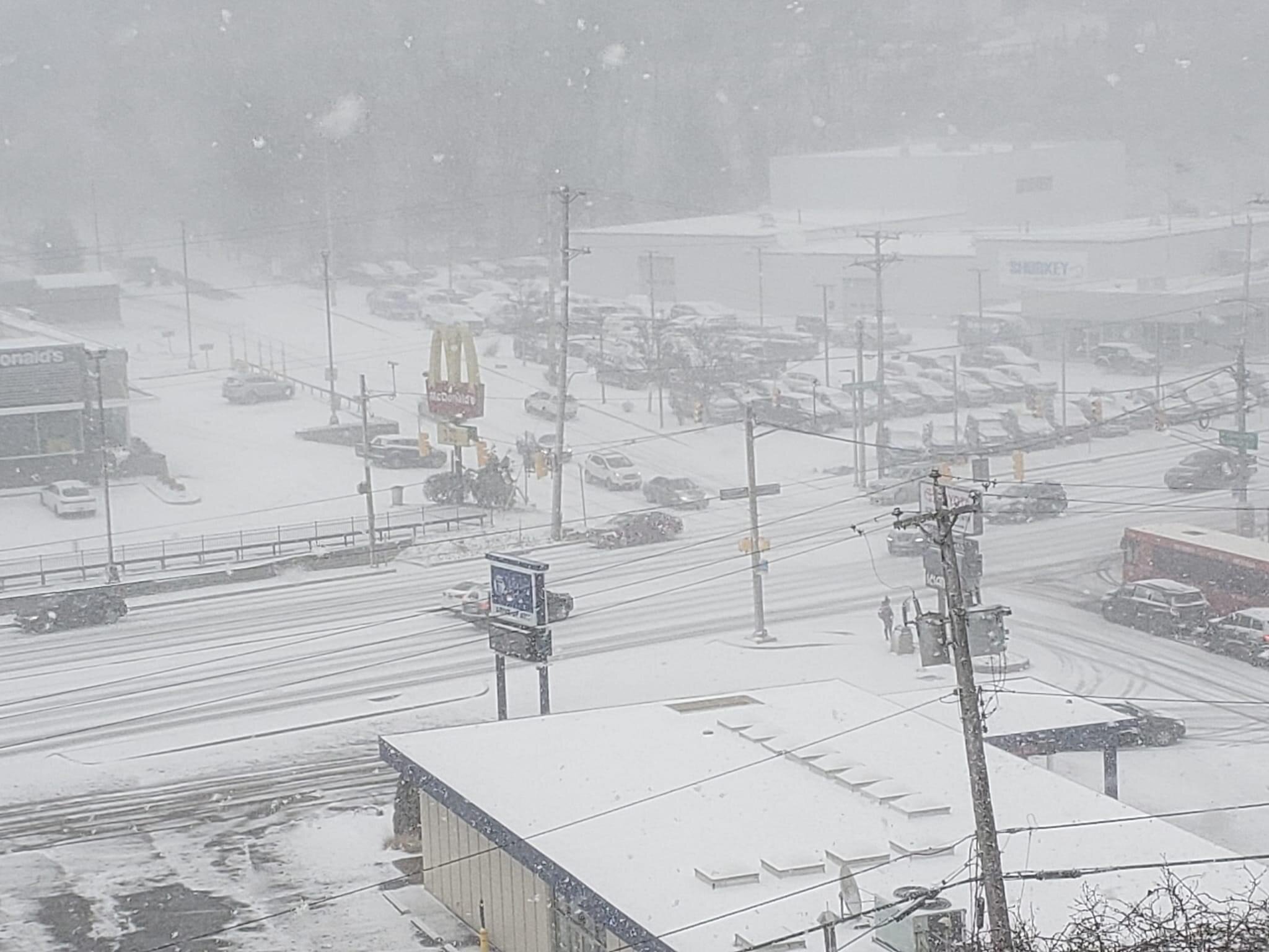
Agree. I have 2 inches of snow already since 7:00. Moderate to heavy. Judging by the returns on radar I wouldn't be surprised if many of us see 4 before it's done. -
Western PA/Pittsburgh Winter 2021/22 Discussion
north pgh replied to meatwad's topic in Upstate New York/Pennsylvania
Not so fast. That first band was great but it looks like several more may be developing south and heading north. I think we can still pick up a couple inches this morning before it tapers off this afternoon. -
Western PA/Pittsburgh Winter 2021/22 Discussion
north pgh replied to meatwad's topic in Upstate New York/Pennsylvania
HRRR has filled that snow hole in and gives us 2-3 inches of snow. I already have close to an inch in the last hour. No sun angle and warm ground when it snows this hard. All pavements are covered as well. -
Western PA/Pittsburgh Winter 2021/22 Discussion
north pgh replied to meatwad's topic in Upstate New York/Pennsylvania
I think it’s funny how we have people arguing over models and storms all winter for a difference of a couple of inches but we we get heavy snow for an hour and it is quiet in here. -
Central PA - Winter 2021/2022
north pgh replied to Bubbler86's topic in Upstate New York/Pennsylvania
Throw out the models for now. We are getting heavy snow in Pittsburgh -
Western PA/Pittsburgh Winter 2021/22 Discussion
north pgh replied to meatwad's topic in Upstate New York/Pennsylvania
This is a reverse bust by Forecasters this morning. Rain showers mixed with snow showers is being replaced by moderate to heavy snow right now. -
Western PA/Pittsburgh Winter 2021/22 Discussion
north pgh replied to meatwad's topic in Upstate New York/Pennsylvania
-
Western PA/Pittsburgh Winter 2021/22 Discussion
north pgh replied to meatwad's topic in Upstate New York/Pennsylvania
Was expecting it here but it never made it this far south. The cold made it however. -
Western PA/Pittsburgh Winter 2021/22 Discussion
north pgh replied to meatwad's topic in Upstate New York/Pennsylvania
Look for March 12th weekend for something. It is the Pittsburgh St Patrick's Day Parade. -
Western PA/Pittsburgh Winter 2021/22 Discussion
north pgh replied to meatwad's topic in Upstate New York/Pennsylvania
32 degrees and still raining. Light glaze of ice on patio furniture and grill cover. -
Pittsburgh/Western PA Banter & Complaint Thread
north pgh replied to blackngoldrules's topic in Upstate New York/Pennsylvania
I wouldn't put a lot of stock in the climate change deal affecting us. I grew up in the 70's and I remember some really good winters and then some really bad ones in the 80's. Then the 90's had some good ones. But also for every good one there is a downer winter. For every 60+ snowfall winter there will also be a -30 snowfall winter. I myself like thunderstorms too so I deal with the summer changes as well. I remember last year we did not have a thunderstorm before mid June which is rare. Then the second half of the summer we had many so you can only hope we have a decent one. I think as I get older I deal with it better. -
Western PA/Pittsburgh Winter 2021/22 Discussion
north pgh replied to meatwad's topic in Upstate New York/Pennsylvania
Looking ahead maybe a few inches from a diving clipper on Sunday. -
Western PA/Pittsburgh Winter 2021/22 Discussion
north pgh replied to meatwad's topic in Upstate New York/Pennsylvania
Keep expectations low and then there are chances for surprises. -
Western PA/Pittsburgh Winter 2021/22 Discussion
north pgh replied to meatwad's topic in Upstate New York/Pennsylvania
-
Western PA/Pittsburgh Winter 2021/22 Discussion
north pgh replied to meatwad's topic in Upstate New York/Pennsylvania
-
Western PA/Pittsburgh Winter 2021/22 Discussion
north pgh replied to meatwad's topic in Upstate New York/Pennsylvania

-
Western PA/Pittsburgh Winter 2021/22 Discussion
north pgh replied to meatwad's topic in Upstate New York/Pennsylvania
Special Weather Statement National Weather Service Pittsburgh PA 1041 AM EST Sat Feb 19 2022 OHZ041-PAZ014-020>022-073-WVZ001-191615- Columbiana-Armstrong-Butler-Westmoreland-Beaver-Allegheny-Hancock- 1041 AM EST Sat Feb 19 2022 ...A LINE OF SNOW SHOWERS WILL AFFECT EAST CENTRAL COLUMBIANA... BEAVER...SOUTHERN BUTLER...NORTHERN ALLEGHENY...NORTHWESTERN WESTMORELAND...SOUTHWESTERN ARMSTRONG AND HANCOCK COUNTIES... At 1040 AM EST, a line of snow showers was located along a line extending from near Calcutta to near Economy to near Sarver. Movement was east at 35 mph. Locations impacted include... Ross Township, McCandless Township, Cranberry, Moon Township, Franklin Park, East Liverpool, Aliquippa, Beaver Falls, Monaca, Shaler Township, Hampton Township, and Robinson Township. This includes the following highways... Pennsylvania Turnpike between mile markers 17 and 47. Interstate 79 in Pennsylvania between mile markers 67 and 87. Interstate 376 in Pennsylvania between mile markers 31 and 52. Visibilities will drop quickly to 2 miles or less in this area of snow. Conditions can deteriorate rapidly in winter weather situations. Be prepared for snow or ice covered roads. Slow down and allow extra time when traveling. LAT...LON 4049 8032 4054 7981 4066 7943 4080 7981 4079 8032 4083 8092 TIME...MOT...LOC 1540Z 292DEG 30KT 4067 8065 4065 8013 4073 7983 $$ -
Western PA/Pittsburgh Winter 2021/22 Discussion
north pgh replied to meatwad's topic in Upstate New York/Pennsylvania
Sun is out but now getting some 40 mph gusts. Really blowing the snow around. Kind of neat to see. It it looks like a smaller band about to coming down from the northwestern part of the county. -
Western PA/Pittsburgh Winter 2021/22 Discussion
north pgh replied to meatwad's topic in Upstate New York/Pennsylvania

-
Western PA/Pittsburgh Winter 2021/22 Discussion
north pgh replied to meatwad's topic in Upstate New York/Pennsylvania
White out conditions in ross now. -
Western PA/Pittsburgh Winter 2021/22 Discussion
north pgh replied to meatwad's topic in Upstate New York/Pennsylvania
You do know that this squall line runs from cranberry to Weirton West Virginia and will drop through all of the county. Of course cranberry will get the snow first. It’s on my doorstep -
Western PA/Pittsburgh Winter 2021/22 Discussion
north pgh replied to meatwad's topic in Upstate New York/Pennsylvania
A nice little burst of snow dropped about 1/4 inch of fluffy snow. Probably the same thing tomorrow morning. Next weeks system seems to be holding true. With it being a week away a southern shift would be nice. -
Western PA/Pittsburgh Winter 2021/22 Discussion
north pgh replied to meatwad's topic in Upstate New York/Pennsylvania
Had some flurries this morning. Some possible heavier snow showers late this afternoon could give some 1/2 to 1 inch fluffy snow. After the warmup hoping to get some backend snow after the front on Friday. Doesn't look promising but 12z Canadian hinting at possible but right now it is on it's own. Looking for anything positive in this calm pattern. -
Western PA/Pittsburgh Winter 2021/22 Discussion
north pgh replied to meatwad's topic in Upstate New York/Pennsylvania
These long term models have been bad lately. I wouldn't be surprised if something pops up in the 10 day range at some point. -
Western PA/Pittsburgh Winter 2021/22 Discussion
north pgh replied to meatwad's topic in Upstate New York/Pennsylvania
Canadian sucking us back in. Time to get back to model tracking