
West Point, NY
-
Posts
1,454 -
Joined
Content Type
Profiles
Blogs
Forums
American Weather
Media Demo
Store
Gallery
Everything posted by West Point, NY
-
Doesn't hold a candle to Obama at a banquet honoring a Marine "Corpseman".
-
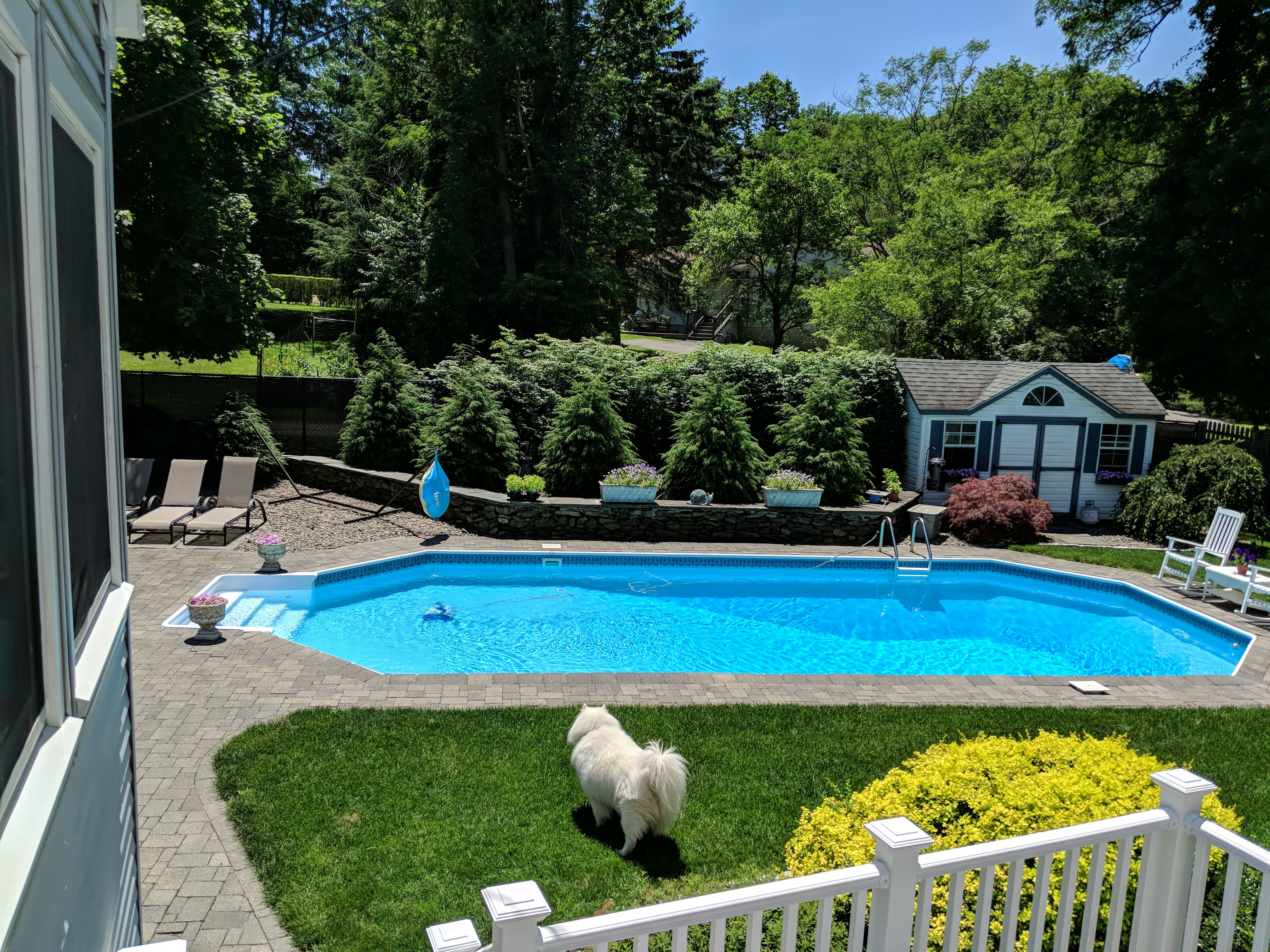
With full sun and an 82 degree pool to take a dip in after cutting the grass... Damn straight. Best day of summer
-
Rubbish. The seas rising less than 1mm a year are much more of a concern. I heard Obama wanted to buy a 15 million dollar mansion on the water in Martha's Vineyard and fellow alarmist Al Gore wanted a 25 million dollar one in Malibu on the Pacific. Fortunately, those 2 wise men realized the seas would inundate these properties in short order and make their investments worthless.
-
But fantastic for August
-
But yet in your mind you are disappointed the kids don't have to suffer playing the tournament in a blazing sun 90/72 environment.
-
He gave up nothing. He got a huge endorsement deal from Nike and became the darling of the far left. He turned down an offer from the Niners which was the best he was going to get on the market because of the crap season he had. His girlfriend is a radical and turned him into an activist. So you can agree with his message but he's far from genuine.
-
Unless dews are down below 55, my central AC is on as soon as the house temp goes over 72. With a breeze, I'll tolerate mid 70s with low dews. If I'm going to pay to run my pool filter 11 hrs a day, I sure as hell am going to pay to keep myself comfortable inside my house.
-
I agree with you. He on the other hand doesn't understand the need for AC whatsoever
-
Yeah. Much more pleasant to sleep in a sweaty bed and wake up to tacky hardwood floors under your feet.. Also great for my Samoyed dog who is suited for Arctic cold. She would absolutely love to live like a homeless man during Summer.
-
Xanadu
-
Those blades will cut you to pieces
-
I'm going to have to try that or maybe the bolts on outside of the housing will loosen the auger enough that I can pull it out. It's thick so it didn't wrap around. Only stuck underneath
-
You know what sucks? When you take your blower out and the auger grabs the thick rubber mat in front of your steps going up to your front porch and it gets stick underneath the blades and you can't pull the shit out... Then you still have to shovel the sleet
-
Large flakes starting to mix back in as rates pick up
-
I just flipped a few minutes ago also.
-
The other thing we have going for us is the lowest dews are to our North and NW not NE. It is in a position to keep pushing rather than be eroded by retreating to the NE as is often the case with highs up over Maine. It wouldn't take much of a last min tick SE to make this a 6-8 dump of snow followed by a few inches of Sleet to bulletproof the pack
-
True. Anyway that single digit dew point air is pushing down the Hudson. Just can't see primarily a Sleet fest not big zr North of 17.
-
If you put out a forecast at 530 am and it hits it while dropping in under an hour, your forecast should have a down arrow next to it and put the mid afternoon temp there
-
If you look at Albany, they were at 25 at 6:25 am they have dropped and leveled off at 18 with the limited daytime heating. Dews are down to 6 and still dropping. Can't see how it's not all Snow/Pl North of NB Bridge. Probably to Bear Mtn Bridge before real freezing rain issues IMO. That Arctic air is pushing down the Hudson. Albanys projected high is 25. We will see it bust.
-
Like I just posted in the main thread, any model that cuts this up into NYS or CT for that matter is wrong. It will go ENE from NJ out toward CC. The air to the North is a brick wall of sub zero Temps pressing down. While rich with moisture, this is not a strong low. If it passes just S of NYC, you will have a freezing rain issue in Putnam after a good dump ofsome snow and a lot of Sleet. If it comes off South Jersey it would probably be a more snow/sleet deal vs freezing rain. My gut still says this tics a bit South at the end once the magnatude of the cold is realized by models that don't start with GFS
-
I'm with you. It's been sunny and 70s here both days and that's perfect for outdoor activities. Who wants to sit on the deck sweating with 70 dews, I don't get. People who still live at home with their parents and don't worry about paying to have the central AC going constantly I guess.


