Stormpc
-
Posts
3,350 -
Joined
-
Last visited
Content Type
Profiles
Blogs
Forums
American Weather
Media Demo
Store
Gallery
Everything posted by Stormpc
-
Yes this is. It's a good storm with several more inches from your area and the South side. We always knew this was going to be a unique situation.
-
The cold dry Dome killed Northern sections for sure.
-
Hard to measure but I have about 4 inches in currituck. It could be a little bit more but I try to be conservative. Absolute blizzard.
-
Idub... this is exceptionally heavy snow. If it gets up there for a few hours you're going to cash in. Really impressive.
-
No idea who Jon Cash is but that's pretty funny. I just got here in 2018.
-
Wait till you see what's coming up from the south. Great rates. Low visibility. It's coming.
-
Im thinking 4-6 in Norfolk, 7 in Chesapeake . 3-5 Newport news. North Virginia Beach 5-7. Pungo and to the Border 5-8
-
January 30th- Feb 1st ULL and coastal storm obs
Stormpc replied to JoshM's topic in Southeastern States
You're in for a ride. -
The “I bring the mojo” Jan 30-Feb 1 potential winter storm
Stormpc replied to lilj4425's topic in Southeastern States
You kept your cool and patiently waited all day. Now it's your time. Good for you. Thank you for not complaining all day. Hope you cash in. -
January 30th- Feb 1st ULL and coastal storm obs
Stormpc replied to JoshM's topic in Southeastern States
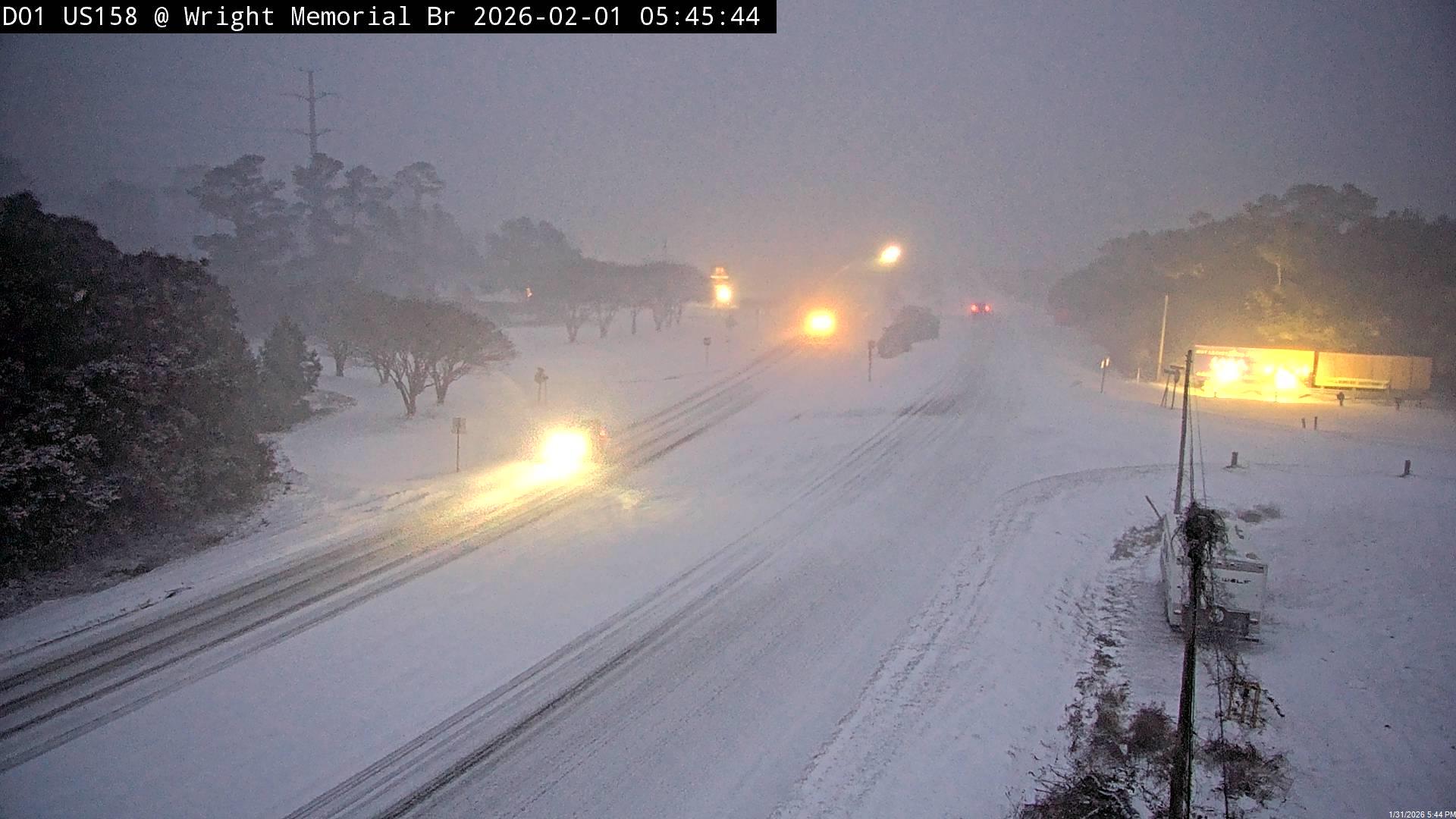
Reporting from Currituck North Carolina I can tell you it's been nearly a blizzard for the last 90 minutes. Somewhere between 2 and 3 inches of snow. Impossible to measure since I'm on the sound and the winds are blasting. A very impressive system. 22/20. Heavy snow... -
Once you saturate this is 1-2 inch an hour stuff.
-
You're probably 90 minutes behind me but I have between 2 and 3 inches already. It's very difficult to measure because of the wind but I've been monitoring one spot in my yard that doesn't get any wind or roof blow off
-
The coastal continues to throw precipitation back to the northwest. We probably have 6 to 8 hours more of meaningful snow. We can cash in. I wouldn't call it a capture but at least both lobes have conjoined.
-
Okay I may have misjudged some things. I went to the side of my house that has no wind and there's definitely a few inches. It is a beast outside right now. Visibility 1/8 of a mile at best. Extremely heavy snow. I don't have anything on my vehicles because it's being blown off.
-
I'm getting plastered. I don't know how much snow there is because I'm right on the sound but certainly between 1 and 2 in. Someone a little further Inland can probably give you a better total
-
Once it starts the Northwest extent is going to shrink. Then we will start pulling in some of the bands further west before it crashes off the coast. We need to cash in now until 10:00 p.m. then who knows
-
Then its going to be getting close to pivot time. The coastal is beginning to jog east as modeled before it turns back Northeast.
-
Its a good one. Saturates the layers and brings mod snow. Im in the tail end of that band awaiting a lull before that Albemarle band gets here.
-
Finally, Heavy Snow. 21 degrees.
-
I don't have an inch yet. Of snow...
-
Currituck side of the Wright Memorial Bridge to Kitty Hawk
-
Its a slow ramp up to light snow. I finally have steady light snow. I'm in Currituck 13 miles south of the Virginia border right on the sound. Somehow the wind took a mini break after being strong all day.
-
This band coming in from the southeast was pretty good. Another one just to the south of that. So we're starting to cook a little bit. Wakefield radar filling in back northwest
-
That's a reach. Considering I have a very light coating and it's been stop and go.
-
Snow just started picking up. Nice dendrites finally falling. Very strong band just to my south ready to Pivot up. I guess it's go time now. Really hard to squeeze anything good with this dry air mass. But looks like we finally done it