
anthonyweather
-
Posts
1,756 -
Joined
-
Last visited
Content Type
Profiles
Blogs
Forums
American Weather
Media Demo
Store
Gallery
Everything posted by anthonyweather
-

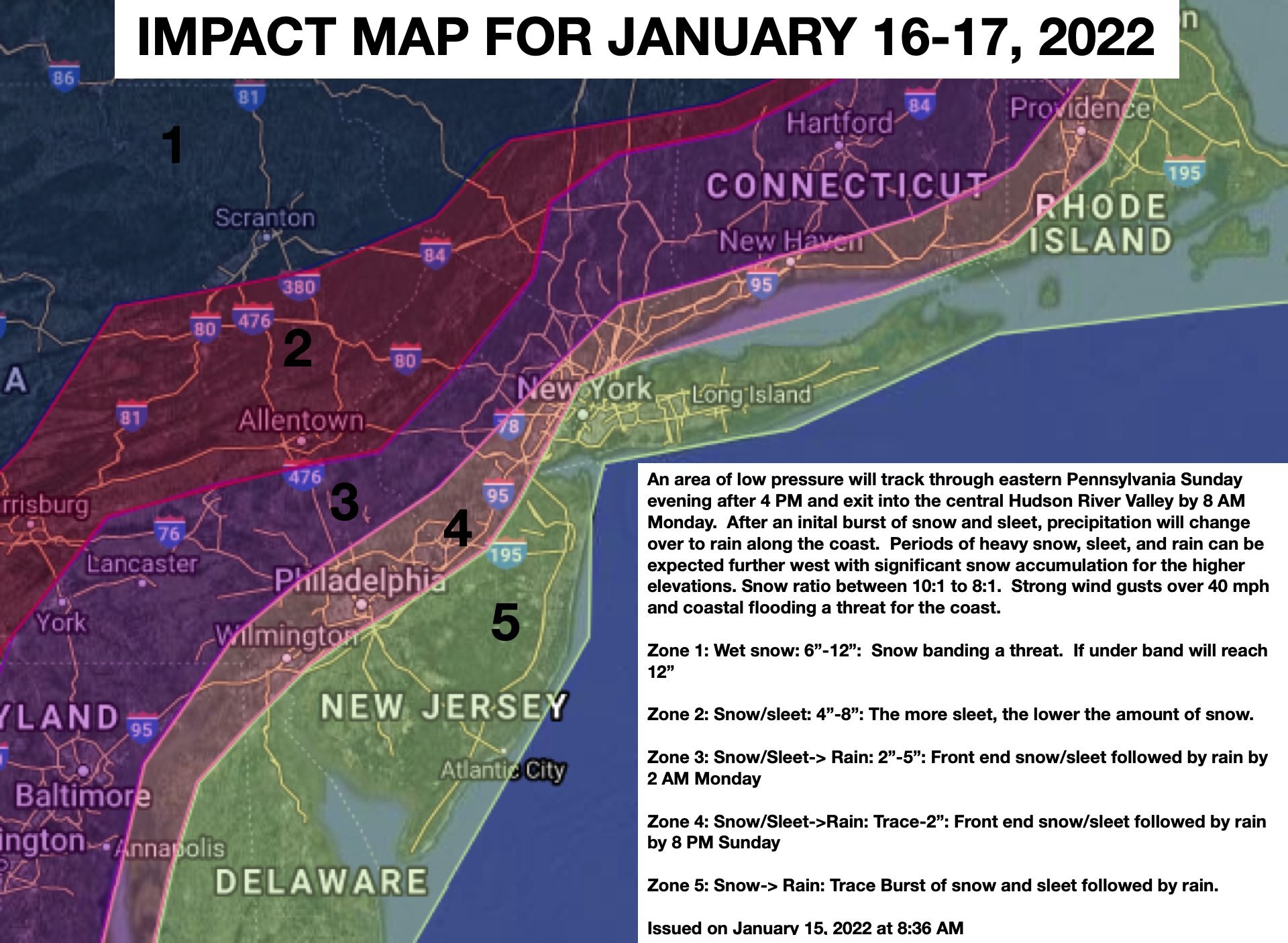
E PA/NJ/ DE Winter 2021-22 OBS Thread
anthonyweather replied to JTA66's topic in Philadelphia Region
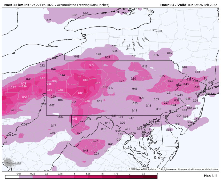
NAM maps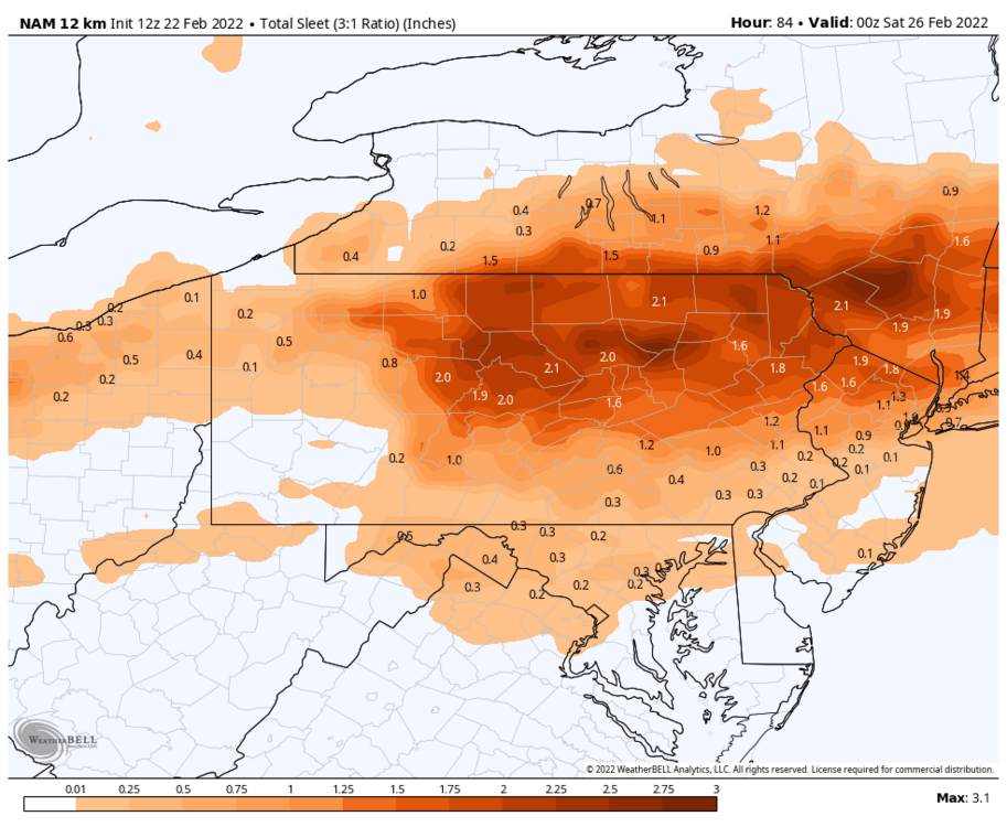
-
E PA/NJ/ DE Winter 2021-22 OBS Thread
anthonyweather replied to JTA66's topic in Philadelphia Region
Wonder how much the 65 degree day tomorrow will affect ice accrual. -
E PA/NJ/ DE Winter 2021-22 OBS Thread
anthonyweather replied to JTA66's topic in Philadelphia Region
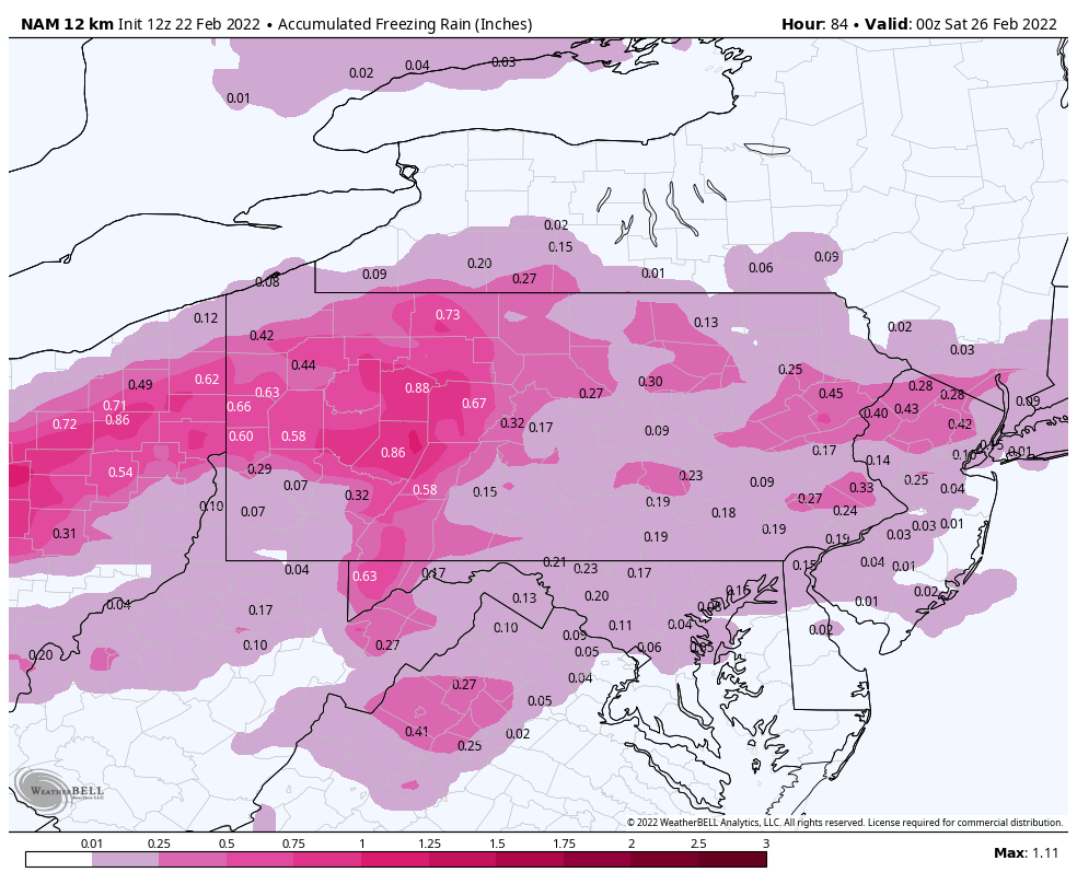
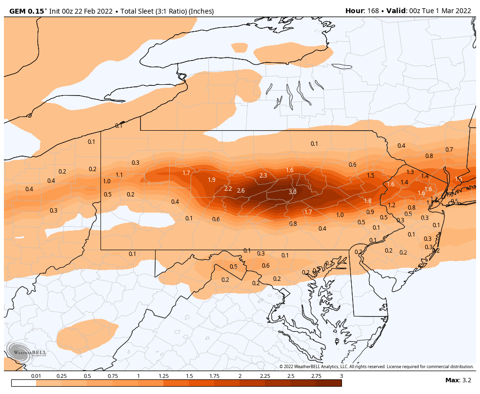
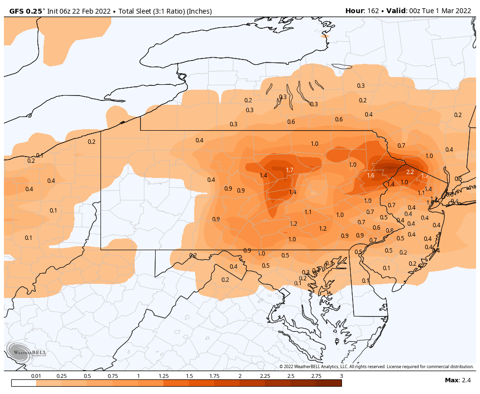
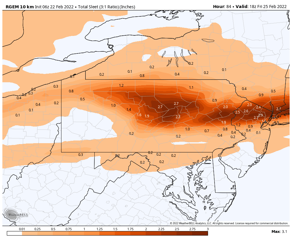
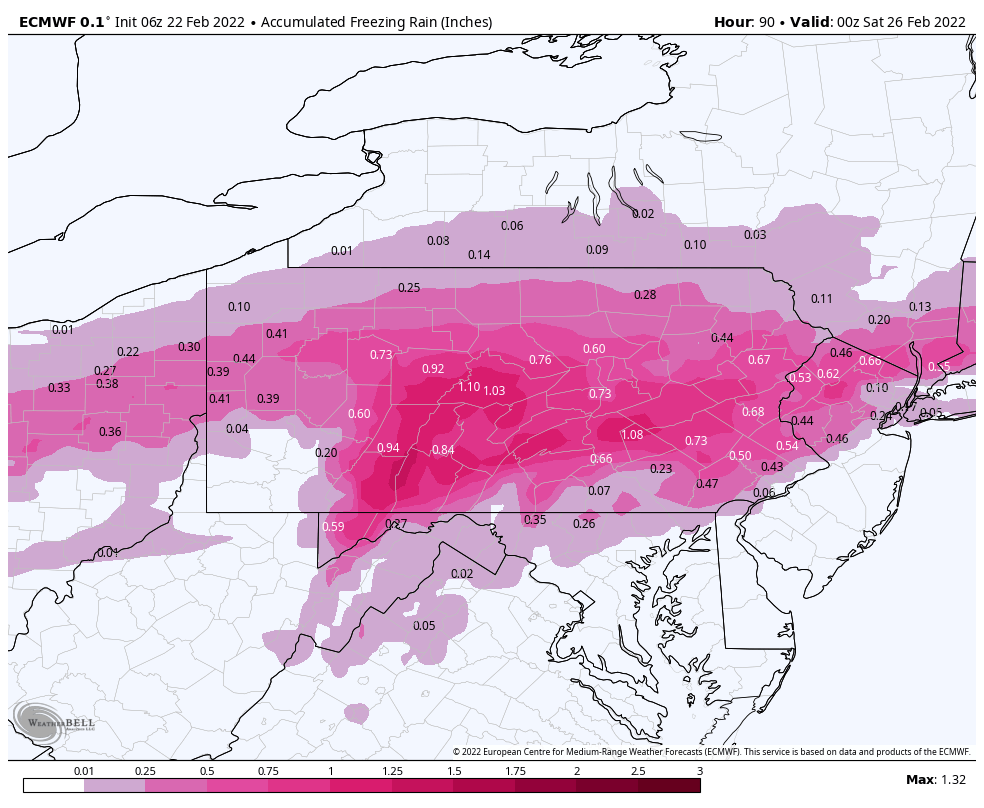
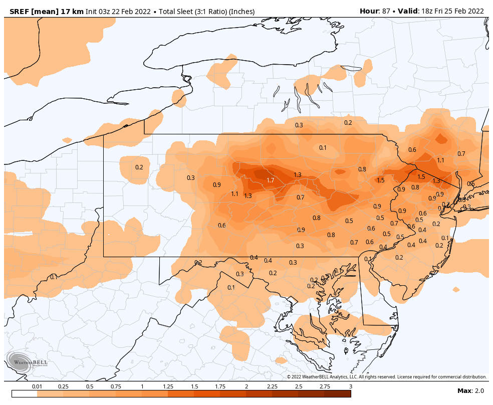
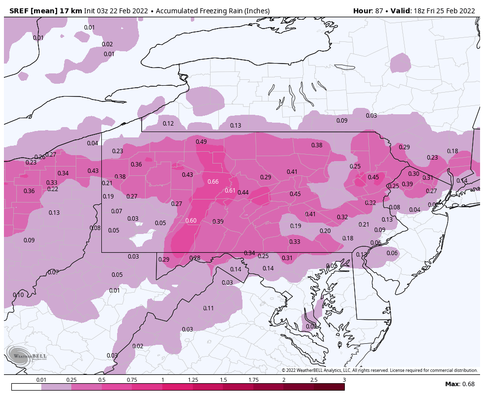
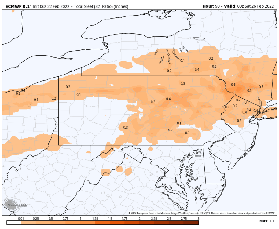
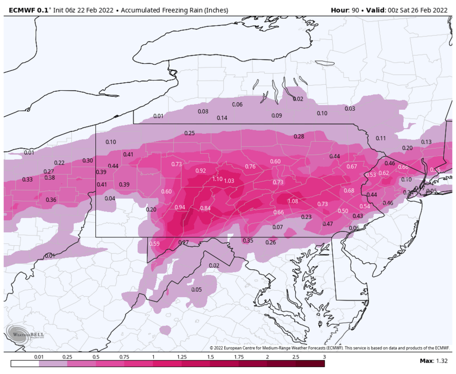
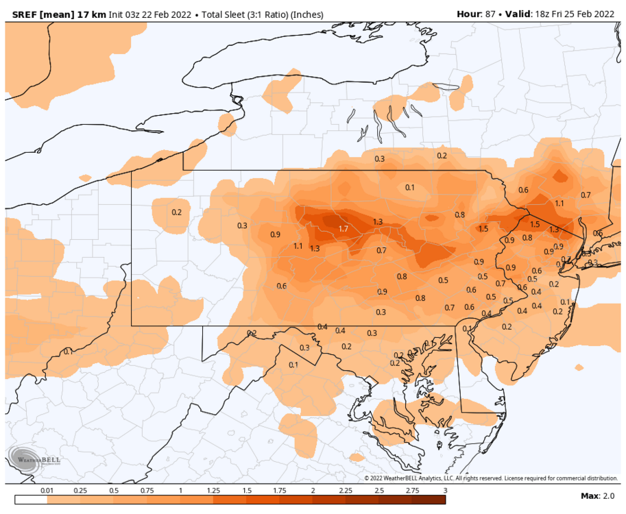
Here is some sleet and ZR maps for closer to home.


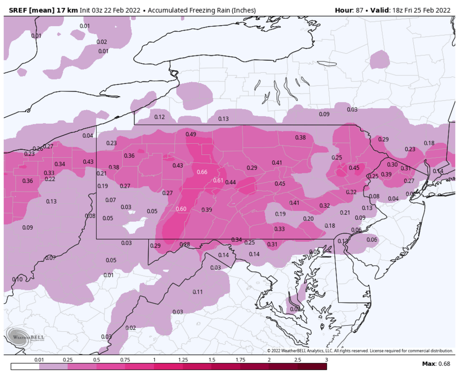
-
E PA/NJ/ DE Winter 2021-22 OBS Thread
anthonyweather replied to JTA66's topic in Philadelphia Region
Tropical is back online. check out the RGEM ice accrual for Arkansas… wow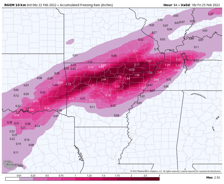
-
E PA/NJ/ DE Winter 2021-22 OBS Thread
anthonyweather replied to JTA66's topic in Philadelphia Region
Glad to see Sunday is still there

-
E PA/NJ/ DE Winter 2021-22 OBS Thread
anthonyweather replied to JTA66's topic in Philadelphia Region
Appears in 2015 we saw something similar, at least according to my map lol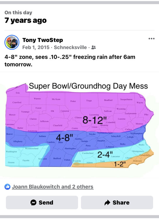
-
January 28th/29th Event Obs - From KU to FU?
anthonyweather replied to JTA66's topic in Philadelphia Region
I’m guessing MAYBE 2” In Allentown? -
January 28th/29th Event Obs - From KU to FU?
anthonyweather replied to JTA66's topic in Philadelphia Region
Check out the boardwalk in AC https://www.skylinewebcams.com/en/webcam/united-states/new-jersey/atlantic-city/atlantic-city-boardwalk.html -
January 28th/29th Event Obs - From KU to FU?
anthonyweather replied to JTA66's topic in Philadelphia Region
Dryer air is pushing in for the LV… -
January 28th/29th Event Obs - From KU to FU?
anthonyweather replied to JTA66's topic in Philadelphia Region
Doesn’t wanna add up, even though it’s snowing hard. pixie dust and wind -
January 28th/29th Event Obs - From KU to FU?
anthonyweather replied to JTA66's topic in Philadelphia Region
Good luck getting measurements on this. Super high ratio stuff here blowing and drifting even with minimal gusts -
January 28th/29th Event Obs - From KU to FU?
anthonyweather replied to JTA66's topic in Philadelphia Region
Looks like radar is pushing past Allentown now, right on target. See how the morning looks -
January 28th/29th Event Obs - From KU to FU?
anthonyweather replied to JTA66's topic in Philadelphia Region
1” here and ripping
-
January 28th/29th Event Obs - From KU to FU?
anthonyweather replied to JTA66's topic in Philadelphia Region
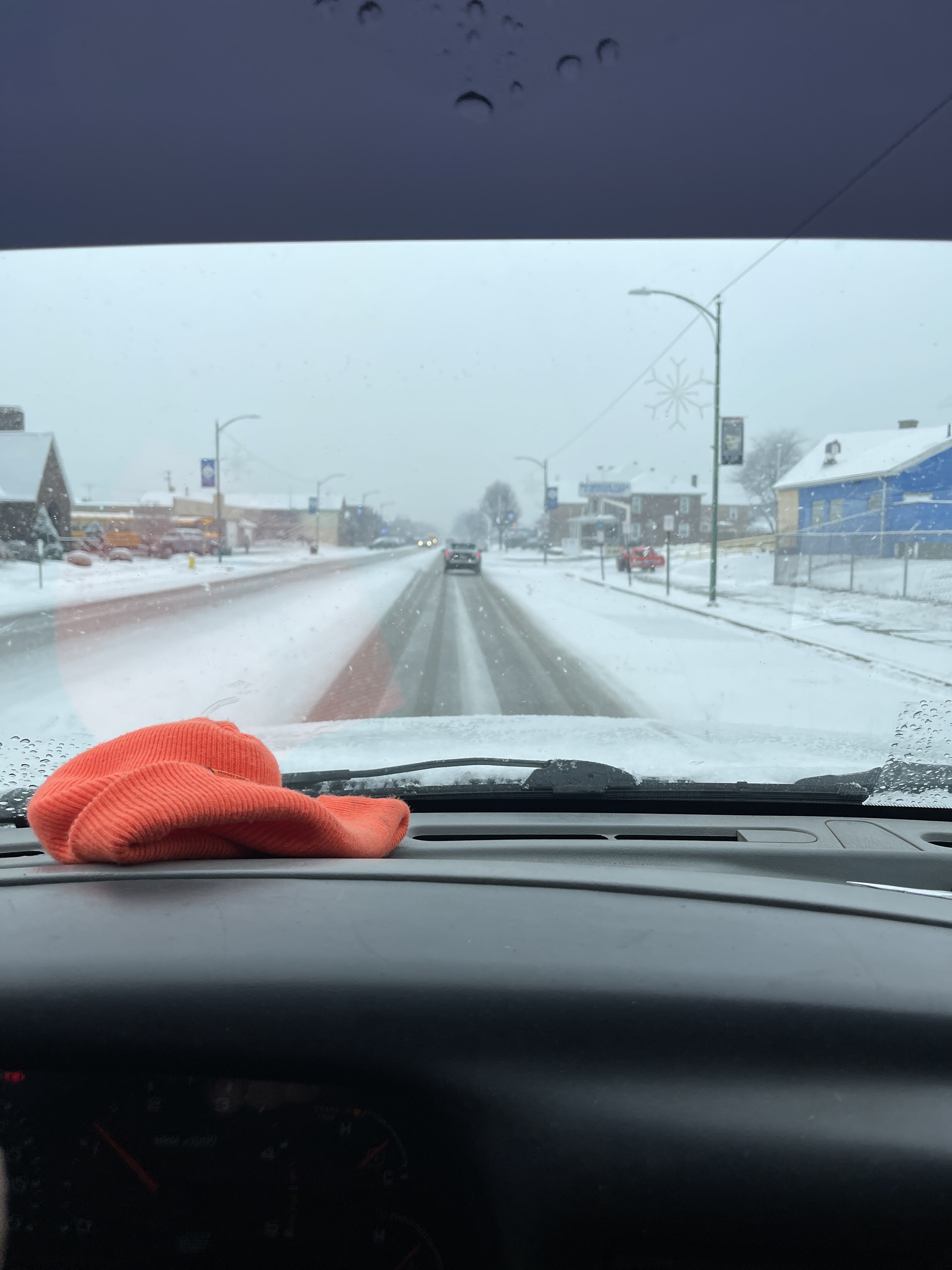
Where I’m at.
-
January 28th/29th Event Obs - From KU to FU?
anthonyweather replied to JTA66's topic in Philadelphia Region
6z euro, again, west…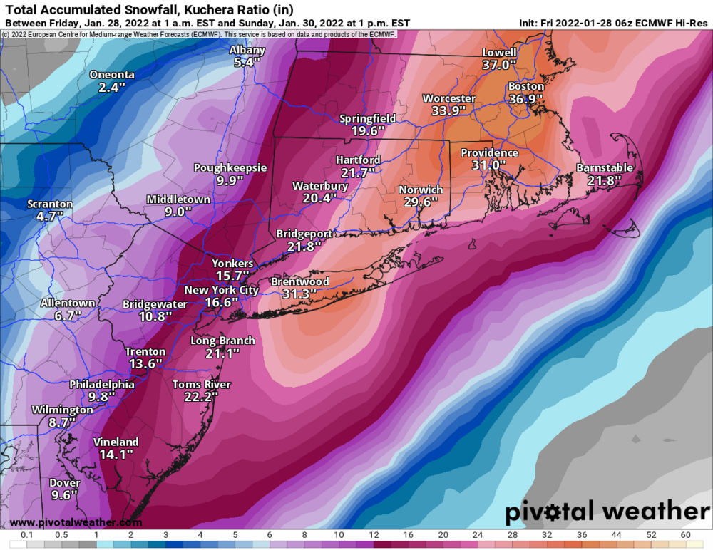
-
January 28th/29th Event Obs - From KU to FU?
anthonyweather replied to JTA66's topic in Philadelphia Region
I would add dendrite growth with the wind begs for tiny flakes and lower ratios. Not low low, but more towards 12:1. this place could be rocking after 00z. EPS spread is west, and boy the ensembles are dragging west!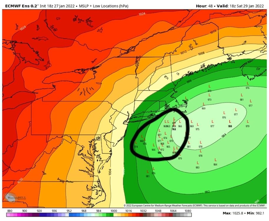
-
January 28th/29th Event Obs - From KU to FU?
anthonyweather replied to JTA66's topic in Philadelphia Region
I’m anxious to see if this keeps going…. As well as that second low… 24 hours of trends yet possible -
January 28th/29th Event Obs - From KU to FU?
anthonyweather replied to JTA66's topic in Philadelphia Region
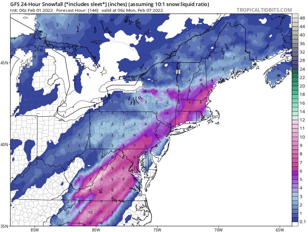
Now the RGEM brings heavy snow to LV… Lol what a dart board right now -
E PA/NJ/ DE Winter 2021-22 OBS Thread
anthonyweather replied to JTA66's topic in Philadelphia Region
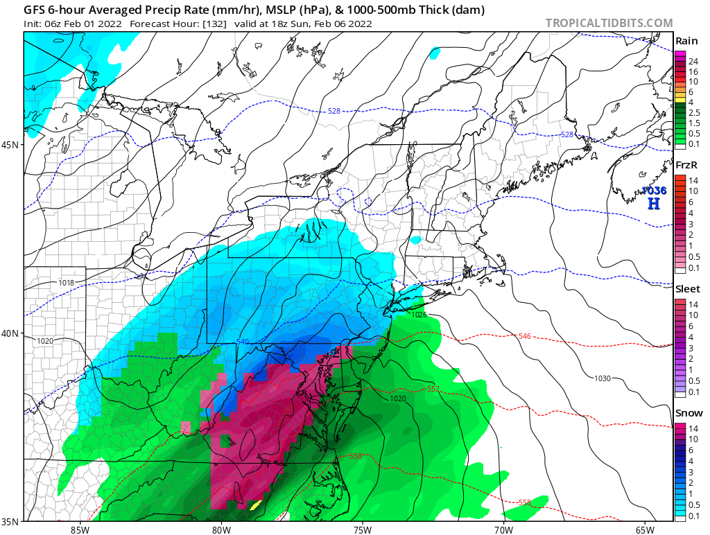
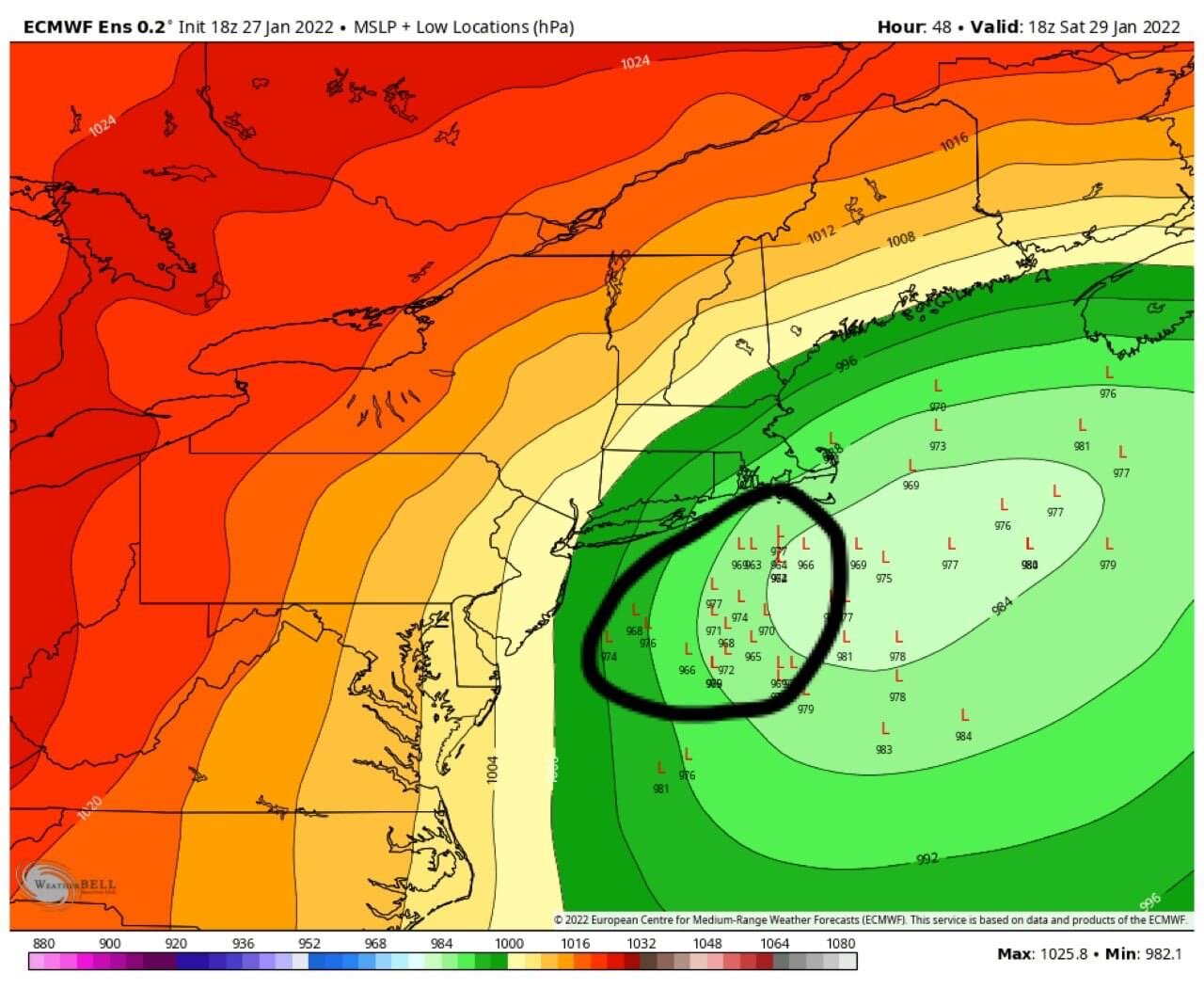
SLP is like 150 east compared to 00z. All hail GFS… yet again? -
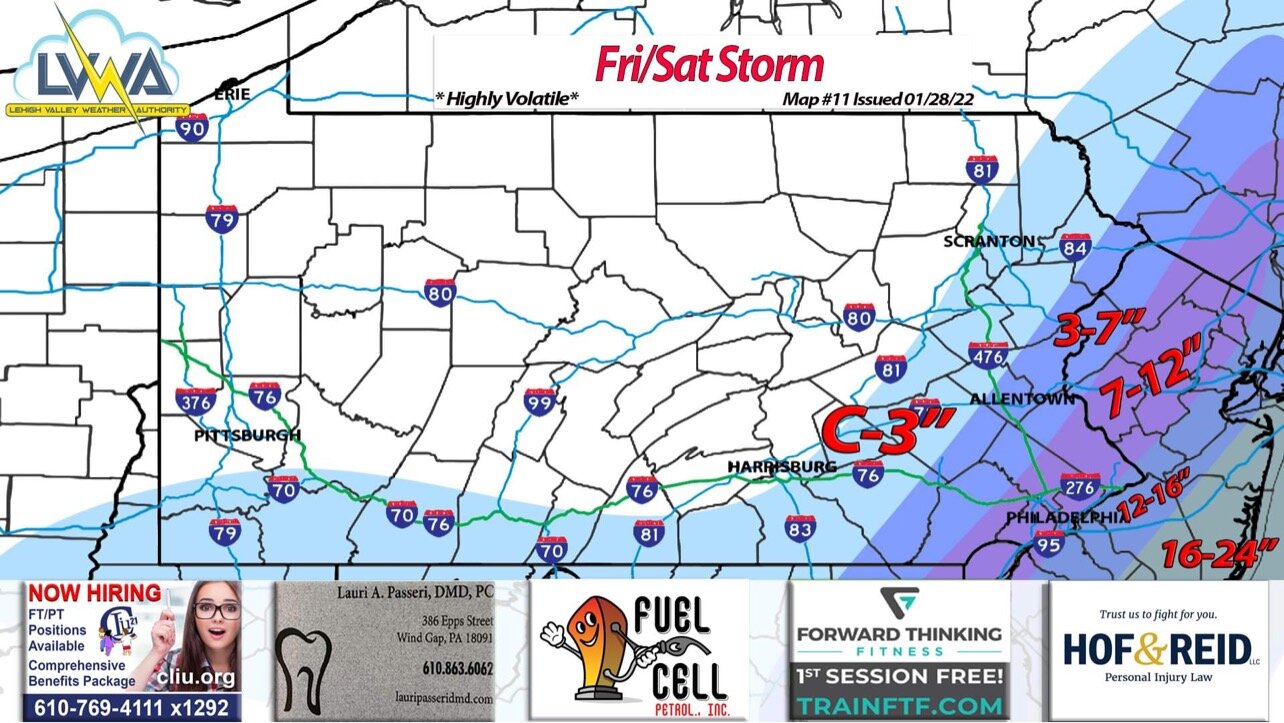
Steve D staying aggressive for the north

-
Good morning! nighttime low reaches -3 here in carbon county, projected was 4 above. Currently 9 degrees
-
Good luck fellers
-
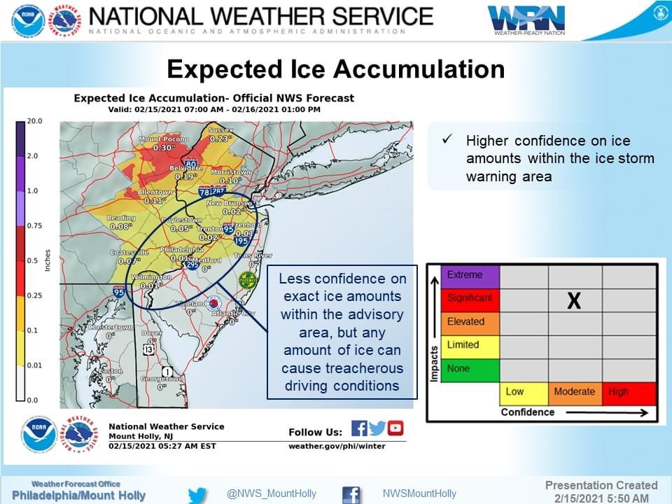
mt holly stays with the ice storm warnings. Indicate may not change to plain rain. Very interesting and bullish (LV POC)
-
Models aside, it IS significant ice probably through midnight-2am LV and poconos. CAD is never modeled correctly, and with the snow pack even more. It’s been hanging around 29-30 up this way. Roadways won’t be an issue, it’s the power lines and trees. IMO they are the cold spots that will build up. ultimately this warmer solution is also setting Thursday to be colder, so win win?
-
Mt holly staying with the ISW