CoastalWx
-
Posts
167,019 -
Joined
-
Last visited
Content Type
Profiles
Blogs
Forums
American Weather
Media Demo
Store
Gallery
Everything posted by CoastalWx
-
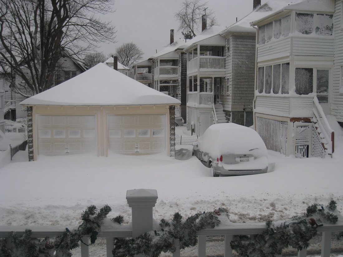
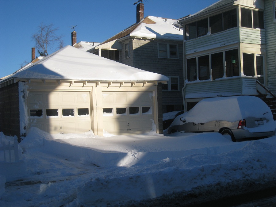
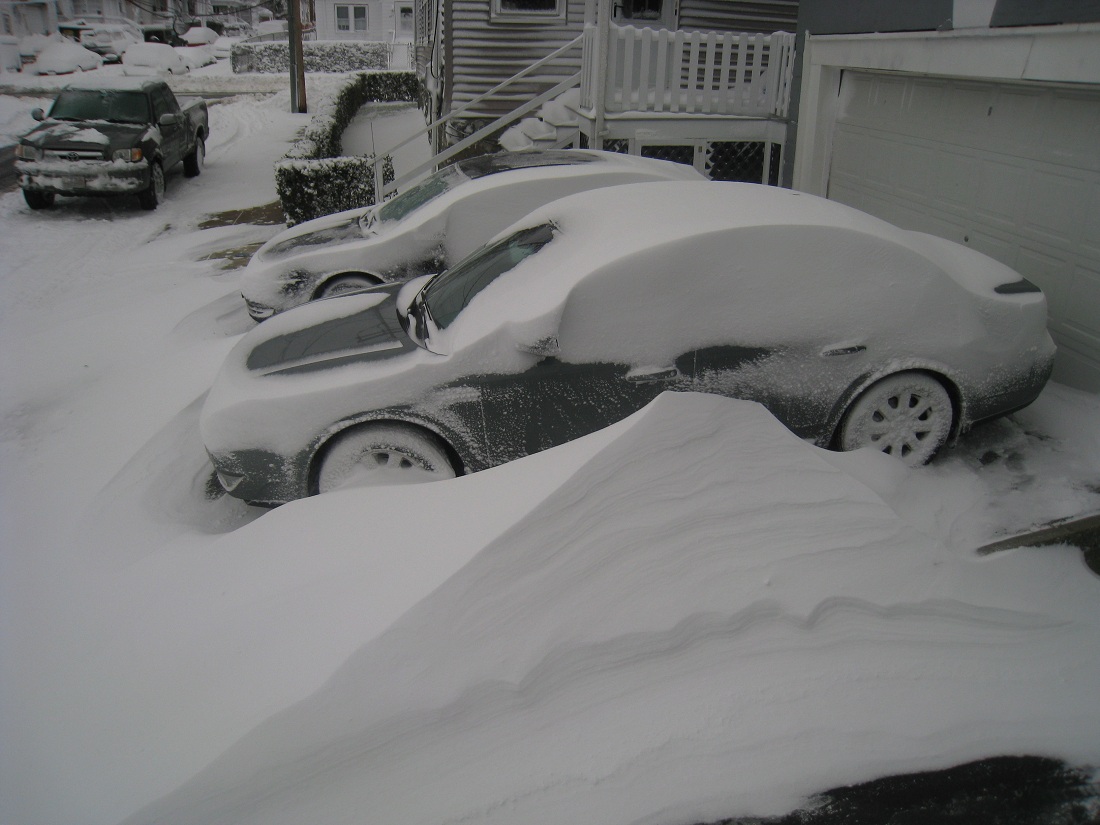
Couple of pics from 12/26 Nice drift.
-
That was an awesome storm. LOL, Foxboro had a virtual condo collapser.
-
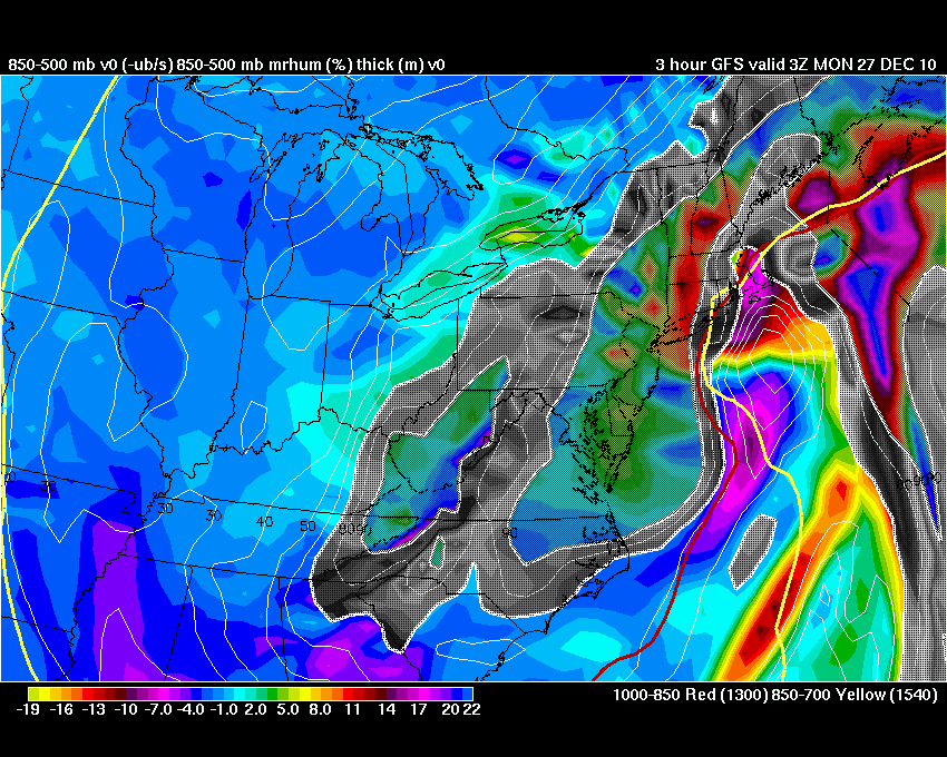
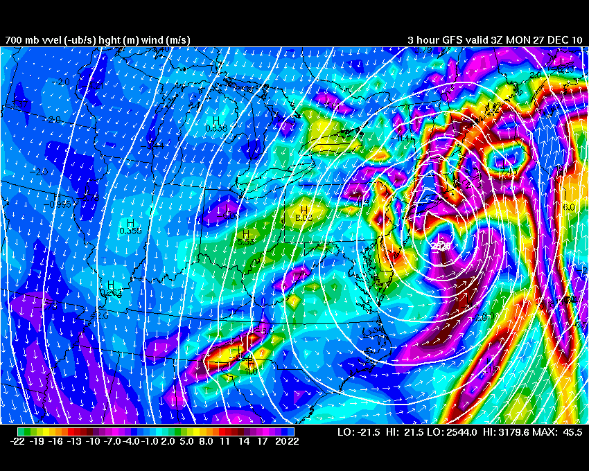
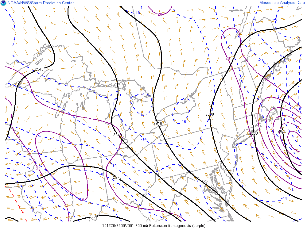
Another view of the intense lift down there. Strong low level frontogenesis too.
-
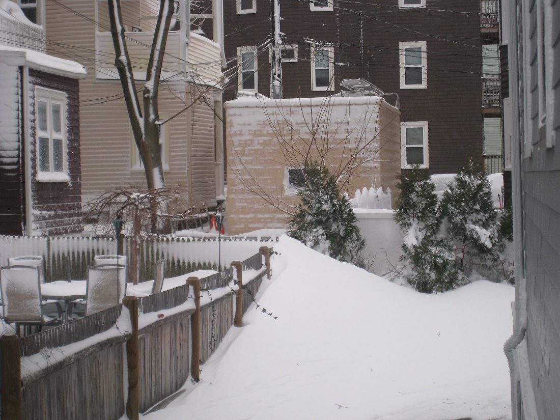
Again, I know it wasn't the greatest for all...but a few nice images I had from 12/26. Nice DS poking into ern mass, but look at the intense lift in se mass.

-
Yeah I thought about digging this thread out again,and getting the weenies fired up. You know it's bad when you post a water vapor animation at 2am, after being asleep for 3 hours.
-
Will is right though. Those are the types of systems that drop a quick 6-8" of snow, then followed by wind whipped cold. I love those too.
-
Don't forget about this little guy.
-
Convective monster.
-
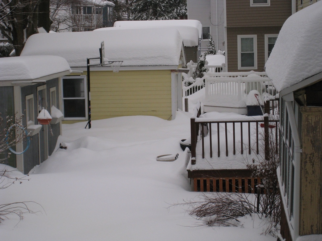
Here is 2/26 for comparison.
-
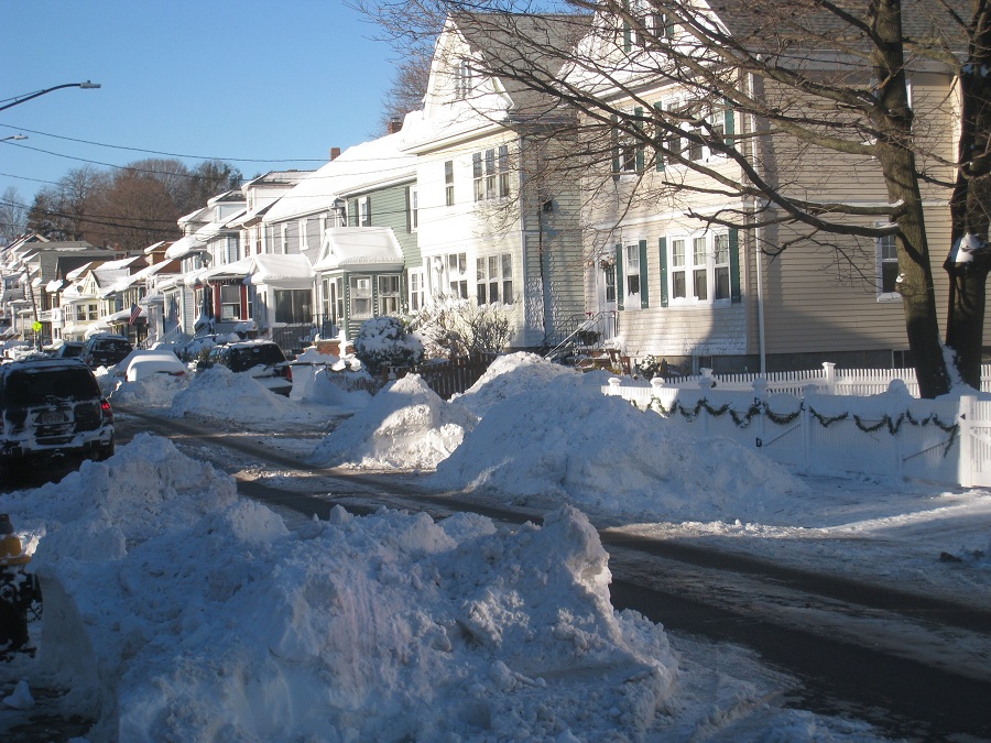
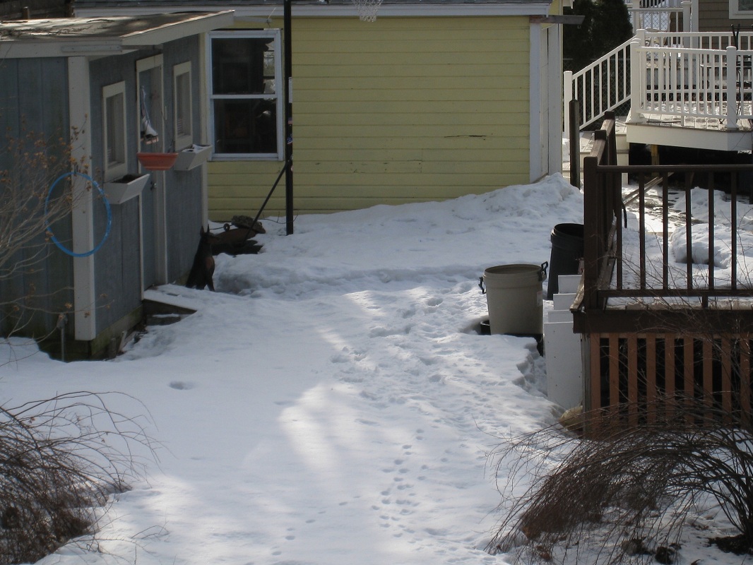
This was actually my highlight, right after the second round of snow on 2/2. That trashbarrel was my benchmark. There might have been some snow that blew off the deck, but the yard is virtually untouched.
-
Dam ORH and the ice that bulletproofed the snowpack.
-
I just right click on the image and "save image as". It saves it as an animation..I don't have to do anything.
-
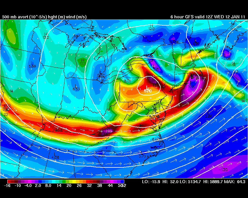
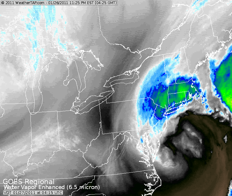
I thought this grab was really cool. It's the coastal front diving southeast on 1/12. This is the image that makes Ray cry and myself just delighted. Check out how the southwestern end was moving to the east much quicker than the area up by Newburyport. The low was pulling to the ene, so it makes sense.
-
That got borderline creepy/scary.
-
Oh yeah, the one where he almost got arrested for trespassing on the grounds of Barnstable Superior Court...trying to measure snow.
-
LOL, I think Messenger probably got blue-balled the worst, considering about 15 miles nw of him got hit hard. I'm humble because I had almost no business getting the snow I got, considering the storm track on some of these. No bragging here, because the next one could easily turn into a nude game of twister for Ray, while I'm listening to raindrops bouncing off my windows.
-
We gotta get you a good one for this winter. You were a good sport during this winter. Obviously you're happy to get good storms and you did get nailed by the 12/20 storm, but I'm sure the posts of Kevin's snowbanks while it was raining were a little disappointing.
-
Yeah we were bumming in the beginning of the month. I think the big MSP blizzard had some wondering if that was going to be the storm track. We got screwed by the one inside runner when the NAO block briefly moved into an unfavorable position. That Cape blitz came along and flipped the script on us.
-
Here's the mid level middle finger for parts of central ma into CT.
-
Phil's private little weenie band.
-
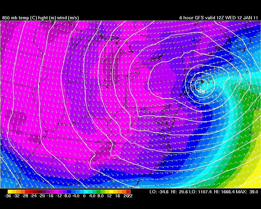
I know I lucked out on 12/26 while it somewhat disappointed many nearby, so I'm probably in my own little world talking about this storm..lol. I'll tell ya....the one thing that I'll remember about 1/12 was how Logan was 33F (even 34F for a brief time iirc) with S+. That is very difficult to do for a prolonged period. A true testament to how heavy that band was, but also having cold temps just off the deck limits melting too. I came back to a Tip blue bomb classic, when I left work. Quite impressive.
-
LOL, oh duh...I was thinking of Jan 12th that nailed him.
-
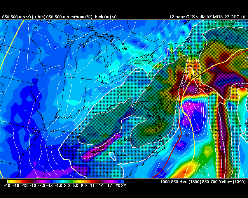
Oh yeah for us it hurt other than near BOS and points sw, but I was thinking more in the broader sense of the northeast in general. 12/26 wasn't compact in that sense, but it had the perfect ingredients in the mid levels to hammer NJ and up into Pete's area. It kept that core of precip very close to the low center, which is what I was thinking of. Jan 12th and 27th both had the mid level lows tucked in perfectly for us..almost better for NYC once again on Jan 27th.
-
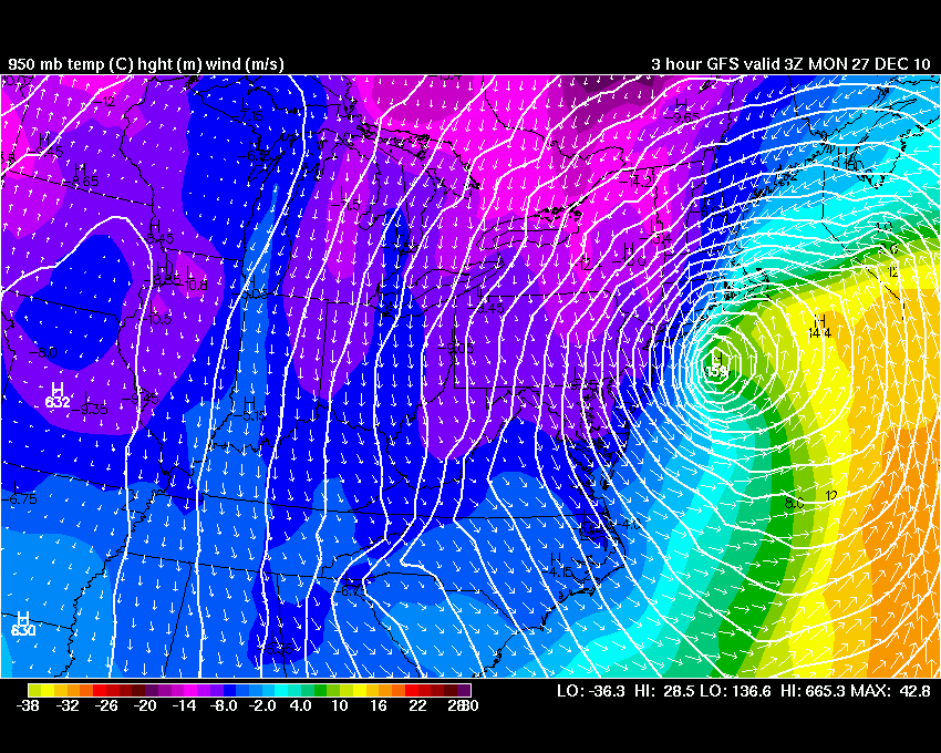
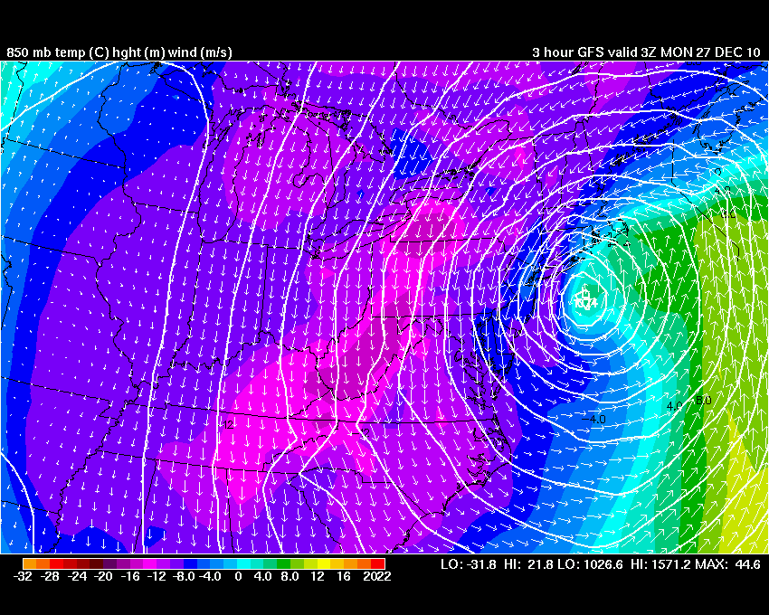
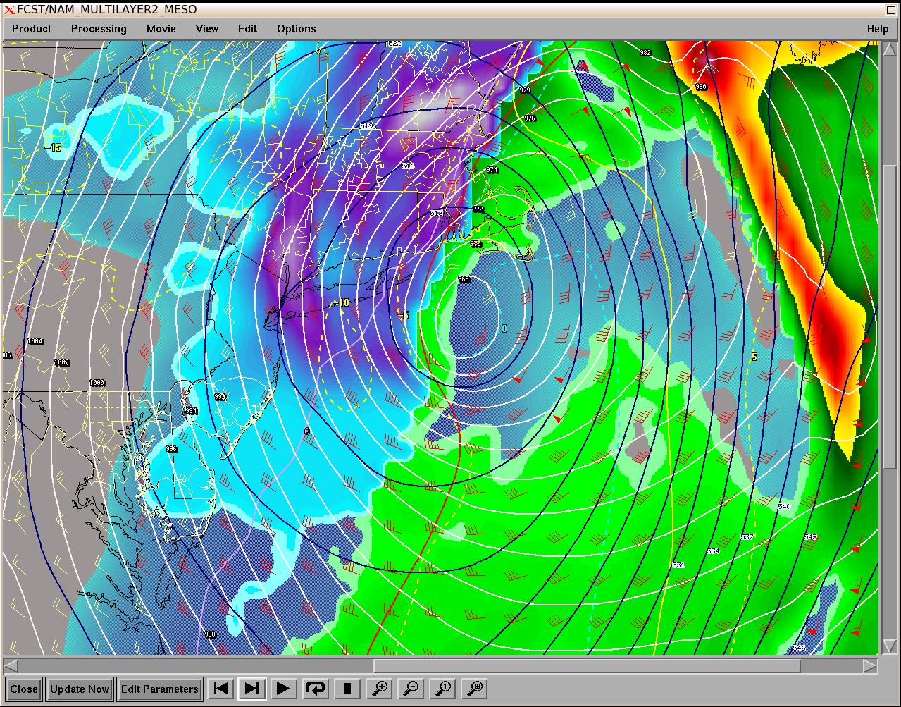
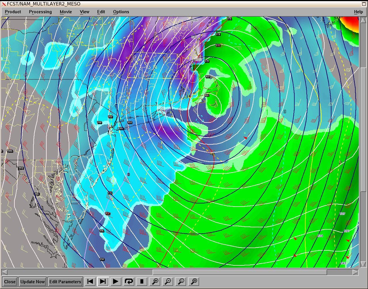
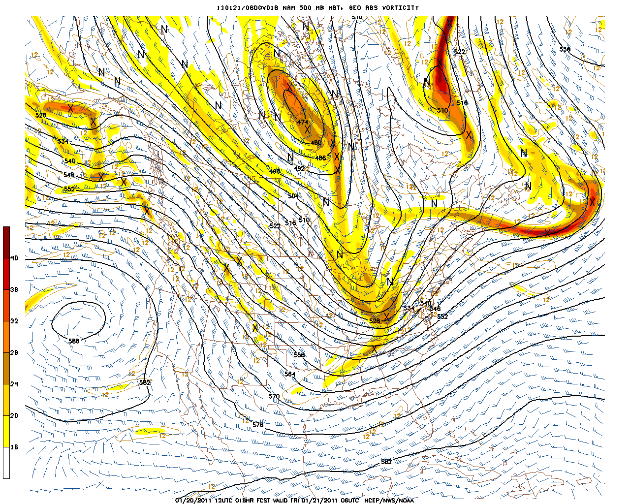
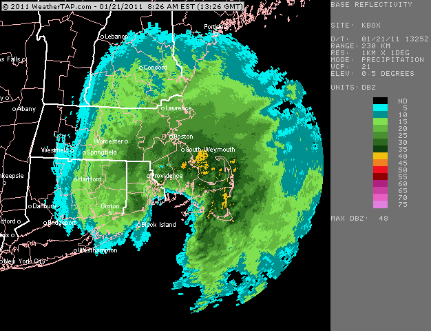
The DS in many of the storms strangely always ended up pretty close to PVD-TAN-PYM...give or take 10 miles or so. Each storm did track close to the Cape, but very similar placements with the DS. What compact bombs we had. I normally don't like seeing models come so close with the DS, but those mid level low ended up developing rapidly and pinched all that off. Great inflow getting caught up in these circulations as well. This was the winter of mid level lows. Dec 26th, Jan 12th, Jan 21st, and Jan 27th all were nice compact mofos.
-
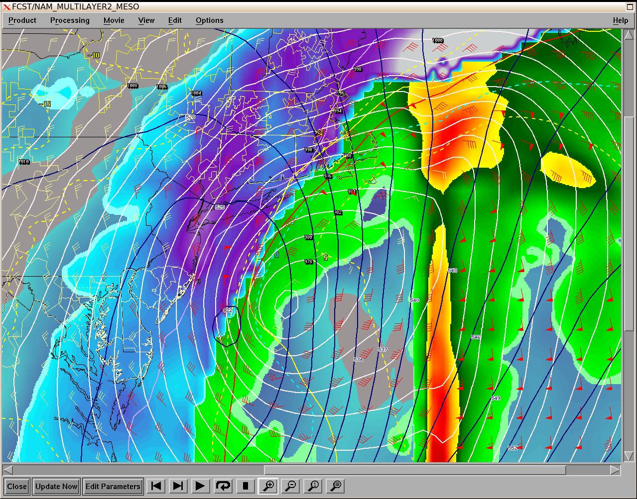
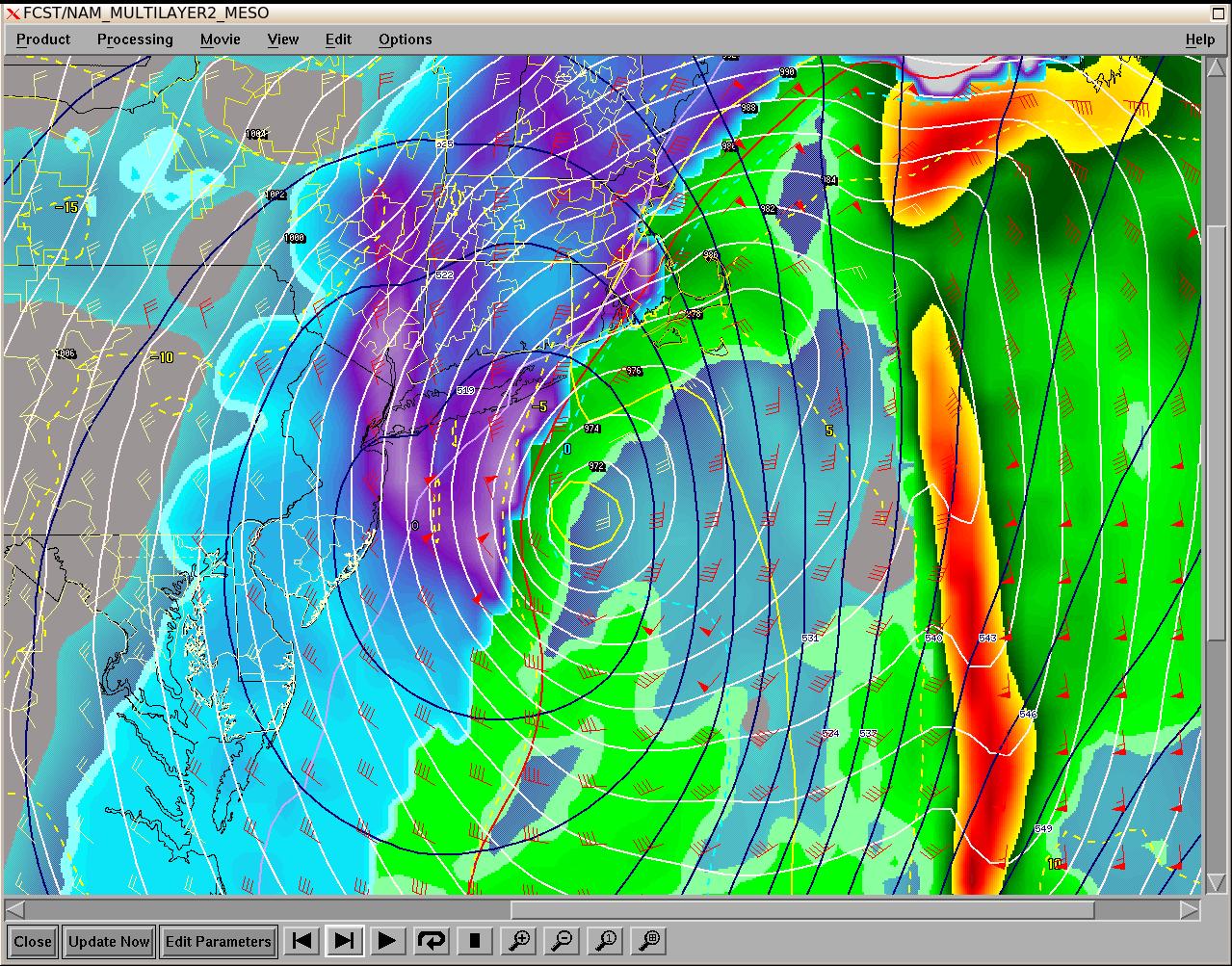
Radar matched up pretty well with DS depicted. Notice that heavy band right on the leading edge of the DS. This is a common phenomenon in storms as the DS can cause that narrow swath to become unstable.