RitualOfTheTrout
-
Posts
3,468 -
Joined
-
Last visited
Content Type
Profiles
Blogs
Forums
American Weather
Media Demo
Store
Gallery
Everything posted by RitualOfTheTrout
-
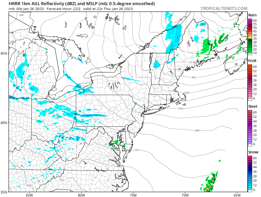
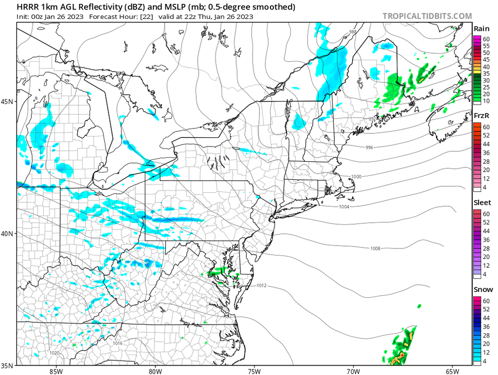
 It was nice to see snow falling all day for sure. Inability to drop below freezing despite 18 hours of NW flow on January 26th deflated my enthusiasm some and definitely took away from what would have otherwise been a bread and butter winter day. Getting some steady light snow now though and ground whitening up finally so take what you can get this year.
 -
Looks like some intense bands / squalls possible tomorrow.
-
Typically 1-2 years, we are in year 3 and most long term models have it breaking down and maybe moving into an El Nino over the next several months.
-
I wouldn't consider what happens tomorrow even part of this event. I agree today it failed. Anecdotally once things start falling apart or conversely getting better the models are playing catch up so we tend to see "good" and "bad" busts. This one had a low ceiling all along, we know historically how these things go, and we knew yesterday it was degrading but there was still some uncertainty with placements of banding and warm air etc so we hung on to hope. To your other post about the SE ridge, its been a constant all winter. Its been rinse and repeat good patterns in the long range end up only being marginally better short interludes to our base state of winter. I pretty much expect the same once we get past the first week of Feb, doesn't mean we can't get lucky along the way. If your in the hobby of tracking storms is strictly end results based, its probably not going to be a healthy experience. If you enjoy following the trends, trying to learn something new, posting obs, and can take joy from the little things while sharing constructively in the loses and triumphs with others who poses this odd obsession with frozen water crystals then you'll realize the end result may be disappointing but the ride was still worth it.
-
Don't discount tonight and tomorrow, very well could produce more snow and feel like a real winter day vs what we got today. Cold NW flow off the lakes enhanced by a series of little waves moving through the upper trough could provide one of those nice snow globe type days were it snows on and off a good part of the day and we manage a couple inches. NAM showed a couple decent bands too, although that of course would be more of a radar / nowcast thing tomorrow. .SHORT TERM /THURSDAY THROUGH FRIDAY/... Perturbed flow with various weak shortwaves is expected in the wake of the exiting winter system that shifts towards the northeast CONUS. The combination of vort advection within broad upper troughing plus cold advection, varied lake enhancement, and orographic lift will promote mostly scattered snow showers Thursday into early Friday morning. Enough moisture is expected to remain to have periods of decent DGZ growth that could lead to an additional 1-2" of snow for most locations.
-
Here is the exact criteria for an advisory, they can be issued even if you don't necessarily meet the totals based on impact etc. Given the uncertainty and potential impact I don't think its crazy off the wall NWS had an advisory issued. A winter storm event (sleet, snow, freezing rain, snow and blowing snow, or a combination of events) is expected to meet or exceed local winter weather advisory criteria in the next 12 to 36 hours but stay below warning criteria. Criteria for snow is 3 inches or more in 12 hours or less covering at least 50 percent of the zone or encompassing most of the population. Use "mid-point" of snowfall range to trigger advisory (i.e 2 to 4 inches of snow = advisory). Criteria for ice is any ice accumulation less than 1/4 inch over at least 50 percent of the zone or encompassing most of the population. Winter Weather Advisory can also be issued for black ice. This is optional. These can also be issued for impact (e.g. morning / evening commute). (Source: https://www.weather.gov/pbz/winterterms#:~:text=Use "mid-point" of snowfall range to trigger advisory,be issued for black ice.)
-
Yeah, quickly changed over to sleet / mix when those returns moved overhead here in SE Allegheny. Not promising, but not surprising.
-
Lets let this move through before calling it a total busted forecast:
-
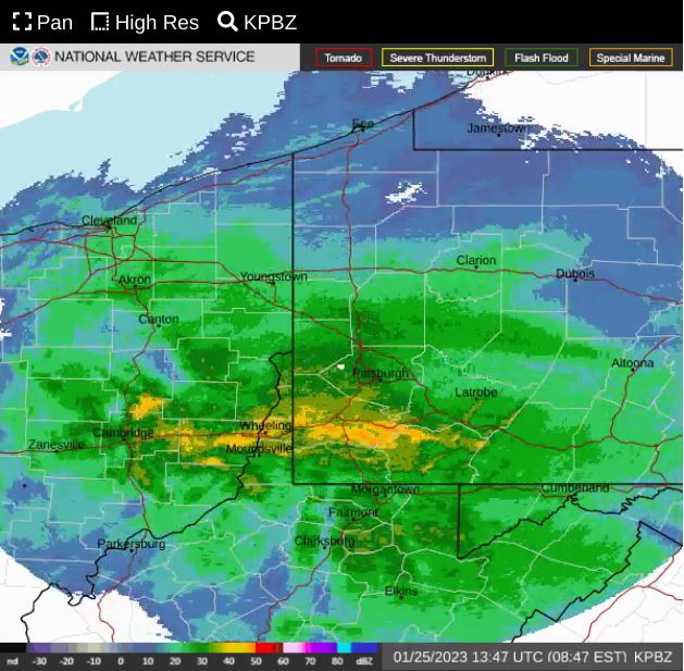
Yes, solid 35-45dbz returns about to enter Allegheny. This is the thump that will make or break it, if that is all snow and not indicative of a mix starting things should get interesting. Missing that initial thump delayed the onset so hopefully most people are at work before it hits the city.
-
Dry slot, what dry slot? Gotta love this region.. lol To be fair, we had a pretty good idea for at least 24 hours this was going to be the outcome, but you can never be 100% until nowcast time. Still think there is a shot at a brief but moderate to heavy burst when that main slug moves in if we can hold onto temps long enough. Surface temperatures are already 32-34 through the area for the most part, but I could see that cool briefly under heavier precip rates. Roads were all pre-treated and with marginal temperatures will probably be minimal impact. This has all the hallmarks of being one of those events were people bitch and moan about how meteorologists suck especially with the impending "winter storm" making headlines on the evening news last night. I can hear it now, wheres the snow, I stayed home / worked from home / my kids school was delayed for this?
-
0z 3k NAM looks lousy too, quick inch or two followed by heavy rain
-
Radiate away! I was outside and skies are crystal clear, ground freezing back up. Should help maximize whatever snow we do get.
-
I think it's just setting realistic expectations vs being outright negative doom and gloomer at least to this point. Data supports it, especially city and south. That being said I'll be watching radar hoping to see the models bust and get a heavy period of snow, but I'm expecting by the time I get home from work whatever does fall will be gone.
-
The earlier runs that had us closer to that WAA band also had the boundary between M/D line / I70, it's now up by I80 / PA NY border on the NAM. I'll be a little disappointed if there's not a burst of heavy snow to watch but if that misses it will be less irritating in some ways to not see it all melt / wash away 2 hours later anyways.
-
Not liking the trends here, everything seems to be leaning towards the best thump being just north of Allegheny County. Still a lot of uncertainty though. NW of the city (sometimes way NW) is going to be favored in this pattern, but you'd think we could get something being so close to the boundary. 00z GFS provides some hope for that, but even that changes so drastically it's hard to put much faith.
-
Everything riding on where that frontogenetic band sets up. Seems like it's been slowly ticking North so wouldn't shock me if NAM is right about placement but little over zealous with amounts. Still time, placement of that feature is a short range thing, if we keep it close still a chance for a good bust during nowcast time.
-
Crazy we can't seem to beat down that ridging in the east even a little bit. Would make a world of difference for our chances that's for sure. I agree though, pretty big changes run to run so nothing set in stone.
-
Anything like this the short range hi res models should out perform when it comes to getting the temp profile nailed down. 3k NAM seems to do well, but we all know typically the change over happens quicker. If your expectation is a quick 1-2 with a period of moderate snow that's probably a reasonable bet, then adjust as we get closer.
-
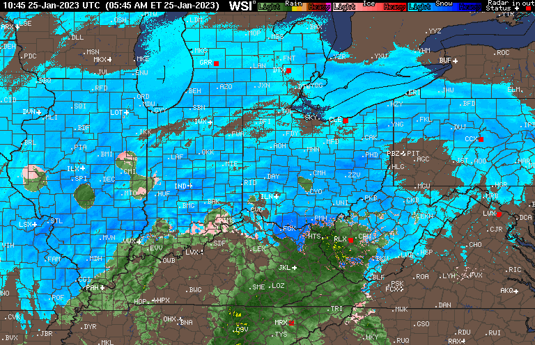
Ended up with about a half inch that all mostly fell between 3am and 9am. Never made it below freezing and it's all melted now. Can see on some higher hills nearby not much higher in elevation made a difference. Rained all day yesterday, my location sucks in these marginal setups and is equally pretty bad in the type of setup we will have Wed.
-
What else can you do but laugh, given the setup etc it's setting up in a way that matches our climo for this type of event. Thing that sucks is track alone this should have been better, just no antecedent cold air to work with
-
I hate looking past events, but yeah right now that one has a better shot of putting down a couple inches. Plus if it's via heavy snow even better.
-
I'll enjoy whatever snow we get, but pretty pessimistic with all the things going against it. My thinking is snow to start, but mainly mix / rain with the marginal temps and the weak lift / precip. The prospects of seeing much more than a slushy coating during daylight hours for my yard with a low elevation is a long shot. Areas just NW of the city may fair a little better but I think you need to really get even further than that for a satisfying event.
-
Whole thing is evolving similar to end of December, marginally favorable period followed by a stronger cold shot that's in and out. Gotta hope time of year helps change the equation to get a little more out of it.
-
I agree, Sunday looks like 1-3 best case scenario when you factor in the very marginal surface temperatures, its likely to get above freezing so some will certainly be lost to melting. I'd feel a bit better about it if we could get a little colder for this one because it's awfully close to going the wrong way. Everything with this upcoming window is about perfect timing of various features without a legit -NAO block or better placement of the ridge out west like you said. The Wednesday storm is still worth tracking though as small changes in the strength / timing of that northern stream energy ahead and the high behind that and even the ultimate evolution of the Sunday storm could be the difference between a driving rain storm and a front end thump to dry slot type setup.
-
Yeah several lightening flashes and wicked gust or downburst knocked the power out.