
allgame830
-
Posts
2,411 -
Joined
-
Last visited
Content Type
Profiles
Blogs
Forums
American Weather
Media Demo
Store
Gallery
Everything posted by allgame830
-

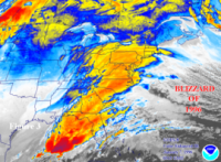
HIGH IMPACT Stormy Christmas (EVE and morning) 12/24-25/20 6P-10A
allgame830 replied to wdrag's topic in New York City Metro
Sorry can someone explain briefly what a stout low level inversion would mean for our area??- 227 replies
-
- 1
-

-
- heavy rain
- flooding potential
- (and 2 more)
-
December 16-17, 2020 Storm Observations and Nowcast
allgame830 replied to wdrag's topic in New York City Metro
Approaching 11” -
December 16-17, 2020 Storm Observations and Nowcast
allgame830 replied to wdrag's topic in New York City Metro
If you look at the future cast that area looks to fill in. -
December 16-17, 2020 Storm Observations and Nowcast
allgame830 replied to wdrag's topic in New York City Metro
4.5” as of 8pm getting smoked right now. -
4.5” getting absolutely smoked right now!!
-
not according to this: https://weather.cod.edu/satrad/nexrad/?parms=DOX-N0C-1-24-100-usa-rad
-
your right it doesn't but your literally the only one on here saying this.... @SnowGoose69 said right above even the NAM is running 30-40 to fast with the change to sleet.
-
so for about every hour late that could mean 1-2" give or take in most locales. Correct?
-
HRRR shouldnt be looked at until tomorrow.
-
Models do have a tendency is over correcting its happened many times and I believe Typhoon Tip made some good points about it... can't find it though now.
-
hey hey what about me LOL LHV Northern Westchester LMAO
-
Reading some from the NE forum many seem to think that the models have over corrected too far NW and will come back some to SE....
- 3,762 replies
-
- 1
-
-
- heavy snow
- heavy rain
- (and 3 more)
-
everybody is doing a lot of short few word posts.... how about we post some images to justify the NW comments and etc....
- 3,762 replies
-
- 1
-
-
- heavy snow
- heavy rain
- (and 3 more)
-
fair enough but the GFS was too south and east... like i said meeting in the middle.
- 3,762 replies
-
- 1
-
-
- heavy snow
- heavy rain
- (and 3 more)
-
Yea I was just about to say that. EURO is still far better then the GFS... all that is doing here is meeting in the middle!
- 3,762 replies
-
- 1
-
-
- heavy snow
- heavy rain
- (and 3 more)
-
When do you think the winds will die down?
-
Wow very impressive!
-
That simply ain't true.... tropical systems can drop 4-6" in 2/3 hours easily.
- 1,530 replies
-
- 1
-
-
- heavy rain
- rip current
- (and 1 more)
-
Those two UKIE maps are some serious business.... like others have said prob cut that wind map in half which is still up in the storm force wind just range.... i am sure a few locations will see hurricane force wind gusts. However, the precip map is extremely concerning on top of those winds. Any thoughts on 4-7" of rain?
-
Yea i know you locale is pretty far inland.... your concern I feel should of on the flooding rains because all of the models have trended in that direction. also if he regains minimal hurricane status ( i am thinking 85mph) then I really don't see much decline in intensity as it moves up to our latitude. Most likely 65-70mph around our region which is all dependent on if does strengthen a bit. some if's.... we'll see. definitely have a better understanding of the situation by later this evening/tonight.
-
OK warranted but backyard is pretty far inland which is not a representation of the alot of the subforum. even for me in the Lower Hudson Valley I still would expect some strong winds and potentially gusts over 50-60mph. Isaias will pack a nice punch. yesterday i was more concerned on flooding now the wind factor has definitely increased quite from NYC on east/north. still believe we see a few inches or rain as opposed to west of NYC in NJ/Eastern PA could see 4-6 inches with some localized amounts up to 8" is not out of the question.
-
well NHC still thinks it will regain minimal hurricane status just before landfall. and no way the shear is still in that range it is sig lower than that at this time.... not sure if anybody should be downplaying a storm like this. I would expect more significant impacts then FAY. Just some gusty winds???.... lets get real now! this is a higher impact storm considering it will be moving faster which does not allow for weakening to be as much and also the phase in with the trough which would help to tighten the wind giradiant.
-
I wouldn’t just call this a nor’easter... this will most certainly pack more of a punch then that!
-
Wintry mix potential weekend of Jan 18-19, 2020
allgame830 replied to wdrag's topic in New York City Metro
That lull is going to be short lived.... -
Wintry mix potential weekend of Jan 18-19, 2020
allgame830 replied to wdrag's topic in New York City Metro
21/1 here