Blizzard-on-GFS
-
Posts
700 -
Joined
-
Last visited
Content Type
Profiles
Blogs
Forums
American Weather
Media Demo
Store
Gallery
Everything posted by Blizzard-on-GFS
-
 Yuck, horrible track for CNJ. I’m hoping the Euro is over amping this.
 -
I'm from central NJ. (Southern Mercer County). There's gonna be a razer sharp cutoff around my parts. I think NYC and north is game set and match to get hammered regardless.
- 3,762 replies
-
- 1
-

-
- heavy snow
- heavy rain
- (and 3 more)
-
I meant to say ZR and Sleet. I'm real nervous for my area just NE of philly. NYC should be fine due to the latitude. I think the farther north you are the better with this storm.
-
Ugly as hell for I-95 and east, I have a feeling this is going to end up being a sleet fest for I-95. That warm nose is gonna muck things up for the coastal crew.
- 3,762 replies
-
- 2
-

-
- heavy snow
- heavy rain
- (and 3 more)
-
Aw man that’s perfect for I-95. This is my dream track, just a hair SE of the GFS.
- 3,762 replies
-
- 1
-
-
- heavy snow
- heavy rain
- (and 3 more)
-
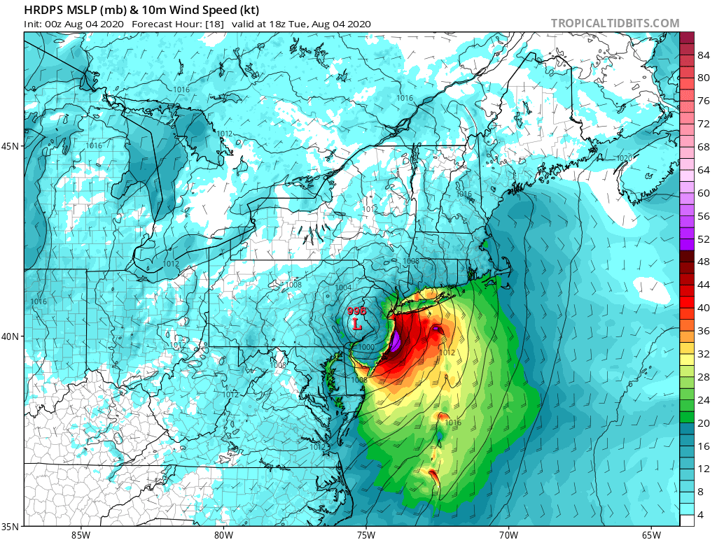
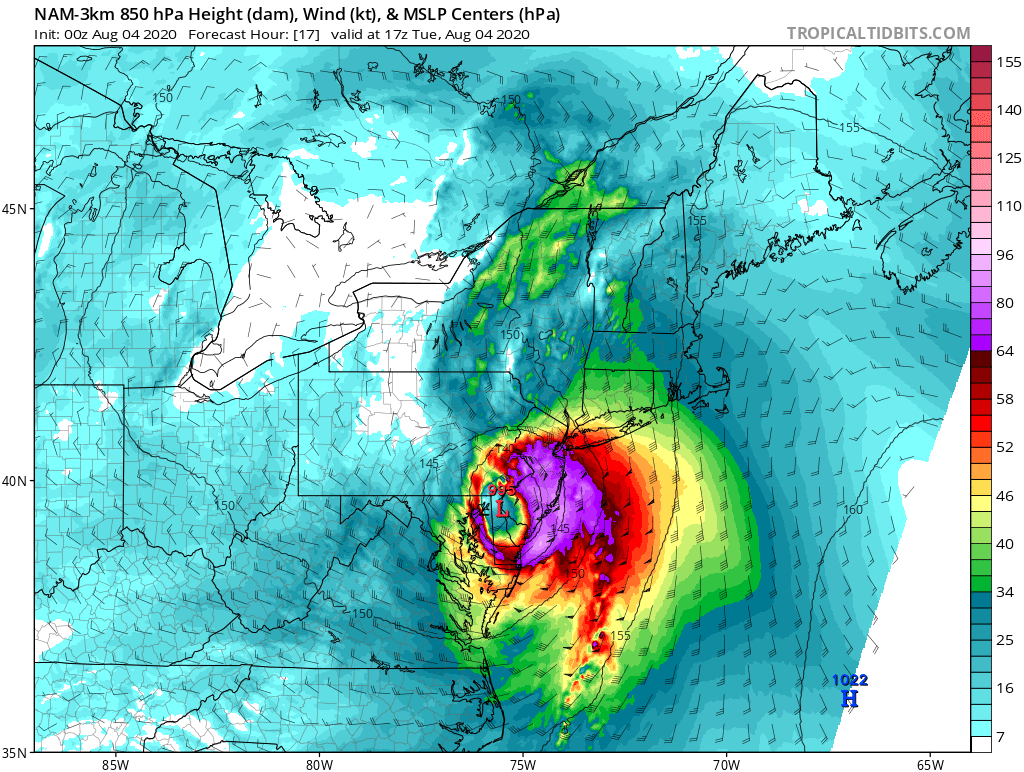
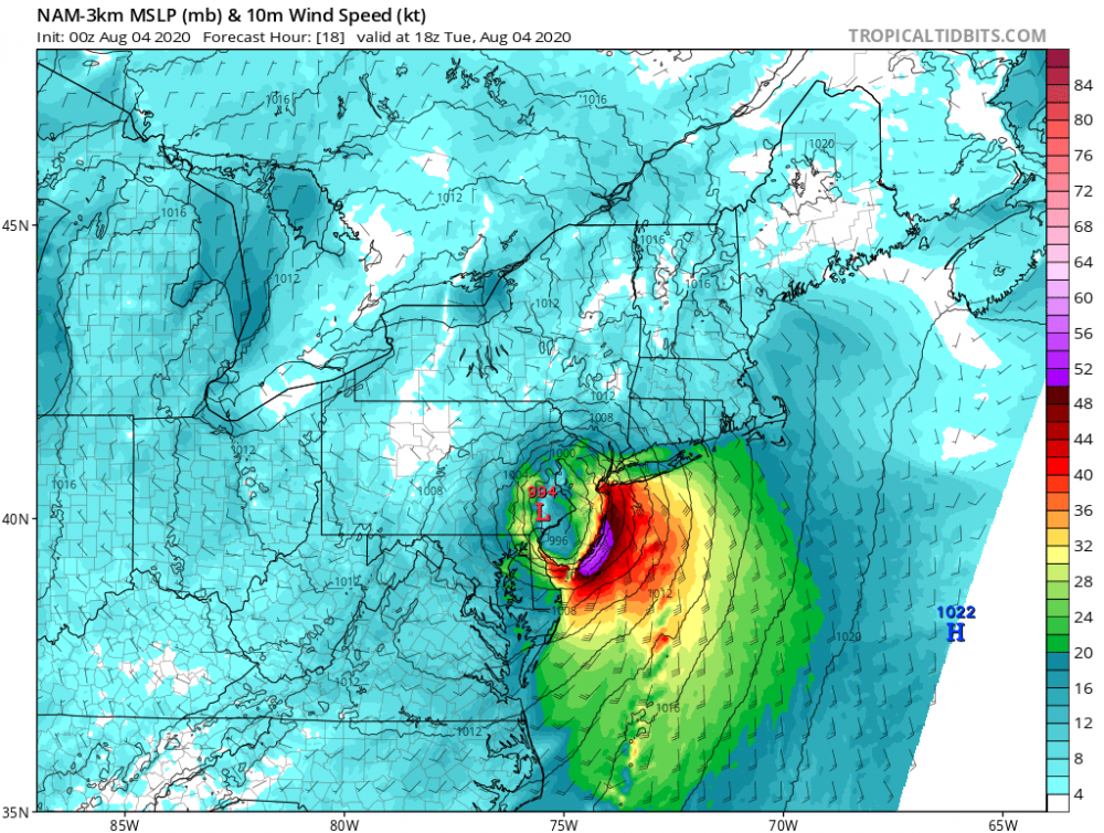
I am in Long Beach island and it appears instead of the worst of the winds are from the Cape May area on the due east side of the eyewall moving north East, can anyone confirm that with reports??
-
Yeah agree, I'm expecting a brief period of 50 mph. Some of the models have shown higher but they are most likely over done.
-
Nearly all of the MESO models show an intense band of roughly 60 MPH sustained winds making its way up the barrier islands of NJ. It's hard to believe but almost every model has it. Gusts would be even higher. I know it's crazy but these winds would probably warrant a hurricane warning for these areas; I doubt the warnings will be hoisted but it will be interesting to see how bad it gets.

-
Awesome, same. I'm in Ship Bottom, NJ on the bay side.
-
Not to be a downer but it's a shame this sub forum is dead. I'll be riding this storm out down LBI but there's not many people here to talk too. It's kind of annoying being a drifter between the Mid-Atlantic, NY, and New England sub-forums to find discussion. The true philly/jersey shore area posts get stuck here. Just my 2 cents, I get it if this post is deleted. Just please don't 5 post me.
-
These winds are going to be WICKED for the coast line. I don't care what anyone else says. This is a unique setup.

-
Wow! Yeah the Jersey Shore and Long Island are gonna get clocked with winds. I’m surprised people are downplaying it. Nearly all the models show hurricane force gusts for the shore points... Care to share the ukie wind map?
-
July 2020 General Discussions & Observations Thread
Blizzard-on-GFS replied to Rtd208's topic in New York City Metro
Here comes the eye!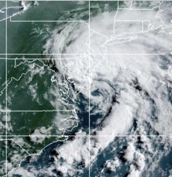
-
A tropical storm is likely gonna landfall in the area in the next 48 hours and there’s radio silence in this sub, where is everyone lol? People are sleeping on Fayz
-
I thought you said weast...
-
January 18, 2020 Mixed Event Obs
Blizzard-on-GFS replied to Ralph Wiggum's topic in Philadelphia Region
Sleet in Bordentown, NJ right now. So when the heavy precipitation moves in from the SW what will the ptype be? If it’s all frozen it looks like a lot of qpf... -
WINTER ARRIVES THIS WEEKEND EVENT JAN 18-19, 2020
Blizzard-on-GFS replied to Albedoman's topic in Philadelphia Region
Expected snowfall less than < 1”. Story of our lives for the last tao Years lol. So pathetic. Haven’t even hit an inch yet this year -
WINTER ARRIVES THIS WEEKEND EVENT JAN 18-19, 2020
Blizzard-on-GFS replied to Albedoman's topic in Philadelphia Region
Probably a combination of both. I think we end up somewhere in the middle. 1-3” of slop to rain for I-95. 2-5” northwest of there. -
Tuesday January 7 Potential Snow Event
Blizzard-on-GFS replied to ChescoWx's topic in Philadelphia Region
Ok maybe my snow-starved eyes are deceiving me but the moisture shield looks way further north and west then projected on the models. I'm not understanding how it isn't going to swing through the area with at least a coating to an inch.... Just a really weird storm, the low takes the benchmark track, juicy moisture shield, yet we are mostly projected to get nothing. Guess we will see soon enough. -
Possible frontal wave snow
Blizzard-on-GFS replied to Zelocita Weather's topic in New York City Metro
JUICE! -
Winter 2019-2020 Banter Thread
Blizzard-on-GFS replied to Ralph Wiggum's topic in Philadelphia Region
I totally agree. To be honest I only come to the Philly thread for observations during events, most of the model discussion happens in the NYC thread. I know we've broached this subject before but I'd be fine with the merger of NYC/Philly. As a CNJ/South Jersey resident I feel caught between two areas. Just my two cents though. -
Man this one hurts, Warned for 4-8” in Mercer county, NJ and we literally got nothing. Hoping to salvage an inch of scraps on the back end as the HRRR alludes to but at this point I’m thinking this one is game, set, set and match. We are really overdue for a nice cold Miller A to bury the whole sub.
-
Ugh I ‘m so disappointed, had a 5-8” consensus snowfall last night on the models dwindle down to I’ll be lucky to see 1-2” in CNJ. It’s been a brutal stretch this last year and a half for my area.
-
One note is that the 3k NAM is far more generous with QPF especially for southern areas. Notably more banding around CNJ>
-
Big OOF on the 12k NAM....this is why we can't have nice things down our way lol.