Ginx snewx
-
Posts
105,747 -
Joined
-
Last visited
Content Type
Profiles
Blogs
Forums
American Weather
Media Demo
Store
Gallery
Everything posted by Ginx snewx
-
 What a run of COC. Gorgeous
 -
2.23
-
Pool is overflowing.
-
Totally crushed
-
Jesus
-
Hmm
-
Saturday, July 18, 2026 Thunderstorm/Severe Weather Potential
Ginx snewx replied to weatherwiz's topic in New England
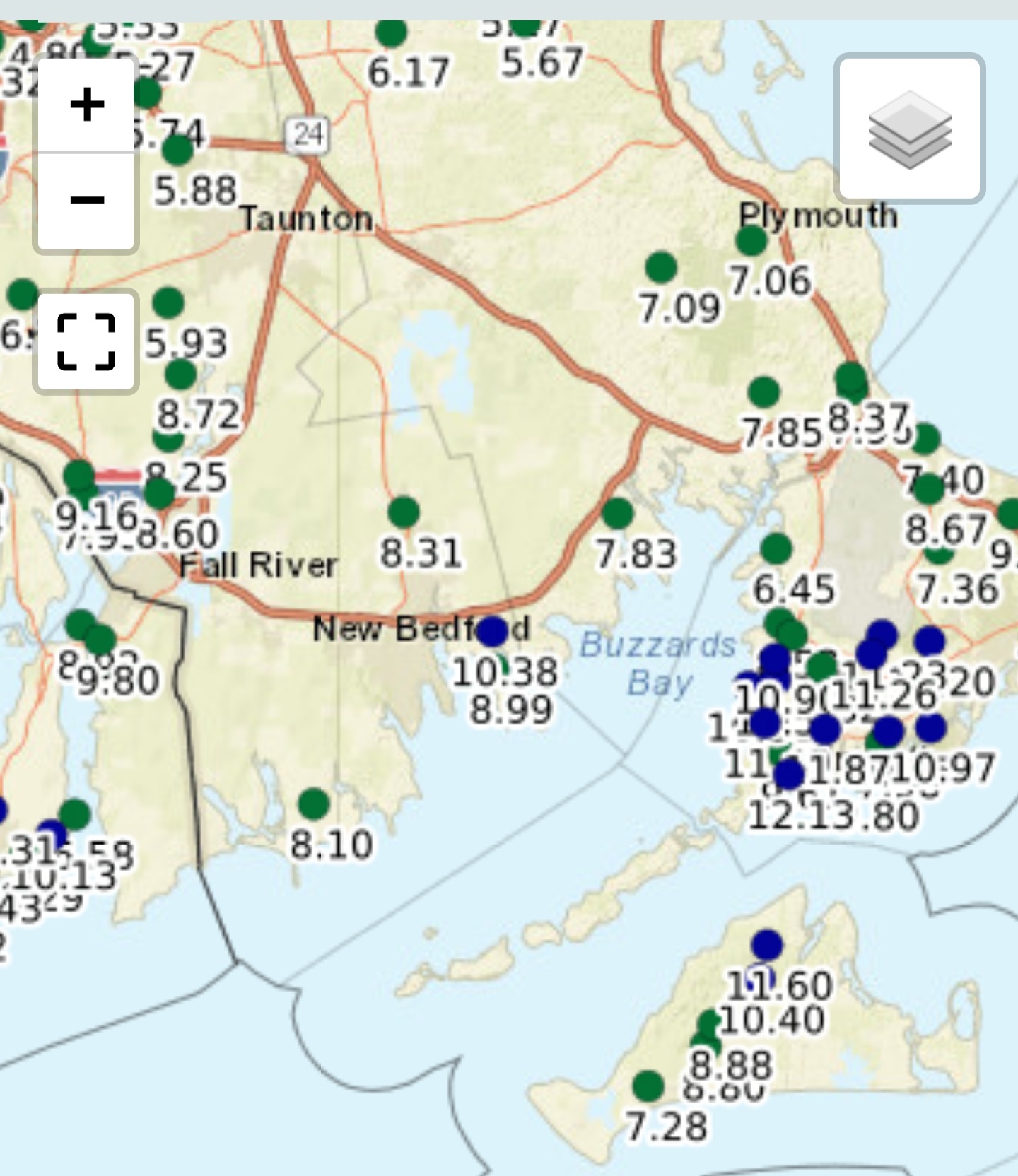
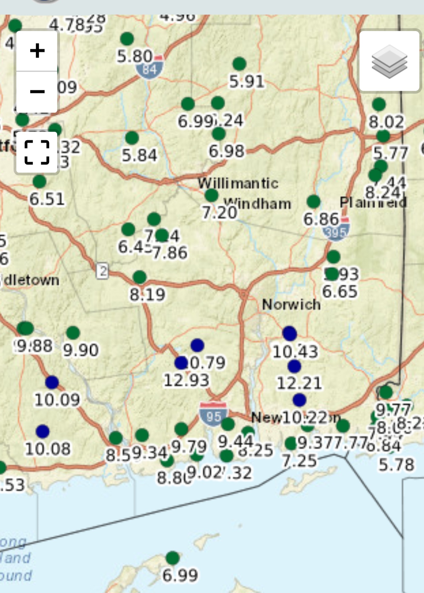
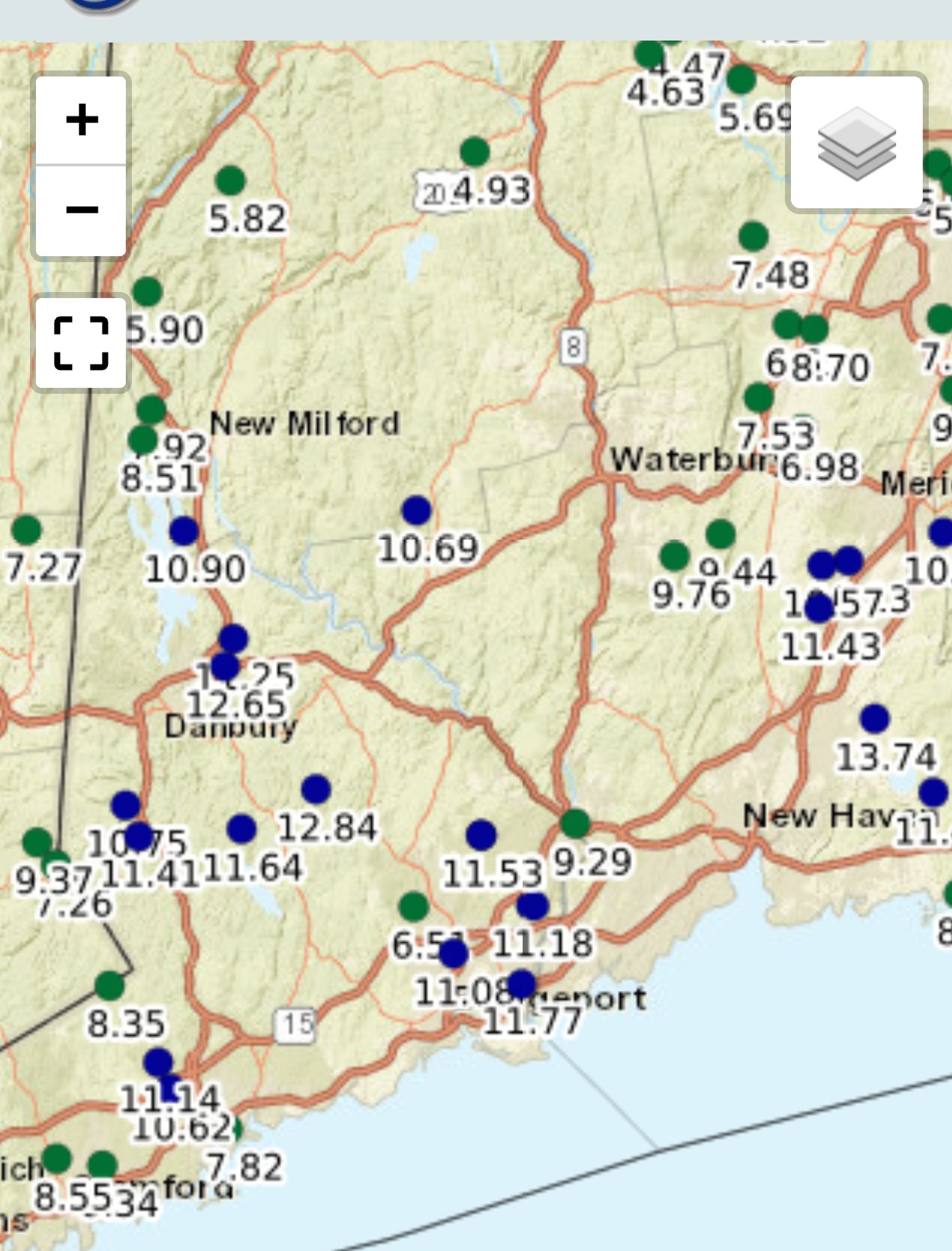
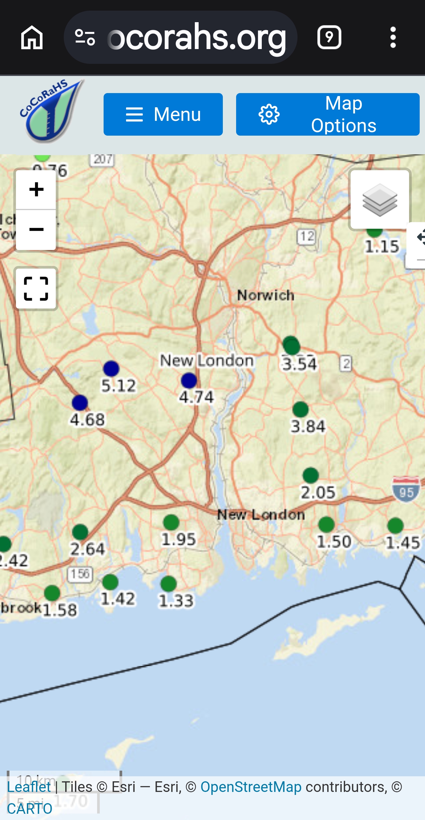
New London 4 to 6
-
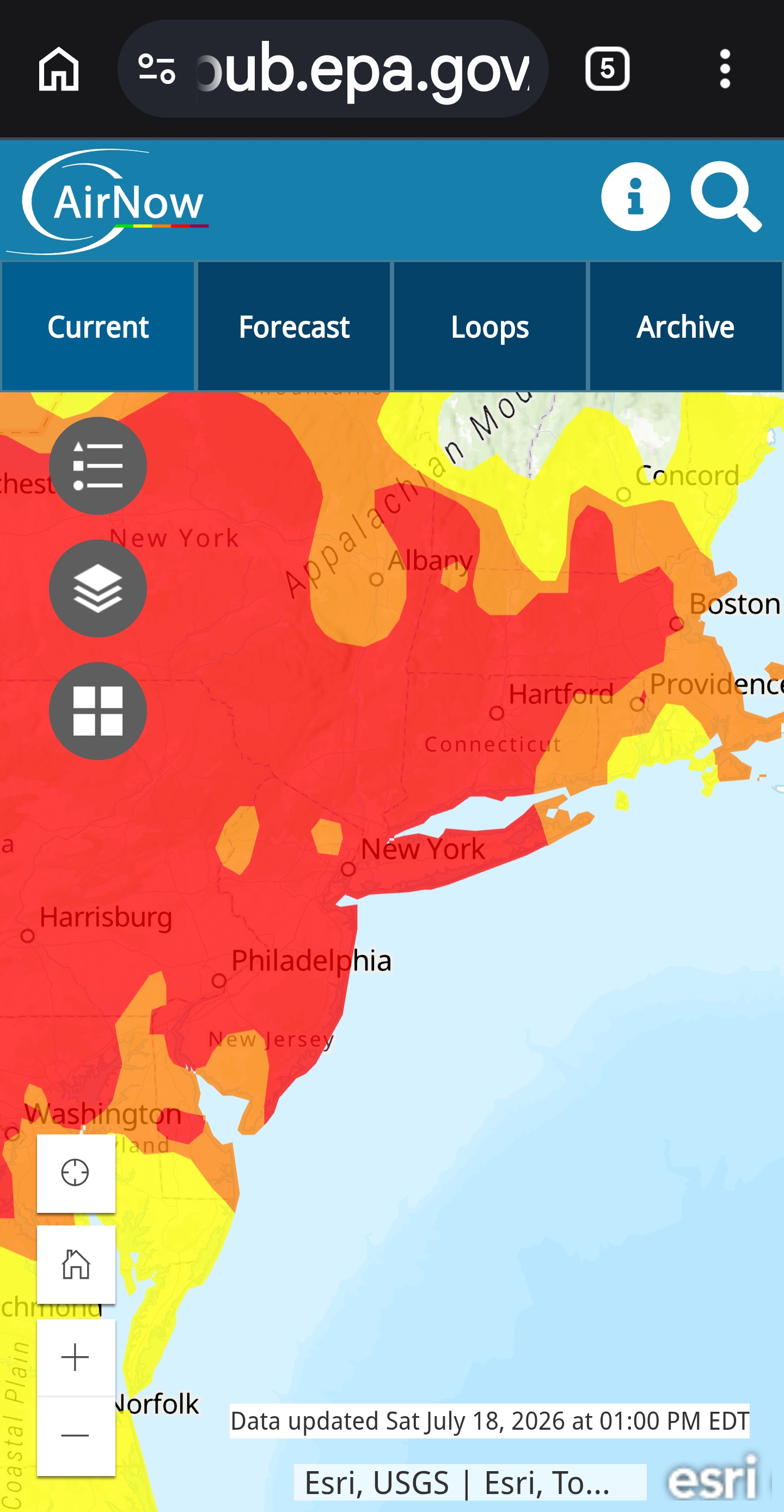
Man Midwest smoked out. I saw AQI over 600 this past week. Centered over Chicago today
-
Saturday, July 18, 2026 Thunderstorm/Severe Weather Potential
Ginx snewx replied to weatherwiz's topic in New England
.91 with tstrms -
Sucks to be you
-
We love huge COC
-
.91 great drink
-
Saturday, July 18, 2026 Thunderstorm/Severe Weather Potential
Ginx snewx replied to weatherwiz's topic in New England
Tough to bust before it happens -
Saturday, July 18, 2026 Thunderstorm/Severe Weather Potential
Ginx snewx replied to weatherwiz's topic in New England
Still smoked too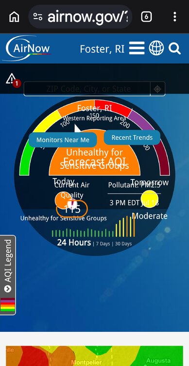
-
Saturday, July 18, 2026 Thunderstorm/Severe Weather Potential
Ginx snewx replied to weatherwiz's topic in New England
Round 2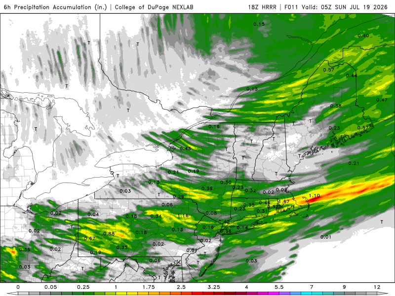
-
Saturday, July 18, 2026 Thunderstorm/Severe Weather Potential
Ginx snewx replied to weatherwiz's topic in New England
.37 pouring -
Saturday, July 18, 2026 Thunderstorm/Severe Weather Potential
Ginx snewx replied to weatherwiz's topic in New England
Smoke um if ya got um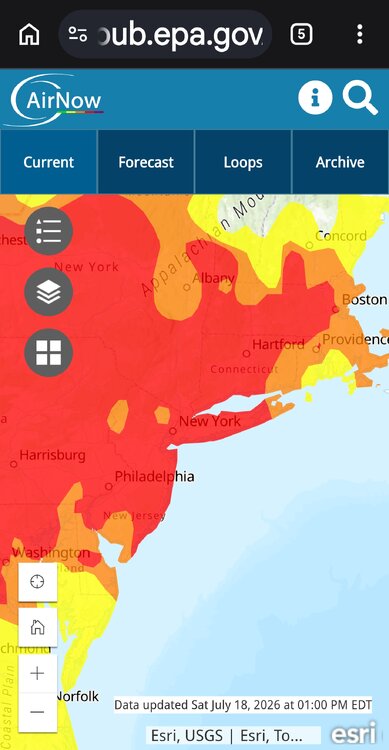
-
As Ditty likes to say. "Finally some COC"
-
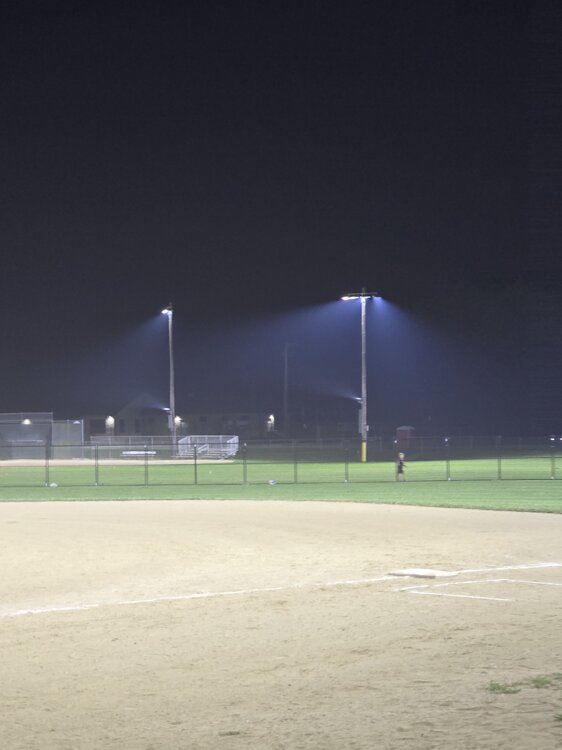
Smokey Women's all star softball night
-
Hoisting the Sultan Signal: Heavy Rain Event July 5-7
Ginx snewx replied to WxWatcher007's topic in New England
Scooter Brett crushed lol must be winter with all the premature fails posts -
Hoisting the Sultan Signal: Heavy Rain Event July 5-7
Ginx snewx replied to WxWatcher007's topic in New England
Crushed by the last hurrah -
Hoisting the Sultan Signal: Heavy Rain Event July 5-7
Ginx snewx replied to WxWatcher007's topic in New England
Link?we all said south coast to pike most vulnerable and it was south coast with 4 to 6. -
Hoisting the Sultan Signal: Heavy Rain Event July 5-7
Ginx snewx replied to WxWatcher007's topic in New England
Analog 850 inflow is very wet for you. Some knew