Ginx snewx
-
Posts
105,737 -
Joined
-
Last visited
Content Type
Profiles
Blogs
Forums
American Weather
Media Demo
Store
Gallery
Everything posted by Ginx snewx
-
 Cut the size double the price. Now garbage
 -
Remember in 2012 when you said we would never see a BN summer month again?
-
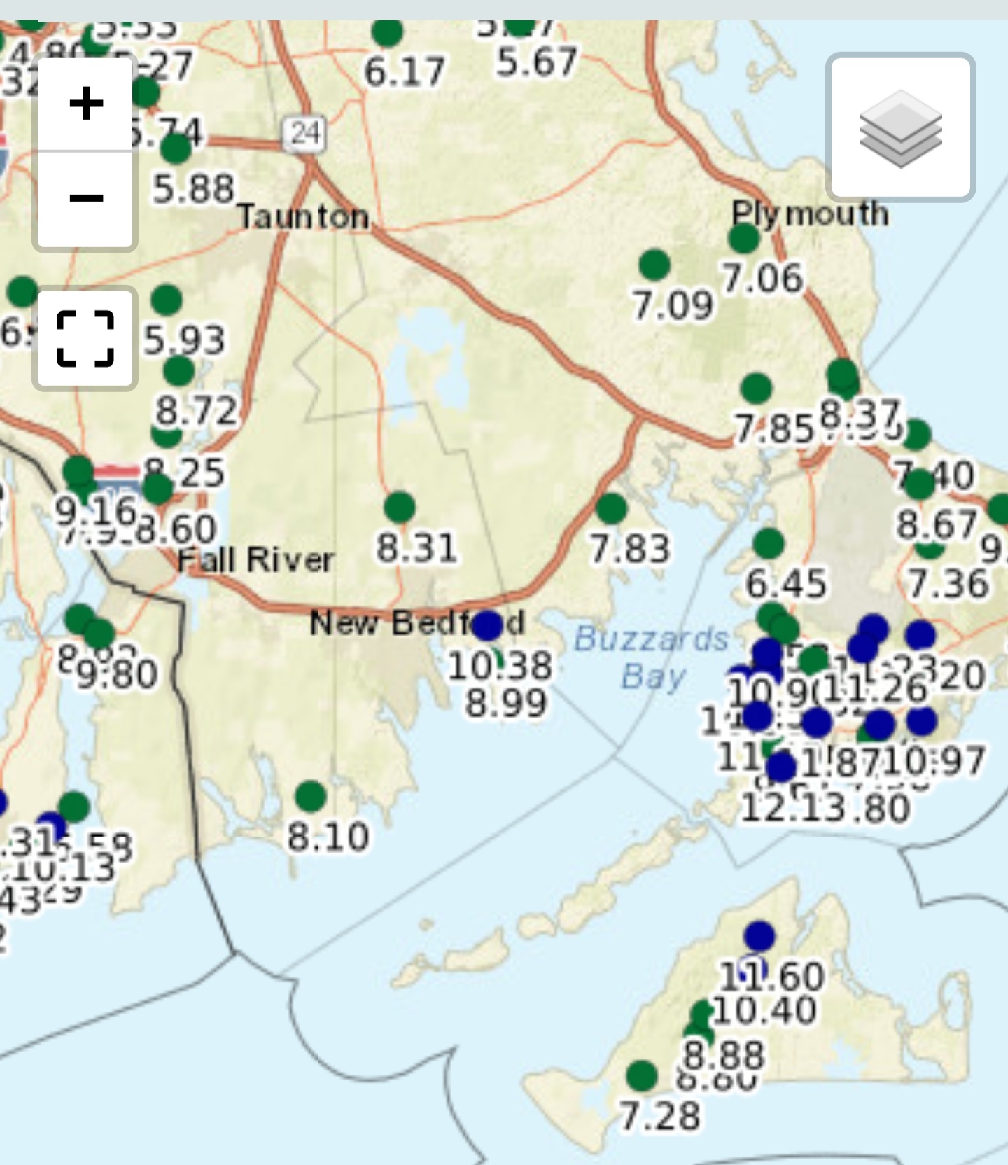
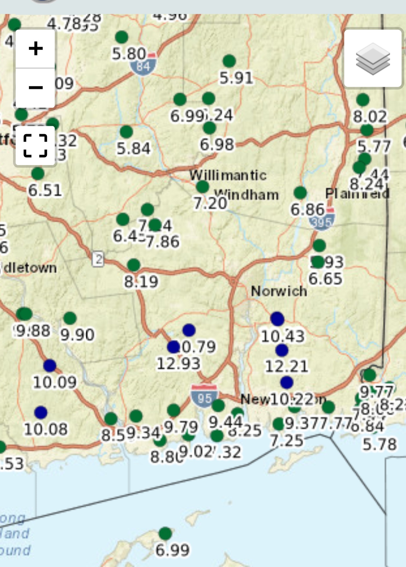
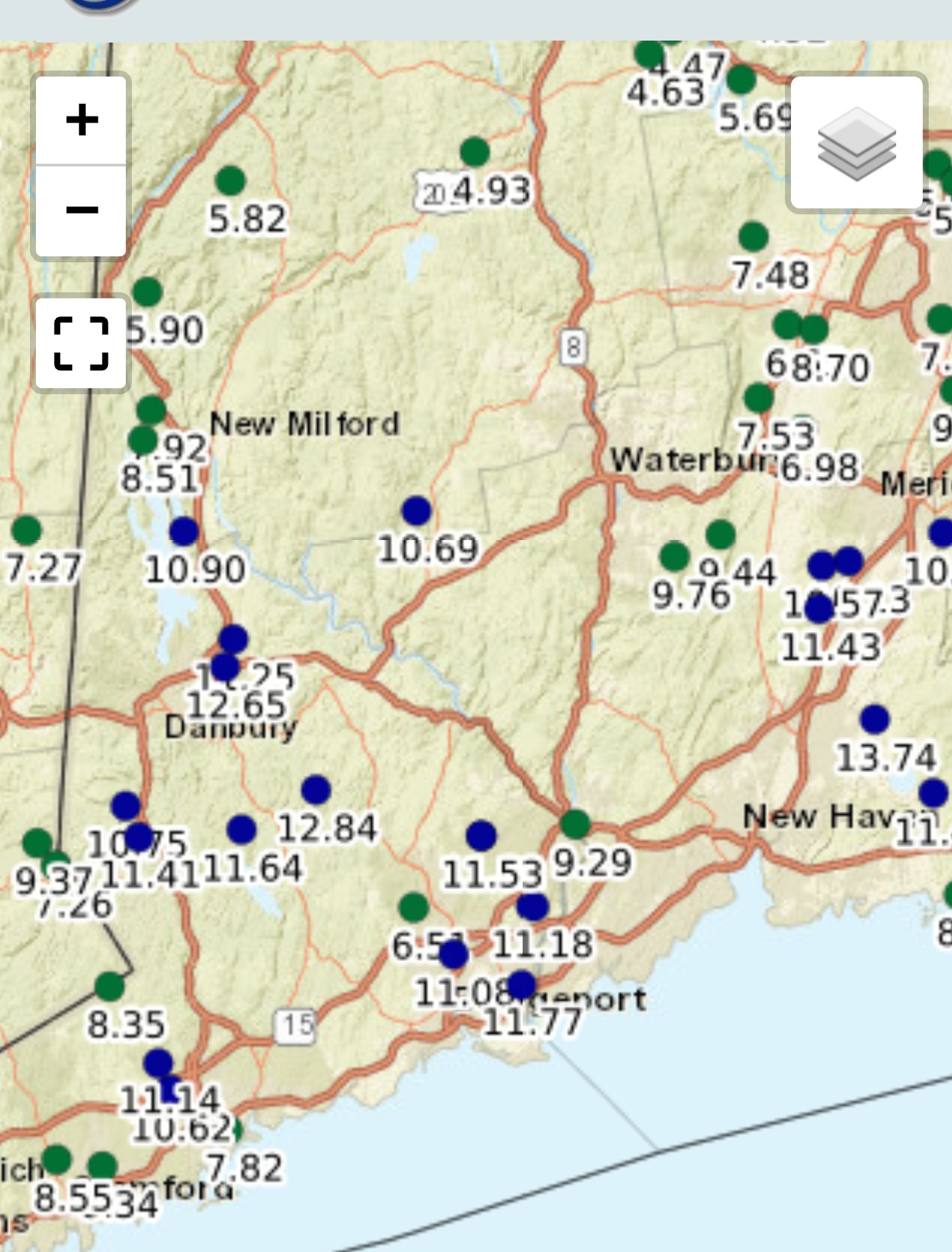
I see some 9 to 10 2 day totals on WUnderground
-
Dumb term for anyone who disagrees with the narrative Tip has.
-
Yore is 3 years ago?. You know what average means right?
-
How about since May 1
-
With 15 plus inches since the middle of May, good. It's plenty lush enough and wells are full
-
Holy shit are we talking record July down there? Squitos must be brutal
-
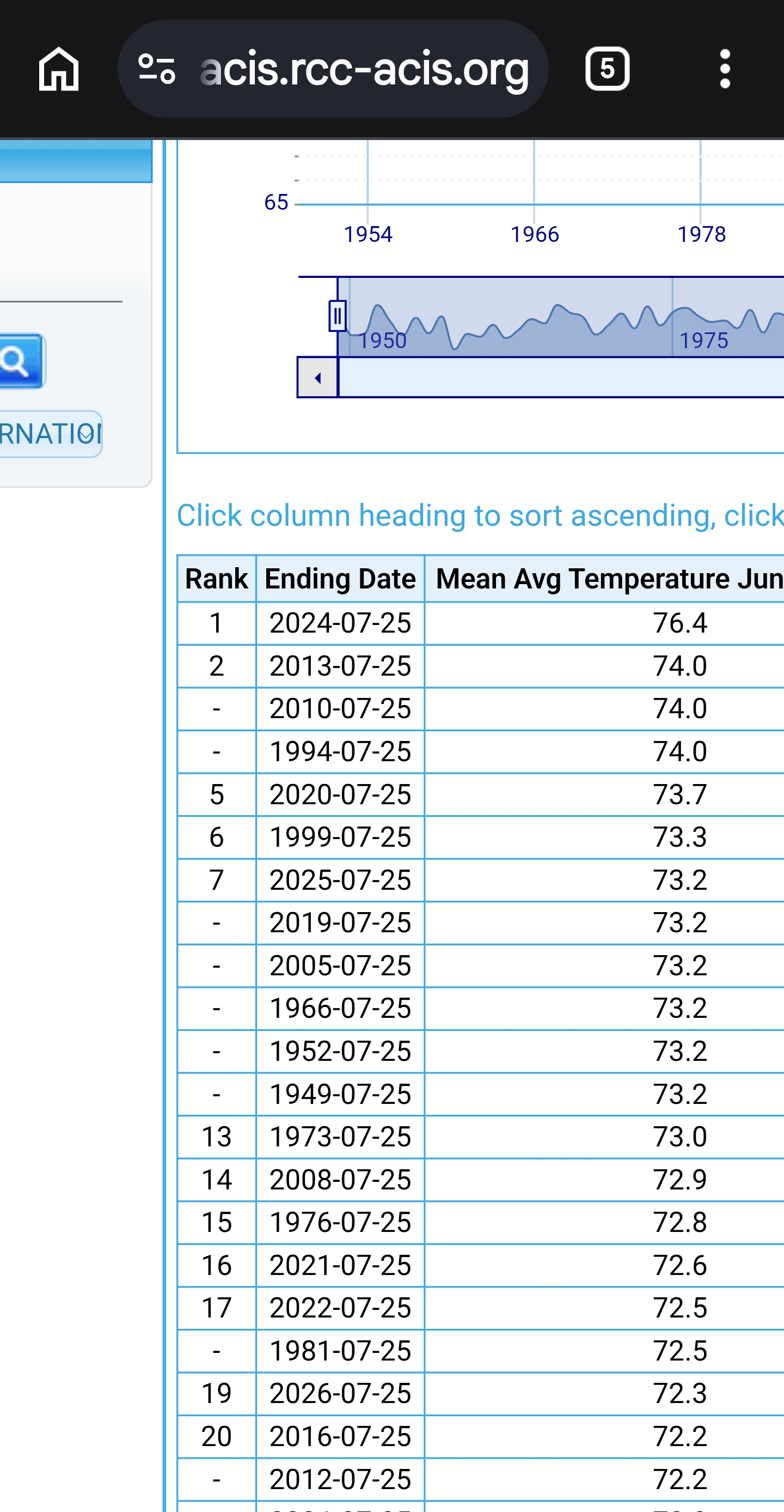
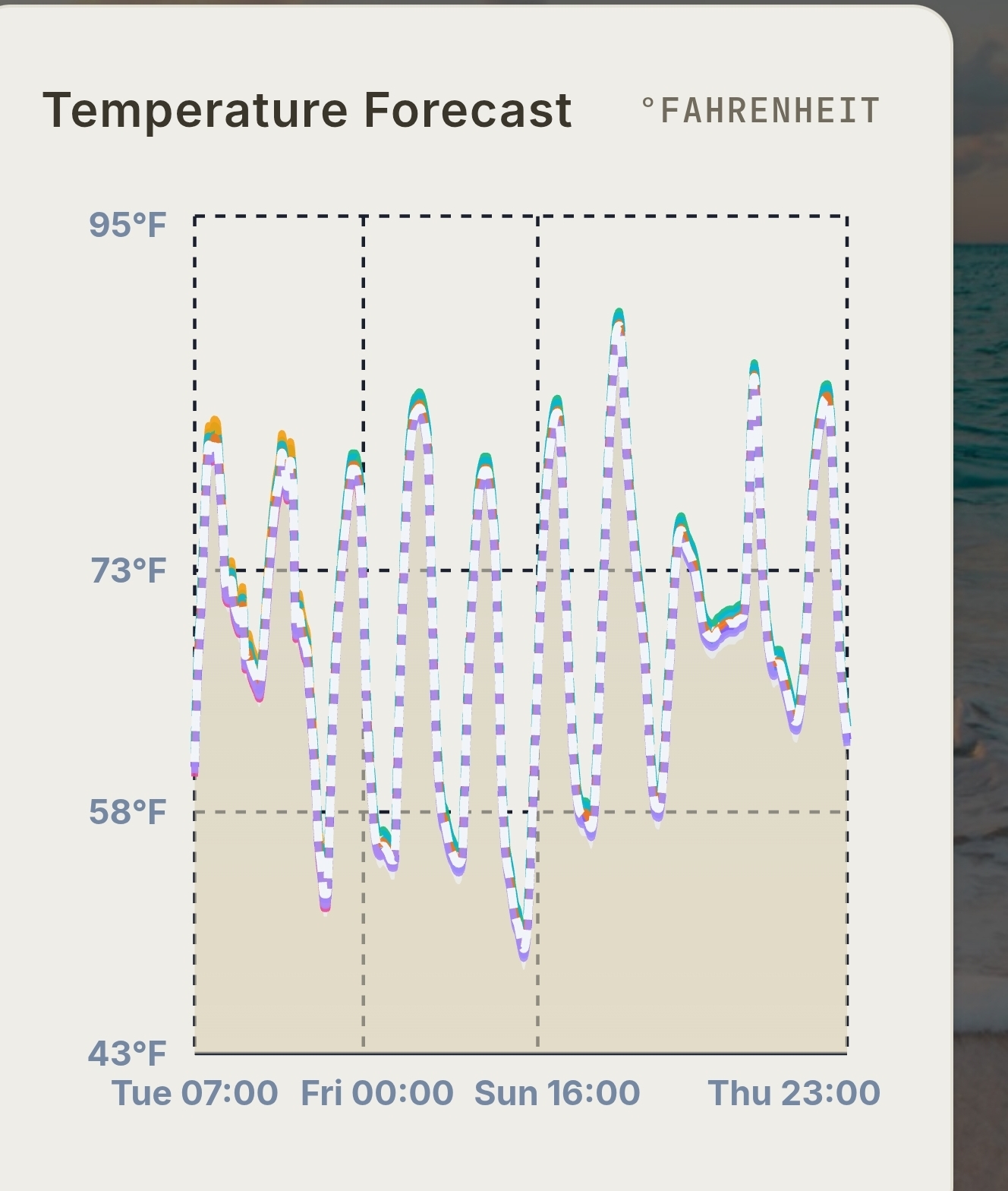
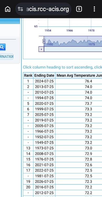
So much for the HHH hottest summer ever Top5! Weeklies BDL
-
Noah comes
-
COC city
-
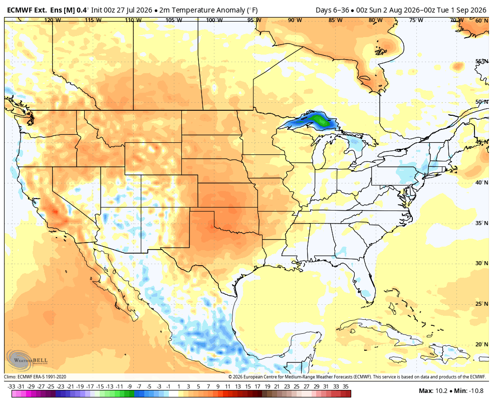
Hottest summer ever Hammer?

-
EPS
-
Of course Kev would never post this HammerTime, as he calls Ryan, tweet. Objectively is not his forte instead he goes right to personal insults.
-
Nice cept for Autotune
-
What a run of COC. Gorgeous
-
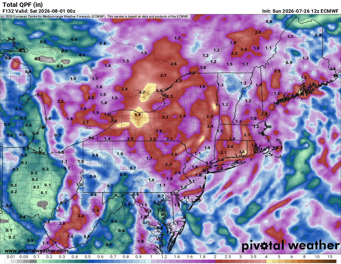
2.23
-
Pool is overflowing.
-
Totally crushed
-
Jesus
-
Hmm
-
Saturday, July 18, 2026 Thunderstorm/Severe Weather Potential
Ginx snewx replied to weatherwiz's topic in New England
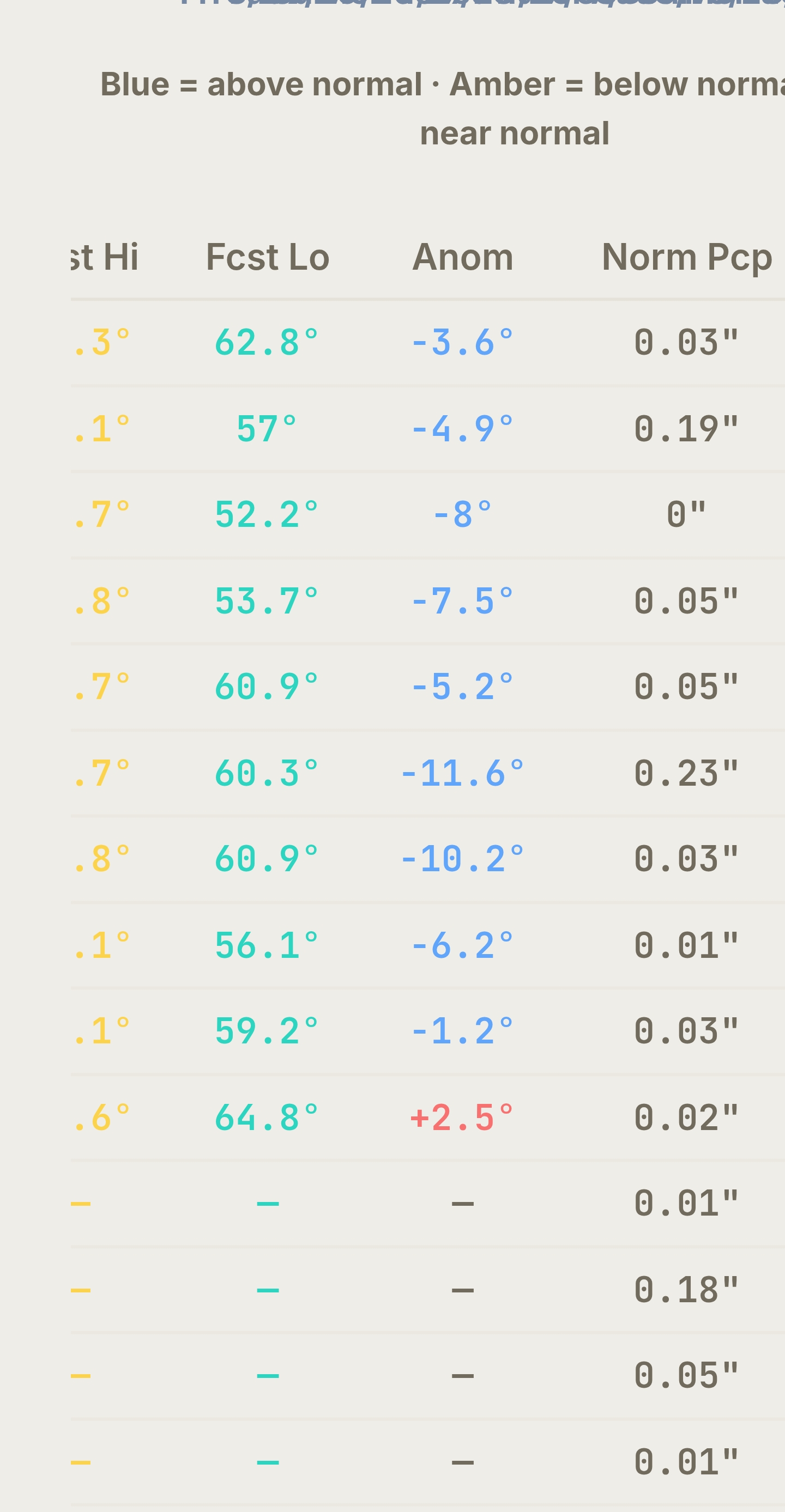
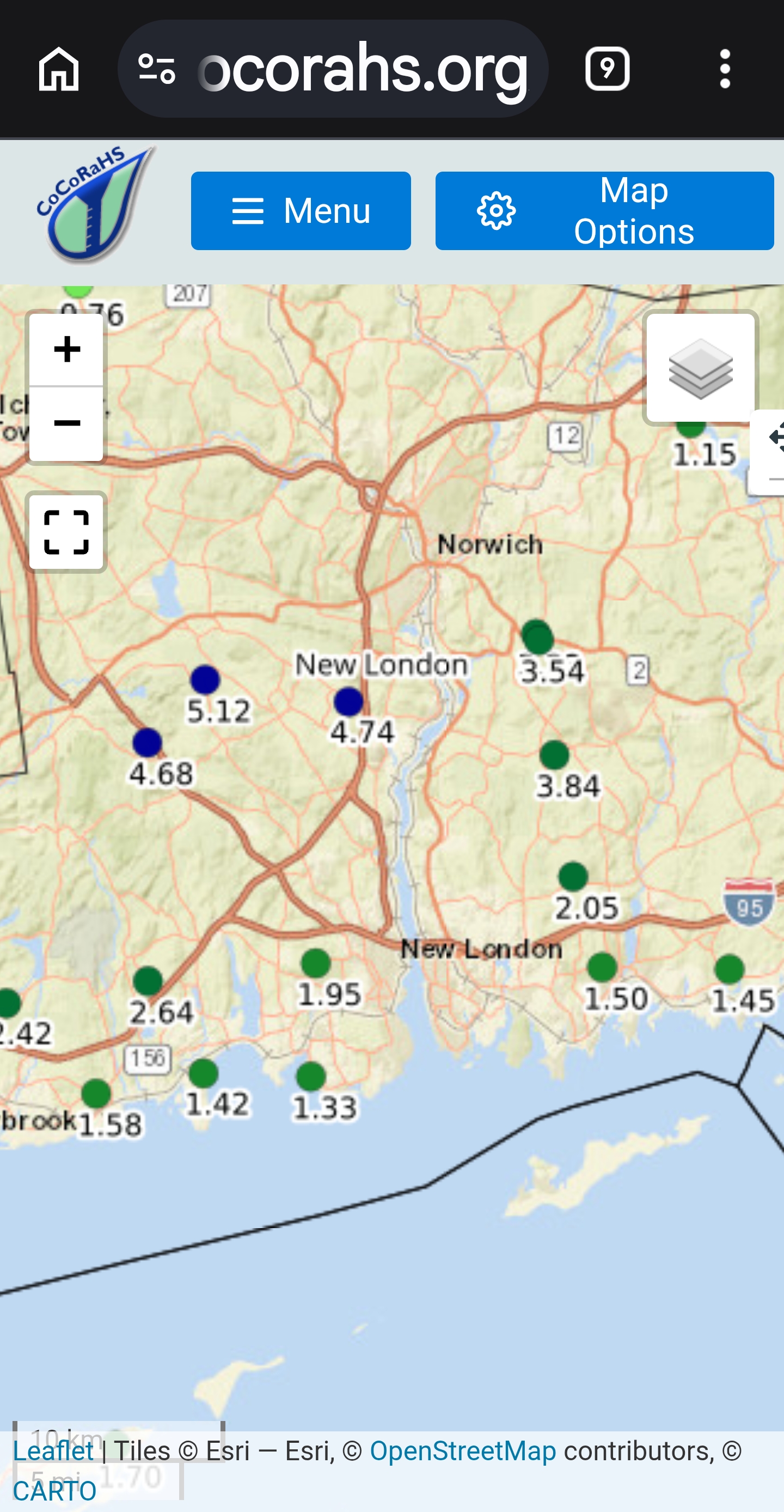
New London 4 to 6
-
Man Midwest smoked out. I saw AQI over 600 this past week. Centered over Chicago today
-
Saturday, July 18, 2026 Thunderstorm/Severe Weather Potential
Ginx snewx replied to weatherwiz's topic in New England
.91 with tstrms