-
Posts
13,145 -
Joined
Content Type
Profiles
Blogs
Forums
American Weather
Media Demo
Store
Gallery
Everything posted by Voyager
-
So my high today is 94 (93.7) so far, which seems quite a bit higher than the forecast, and higher than every other official station (Allentown, Lehighton, Philly, etc) Makes me wonder if the fan isn't working properly, or if my sensor is off.
- 6,666 replies
-
I have no idea, as I was home and in bed when it all occurred, but 2.5 fell near our Reading customer, and between 1 and 2 inches fell from Berks into the Lehigh Valley per the various PWS's I perused.
- 6,666 replies
-
We had sprinkles here, that didn't even move the needle. 0.00" yesterday and overnight. I'm just glad those heavy rains came after midnight. Both our Reading and Allentown water plants were dead in the crosshairs, but I was done and parked the truck at 11:30pm. I guess the overnight shift drivers got soaked.
- 6,666 replies
-
Apparently some slow movers rolled through Berks and Lehigh Counties this overnight morning. Those areas have a flood warning with some locations getting 2-3 inches of rain. Meanwhile, up here on the other side of the Blue Mountain, we remained high and dry.
- 6,666 replies
-
I've got a winch on my Jeep, so actually I could just pull them out of the way...lol
- 6,666 replies
-
Hopefully after midnight. By then I'll be (hopefully) done with my shift and have the truck parked.
- 6,666 replies
-
Well, it's raining a bit here. Not exactly what I wanted as I'm totally wiped out from lack of sleep working a 2pm to 2am job. I get to bed between 2 and 3am, but my natural body, plus my wife getting ready for work and the dog carrying on, has me up at 6am. I'm just not into getting wet hooking an unhooking hoses tonight. On a side note, besides being so tired, I'm also stressed and deeply bummed out. Stressed from what still going on with moms residual financial obligations. And bummed because most of my neighbor friends have turnd on me and shunned me because they think I did my wife wrong by going to help my mom. At some point, I'm going to crack if something doesn't change. I was so stoked about coming back home, but more and more I'm wishing I'd have stayed out west.
- 6,666 replies
-
- 1
-

-
The weather gods are prepping us for winter snowstorms...
- 6,666 replies
-
- 1
-

-
Got 0 66" at the house. Of course it hit right when I was hooking up to load my last delivery of the night. I got soaked. Then I got to run in it all the way to Allentown where I got soaked again. No real wind, but it was a good rain and lightning producer.
- 6,666 replies
-
- 2
-

-
As others have said, it doesn't look like much is going to happen south of 80 and east of the river...
- 6,666 replies
-
- 6,666 replies
-
- 1
-

-
Dead on nooners. 89/79, HI 104
- 6,666 replies
-
- 1
-

-
I'm up to 81 despite the low overcast.
- 6,666 replies
-
- 1
-

-
Anyone else notice that whenever there is a severe threat "forecast" for a particular day we start out overcast?
- 6,666 replies
-
- 1
-

-
That seems to usually happen.
- 6,666 replies
-
- 1
-

-
My low this morning was 73, which is quite high for here. No matter how hot it is, our lows usually dip to the 60's most nights. Even under solid cloudcover this morning, we've risen to 78 now.
- 6,666 replies
-
- 1
-

-
Thanks for the detailed analysis, Quincy. I'm about 20 or so miles southeast of the I-80/I-81 interchange. Not sure what to expect as I seem to be on the edge of the good stuff.
- 6,666 replies
-
Anyone see State College's Facebook post? Storms and possible tornados tomorrow evening.
- 6,666 replies
-
Ugh. I hope they reissue my old plate then. I don't want that ugly thing on the back of my Jeep.
- 6,666 replies
-
Nevermind. I just looked it up....and I agree with you. I just hope it's going be a special order plate, and not standard issue going forward.
- 6,666 replies
-
- 1
-

-
What does it look like? Haven't seen it yet.
- 6,666 replies
-
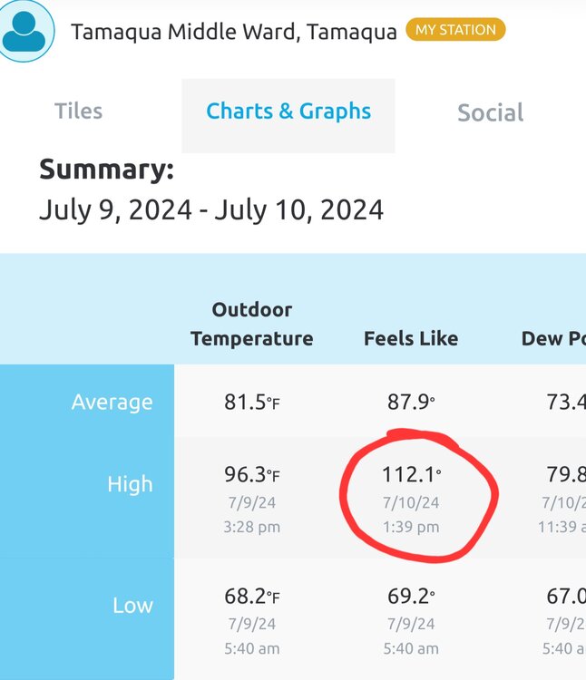
Highest heat index on my station today so far has been 110.3 degrees at 1:18pm.
- 6,666 replies
-
Well at least it "feels" cooler down your way...lol
- 6,666 replies
-
- 2
-

-
- 6,666 replies
-
- 1
-

-
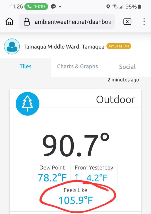
88 here at 9:45am. Look at that DP and heat index...
- 6,666 replies
-
- 2
-

-


