Voyager
-
Posts
13,316 -
Joined
Content Type
Profiles
Blogs
Forums
American Weather
Media Demo
Store
Gallery
Everything posted by Voyager
-
I know how they're going to play out. Tamaqua and eastern Schuylkill County will be fringed, as usual.
-
Got a half inch in Tamaqua, but everything seems to have now consolidated southeast from Allentown on south.
-
That map perfectly depicts what I've been saying for about a month now. While it does show 1.5 to 2 inches in eastern Schuylkill, the heaviest rain, if the map were to verify, would be the usual north of I-80/south of I-78 scenario.
-
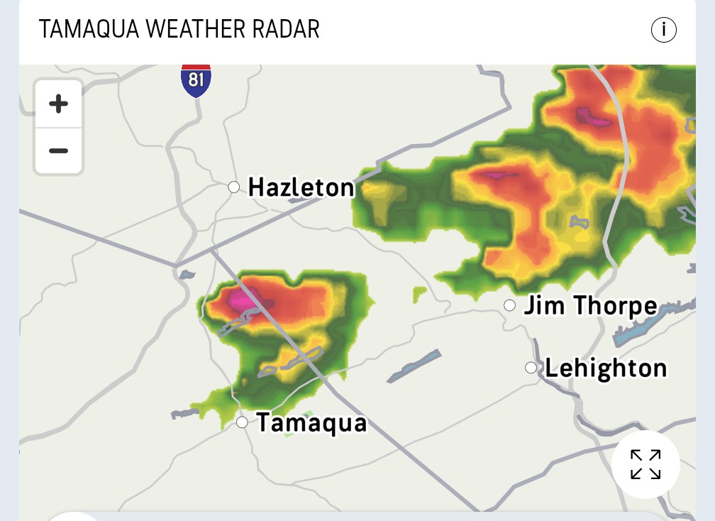
Not used to seeing towers like this one first thing in the morning. Looks like some kind of "storm" between Hazleton and I-80 per radar.

-
Send your rain my way. Didn't get a drop today.
-
Not a single drop of rain fell in Tamaqua...yet, but said rain and cloudcover was close enough to cool us down to our current 87 degrees.
-
Wish I'd have brought the video cameras out today. The atmosphere's a boilin' this afternoon. Would have made for an interesting video.
-
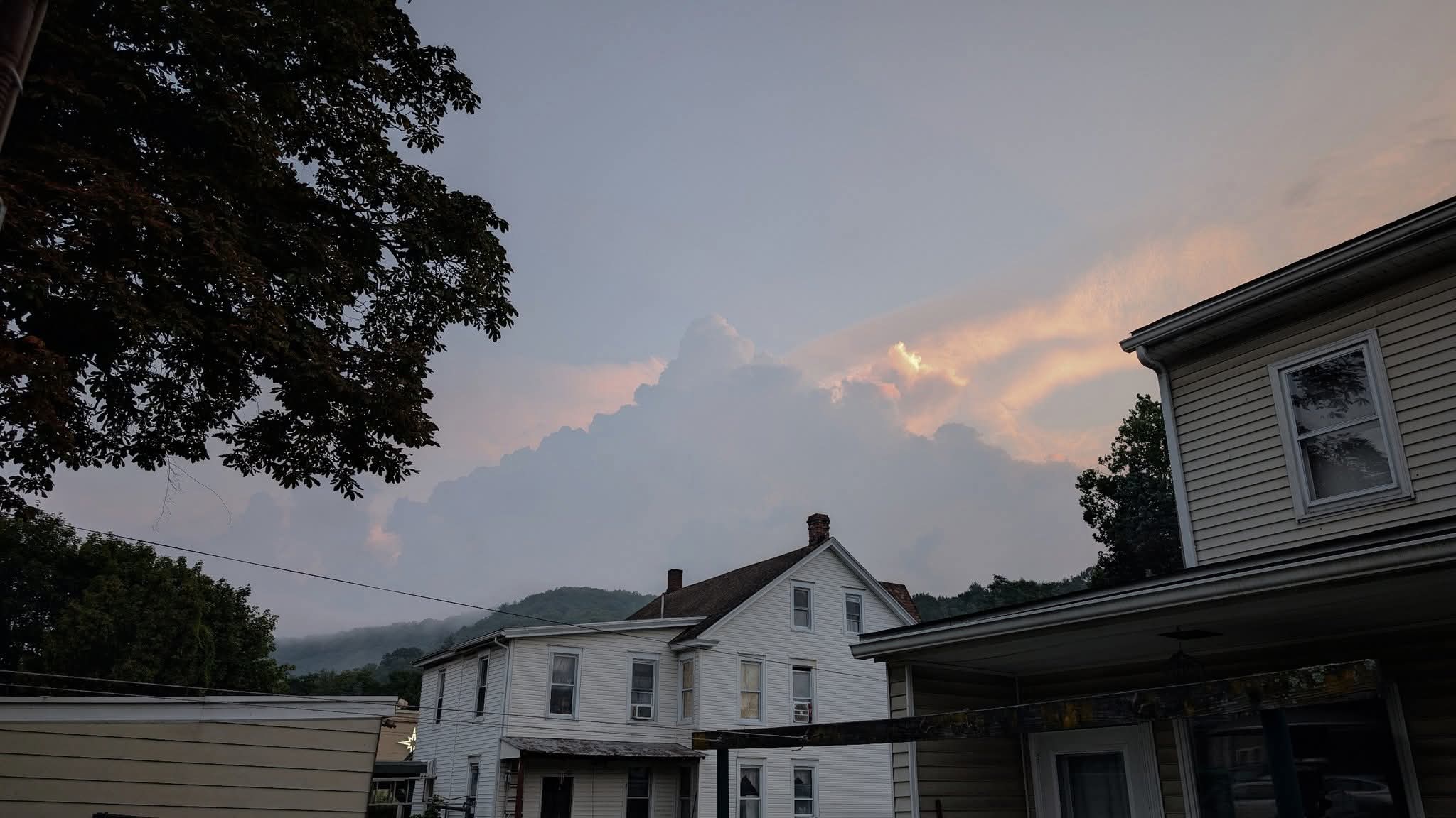
Thought this looked cool, though, up in Hazleton.

-
Typical. Storm moving east-southeast. Wouldn't have it any other way...

-
Dead on nooners. Up to 93, and the dew point is still 75...
-
90/75 already, at 11:15am. It's going to be a rough one today, even for this heat miser...
-
The southern tier again. I joked about it in yesterday's video (not uploaded yet) about how someone sprayed storm repellent over the eastern coal region, and how most of the big storms are south of I-78...lol
-
The thing that's pissing me off about this summer is the lack of good thunderstorms in and around Tamaqua. I'm wide left, wide right, or they die out, or they form south or east of me. All this volatility and nothing to show for it.
-
Got .65" out the overnight showers.
-
I see that. Will this be the one that holds together and rakes us all, or does it fall apart?
-
Future radar already showing the Tamaqua Split/I-81 collapse...
-
I've got to admit, even though I like summer heat, the crazy humidity has been hard to take some days.
-
Not here...lol 67 yesterday and 68 this morning.
-
After next week, I won't have that availability. Since there's no foreseeable path to day shift at my current company, I'm starting a new job next Monday....unless my current boss finds a way to slot me into a 5am start time. With no one quitting or retiring, though, anytime soon, I just don't see it happening.
-
I got .29" in Tamaqua. While I saw a good one driving through Cross Keys and Leesport, north of Reading on PA61, Tamaqua was on the fringe of the first storm and missed completely on the second one.
-
Not much in Tamaqua, but it was bad down between Hamburg and Reading on PA61. Easily 40+ gusts as it was ripping branches out of the trees, and actually looked like an Arizona dust storm prior to the rain hitting.
-
I like my 70 degree nights...
-
RIP Mr Burns...
-
Unless you live in Tamaqua...lol
-
RIP Ozzy... You made it to your farewell concert and you did get to say your goodbyes to your fans.