

Syrmax
-
Posts
5,654 -
Joined
-
Last visited
Content Type
Profiles
Blogs
Forums
American Weather
Media Demo
Store
Gallery
Posts posted by Syrmax
-
-
3 minutes ago, CNY_WX said:
KBGM should be in the middle of the heavier returns and their visibility is only 1/2 mile
KBGM 200353Z 11011KT 1/2SM SN FZFG VV007 M04/M06 A2972 RMK AO2 SLP087 P0005 T10441056
That’s Good news. The better radar returns are working NE and nearing us.
-
3 minutes ago, CNY_WX said:
It will be interesting to see the final ratios.
I'm going to take a midnight measurement. Last was at 6pm. It was 11.8:1 then, and I'd expect same at midnight. There's enough wind to possibly skew a measurement or what's in the gauge though. We'll see. I'm guessing we'll be near 5" at midnight.
-
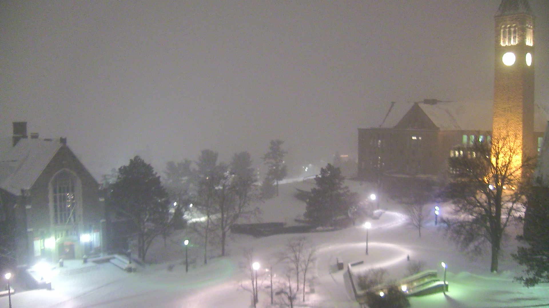
5 minutes ago, CNY_WX said:
Looks like it’s snowing nicely on the Cornell campus.

Such a beautiful campus. I golfed there last summer. Great course and setting.
-
15 minutes ago, CNY_WX said:
Coming down pretty good but what is it with this crappy flake size? If you put 10 of these flakes together you might make a decent dendrite!
This is always the problem when I start looking at a Kuchera derived snowfall map... it almost becomes a snowfall expectation in the back of my mind, even though I know better. Looks nice but other factors are more important than just temperature profiles, and make or break a storm. A sounding right now would help understand what’s happening. Guessing, low temps leaving the snow growth zone relatively low in the column, lousy UVV or it’s not aligned with a low snow growth zone, or the UVV is just too broad or diffuse. Or some permutation of those factors? I think Nick, OSU, mentioned something this the other day.
-
So, toying with some back of the envelop maths while we wait for the enhanced lift to do its dirty work...we have been averaging 3/8-1/2" per hr snow since noon around SYR. If 1/2"/hr kept up till end of storm, say noon, that's another 6.5" and bring us to 10" total. Not often that a 10" snowfall would bring massive wailing and gnashing of teeth but it would. So I have to think we end up closer to 16-18" getting under a mesoband for a while.
-
KALB still at 9F at 9pm and 1.2 mi vis, same as Syracuse and ROC.
KPIT screwed at 35F and rain.
KJFK 38F and preparing to break out the beach balls and summer drinks.
-
3 minutes ago, phoenixny said:
Team Wayne Mahar has not budged on totals. 10 to 16 for us. Kinda a big deal with locals. Teske/Mahar amounts. 10-16 vs 18+
Clearly, they aren’t onboard with Team Kuchera.
")
-
4 minutes ago, phoenixny said:
I have been drinking so trust your measurements more than mine. We are close and it's not lake effect. Lmao
LOL. The wind has picked up...which could become an issue for accurate measurements...so who knows, you may be closer to correct than me.
-
-
36 minutes ago, mattny88 said:
Everybody go to jeremy kappel 945 pm facebook live page he is the rochester meteorologist who got fired from whec 10 news..he has some really great analysis and updates on the storm..his videos are usually always at least 15 minutes and he answers questions us weather ethusiasts may have..Highly recommend tuning in at 945
I checked out his previous live cast and will view his 2145 broadcast. Not bad. Good guy that got completely boned by the Idiocracy.
-
Rice snow continues IMBY. Measured another 1.5” at 9pm...that’s over a 3 hr period. Total is 3.5”. Unimpressive entry level snowfall thus far but even if the meso banding fails (which I doubt) we will end up with 6-10”. Which isn’t bad. Just trying to figure out a worst case scenario. Wind has picked up.
KBGM now thinking So. Tier of NY stays more snowy with mix being more limited. Hopefully that’s right.
-
KBUF with the snowy xoxo’s for CNY_wx, Ty and me.

-
 1
1
-
-
1 minute ago, OSUmetstud said:
Im going to say those reports are nonsense. 9 cm (3.6") so far at cyhm. Probably more a bit more closer to the lake. I dont know who the met is reporting larger amounts via tape measurer on twitter.
Gotta be cm not inches.
-
It’s looking torchy to South and East. At least the major ice storm concerns should be allayed. Already entire state of NJ at or above 32 along with A lot of CT.
-
1 minute ago, rochesterdave said:
21” being reported near Hamilton Ontario. Lake effect
Sounds like the drinking started early there. WTF.
-
1
-
 1
1
-
-
We’ve gone from 13 to 20 degrees in 2 hrs...from 6pm to 8pm. Juicy.
-
8 minutes ago, wolfie09 said:
This is what it had by 0z, so minus that lol

I had 0.17” melted at 6p v 0.1 on model at 7p.
-
I had an over/ under of 18” here...21” seems aggressive for “the bar”.
-
Just now, CNY_WX said:
I’ll take the under on that!
Agree. That’s not happening. I thought it was the upper 1 in 10 probability map but no....
probably someone not getting paid at KBGM just f*cking with us.
-
I was gonna say Take ‘me down but KBGM says...take em up!

-
1
-
-
16 minutes ago, WesterlyWx said:
Don't worry your not alone. I'm in the same boat lol!
Felt like Ike we were off to a blazing start which likely got my expectations too unrealistically high so now just need to check myself, tell myself we weren't even supposed to have this much snow by now, and be positive. This one should end with 1'+ here which will only take about another 6-6.5" to accomplish.
Don’t sweat it. Long way to go. You have 5-6” already....we have 2” here and hoping we get another foot or so.
-
1
-
-
Just measured at 6pm. 2.0"...0.17" melted. That's a ratio of 11.8:1...pretty small dendrites on average since snow started around 11 a.m. here. Total of 7" on ground, 13F temp.
-
1
-
-
It gon snow!
-
1
-
-
Game Day! Take 'em up!
Gotta go hit golf balls this a.m. then furniture shopping then get gas for snowblower.

-
1
-


Upstate/Eastern New York
in Upstate New York/Pennsylvania
Posted
Only thing that will generate big numbers is meso banding, I don’t see that actually developing quite yet. We could be looking at a 12:1 ratio for the entire event. ROC may be saved by Lake Ontario ultimately...and it seems they are a couple inches ahead of us already.