
JonClaw
-
Posts
655 -
Joined
-
Last visited
Content Type
Profiles
Blogs
Forums
American Weather
Media Demo
Store
Gallery
Everything posted by JonClaw
-
URGENT - IMMEDIATE BROADCAST REQUESTED Severe Thunderstorm Watch Number 489 NWS Storm Prediction Center Norman OK 1110 AM EDT Sun Jun 30 2024 The NWS Storm Prediction Center has issued a * Severe Thunderstorm Watch for portions of Connecticut Northern Delaware Massachusetts New Jersey Southern New York Central and Eastern Pennsylvania Rhode Island Coastal Waters * Effective this Sunday morning and evening from 1110 AM until 700 PM EDT. * Primary threats include... Widespread damaging winds likely with isolated significant gusts to 75 mph possible Isolated large hail events to 1.5 inches in diameter possible SUMMARY...A mix of thunderstorm clusters and supercells should pose a threat for numerous to widespread severe/damaging winds as they move eastward this afternoon and evening. Peak wind gusts should generally range around 60-70 mph, with isolated gusts perhaps reaching up to 75 mph. Occasional hail around 1-1.5 inches in diameter may also occur with any sustained supercell. The severe thunderstorm watch area is approximately along and 100 statute miles east and west of a line from 35 miles north northwest of Worcester MA to 30 miles west southwest of Philadelphia PA. For a complete depiction of the watch see the associated watch outline update (WOUS64 KWNS WOU9). PRECAUTIONARY/PREPAREDNESS ACTIONS... REMEMBER...A Severe Thunderstorm Watch means conditions are favorable for severe thunderstorms in and close to the watch area. Persons in these areas should be on the lookout for threatening weather conditions and listen for later statements and possible warnings. Severe thunderstorms can and occasionally do produce tornadoes. && AVIATION...A few severe thunderstorms with hail surface and aloft to 1.5 inches. Extreme turbulence and surface wind gusts to 65 knots. A few cumulonimbi with maximum tops to 500. Mean storm motion vector 27035. ...Gleason
-
 A quick look at NOAAs Historical tracks has both David (1979) and Allen (1980) hitting around there. EDIT: Ivan as well in 2004, per WxWatcher007
 -
When was the last time NYC was under Enhanced Risk by the SPC?
-
Bullseye
-
Definitely an above par thunderstorm IMBY
-
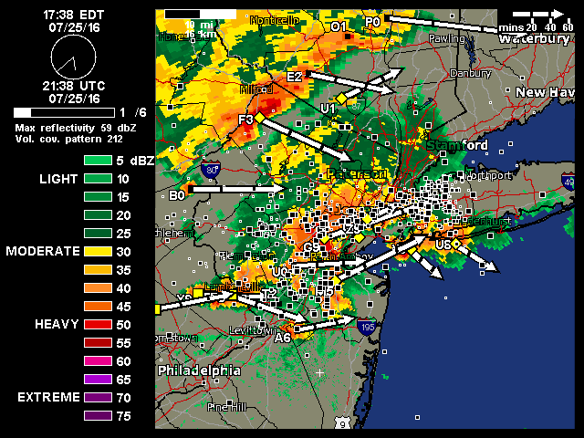
One of the more impressive rain and wind storms in a while EDIT: Hail! Can't see how big though.
-
Some beautiful cloud-to-cloud lightning ahead of the cell.
-
Core of this cell is aimed right at my backyard. Should be good!
-
NAM has NYC getting shellacked tomorrow evening.
-
Pretty nice downpour now. A rumble of thunder and the air has cooled down considerably.
-
That Newark cell is aimed right for me
-
Another sudden heavy shower
-
Absolute deluge in Queens
-
Some really strong gusts with this storm.
-
Downpour in Queens
-
2024 Hurricane season forecast contest -- results now posted
JonClaw replied to Roger Smith's topic in Tropical Headquarters
25/12/5 -
Raining now in Brooklyn. A lot of people about to get caught in it.
- 1,603 replies
-
- 1
-

-
- spring
- cool temps
- (and 3 more)
-
Sky darkening to my southwest in Downtown Brooklyn. Should be a good one.
-
I love it when heat overperforms.
-
Fantastic weather today!
-
Pea size hail!
-
The first crash of thunder of the season always feels good.
-
Refresher snow & obs between ~midnight and Noon Sat Feb 17 2024
JonClaw replied to wdrag's topic in New York City Metro
Just woke up and checked the snow reports. Coney Island got how much?! -
2/13 Significant/Major Winter Storm Discussion & Observations
JonClaw replied to Northof78's topic in New York City Metro
Sun breaking through IMBY. Good storm considering how this winter has been. -
2/13 Significant/Major Winter Storm Discussion & Observations
JonClaw replied to Northof78's topic in New York City Metro
Moderate/Heavy Snow, flakes are bigger.

