GoAPPS
-
Posts
133 -
Joined
-
Last visited
Content Type
Profiles
Blogs
Forums
American Weather
Media Demo
Store
Gallery
Everything posted by GoAPPS
-
I know we're talking about this weekend, but the models are also hinting at a winter storm next weekend.
-
I won’t put much stock in these model runs until Thursday at the earliest.
-

2021-2022 Fall/Winter Mountains Thread
GoAPPS replied to BlueRidgeFolklore's topic in Southeastern States
-
Western PA/Pittsburgh Fall Weather Discussion
GoAPPS replied to Ahoff's topic in Upstate New York/Pennsylvania
The cell just north of Pittsburgh looks like it has a TDS. -
- 310 replies
-
- 1
-

-
- late freeze
- warm
- (and 3 more)
-
-
-
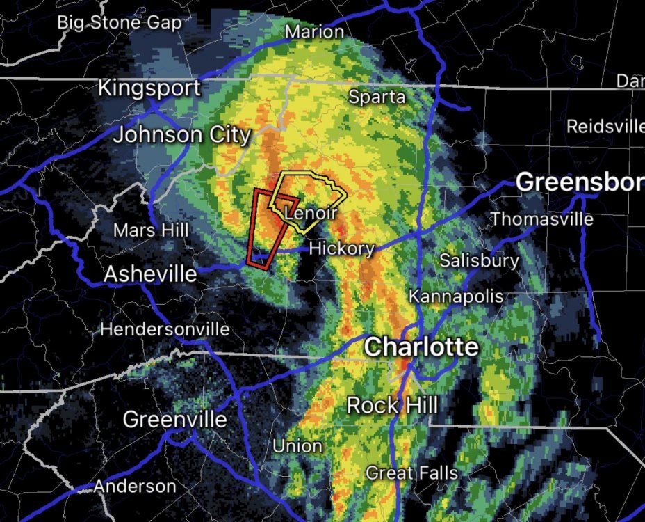
What is that structure in the foothills, a mesolow? It keeps producing tornado warnings.
-
Yeah, I headed out to the Bent Creek area for some mountain biking, but it started hailing just before I got there. I saw some miserable folks riding their bikes back to their cars while getting hailed on and said "screw that."
-
A tornado outbreak -- including the threat of a few long-tracked, violent tornadoes -- is expected today into early this evening over the Southeast, especially parts of Mississippi, Alabama and Tennessee. Tornadoes, large to very large hail, and damaging winds to hurricane force also are possible over a broad area from the central Gulf Coast to the Ohio Valley and southern Appalachians. Not sure I've ever seen language that strong used to describe a situation in the Southeast.
-
Are you telling me someone misinterpreted the data on Twitter?
-

-
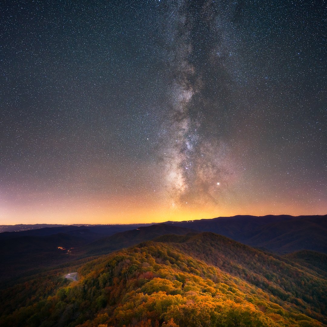
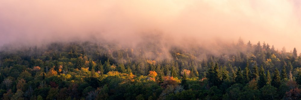
Here's a blue-hour blend photo from a lookout tower along the Blue Ridge Parkway (North Carolina, October 2019). Using a planning app (PhotoPills), I was able to determine that the Milky Way would align with my position along a colorful ridge line after dark. I took a series of blue hour photos to capture the foreground while it was still dimly lit by the fading twilight. I combined the data of these photos into one image that could pull out the color detail of the foreground landscape. When dark fell, I took a series of long exposures and combined their data in a program called Sequator. I brought the detail of the Milky Way out of the background using Photoshop, then I blended the foreground data with the night sky data for a composite. I used a Sony A7RIII camera body and a Sigma 14-24 f/2.8 lens, but you can get similar results with much cheaper setups. It's all in the processing. When I say "combining data," I'm talking about stacking, a process that aligns several images and averages out the data so that what stays behind is only the pixels that stay the same through the sequence. This eliminates transient objects, like hot pixels and thermal noise - the reason so many low-light photos look so grainy. The weather conditions were cool and clear, so clear that you can actually see a little airglow in the photo.

-
Snow in Asheville.
-
Light snow in Asheville.
-
Light rain in Asheville, but it's probably going to change back to snow.
-
Moisture stream is now coming from the northwest in Asheville, so this might be our chance.
-
Light snow in Asheville.
-
So the NAM and HRRR are in huge disagreement, especially in lower elevations like Asheville. Anyone have thoughts?
-
Some of the reasons are: 1) It's a smaller group. Larger groups always attract weenies, trolls, and idiots. 2) Lower stakes. We all typically see snow at least once every year, so each event doesn't feel like our only chance.
-
Snowing in Asheville.
-
Crazy that we’re talking about snow on one end of the state (NC) and tornadoes on the other. What a dynamic water weather system! EDIT: "Weather," not "water" lol.
-
I'm looking for a KAVL Skew-T sounding, but I can't seem to find it anywhere. Is that data publicly available?
-
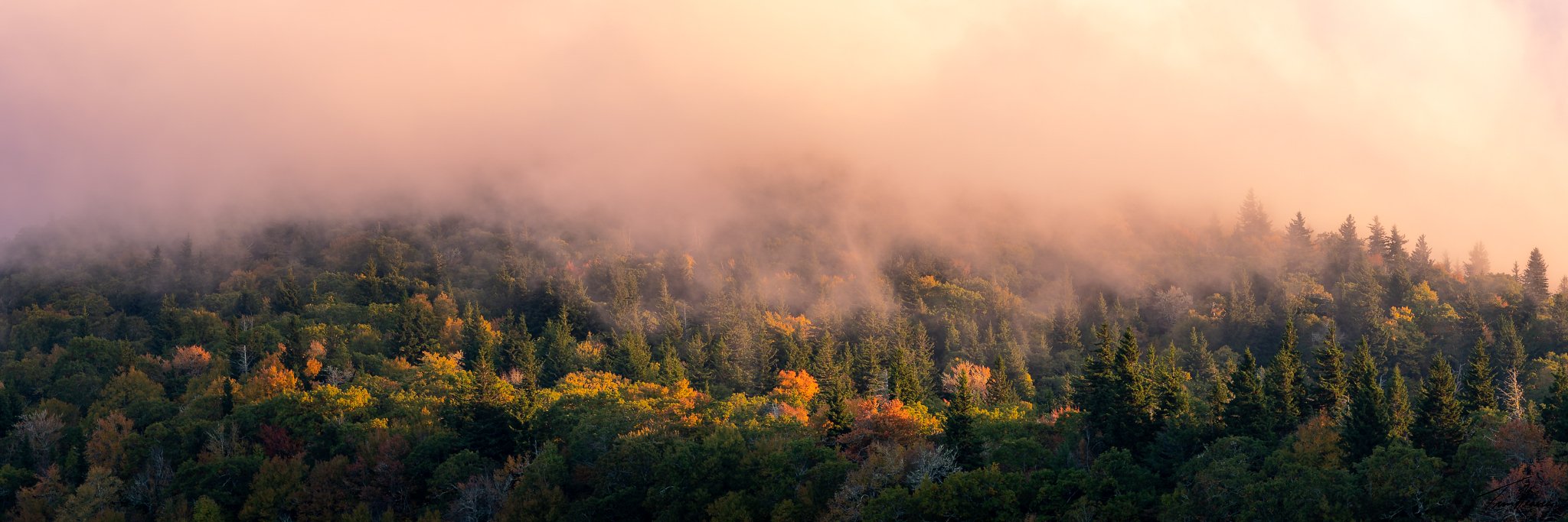
Near Mt. Pisgah from last Tuesday.
-
Severe today (May 5): Slight risk / Possible MCS
GoAPPS replied to calm_days's topic in Southeastern States
Don't see that kind of storm around here very often.