Sey-Mour Snow
-
Posts
5,134 -
Joined
-
Last visited
Content Type
Profiles
Blogs
Forums
American Weather
Media Demo
Store
Gallery
Everything posted by Sey-Mour Snow
-
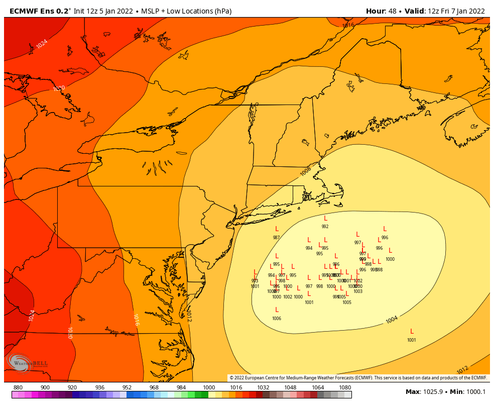
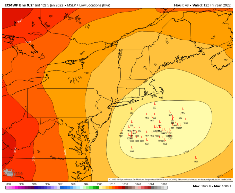
With a 1035 high in Canada
-
 I just posted a map, what do you think.. looks pretty convincing west lean
 -
I just zoomed in and ya a lot of west members still, 65%
-
most guidance is like 1am to 7am for CT maybe 8-9am for you.. hopefully we can get it to trend longer til noon, I hate when snow ends around daybreak...
-
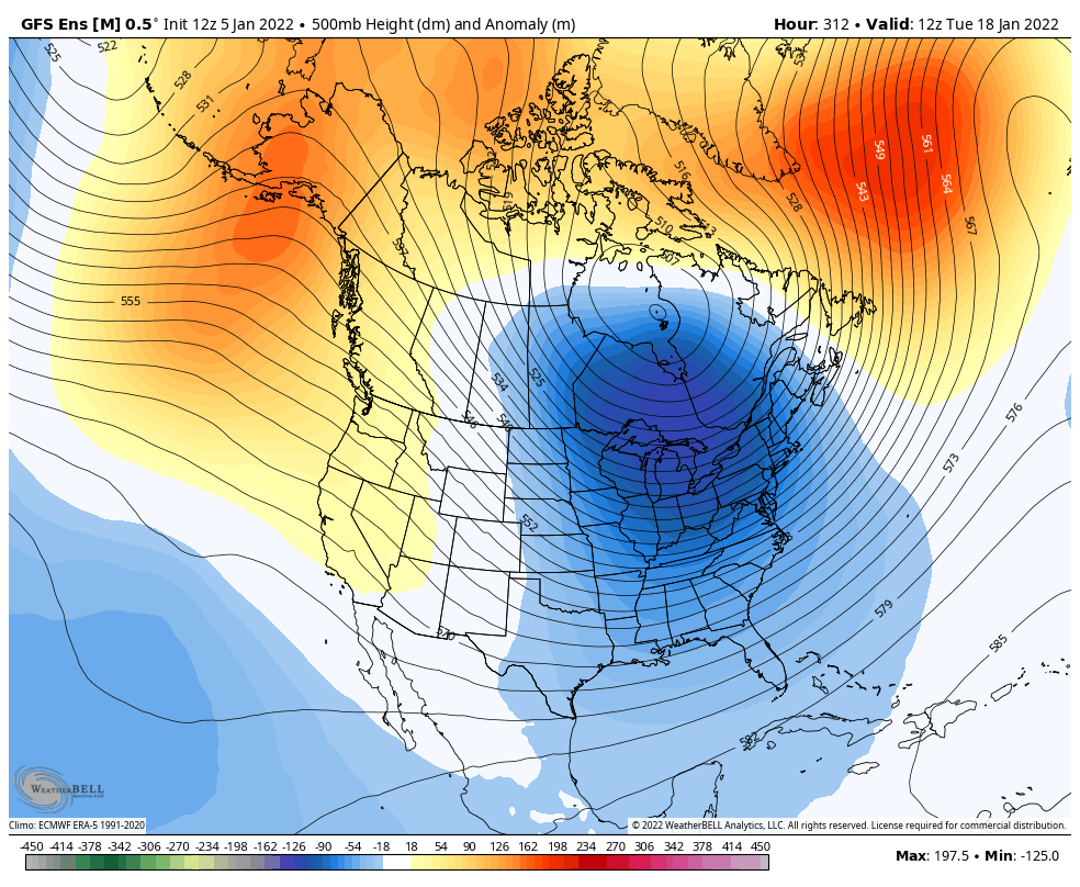
Ya GEFS are beautiful.
-
What do you think about the one GEFS is showing for mid month? Head fake?
-
I feel like that euro run would argue 3-6” for most of CT as we’d have some nice banding for a bit.. maybe 1-3” far NW.
-
Tic east and less amped than 6z again, it flips every cycle...
-
The chase is fun especially when it ends up snowy.. Let's hope for some good trends the next 24-36 hours..
-
Ya have to keep a close eye on that 15th period a lot of storminess just waiting to explode off the coast
-
GFS trying for some anafrontal very early Monday as the front slows and the cold air rushes in
-
HRDPS would be solid if extended past 48
-
I'm down for getting 6-10" of fluff regionwide off of .3-.5" Liquid..
-
Ya, I'm def not punting at all am still very hopeful for 3-6" even back here.. There are plenty of favorable factors as well
-
That was very well advertised within 24-36 hours out by GFS and some other models but not all guidance. I was intrigued by that storm with such a short window for a major snowstorm there..
-
Why? Bc a hugger that mixes which was the "most likely" scenario for many and it obviously is not happening, the biggest risk in my mind has always been the goods miss to the east. Obviously we can still get a nice 3-6" out of this, but the East risk is the one that played out.
-
Some tried to tell them and got ridiculed. I’m still holding out hope that this tracks bear ack but my original fears are still the biggest worry.
-
Destroys eastern areas with a very quick hitting 2-3” per hour band.
-
Man HRRR long range is freaking awesome 985 bombing just SW of Nantucket at 48, CCB destroying eastern areas with 2"+ per hour rates
-
Ya lets hope at least for the lower range, with some good mid levels and banding, and hopefully no east shifts should be ok..
-
Sorry, I'm done, just epic icing and travel nightmare here, unreal to see.. Long range Hrrr which nailed the DC storm looks good at 48, improvement from the 6z run..
-
Still a west lean, but its a 6z run so meh.. If 12z shows it then that'll break the trend.. We still get these amped up 6z and 18z runs..
-
Ya home obs are cold.


-
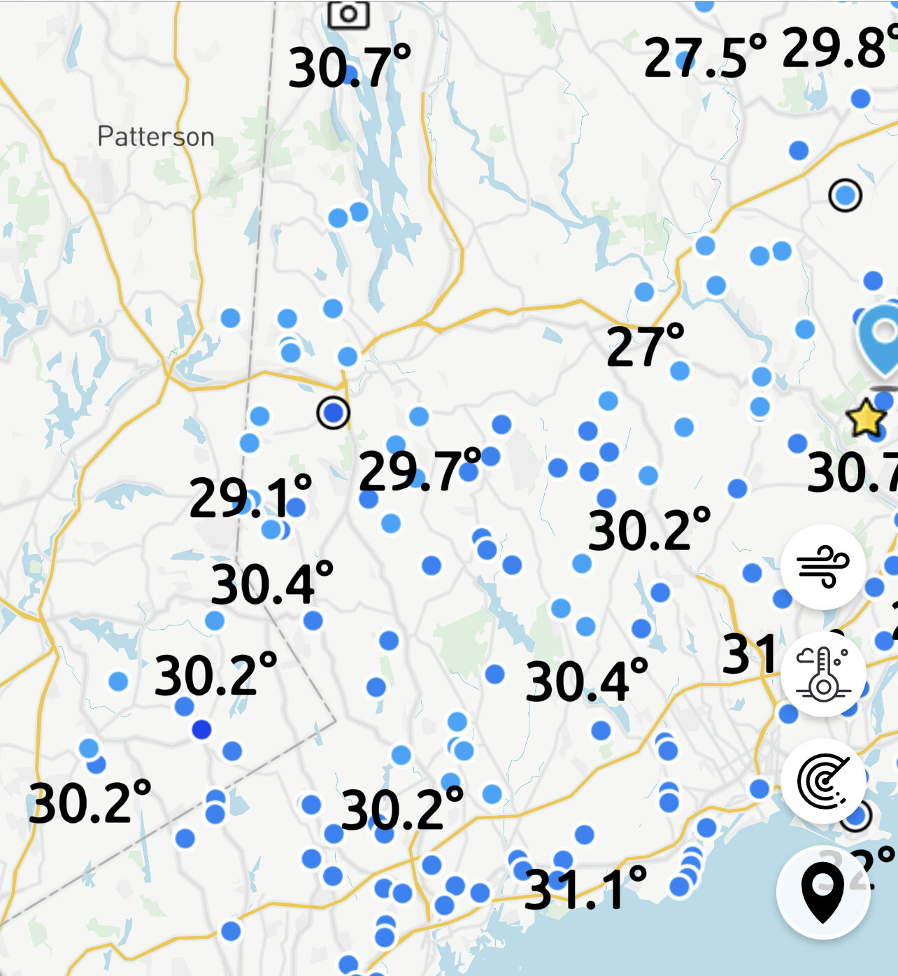
28-31 in Fairfield county 30 car pileup in Bridgeport..