Sey-Mour Snow
-
Posts
6,889 -
Joined
-
Last visited
About Sey-Mour Snow

- Birthday 08/20/1985
-

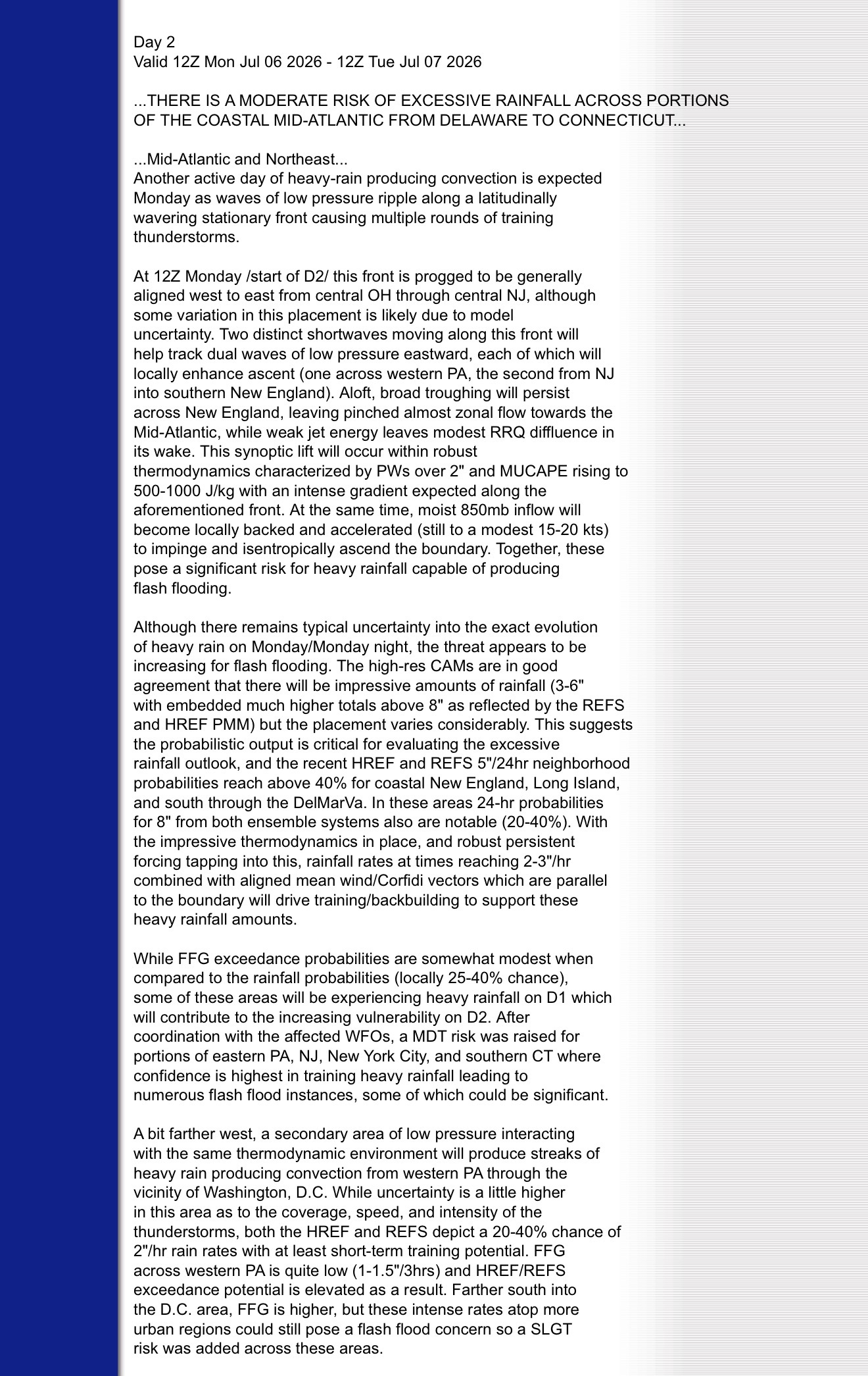
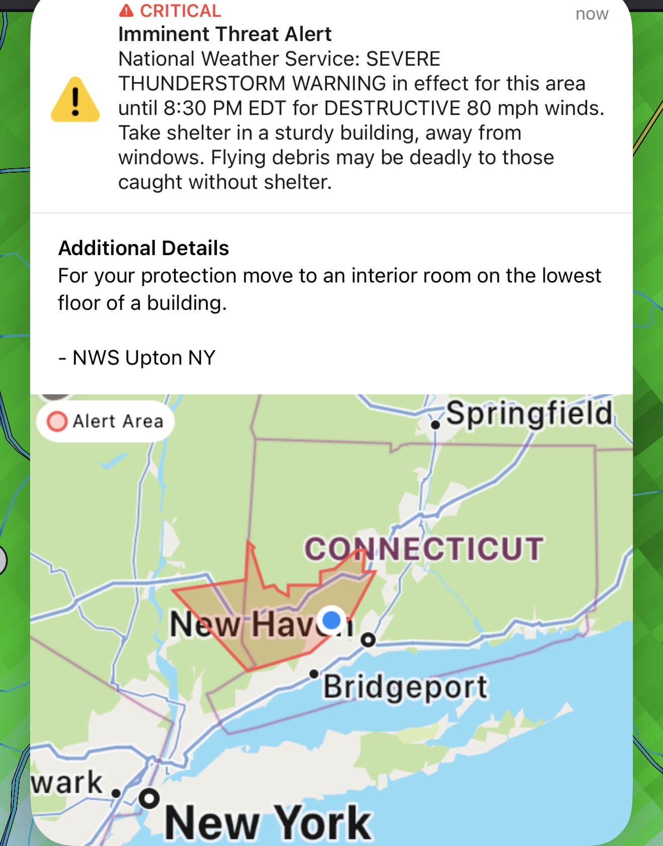
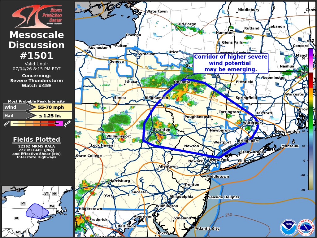
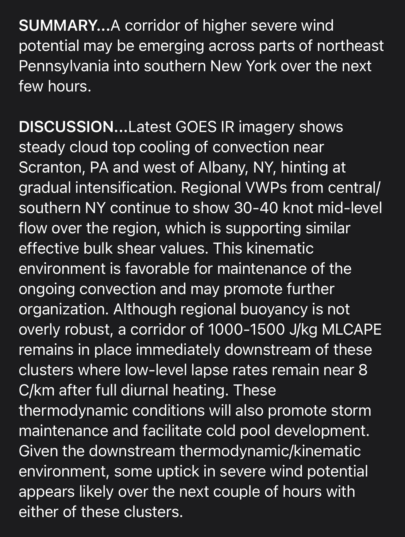
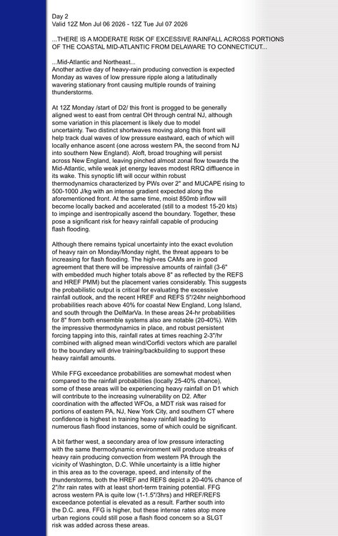
Hoisting the Sultan Signal: Heavy Rain Event July 5-7
Sey-Mour Snow replied to WxWatcher007's topic in New England
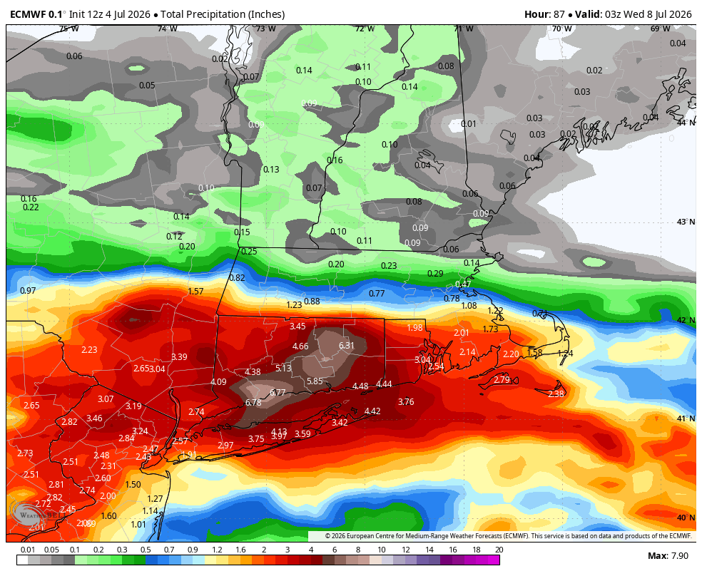
4.41” yesterday -
Hoisting the Sultan Signal: Heavy Rain Event July 5-7
Sey-Mour Snow replied to WxWatcher007's topic in New England
Looks like SECT will clean up this evening with heavier rates and have some flash flooding issues. Starting to get a good bit of ponding and runoff here but no torrential rain yet will help prevent any flash flooding. Although we are now up to 6” of rain on the month and 8” in 10 days so the ground can’t handle much more. -
Hoisting the Sultan Signal: Heavy Rain Event July 5-7
Sey-Mour Snow replied to WxWatcher007's topic in New England
Heaviest rain of the day 3.25” -
Hoisting the Sultan Signal: Heavy Rain Event July 5-7
Sey-Mour Snow replied to WxWatcher007's topic in New England
No doubt boring but beneficial yes -
Hoisting the Sultan Signal: Heavy Rain Event July 5-7
Sey-Mour Snow replied to WxWatcher007's topic in New England
Still a while to go, should be a widespread 2-5” across the state with isolated higher amounts. Already at 2” here just from today -
Hoisting the Sultan Signal: Heavy Rain Event July 5-7
Sey-Mour Snow replied to WxWatcher007's topic in New England
-
Solid rain producer another inch can't tell if there was any damage locally.. 4"of rain in the past 2 weeks..
-
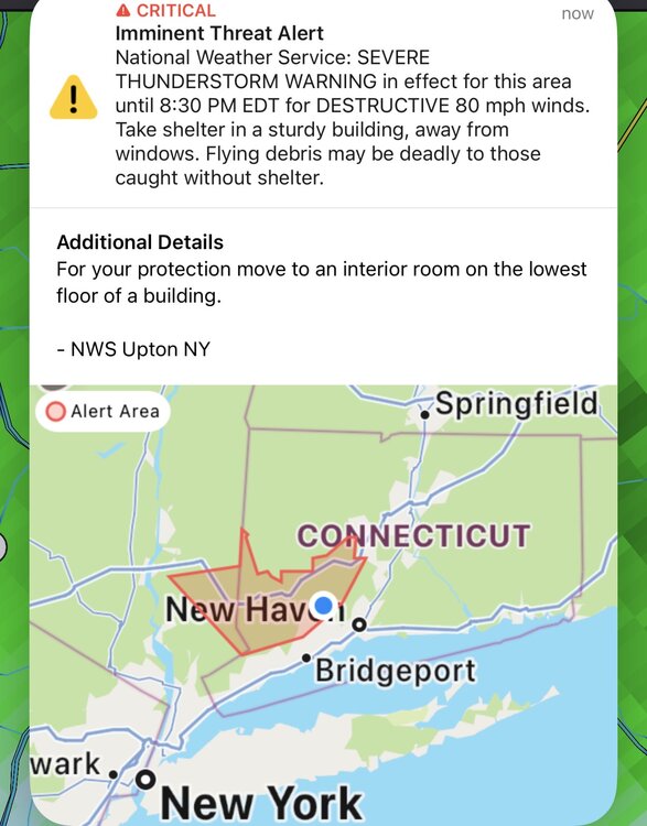
Monroe getting rocked with the worst of the wind. Just average here so far
-
Never had this before! All our devices are going wild! Emergency alerts!
-
Storm is trying to build into your good
-
Seymour Rain

-
Saw a 103 in Medford Mass in the nws obs.. 101 here in Seymour at lower elevation
-
https://x.com/burgwx/status/2072714292655194125?s=46 cool stat above temp of 96 before noon in KNYC
-
84/79 already