

wxsniss
-
Posts
5,520 -
Joined
-
Last visited
Content Type
Profiles
Blogs
Forums
American Weather
Media Demo
Store
Gallery
Everything posted by wxsniss
-
And while we have a fresh example, put me in the column of folks who are a little delighted (relieved?) to see that Euro-AI was completely useless this last event. Wonder how the Google GenCast that received all this media hype a few weeks ago did…
-
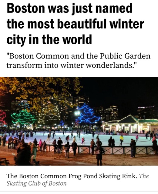
From today: https://www.boston.com/travel/travel/2024/12/20/boston-was-just-named-the-most-beautiful-winter-city-in-the-world/
-
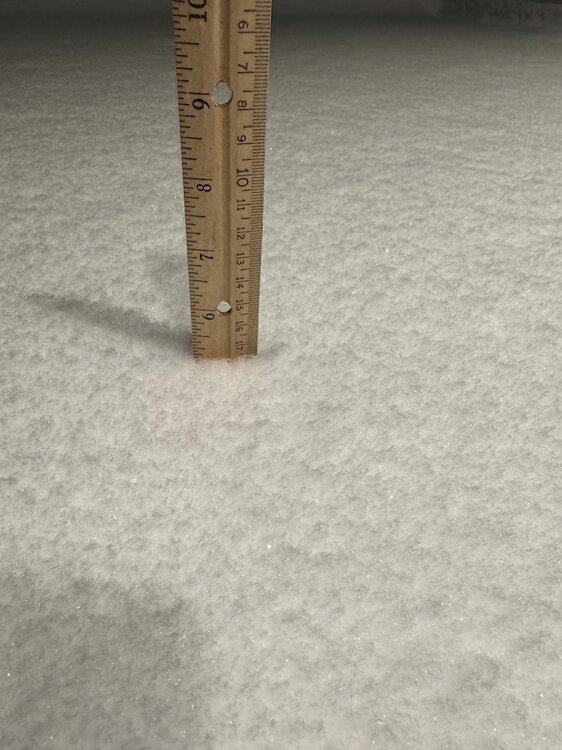
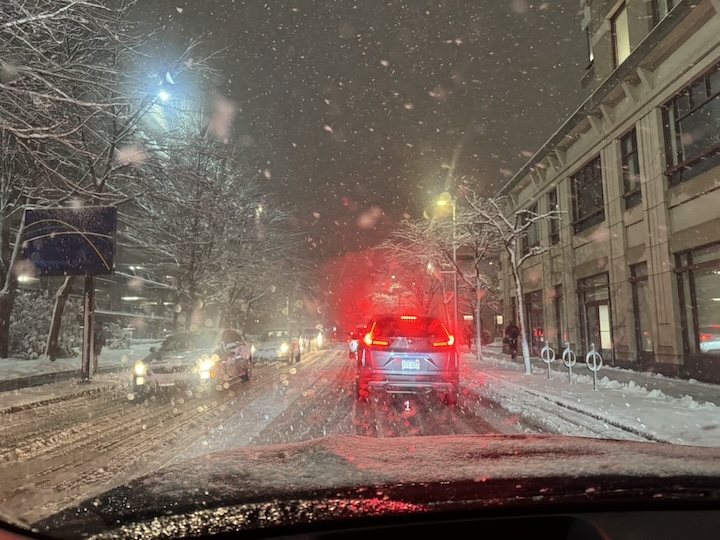
Took a weenie drive... almost a foreign feeling, it looks like WINTER... finally! ~5-5.2" measurements near Coolidge Corner Amazing how a positive bust (and for a change one where we're not futilely waiting to wetbulb) can partly heal the famished, even if it was just a few inches.
-
Completely sympathize. I was fully expecting mostly white rain in the city with C-1" to finish, par for the past 3 years. Literally 5 mile of CF placement made all the difference for you guys further east. Still have a few hours and CF looks over/past you, hopefully you pick up a few:
-
Westwood jack?
-
I'm trying to figure out... was this truly a NAM coup, or was it right for the wrong reasons i.e., OES + slightly further east CF (the larger synoptic snowfall from CCB in fact remained well offshore) that achieved the higher amounts in Boston / southwestern burbs...
-
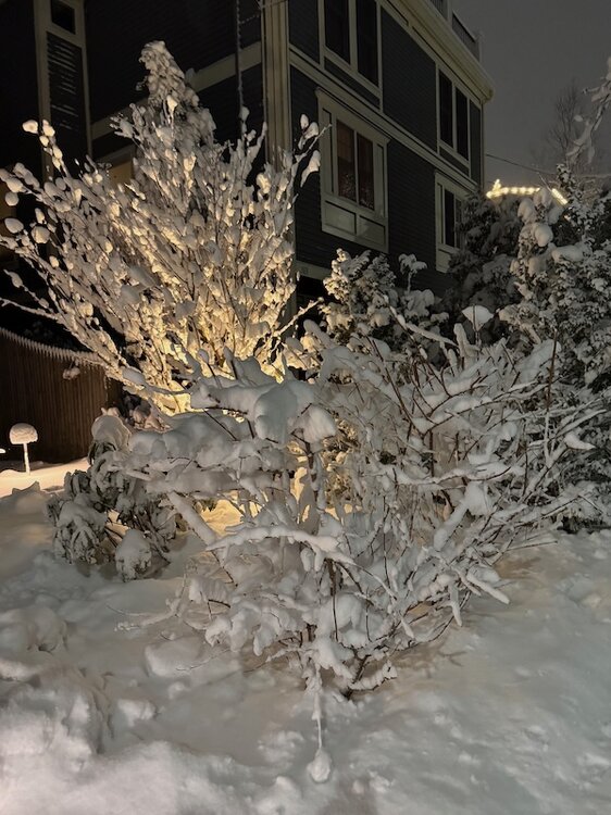
Best snowfall in Boston metro in years... years since we've had snow covered roads like this in the city:
-
Yep, and fwiw much of that bust so far is OES and placement of the CF Bodes well for later this afternoon when larger synoptic stuff develops 18z HRRR looks great for 4-6pm
-
Honestly was surprised to be on NW side of CF all morning here in Fenway, I thought it would set up closer to 128 and we'd be in white rain all day Boston metro has not had a positive bust for years, meager as this is it's a great feeling. We've been < 1 mi vis for hours. Guesstimating 1-2" so far and all OES. I think this is the CF now, between Quincy / Weymouth and Canton / Randolph, slinking SE... @CoastalWx and others you should hopefully turn soon
-
And last night I thought NAM should be introduced to DOGE… This OES already beating my expectations this morning. CF sitting just southeast of city, great snow growth in Brookline.
-
Destructive interference from that lead vorticity and we just miss a significant event... if this were a single isolated model run, I'd be tempted to attribute the disconnect between H5 and surface low position as runaway convection 48-60 hrs out, still not unrealistic for this to weigh the lead annoying energy slightly less as we get closer
-
December 2024 - Best look to an early December pattern in many a year!
wxsniss replied to FXWX's topic in New England
93-94 was my first winter in Boston. Man were my expectations irreversibly distorted. The potential and actual results of this December remind me of a Jerod Mayo pre-season quote I heard on WEEI this morning: "1000% percent... we have a lot of cap space... ready to burn some cash" -
Euro definite improvement vs. 12z... trough looked more promising than surface reflection, but continued trend of slightly more negative tilt and vort more consolidated Verbatim still just a very minor event for Cape / SEMA
-
All 0z guidance so far jumped in same direction... a good sign as responsible pieces of energy are just approaching BC
-
Good to be back. So desperate for snow like everyone here / depressed by what seems like a new climate normal, seemingly exactly coinciding with Brady leaving. At the very least for my toddler to experience snow, he was so excited Jan 7 2024. One major and somewhat earlier improvement on this 0z NAM is vort max is more consolidated at base of trough... e.g. h54-60 it was previously shmearing out into Tenn / Miss, now more consolidated. We get better trough structure and start to see a negative tilt. This is so close to something much better.
-
I actually posted the Nature paper link and portion of abstract about GenCast yesterday, lost in the Banter thread… curious about people’s thoughts.
-
Nice to see first flakes of season... light-moderate in Coolidge Corner, slushy coating on cars, 34F
-
New England Winter 2024-25 Bantering, Whining, and Sobbing Thread
wxsniss replied to klw's topic in New England
Thoughts? Anyone try this? Part of me hopes this is just more typical hype than an actual game changer… I think we’d all miss the suspense and art of forecasting snow storms. https://www.nytimes.com/2024/12/04/science/google-ai-weather-forecast.html https://www.nature.com/articles/s41586-024-08252-9 “ Here we introduce GenCast, a probabilistic weather model with greater skill and speed than the top operational medium-range weather forecast in the world, ENS, the ensemble forecast of the European Centre for Medium-Range Weather Forecasts4. GenCast is an ML weather prediction method, trained on decades of reanalysis data. GenCast generates an ensemble of stochastic 15-day global forecasts, at 12-h steps and 0.25° latitude–longitude resolution, for more than 80 surface and atmospheric variables, in 8 min. It has greater skill than ENS on 97.2% of 1,320 targets we evaluated and better predicts extreme weather, tropical cyclone tracks and wind power production.” -
Working out nicely for game... early cloud cover will mitigate temps, and we might get a nice canopy sunset later Never understood the flood watch outside of southern areas... NAM/HRRR were pretty good in timing of clearing, GFS was only guidance keeping significant activity into late afternoon
-
Will be at Fenway Saturday 4pm game, first time for the kids... Don't like the sound of a Flood Watch through 8pm, but only 12z HREF still has some lingering rain east through most of the game (and backed off from 0z HREF) vs. NAM/3kNAM/HRRR clear it out a few hours earlier
-
Impressive event to watch on radar I didn't measure but I'm guessing this was probably close to derecho criteria? 60 mile span with multiple mesovorts / bows, frequent gusts > 58 mph along most of its length, several gusts > 75 mph... but maybe was < 400 miles in duration? Outflow starting outpacing the band around Providence
-
That crisp bowing heading for Duxbury is impressive That has potential for some rotation too
-
Yeah didn't see any rotation on that warned area, bowing shape was more suspicious than anything Looks like this is dulling as it gets to coast for Boston area, still crisp further south Taunton area and east
-
TOR up!


