wxsniss
-
Posts
5,520 -
Joined
-
Last visited
Content Type
Profiles
Blogs
Forums
American Weather
Media Demo
Store
Gallery
Everything posted by wxsniss
-
Feb 28th-March 1st long duration Miller B threat
wxsniss replied to George001's topic in New England
12z HREF continues robust... very similar to 0z I posted last night -
0z Euro finds the sweet spot... slowly deamplifies as it shunts east, but a nice hit for much of NE, a tick south of 12z run
-
Feb 28th-March 1st long duration Miller B threat
wxsniss replied to George001's topic in New England
Let's hope it's on to something. It's the most robust at the moment. My guess is the higher 4-8" totals east rely on some northern stream infusion after ~15z Tuesday... you can see rates pulse back up for a few hours at the end. Unfortunately we'll be struggling with temps then too. We're scrapping for crumbs this season. -
Feb 28th-March 1st long duration Miller B threat
wxsniss replied to George001's topic in New England
0z HREF... wish it were reliable Really keeps the stuff in eSNE going most of Tuesday -
Big tick NW following the OP... Would be nice for many if this remained fixed as is... Both panels from 12z EPS (138 hrs, 144 hrs)
-
Feb 28th-March 1st long duration Miller B threat
wxsniss replied to George001's topic in New England
Will alluded to this... when we're trying to squeeze out dynamics from this decaying thing, the slightest kink in heights determines 4-8 vs. 2-4 in southeast/eastern MA / RI... 0z NAM top, GFS bottom... Don't think it's possible to realtime assess shortwave (currently over California) to determine which is more accurate -
Feb 28th-March 1st long duration Miller B threat
wxsniss replied to George001's topic in New England
Never loses its charm... (crappy phone camera ftl) -
Feb 28th-March 1st long duration Miller B threat
wxsniss replied to George001's topic in New England
A similar experience... Ski trip to Tahoe Feb 2007. On the drive up, we had to pull off and sleep in the car for hours because they did not allow vehicles without snow chains above a certain elevation. Whiteout conditions on the slopes the next day. I took this from inside one of the ski lodges the next day: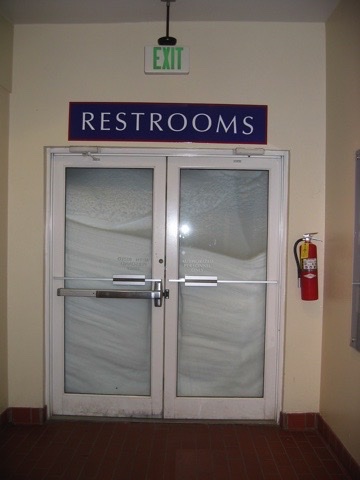
-
Feb 28th-March 1st long duration Miller B threat
wxsniss replied to George001's topic in New England
Yep. Euro last night was a pipeline for potent shortwaves ejecting out of the southwest that subsequently deamplify riding up and over the southeast ridge. Counters cyclogenesis with that trajectory, so we're left more dependent on potency of the incoming shortwave. Same issue for 3/4 system as currently depicted. Infusion of northern stream had been compensating. -
Feb 28th-March 1st long duration Miller B threat
wxsniss replied to George001's topic in New England
Haven't posted since this became disconnected from the northern stream, but agree with the disappointment. The 2/22 12z Euro was a flash in the pan for seasonal redemption, but notwithstanding there was a solid day of guidance hitting double digits for much of SNE that was realistic given the setup. Looking at tonight's 0z Euro... it's a really good shortwave, and even digs slightly better and slightly more negative tilt by 6z-12z Tuesday than earlier run. Doesn't reflect at the surface, but wouldn't take much to get this more amplified over the weekend. Is there some irony that this same shortwave is bringing blizzard conditions to southern California, but won't in New England? Fitting capstone for this season. -
Feb 28th-March 1st long duration Miller B threat
wxsniss replied to George001's topic in New England
Just catching up... Improvements on 0z GFS are the more potent lead shortwave and we boost the overrunning portion, making up for today's "pancaking" trend Tip was describing. Verbatim 12"+ for eastern SNE. Still not getting the same degree of N stream injection we saw yesterday, so it's a smeared CCB rather than the more consolidated and earlier secondary we saw on 2/22 12z Euro. And still room for that degree of injection to fluctuate in the next days of guidance. -
Feb 28th-March 1st long duration Miller B threat
wxsniss replied to George001's topic in New England
I take it 50th percentile = median? Definitely informative if you have some outliers like e19... in this case mean ≈ median gives more confidence to toss those outliers. Caveat being the entire ens/op could be off. -
Feb 28th-March 1st long duration Miller B threat
wxsniss replied to George001's topic in New England
Agree, increasing confidence in our biggest event of the season for SNE (a pretty low bar). Blockbuster is definitely still on table, but there are many more paths to pedestrian as illustrated tonight. -
Feb 28th-March 1st long duration Miller B threat
wxsniss replied to George001's topic in New England
EPS also have lead energy escaping east giving a flatter solution -
Feb 28th-March 1st long duration Miller B threat
wxsniss replied to George001's topic in New England
Looks like the lead shortwave shoots out too quick, misses the better phasing we saw earlier -
Woof woof We obviously want to see more continuity through tomorrow, but no question this is the best signal (cross-guidance and ensemble support + in shortest lead time) we've seen all winter
-
Agree with both, just was amused by the very precise shirk inside 128. Honestly haven't invested much time / care in this one, a pretty low ceiling for SNE. Not true for next week...
-
Circle shirk?
-
Woof for 2/28... nice cross guidance signal
-
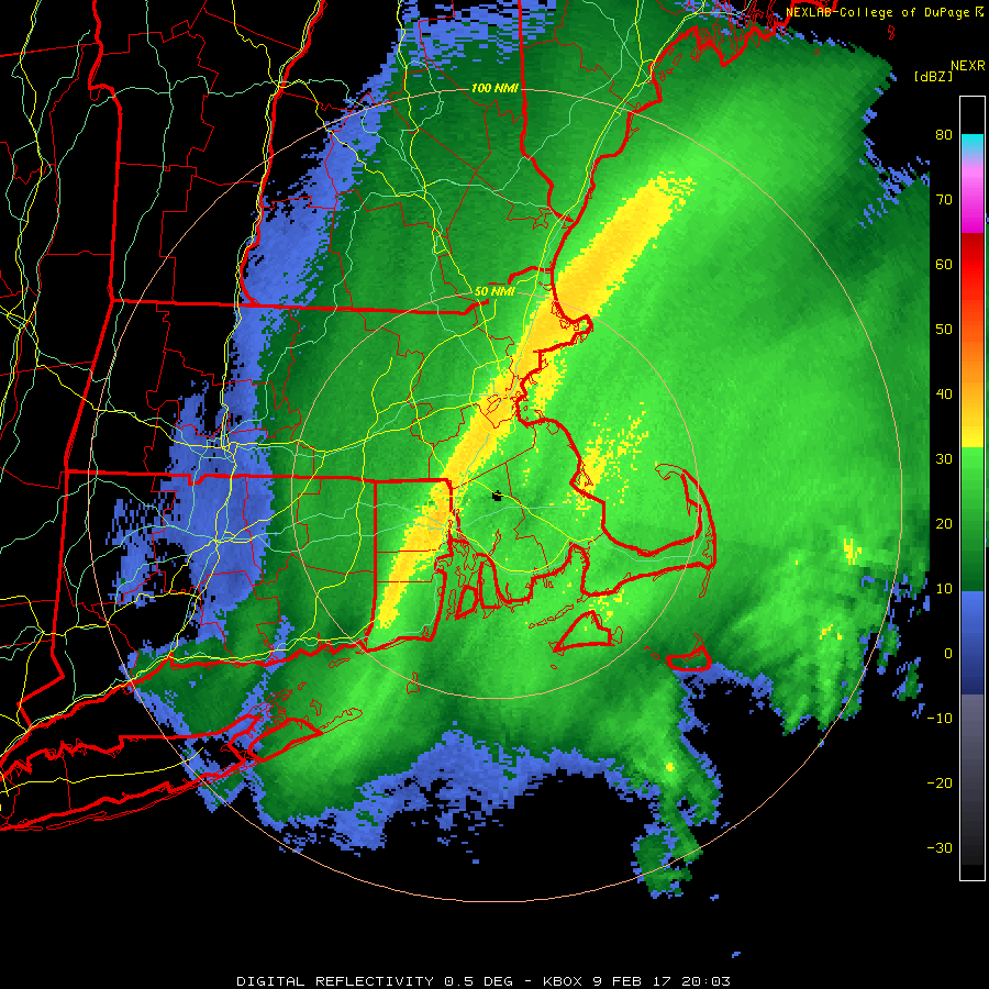
This was days after the 28-3 Superbowl... Similar to 2015, sometimes feels like concordant feast or famine in these parts Thundersnow ~2:30-3:30pm in eastern MA
-
https://www.boston.com/weather/weather/2023/02/08/could-winter-in-boston-be-over-before-it-starts/
-
-10˚F !!!
-
HRRR suggests we have a few more ticks, bottom around 2-4am 12:40am Wundermap:
-
-9 Gusts picking up again
-
KBOS -7 at 11:45pm I believe that’s a new record low for Feb 3