

wxsniss
-
Posts
5,796 -
Joined
-
Last visited
Content Type
Profiles
Blogs
Forums
American Weather
Media Demo
Store
Gallery
Everything posted by wxsniss
-
NAM lost the lead piece of energy that was preventing better tilting of trough in its prior runs... that is one of the main reasons NAM has been further southeast compared to other guidance. 2 players shown below Euro / NAM weaker solutions than other guidance because (i) lead energy #2 (circled green below) was preventing better tilting of trough on NAM up to 12z run, and (ii) subsequent energy #1 is weaker on Euro compared to other guidance. Now that 18z NAM lost that lead energy #2, all guidance is very similar except for strength of followup energy #1. Canadians have energy #1 on roids and not sure I believe it compared to rest of guidance... all energy is sampled pretty well. I'm leaning 70/30 GFS/Euro at this point, which would be a great hit for most of SNE. 12z NAM top / 18z NAM bottom:
-
0z Euro a tick more NW and more juiced than 12z, towards GFS Euro and GFS actually not too far off straddling high-end advisory / low-end warning RGEM / NAM seem to be the outlier extremes, and opposite at that... lends more credence to globals
-
Great vertical lift and banding signature sweeping through SNE on 0z GFS... has had something like this several cycles
-
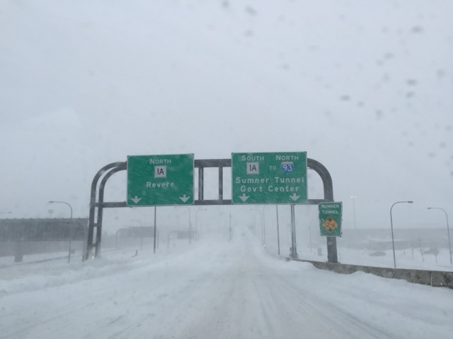
Logan 1.8" at 7:05pm Measured ~2" Coolidge Corner but lots of compaction I was happy to see those in South Shore that missed out on the Dec 20 event do well today!
-
Loving this discussion all. Tip, the bolded above seems like something you can objectively quantify and then show an association that supports this attribution... do we have data on "basal flow rate" in the past 5 years vs. other years and how that relates to cyclogenesis / snowfall? (Asking not out of skepticism, I've always found this a compelling theory)
-
Fortunately, whether because of limitations in input data +/- inadequate computing, my hunch is AI forecasting has a very long way to go before it can nail these highly impactful nuances. Which I'm ok with... this hobby would lose much of its suspense and thrill if we had perfect deterministic models.
-
x [probability of a goal-line interception to win a SB] = 1:100,000,000 ?
-
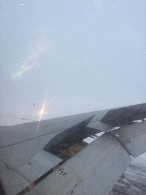
While we're reminiscing... That 2015 period always reminds me of that made-up term Dwight uses in The Office... "perfektenschlag" for when absolutely everything just goes right. I flew back from a certain football game played in Glendale AZ... and land to this at Logan:
-
The assumption is always better sampling -> better result lol
-
I posted in Banter, but I guess this thread is basically that until the Miracle of 0z... check out this reverse LES:
-
Well said. On Sunday I was bullish and tossed the Euro because it was "threading the needle to a non-event here"... I underestimated. Pretty sure this is correct looking at climod2: for KBOS and probably multiple SNE sites, 2022-2025 so far the worst 3 year snowfall in recorded history. And nothing comes close.
-
New England Winter 2024-25 Bantering, Whining, and Sobbing Thread
wxsniss replied to klw's topic in New England
Almost looks like LES in reverse… -
Haunts me that I wrote "Euro is threading the needle to a non-event" on Sunday... the way these streams were positioned and take-your-pick of vorticity boluses, this looked so promising over the weekend... now it's variations of a theme of fail Non-zero chance we get improvements with better sampling of northern energy, but yeah that S stream backing out makes this such a gut-wrenching miss... what a stretch for SNE
-
0z EPS not improved vs. 12z... initially looked better at H5 through 96hrs but ultimately surface low members largely OTS... there's a handful of 960s-970s members in there so seems phase does eventually happen but too late for impact A negative sweep at 0z is definitely concerning and bucks the model momentum today. Northern stream energy is the critical variable, so there's still room to trend back to a better phase with improved sampling, but that's gotta happen in the next ~24-36 hours (looks like energy enters BC coast ~12z Wednesday)
-
Definite step back Weaker northern stream energy + less proficient phase --> more progressive trough --> scraper and less intense surface low. But not sure I'd call this a cave to Euro... Euro multiple cycles has a low far OTS and barely latitude of Delaware... GFS / many GEFS members have had multiple runs deeper low vicinity of BM
-
Continued big improvement with 18z GEFS at H5 and surface members Model momentum today favors a huge impact, details tbd... I maintain what I said yesterday: Euro/EPS is the one threading the needle to a non-event. Won't be surprised if it abruptly jumps in one cycle to a big hit between tonight - Tuesday 12z.
-
I’m relatively bullish on this. Feels like there’s multiple ways to have some impact… longwave pattern is decent, stronger northern energy and/or the slightest stream interaction gets at least some impact to 95 corridor/SNE… Usual caveats, nothing is guaranteed at this point and details tbd… but the “thread the needle” outcome is OTS imo.
-
Today's cold snowless winter day ≈ Pats win #4... useless and unwanted by winter/Pats fans. Just looked GFS 18z/6z vs. 12z H5 so hugely different... especially northern stream energy dives down better on 18z/6z instead of getting lost over Manitoba. Unfortunately I don't think we'll be confident with that variable until closer, but I'm not so discouraged by the 12z suite. When the outcome is so sensitive to just the slightest stream interaction, I actually lean against OTS with zero impacts as depicted at 12z.
-
All somehow related ways to mark the holiday Merry Christmas and Happy Hanukah all! Here’s to some region-wide crushings of yore in January…
-
Cobblestoned lamp-lit Beacon hill is pretty iconic too Anyway, not necessarily agreeing with this list (methodology was by showing people photos), but here were top cities:
-
And while we have a fresh example, put me in the column of folks who are a little delighted (relieved?) to see that Euro-AI was completely useless this last event. Wonder how the Google GenCast that received all this media hype a few weeks ago did…
-
From today: https://www.boston.com/travel/travel/2024/12/20/boston-was-just-named-the-most-beautiful-winter-city-in-the-world/
-
Took a weenie drive... almost a foreign feeling, it looks like WINTER... finally! ~5-5.2" measurements near Coolidge Corner Amazing how a positive bust (and for a change one where we're not futilely waiting to wetbulb) can partly heal the famished, even if it was just a few inches.
-
Completely sympathize. I was fully expecting mostly white rain in the city with C-1" to finish, par for the past 3 years. Literally 5 mile of CF placement made all the difference for you guys further east. Still have a few hours and CF looks over/past you, hopefully you pick up a few:
-
Westwood jack?


