
SLPressure
-
Posts
558 -
Joined
-
Last visited
Content Type
Profiles
Blogs
Forums
American Weather
Media Demo
Store
Gallery
Everything posted by SLPressure
-
Thank you!
-
I have to lead an outdoor program this evening in the Mt. Vernon are of Fairfax county. With the waffling of the precipitation potential, what are thoughts on odds of steady, moderate, rain between 6 and 9 pm?
-
I know we used to have a storm mode sometime in the past. Wasn't there also a model mode? No banter during the running of the models, or something to that effect. Parsing through 10 pages to find real information is getting old.
-
6.8" National Harbor
-
Yeah, can't always go with the verbatim translation of any model output. Or with the current temperature. Or with anything to do with the weather. It will definitely humble anyone. But I am loving that I was wrong!
-
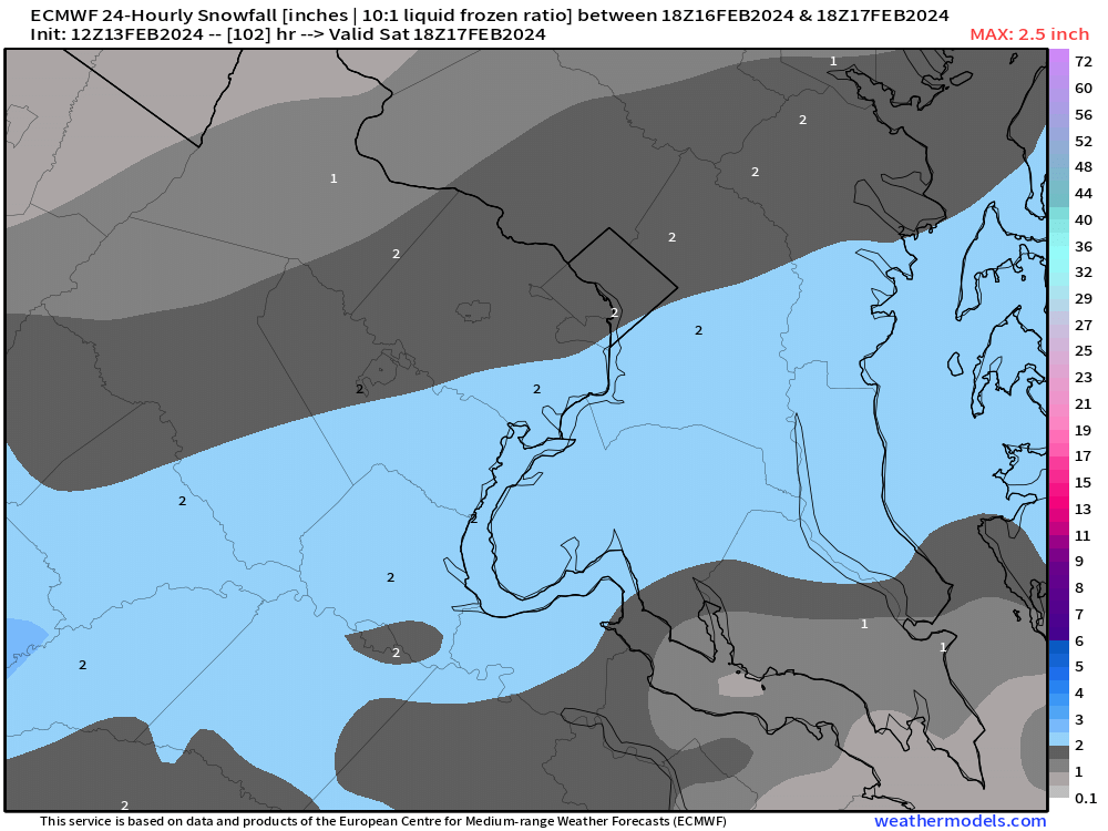
DCA still at 34. Modeled at 29. Doesn't bode well for the temperature forecast today. NAM 3k 10:1 4-8, Positive snow depth change 2-3.
-
On TT, there is the option to look at "positive snow depth change". What exactly does that mean? It shows 7 north to 8 south at 45h, yet 10-1 has 8 north to 12 south. Which is more accurate?
-
I know it has been previous mentioned, snowing for 24 hours and the hourly rate is relatively light. How will daytime temperatures above 32 degrees affect the accumulation as depicted on the modeled maps?
-
Ugly for us south and east of DC. Ugh.
-
NFL model forum. Awesome!
-
January Medium/Long Range: A snowy January ahead?
SLPressure replied to mappy's topic in Mid Atlantic
LOL. I took the bait. My bad. -
SN+ at the moment. Covering everything all over again. Awesomely beautiful!
-
Just started snowing again in National Harbor. 6" on the ground so far.
-
Thank you!
-
Oof?
-
What is the lead time for NHC, re: posting watches and warnings? And do they only post along coastlines? Maybe a dumb question, but just curious. Visiting family in Orlando at the moment. And when was the last time Orlando was under a hurricane warning?
-
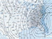
The Weekend Rule? Saturday 2/17 - The Icon Storm
SLPressure replied to DDweatherman's topic in Mid Atlantic
39/22 National Harbor -
The Weekend Rule? Saturday 2/17 - The Icon Storm
SLPressure replied to DDweatherman's topic in Mid Atlantic
-
The choices on weathermodels.com are - ECMWF - ECMWF 3hr - ECMWF 1hr - and then the 4 choices of - EPS - Cyclones - Members - and 46 days. Which one, or is it all of them, that are AI-enhanced?
-
28/14 dusting on grass.
-
2023 Mid-Atlantic Severe Wx Thread (General Discussion)
SLPressure replied to Kmlwx's topic in Mid Atlantic
86/73 sunny skies National Harbor -
2023 Mid-Atlantic Severe Wx Thread (General Discussion)
SLPressure replied to Kmlwx's topic in Mid Atlantic
84/72 sunny -
2023 Mid-Atlantic Severe Wx Thread (General Discussion)
SLPressure replied to Kmlwx's topic in Mid Atlantic
78/69 mostly sunny in Oxon Hill. -
Hail reported in California, MD.
-
December 22-23, 2022: Warm Rain to Arctic Chill
SLPressure replied to WxUSAF's topic in Mid Atlantic
Snowing in Clinton.


