Disc
-
Posts
3,996 -
Joined
-
Last visited
Content Type
Profiles
Blogs
Forums
American Weather
Media Demo
Store
Gallery
Everything posted by Disc
-
Speaking more for southern VA here... The is a very dense arctic airmass that is moving across the northern parts of the CONUS. This airmass will obviously moderate some, but it will still be very dry and will be hard to scour out once the precipitation begins to fall into it. I've seen some of the best CAD favored areas hang onto below freezing temperatures for an entire duration of an event even with a retreating high. While yes, ZR is self-limiting and the high is transient, these mountain valleys are incredibly hard to "warm" once the low-level cold is locked in with precip falling. The lighter precipitation at the start with temps in the mid-20s is very much a concern. 6-8hrs of that and you have a mess. Like usual, I'd be most concerned about the Blue Ridge and areas just to the east.
-
Wx station got down to 32 this morning. Last pleasant day before the first upslope/gradient wind event of the season occurs. Will likely be some areas (higher elevations) gusting close to 50mph tomorrow evening.
-
You were probably about spot on. My home wx station sits at 2,700ft in a slight bowl. Optimal radiation! You're gonna love that first arctic cold front. Winds gusting 40 to 50mph and single digit wind chills with snow squalls.
-
38.7 for the low on my wx station.
-

-
A couple spots down into the upper 30s in the sheltered high elevation valley locations. Heat and some humidity coming back next week though.
-
Howdy neighbor! Welcome to the area. We'll certainly be keeping an eye on it here.
-
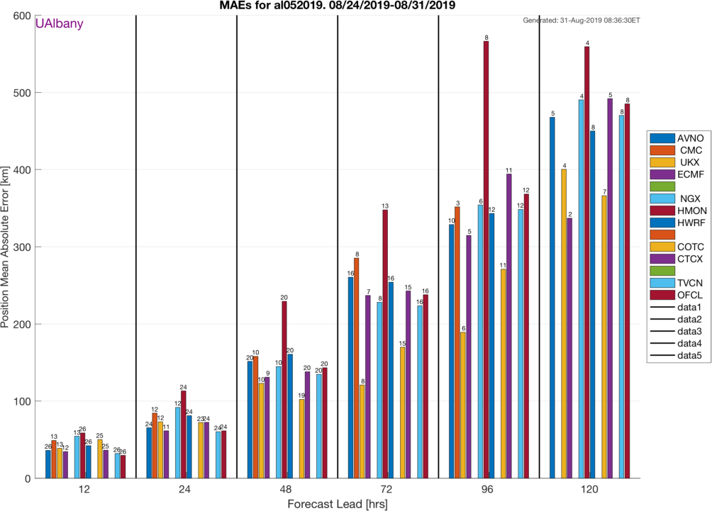
Just now seeing this as I haven't been on. I will comment that there has been research done with intra-cloud lightning preceding an uptick in severe potential and it's usually a better indicator than CG. Many times, storms will only have intra-cloud at the beginning of their life, whereas CGs don't follow until later on. As an example, the graph below shows a scenario where you see a large uptick in intra-cloud just before there is a large jump in MESH and a hail report of up to 6". When looking at the CGs, it tends to remain much more constant, with little to no trends.
- 2,802 replies
-
- 2
-

-
- severe
- thunderstorms
- (and 4 more)
-
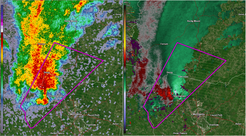
A very impressive storm for this area. Stronger than the Feb Appomattox tornado in 2016 and the Elon/Amherst tornado of last year. Both were also EF3s. Edit: For some reason the animation won't work here. I guess it's not supported. So here's a link: https://i.imgur.com/aBXa6ku.gifv
- 2,802 replies
-
- 6
-

-
-
- severe
- thunderstorms
- (and 4 more)
-
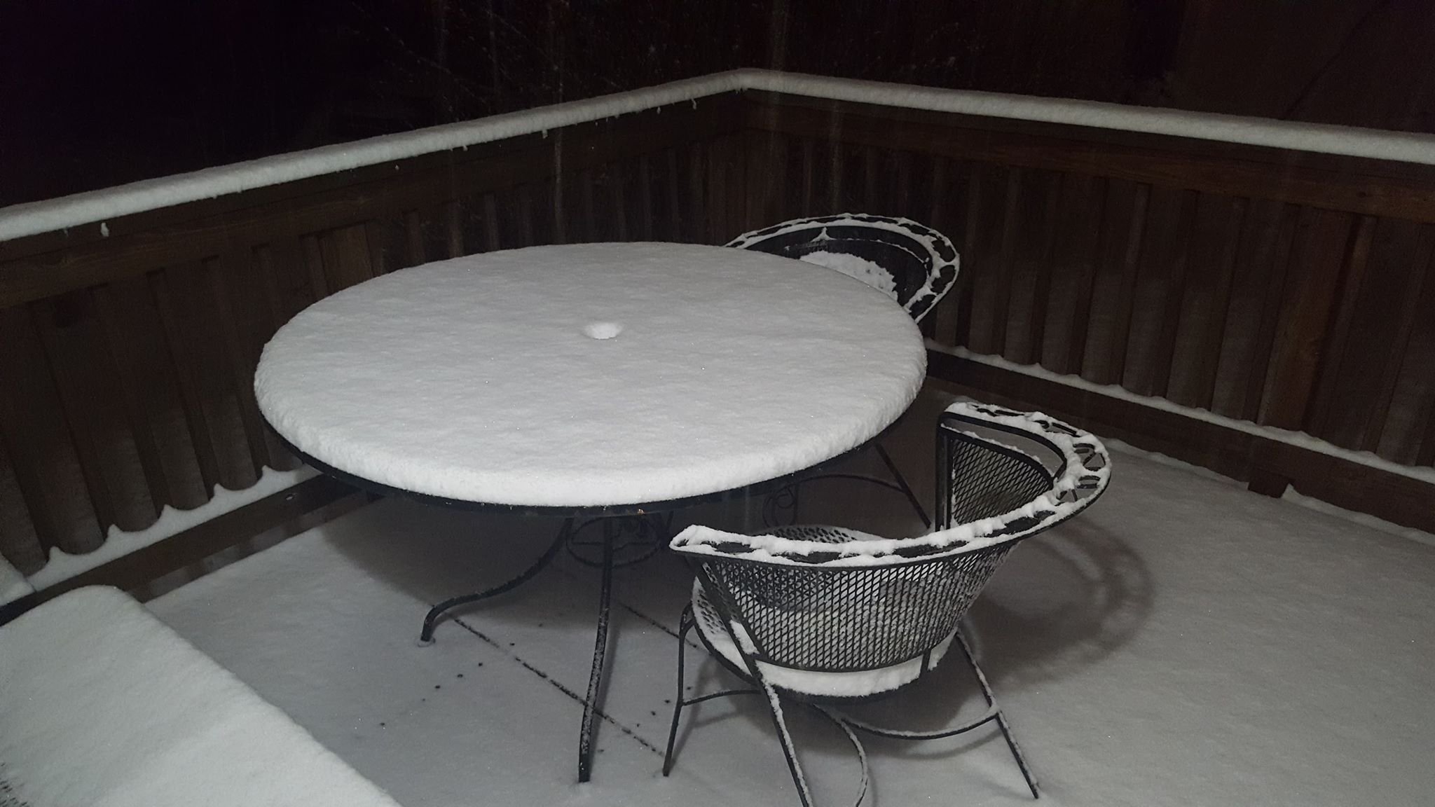
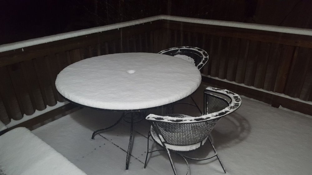
Moderate snow currently, even though it doesn't show much in the pic.
-
New MD out: https://www.spc.noaa.gov/products/md/md0111.html
-
Lasting a bit longer than I expected it to. I was confident we'd switch over with this band moving through.
-
Blacksburg. Says it on my profile..
-
Still all snow down here believe it or not.
-
About a 1/2" here east of Blacksburg. Still all snow so far..
-
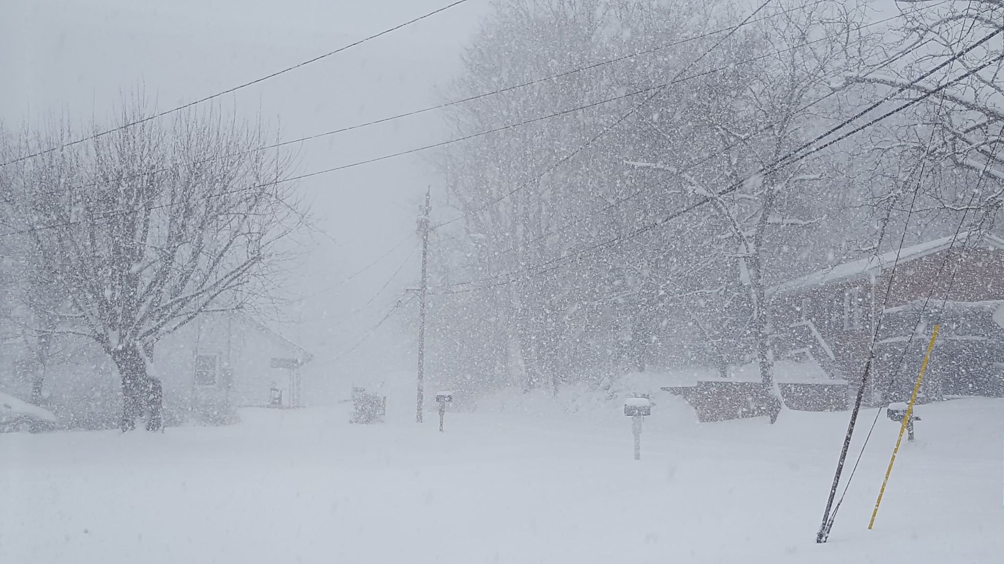
Very nice band of snow moving through down here. Hoping the snow/ice line will decide to setup just to my south.
-
2-3"/hr rates are back. Just measured 11"
-
Just started picking up here again. This one will easily push me over a foot.
-
Yes, it was coming down absurdly heavy. Could almost watch it pile up. That was a good one here, but definitely not as good as up there!
-
Over 7" here...

-
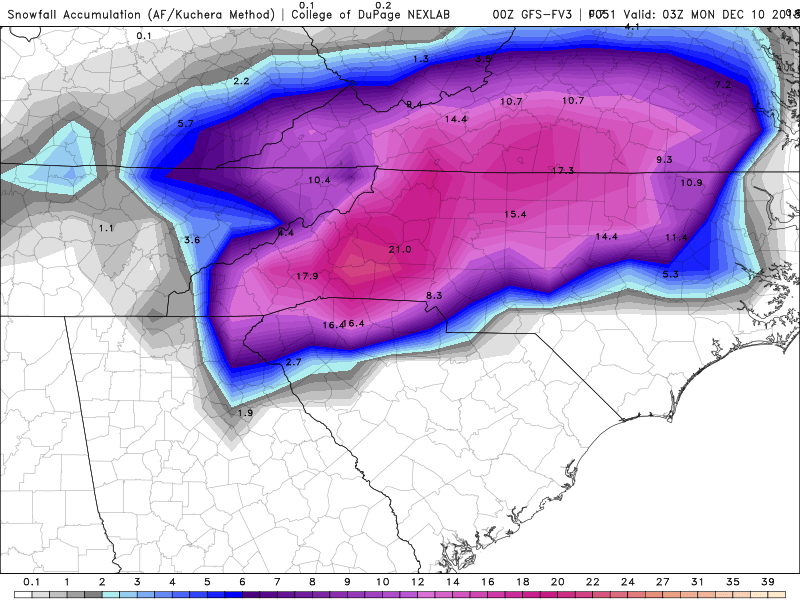
Can I hyperventilate here? That Euro run was amazing and my weenie mode is off the charts. That is all.
-
Just something that would make it so we don't have to scroll through a bunch of images, COD allows a GIF to be made so you can post the whole run in one post.
-
We'll use one without all the ice.
-
I think you will see some decent snow, probably at least warning criteria for sure. It's gonna be really close up here.
-
And RGEM and ICON.