jaxjagman
-
Posts
8,627 -
Joined
-
Last visited
Content Type
Profiles
Blogs
Forums
American Weather
Media Demo
Store
Gallery
Everything posted by jaxjagman
-
 https://buzzcam.net/MI240.html Memphis
 -
Why it best to add your location,it does help
-
You guys always hit the jack pot
-
I use google chrome,if you use that get awesome screen recorder and screenshot,thats what i use
-
https://g1.ipcamlive.com/player/player.php?alias=brentwood201173a

-
Ive been watching the Weather Nation and someone is reporting,in Florence,Al and it snowing there,our DP'S are @ 19 here,no snow for us yet
-
Mempho,where have you been hiding?
-
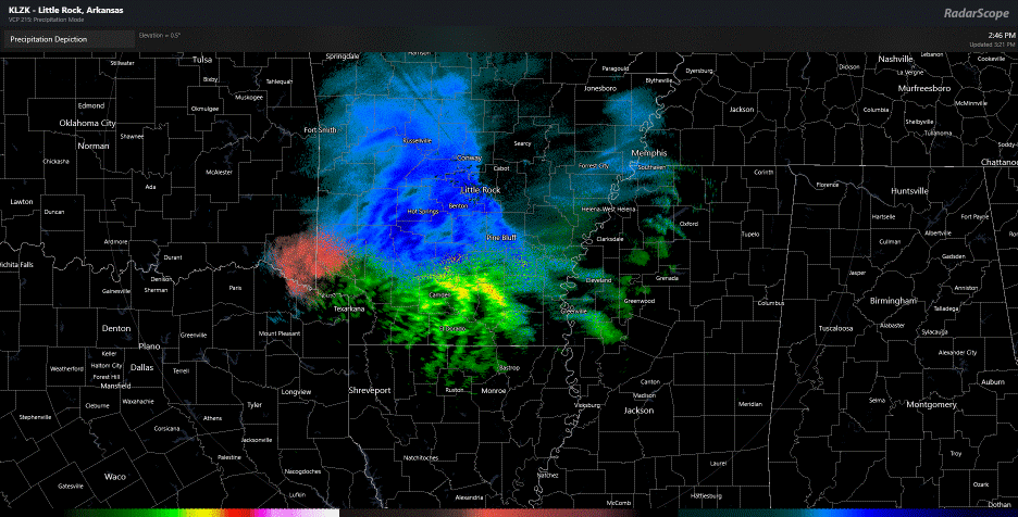
Its raining east of the Miss River but the short range models showed this,it should change over soon
-
Least the Mesoscales dont show this right now
-
If you look at the HRRR,start at hr 7 on the surface map and keep going
-
HRRR shows it also,maybe its right,looks like a inverted trough
-
Its doing some weird shit..lol
-
Dont like the RAP,LP is going through Central MS
-
National Weather Service Nashville TN 841 PM CST Thu Jan 9 2025 ...New UPDATE... .KEY MESSAGES... Updated at 830 PM CST Thu Jan 9 2025 - High chance of significant snow accumulation and major travel impacts Friday into early Saturday. - Cold temperatures through the weekend with lows in the teens and 20s. - Temperatures below freezing during nighttime hours next week will re-freeze any melted snow, resulting in black ice and continued hazardous travel especially on secondary roads. && .UPDATE... Issued at 830 PM CST Thu Jan 9 2025 Have updated the short-term grids with the most recent model data and there`s no appreciable change in the forecast. We are still expecting widespread amounts of 4-7". Some locations will likely exceed that range. Other locations, mainly our southern areas near the TN/AL border, can expect less than 4", but also with light ice accumulations. Either way, the impacts are going to be the same area-wide. Radar imagery shows the leading edge of the snow just now reaching the Memphis Metro Area. The environment across Middle Tennessee is still relatively dry. Dew points are mostly in the teens, and the evening sounding from OHX gives a Precipitable Water of just 0.16", which is actually below the 10th percentile for this date. So we`re going to need quite a bit of moisture advection in order for precipitation to start reaching the ground. That should happen rather quickly now that the upper ridge has passed east of Middle Tennessee and the upper flow is in the process of turning southwestward. The forecast is still on track.
-
Nashville bumped the totals up since this morning here,they must feel pretty confident,more than i am anyways right now Tonight Snow showers likely, mainly after 5am. Increasing clouds, with a low around 25. Calm wind. Chance of precipitation is 60%. Total nighttime snow accumulation of less than a half inch possible. Friday Snow showers. The snow could be heavy at times. High near 32. Calm wind becoming east southeast around 5 mph. Chance of precipitation is 100%. New snow accumulation of 4 to 8 inches possible. Friday Night Snow showers likely, mainly before 9pm. Cloudy, with a low around 27. Calm wind becoming west northwest around 5 mph after midnight. Chance of precipitation is 60%. New snow accumulation of less than a half inch possible.
-
We was in a WSW several years ago,models didnt even so much of any WN and we ended up with all rain here
-
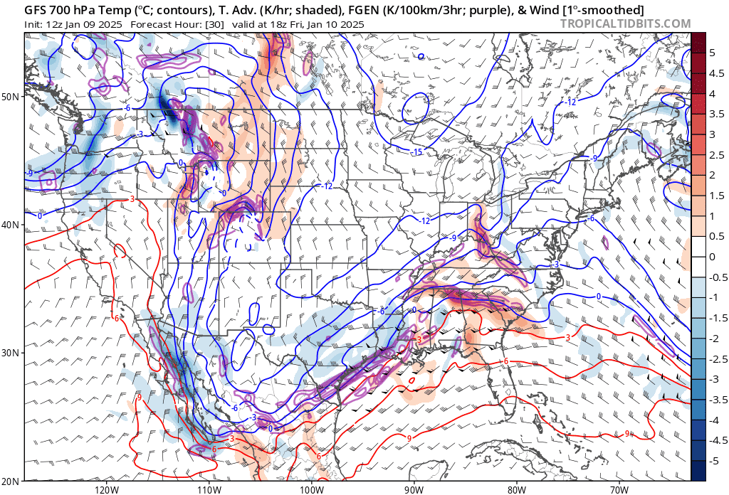
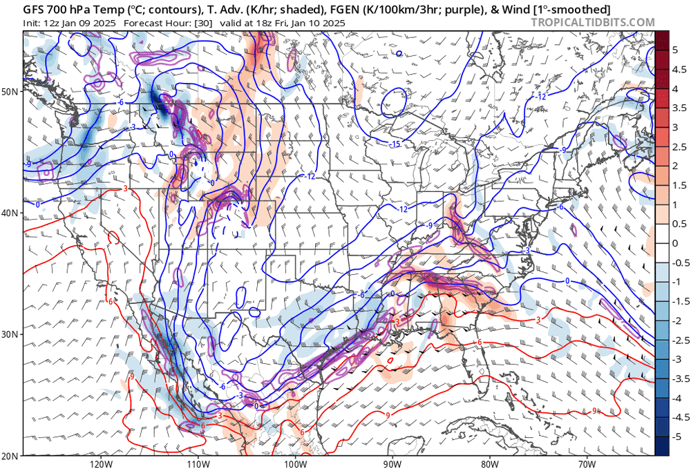
GFS is locked in
-
Looks like a Christmas light show right now
-
Link,forgot it https://www.cpc.ncep.noaa.gov/products/predictions/threats/threats.php
-
Slight risk of much below normal temperatures for portions of the Ohio, Tennessee, Middle and Lower Mississippi Valleys, Southeast, and Mid-Atlantic, Fri-Sat, Jan 17-18. Slight risk of much below normal temperatures for parts of the Northwest, Rockies, Central and Northern Plains, and the Upper and Middle Mississippi Valley, Sun-Wed, Jan 19-22. Slight risk of much below normal temperatures for parts of the Southern Plains, Lower Mississippi Valley, Tennessee and Ohio Valleys, Southeast and Great Lakes, Mon-Thu, Jan 20-23. Slight risk of heavy precipitation for portions of the Lower Mississippi Valley, Southern Plains, and Tennessee Valley and Southeast, Fri-Tue, Jan 17-21. Slight risk of heavy snow for portions of the Central and Southern Rockies and Plains, Middle and Upper Mississippi, Ohio, and Tennessee Valleys, Great Lakes, Central and Southern Appalachians, Mid-Atlantic and Northeast, Fri-Tue, Jan 17-21. Slight risk of high winds for portions of the Central and Southern Plains, Middle Mississippi Valley, and Great Lakes, Sat-Mon, Jan 18-21. Slight risk for periods of high winds for much of the Four Corners and surrounding areas, Fri-Mon, Jan 17-20. Detailed Summary
-
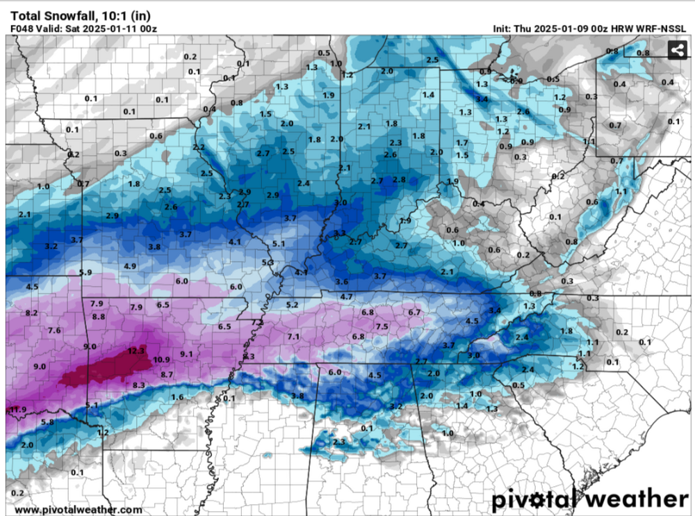
GFS shows a heavy band of snow tomorrow setting up from SW/TN.Mid Tn into east TN,VA after,if it right anyways
-
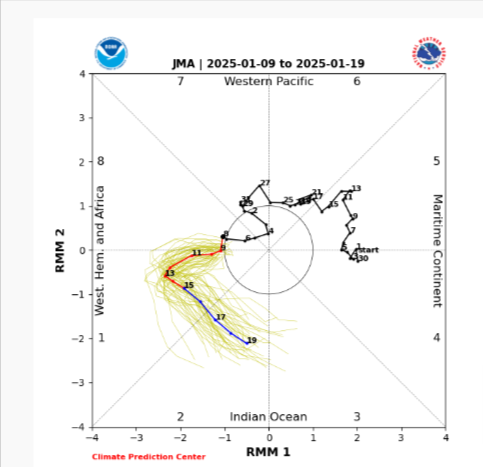
Long range i still believe the Euro is wrong.Seems possible all its doing is seeing destructive interference from Rossby,Kelvin Waves
-
Not much change just comes in a little faster than earlier
-
National Weather Service Nashville TN 818 PM CST Wed Jan 8 2025 ...New UPDATE... .KEY MESSAGES... Updated at 806 PM CST Wed Jan 8 2025 - High chance of snow accumulation and travel impacts Friday into early Saturday. - Cold temperatures this week with lows in the teens tonight. - Temperatures below freezing during nighttime hours next week will re-freeze any melted snow, resulting in black ice and continued hazardous travel especially on secondary roads. && .UPDATE... Issued at 806 PM CST Wed Jan 8 2025 Skies are finally clearing out of Middle TN as a trough has exited to the east. It`s been cold, but this trough brought a reinforcing shot of colder air. This combined with clearing skies will make for a very cold night across the area. Widespread lows in the teens are expected with a medium chance (30-50%) that temperatures fall into the single digits along the upper Plateau. One more quiet day is on tap Thursday as temperatures only warm into the mid-30s. Our winter storm will be approaching by tomorrow night, with snow moving into the area from southwest after midnight. As far as forecast concerns and uncertainty, not much has changed from the previous discussion below. The bottom line is that you should be prepared for significant travel impacts by mid-Friday morning.
-
Actually its KINDA like the NAM...fwiw,LP cutting through B'HAM