National Weather Service Nashville TN
1148 AM CST Fri Jan 10 2025
...New SHORT TERM, LONG TERM...
.KEY MESSAGES...
Updated at 1141 AM CST Fri Jan 10 2025
- Continued snow/light ice accumulation and major travel impacts
today into early Saturday.
- Cold temperatures into next week with lows in the teens and
20s.
- Temperatures below freezing during nighttime hours next week
will re-freeze any melted snow, resulting in black ice and
continued hazardous travel especially on secondary roads.
&&
.SHORT TERM...
(Rest of today through Saturday)
Issued at 1141 AM CST Fri Jan 10 2025
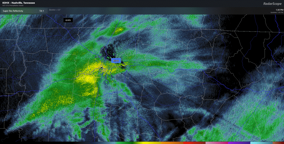
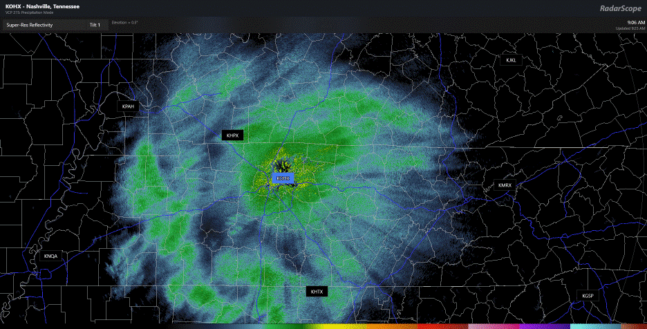
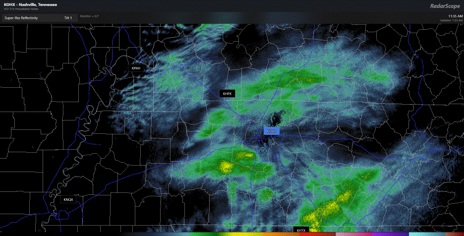
Our current winter weather event is well under way at forecast time.
Currently, Middle TN is all snow with our heaviest totals in our
southwest counties so far, right around 4 inches. Additional
snowfall is expected for them and the rest of the area throughout
the afternoon hours. However, there is a feature we`ve been
monitoring for the last hour or two: that warm nose that we`ve been
talking about the last few days is making its way northward.
Northern Alabama/Mississippi/Georgia already have reports of a
transition to freezing rain and sleet as this nose moves northward.
This line/transition is expected to move into our southern TN
counties over the next few hours, but there is very little
confidence in saying how far north it will reach into the mid-state.
Current wisdom from our models suggest that it should remain south
of the I-40 corridor until the precipitation stops falling. That
means everyone along and north of I-40 should remain all snow, where
those south of I-40, especially closer to the AL/TN state line, have
a medium to high chance of seeing a transition to sleet and maybe
even some light ice accumulations from freezing rain. This should
begin to occur right around the noon hour on the state line and move
north over the next few hours. Forecast snowfall totals haven`t
changed. We still have several hours of snow before the machine
shuts off. By early this evening, wintry weather should start
transitioning off the Plateau and be completely into East TN before
midnight. For this reason, I`m going to adjust the timing on our
headlines, likely ending them by midnight. Here`s the downside:
major travel impacts are going to be with us for a while. TDOT is
likely to have the interstates under control pretty quickly, but
secondary, less-traveled roads are going to be an issue for a few
days as things thaw during the day, melt and re-freeze at night.
Slick roads will be the story for the next few mornings.
&&
.LONG TERM...
(Saturday Night through next Friday)
Issued at 1141 AM CST Fri Jan 10 2025
As for the rest of the forecast, it`s really pretty benign. Two
systems are currently being shown to swing through the TN Valley
region (one Sunday night and another Tuesday night), but both look
dry at this time and will likely only act to reinforce the colder
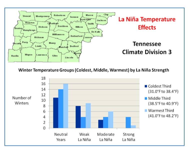
air in the area. Overall, we will remain below normals for this time
of the year, but nothing too extreme.
Our next chance of precip may come next weekend. Obviously, this far
out, the details are sketchy, but there is some indication Old Man
Winter might show his head once again. More on that with future
forecast packages.


 About over for us other than some flakes and maybe a brief shower