jaxjagman
-
Posts
8,627 -
Joined
-
Last visited
Content Type
Profiles
Blogs
Forums
American Weather
Media Demo
Store
Gallery
Everything posted by jaxjagman
-
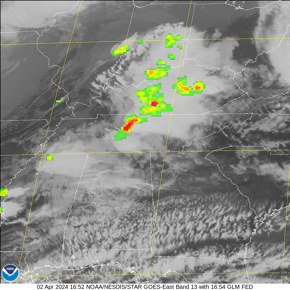
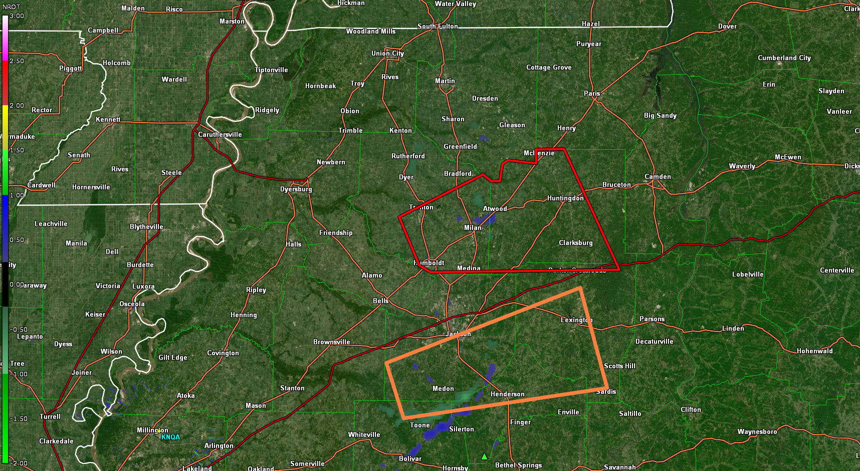
Cells seem to be moving pretty quick now than earlier
-
Some decent rotation starting to show west of Fairview
-
Big tornado
-
Nice thunderstorm,power got knocked off for a few min,wish it was at night,some intense lightning
-
RAP and HRR shows more that will develop later on so we'll see
-
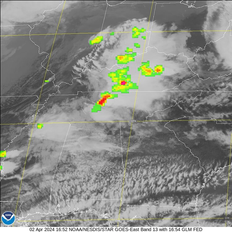
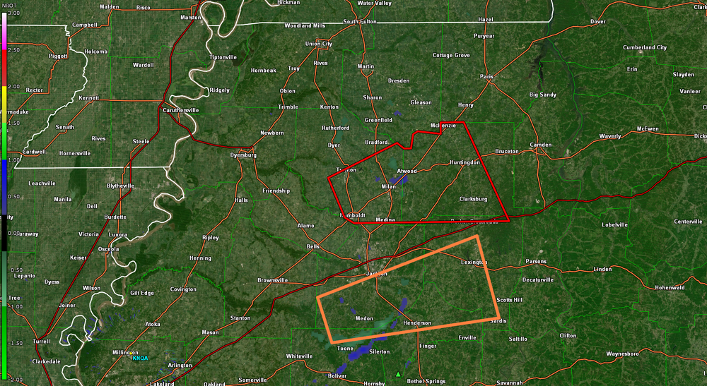
URGENT - IMMEDIATE BROADCAST REQUESTED Tornado Watch Number 75 NWS Storm Prediction Center Norman OK 950 AM CDT Tue Apr 2 2024 The NWS Storm Prediction Center has issued a * Tornado Watch for portions of Southern Kentucky Western and middle Tennessee * Effective this Tuesday morning and afternoon from 950 AM until 300 PM CDT. * Primary threats include... A few tornadoes likely with a couple intense tornadoes possible Widespread damaging winds and isolated significant gusts to 75 mph likely Scattered large hail events to 1.5 inches in diameter likely SUMMARY...A loose cluster of storms in western Tennessee is expected to evolve into a couple of supercells while spreading east-northeastward toward southern Kentucky and middle Tennessee through midday and early afternoon. The environment ahead of the storms will be favorable for tornadoes, a couple of which could be strong (roughly EF2), as well as damaging gusts up to 75 mph and large hail of 1-1.5 inches in diameter. The tornado watch area is approximately along and 50 statute miles north and south of a line from 20 miles north of Jackson TN to 45 miles north of Crossville TN. For a complete depiction of the watch see the associated watch outline update (WOUS64 KWNS WOU5).
-
Neither has much rotation right now
-
The thunderstorm cell looks more impressive than the tornado cell in SW TN
-
HRR last couple runs keeps honing in on the TN/KY line for some possible strong tornadoes mid afternoon
-
Sound like winds and if cells can remain broken tornadoes possibly
-
Just start another severe thread,this one is 3 years old,bout time to start a new one
-
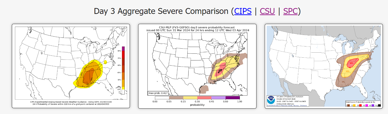
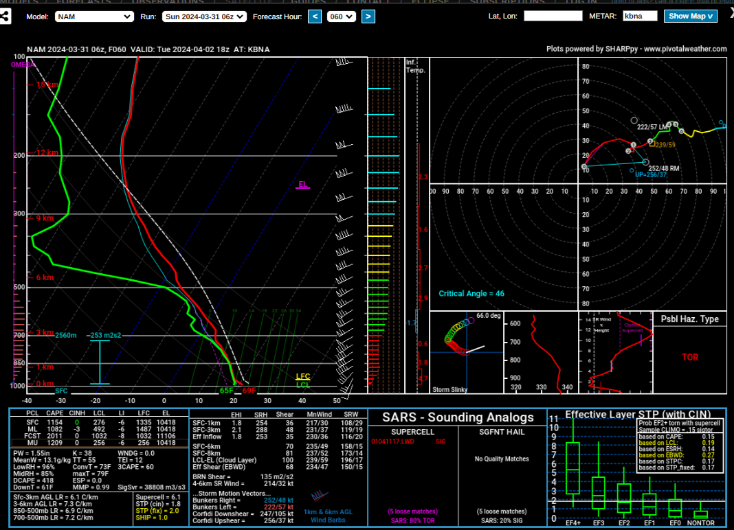
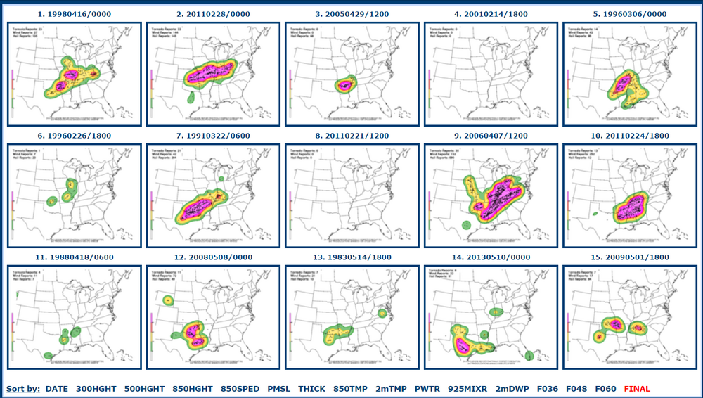
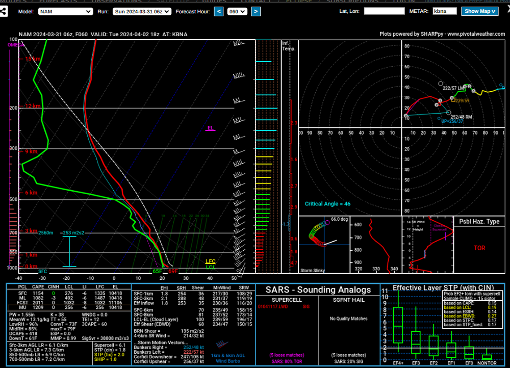
Still top analog is Mid April 1998 by the NAM 12z today,Disco from Nahshville LONG TERM... (Monday Night through next Sunday) Issued at 1106 AM CDT Sun Mar 31 2024 The main concern in the extended forecast continues to be on Tuesday with the expectation of some severe storms. A wave of energy within a larger positively-tilted, broad trough will eject out of the SW CONUS on Monday with a surface low developing in response. The surface low will move from the Ozarks into the Midwest and deepen as Tuesday progresses. Storms could be ongoing early Tuesday morning to our north and west. A couple of the CAMS including the HRRR have some activity leaking into our northwest around dawn. There could be enough instability in place where a severe storm cannot be ruled out. The main show continues to appear to be in the afternoon ahead of the cold front. Models continue to show surface CAPE values between 500 to close to 900 J/kg during the afternoon. Models are suggesting storms will develop ahead of the front over the western third of the CWA and move eastward as the afternoon and evening progresses. 0-500mb bulk shear will be ample to support organized updrafts with values greater than 60 kts. 0-1 km SRH values could be between 200-250 m2/s2 over the eastern half of the area Tuesday afternoon. Storm modes may be a mix bag of clusters, supercells, or line segments. Given all of that damaging winds, large hail, and tornadoes all look possible. The severe storm window should end between 00z and 03z Wednesday.
.thumb.png.2f531cbadb17ed83bcebf47ab4052195.png)
-
Good luck to the Vols today.
-
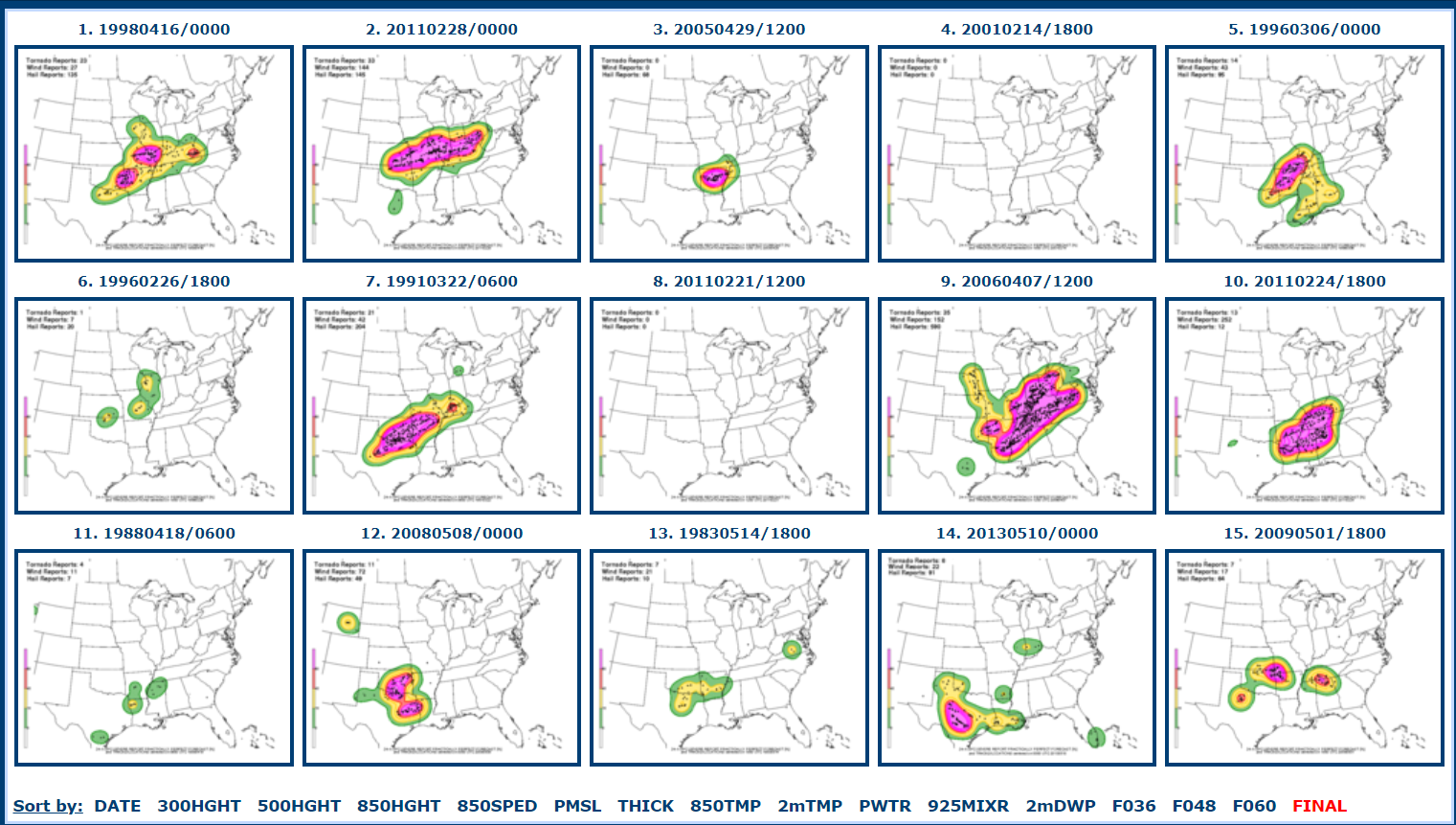
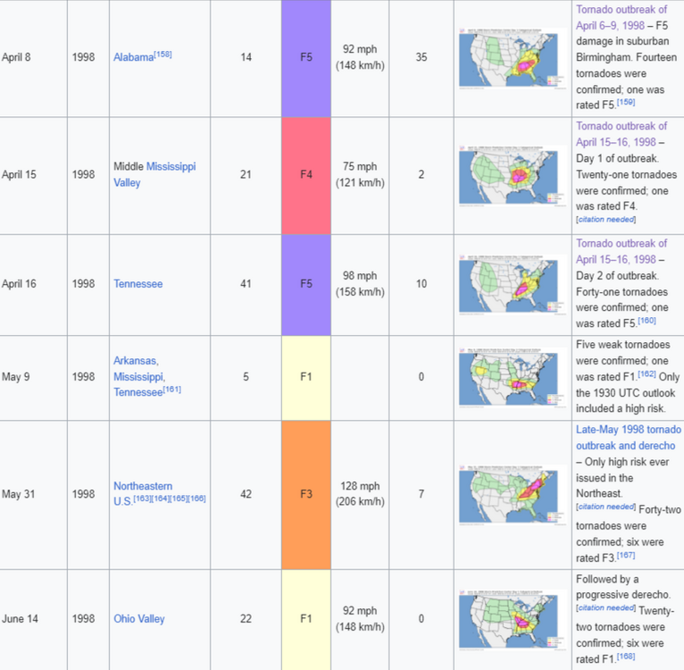
April 16,1998 top analog by the NAM,don't mean we'll see a repeat,could even change from the next few runs ,just saying.
-
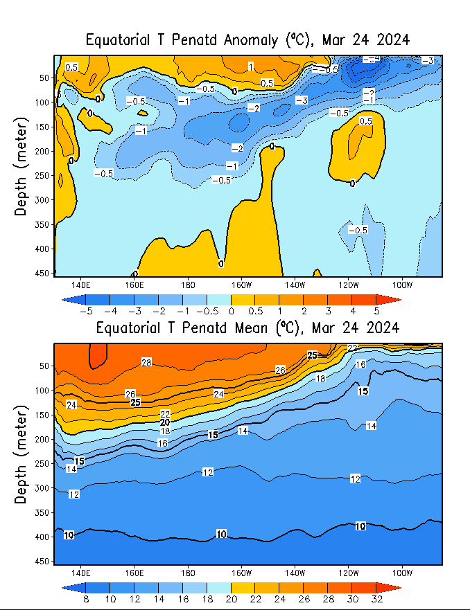
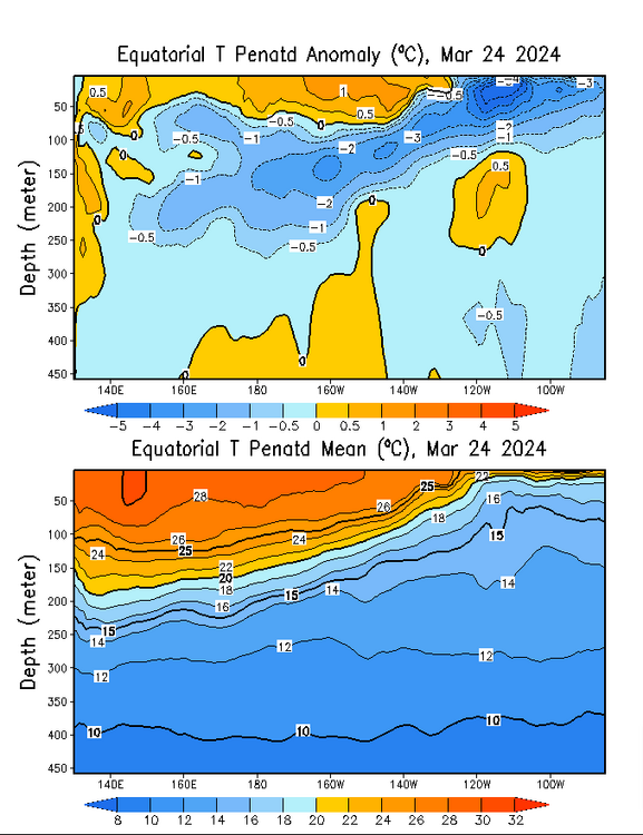
Still think this is very similar to what happened in 1997-98 NINO/NINA.The surface is warming right now thanks to a WWB,during this time the subsurface along the IDL and even west got to around -3C into April,the CCKW into May along with the MJO made a quick dismise of NINO
-
More or less a couple systems the warm sector has had a decent capping inversion for us. Tuesday like you mentioned is timing.If the Euro is right we'd have some broken cells into Tn by the cams,more severe.
-
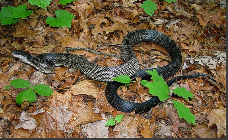
Gray Ratsnakes are pretty common in Tn
-

-
Mammoth Cave is pretty cool,have fun!! Welcome to the board.Like PW just said beyond a certain time frame the models can change. Right now into Late Monday and Tuesday looks like a cold front by the Euro and GFS models,might be your biggest issue.But i wouldnt trust much myself beyond that point right now
-
I dont know.Some of the short range models are coming in quicker tomorrow,wouldn't surprise me if a slight risk was introduced further east next update close to Nashville
-
It just would do this in mid March
-
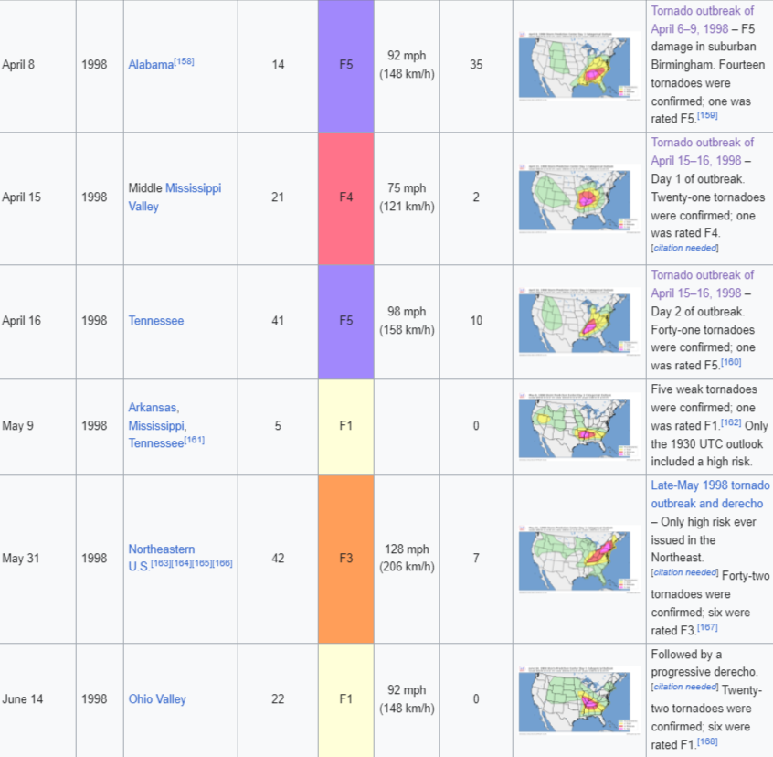
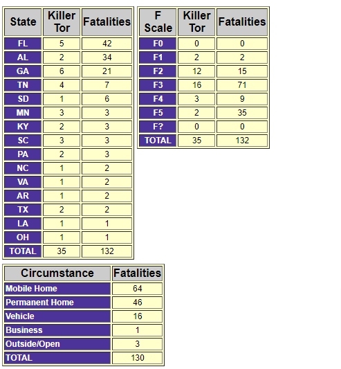
I'm still surprised more people didnt die in the Nashviile (downtown) from the F3 .The Kissimmee,Fl tornado (F3)was the worse in late Feb but the Birmingham F5 lifted 2 miles from downtown,that would have been catastrophic if it hit downtown.The chart is from fatalities in 1998
-
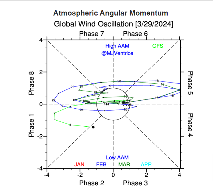
Towards as we get into April we could get active again.We had a similar pattern back into 1998 with a minor SSW in March along with a ElNino quite similar to this one to an extent based on the ONI. 1997 -0.5 -0.4 -0.1 0.3 0.8 1.2 1.6 1.9 2.1 2.3 2.4 2.4 1998 2.2 1.9 1.4 1.0 0.5 -0.1 -0.8 -1.1 -1.3 -1.4 -1.5 -1.6 But anyways the MJO by the CFS is showing the MJO getting into Africa/western IO into the first/2nd week of AprilUntil then we should start to see the AAM rise then revert back into a -AAM into April, But during this time frame we saw some violent tornadoes into Alabama https://www.weather.gov/bmx/event_04081998 We also saw the F5 hit Larwenceburg,Tn around a week later No forecast,nothing to panic about but there is some similarities from 1998 that i'm seeing right now to be a active period possibly well into spring


.png.fe0cc4395b58dc5f722daf643af9f763.png)