jaxjagman
-
Posts
8,627 -
Joined
-
Last visited
Content Type
Profiles
Blogs
Forums
American Weather
Media Demo
Store
Gallery
Everything posted by jaxjagman
-
Not sure,the Euro today is showing a LLJ 60-70KTS,wouldnt rule out thunder
-
nah,its cutting through Tn
-
HP to the north looks stronger
-
GFS isnt giving up
-
-
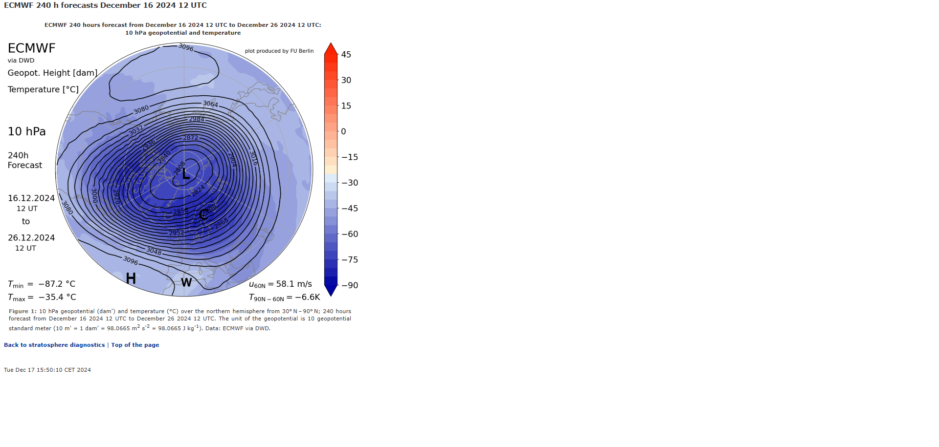
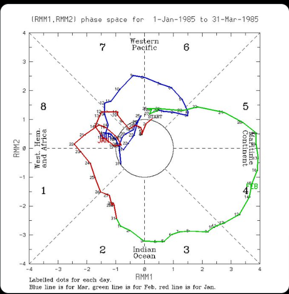
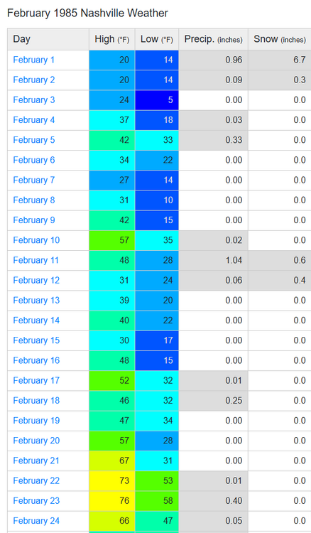
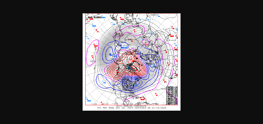
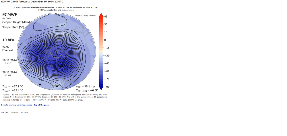
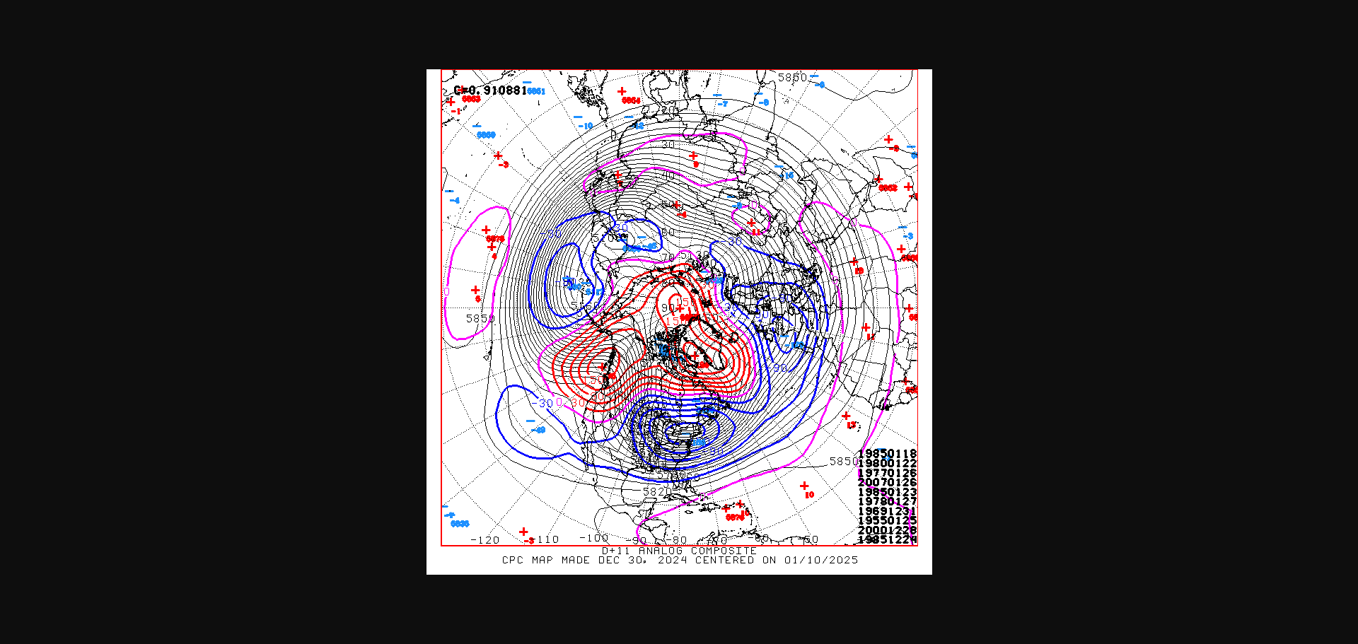
1985,TOP ANALOG,dont mean it will be that way today,tomorrow ,next day,just for fun went back to look. We didnt really have much of a thaw until the 3rd week of Feb,some moderation yes.I got to run so have to make this fast so put some charts up
-
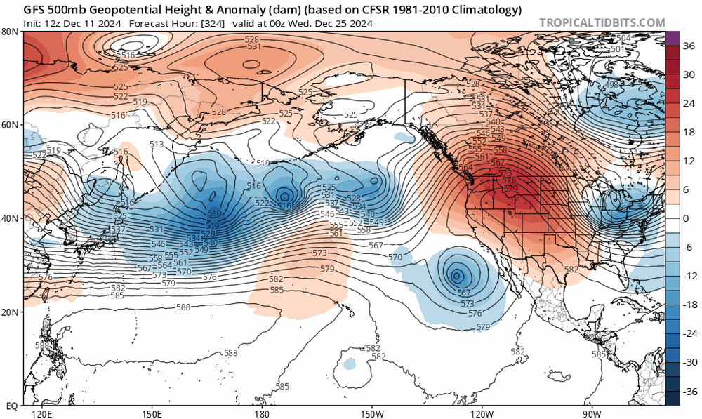
Right now to me the GFS is the outlier,most of all the models seem to take the LP through Tn,GFS is suppressed down south,still anyone could be right,going through Tn would bring with it the warm nose,then you could only hope for wrap around
-
https://en.wikipedia.org/wiki/1985_North_American_cold_wave
-
I'm just saying when you see the Rex block into the Hudson this pulls the trough axis further west,when its more east of Greenland or for that matter even over Greenland the trough axis is further east,,i shouldnt have said its not as cold,its still cold,thats what i'm seeing

-
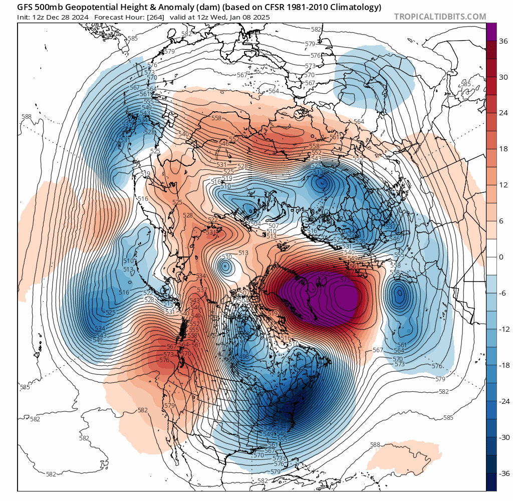
GFS dont look as cold,one reason should be where the blocking is around Greenland,it dont show it into the Hudson this go around run
-
Be kinda shocked if we dont get a sytem somewhere as active as East Asia is
-
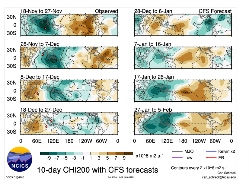
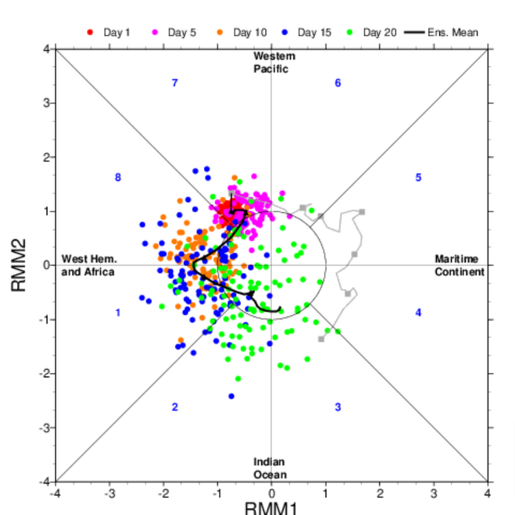
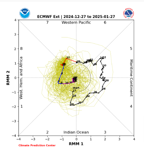
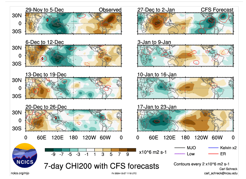
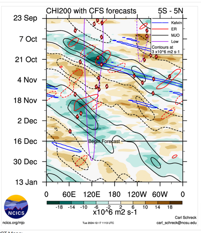
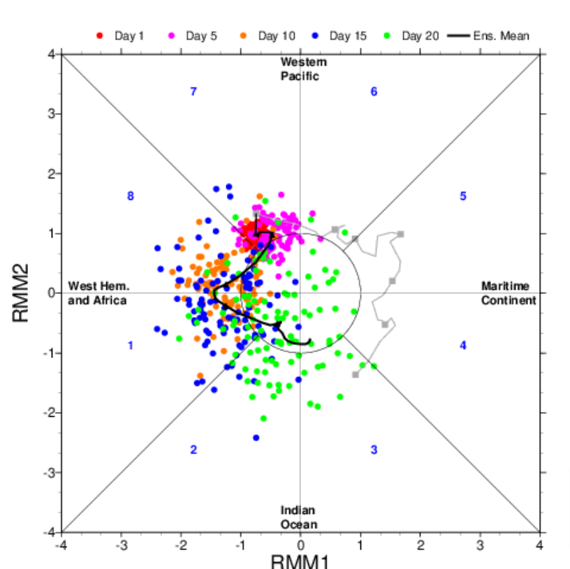
I dunno,surely could be wrong but the MJO getting into Africa in a few days,still seems to me its gonna hit a ERW maybe and stall out into the IO,this is what the CFS is showing which in turn is causing destructive interference with the MJO signal,think the EMON is showing this today because it kills the signal for days in the heart of the COD
-
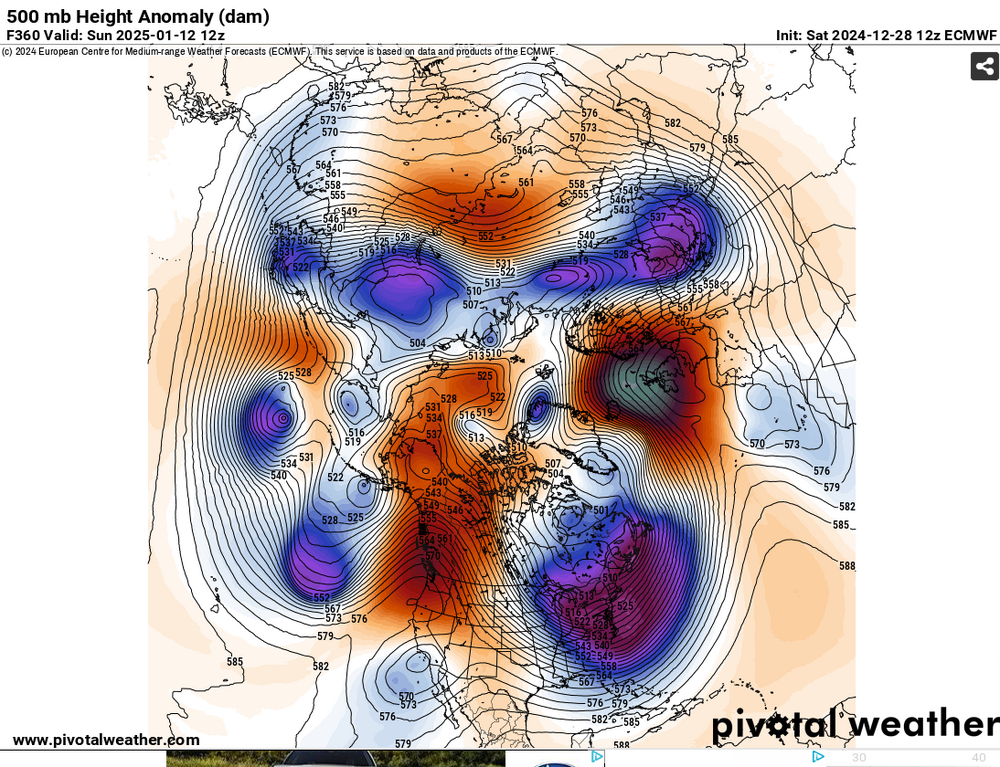
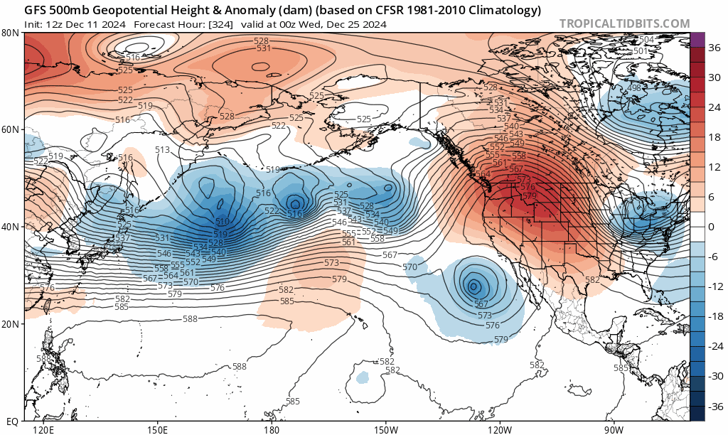
The Euro would be quite impressive with a long stretch of days even without temps moderating above freezing,we dont see that to often here.Even at the end of the run it shows a +PNA/-AO
-
That would be depressing to see more snow off the Florida coast than what we would get,what the GFS shows,but its still to far out to really believe
-
GEFS doesnt show the blocking the Euro has.Euro looks pretty nice into Greenland, Baffin into the Hudson Strait.Who knows who will be right
-
https://site.extension.uga.edu/climate/2016/01/cold-and-snow-in-miami-in-1977-nearly-wipes-out-citrus/ I was living in Jacksonville but was younger,i thought i recalled it did snow in Miami
-
Headed in the right direction anyways.GEFS looks even better than yesterday
-
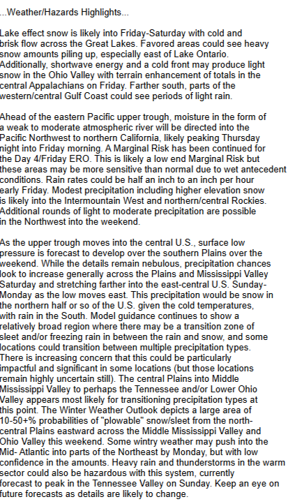
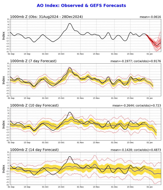
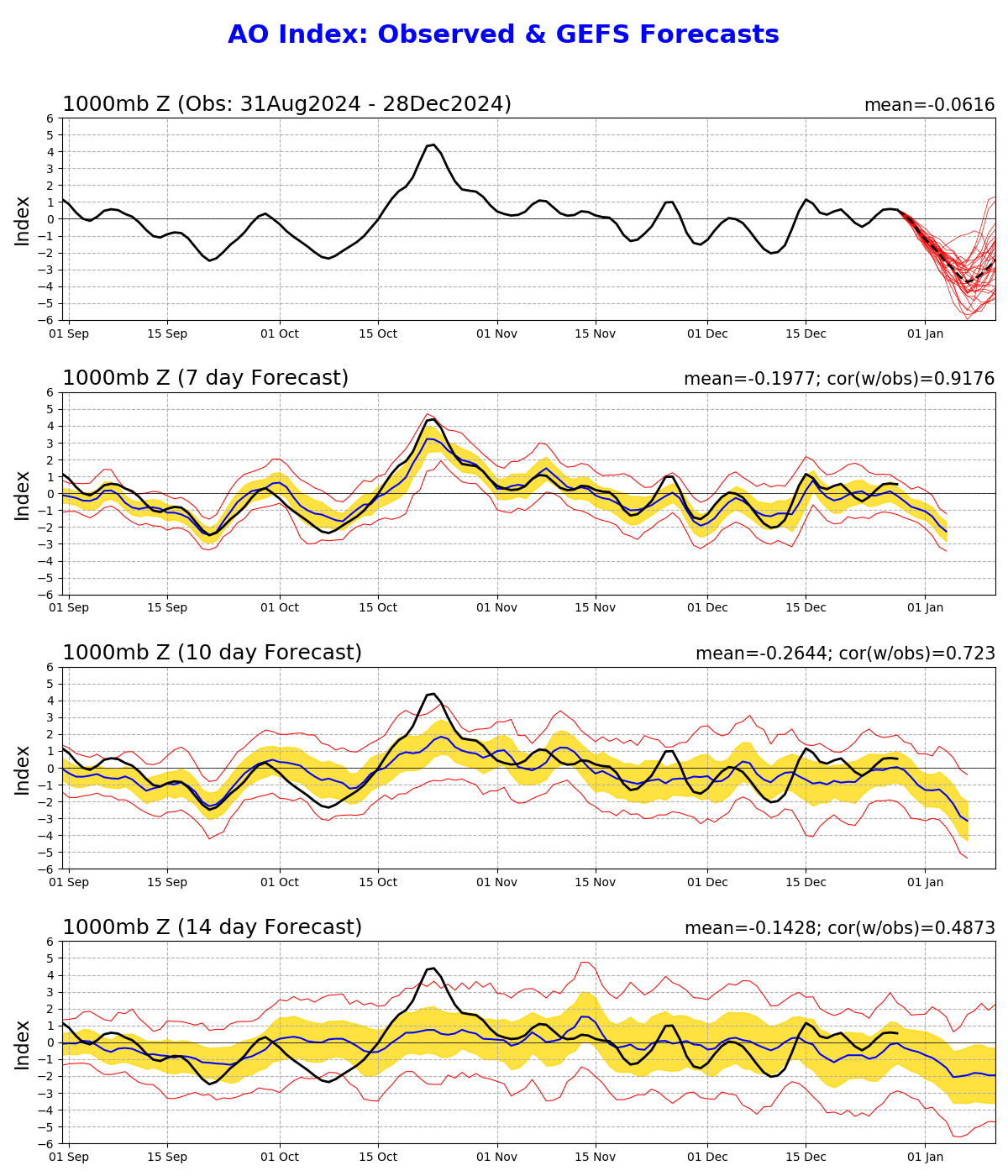
https://www.asahi.com/ajw/articles/15565132 Crazy If we dont get some snow with this patten into Jan i give up on winter other than its gonna get cold.We seem to headed into Jan with the East Asia jet retraction for a few days with a +PNA and -AO/NAO as we get into Jan.As we get into Jan the AO drops somewhere possibly 2-3 sigma,just what it shows today,that should get us fairly cold if it dont change Long range the models show the East Asia jet extension back again.CFS want to strenghten the MJO signal tho into the IO,but this could be its thinking of a ERW that slows the progression of the MJO signal,kinda similar i think what we seen recently when the MJO was into phase 6,we'll see
-
Mid and long ranges believe you'd rather see height falls into East China into the Koreas and not the opposite.Instead the EPS shows this more into the Sea of Japan into the Western Pac,without a definitive sign of a -NAO your trough axis will,could be seemingly to far east of us to get much of anything but hoping for a clipper or possibly even cold chasing rain with a chance even for severe weather
-
THIS !! ,i dont get myself in BAMS recent post why you are comparing the EPO and how good the Canadian model did to the Euro AIFS and calling AIFS a EPIC failure,i mean the AIFS is an experimental project,kinda silly to me to even compare the two
-
Least signs today at that breaking down
.thumb.gif.a9f8a9d33b611149549affeee986db87.gif)
-
That's what ive been thinking as well.The SPV is fairly solid right now and not really much signs of changing,.long range the Euro is about on the pole,so who knows.2014 when it got really cold the PV was weak,much weaker and displaced,maybe that can happen again.Least its been a wet and not a well AN pattern as of now,we need the rain
-
I still think its a waiting game.We always get killed in winter in our parts when the jet enhances past 150W-180W(SER),but still so far even into the long range even into East Asia has been a rather a active period,could be the warm SSTS into the Sea of Japan,Yellow Sea,dunno.But right now seems more like a progressive pattern.yesterday the Euro looked like +NAO,today its now hinting a Rex block into Greenland in the long range
-
Think id use some caution in the long range around Christmas,alot of moving parts from East Asia into the NW,but i get the MJO part

-
That's my thinking also but it might not be t-shirt weather...lol..but if you want snow better go up north,not promising for us


.gif.a2085d4269e867279399ee0076547eb6.gif)