jaxjagman
-
Posts
8,627 -
Joined
-
Last visited
Content Type
Profiles
Blogs
Forums
American Weather
Media Demo
Store
Gallery
Everything posted by jaxjagman
-
Parts down south would be a disaster by the GFS,SN,IP,ZR,yuck
-
You can look at the thermals and see why there is more snow with the CMC.Much colder better ratios.Maybe it will be right,but it still has a cold bias
-
Hopefully the strays that cut into Tn isnt right
-
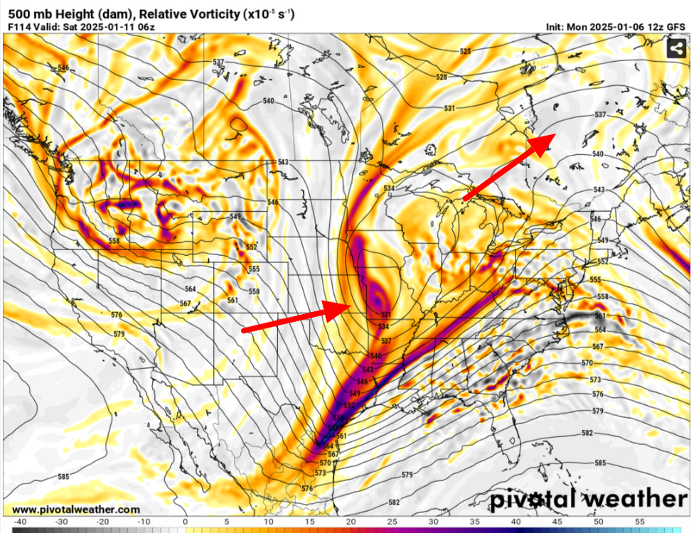
Icon,GFS,AND CMC dont flatten the Vort out like the Euro does.Euro is right its gonna cut into the QPFS,who knows right now whos gonna be right
-
Need that piece of energy to phase like the GFS shows,Euro dont its around that area where the point is to the NE
-
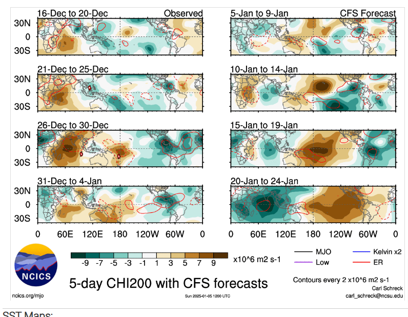
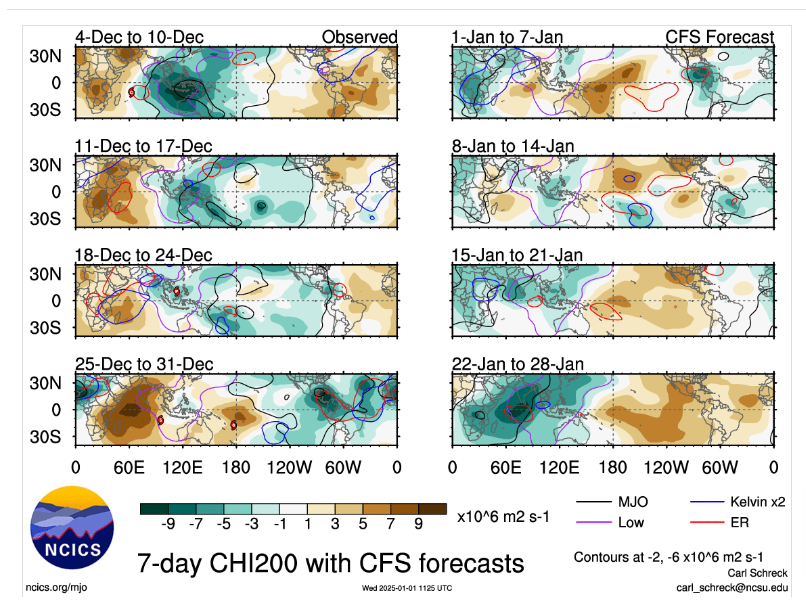
CFS has been showing this for several days.A Rossby Wave will get into the IO and slow the progression into the IO and potentially show a stronger signal into the IO
-
Dont wanna see that neutral tilt,bringing in the LLJ unlike the Euro shows right now

-
Gfs has more of a neutral tilted trough that is brutal with WAA,Euro is more positive much less WAA right now,least we have a chance ,the next storm
-
-
If the CFS is anywhere right the MJO signal should strenghten into the IO and possibly even stall out from a ERW after that towards the end of its showing a Kelvin Wave.Kelvin Waves can cause destructive interference with the MJO signal and it could actually be stronger than what the Euro maps shows above into the Maritime and not go back into the COD
-
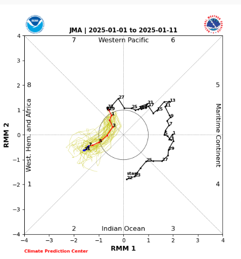
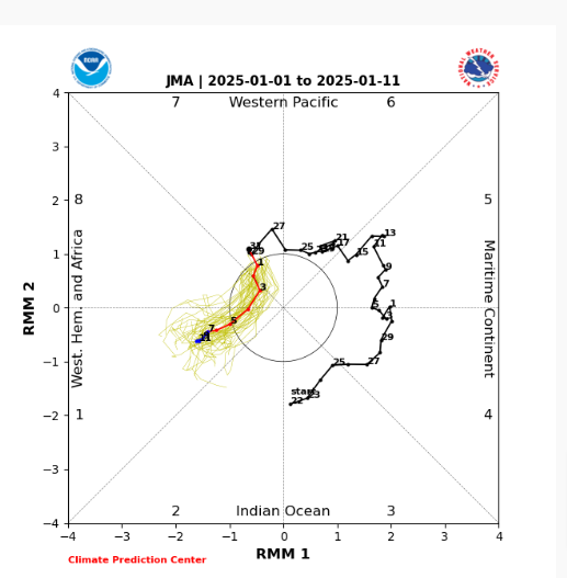
I still think JMA does the best for what ever reason if you are looking at the RMM's..JMHO
-
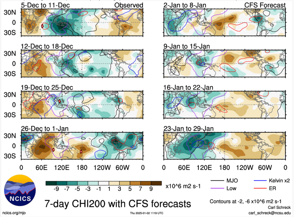
Nice its showing what the CFS has been showing for several days,it finally flipped

-
This is one reason why you should use the ensembles in the long range.Both the Euro and GFS showed this cut-off around the BAJAS last night,the Euro phased the system and it totally destroyed the good PNA,the ensembles didnt show this by the GEFS or EPS
-
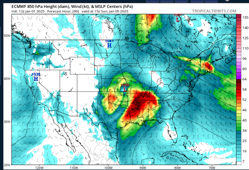
Shouldnt have any impact on us.That's a strong LLJ 55-65 KTS coming through Tn,thats a big warm nose
-
Should still be cold.Long range i'd surely stick with the ensembles
-
Find out in a few days.The CFS continues to show possibly a ERW into the IO down the road,its not backed down any.This should/could stall out the MJO signal or even make it stronger into the IO.Dunno,surely could change
-
Think this is could be from a KW.The MJO looks to still be headed into the NH but dives into the COD as the signal weakens.But what most models keep showing it should strenghten as it heads towards Africa and the IO at this time.Least thats my what i believe.
-
But they've been wrong many times and the public dont understand in winter time strorms.Its hard to forecast the magnitude of artic air in our parts because the models have notoriously been wrong in past storms.I really dont blame them...jmho
-
.LONG TERM... (Thursday Night through next Wednesday) Issued at 145 AM CST Wed Jan 1 2025 By Thursday night, a quick-hitting clipper system will push through across the Ohio River Valley. As of now, it appears the only influence we`ll feel from it will be an increase in clouds Thursday night through Friday and a drop in temperatures. There is a low possibility that a few snow showers could pass through our extreme northeastern counties Friday morning, but nothing of any consequence. Ensembles do not currently favor that outcome, thus left mention of any precip out of the forecast for now. This system will usher is the first real Arctic air of our upcoming series of cold blasts; lows Friday night will dip as low as 14 degrees along the Plateau and 20-25 degrees elsewhere across Middle TN. The biggest question mark of this forecast package continues to be the messy system that moves in during the Sunday afternoon/Monday morning timeframe. Confidence in exact precip type and amount remains low, but confidence in precip occuring during this timeframe is high. After analyzing the wet-bulb temperature profile on a few soundings, the current window for any freezing precip looks to be small, at least from looking at the GFS and GEFS ensemble members. It`s important to note here that there is a large spread in the ensembles of what the temperature at the surface will be on Sunday. Also realize that these outcomes will likely change plenty more times between now and then, so take whatever you see with a grain of salt. Whatever precip we do get will stay with us through the majority of the day Monday, coming to an end from west to east. After this system, conditions look to remain dry through at least Thursday, but temperatures will be bitterly cold through the week with highs barely near freezing and overnight lows in the teens to low 20s. The "warmest" day of the week currently looks to be Monday with highs in the upper 30s to low 40s.
-
Reminds me of the DGEX,we use to see this all the time

-
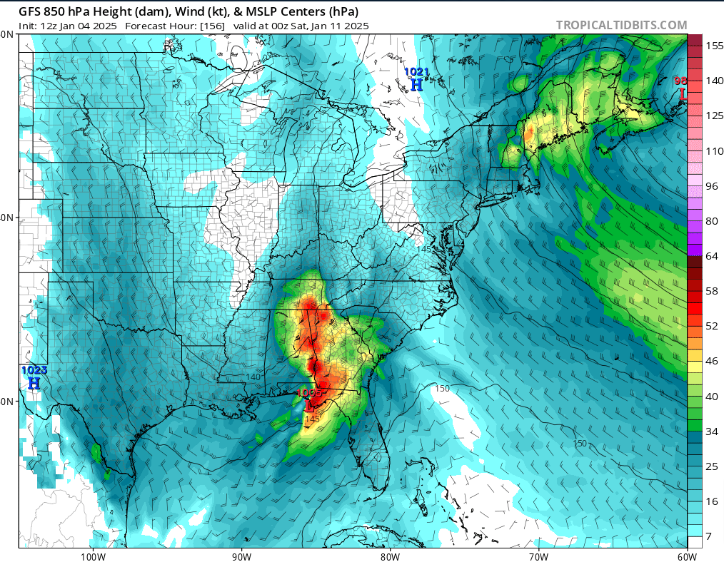
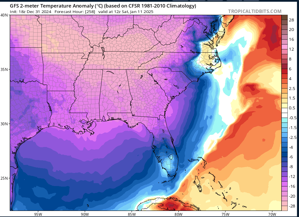
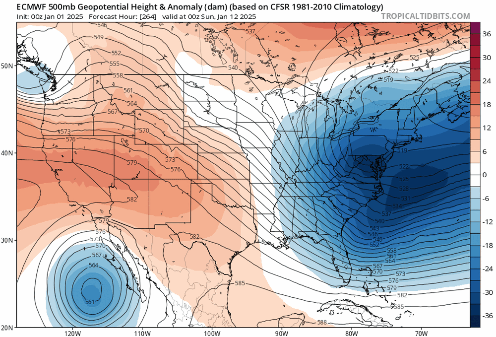
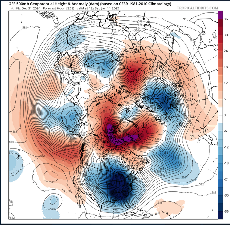
That some insane cold by the GFS,its almost freezing down into Cuba..lmao
-
YEP,i was thinking the same thing
-
All time low in Nashville is -17
-
-
Yeah the timing is still off by the GFS,its looks slower and seemingly colder air presses in,this still could change,both could still be wrong