dendrite
-
Posts
75,092 -
Joined
Content Type
Profiles
Blogs
Forums
American Weather
Media Demo
Store
Gallery
Everything posted by dendrite
-
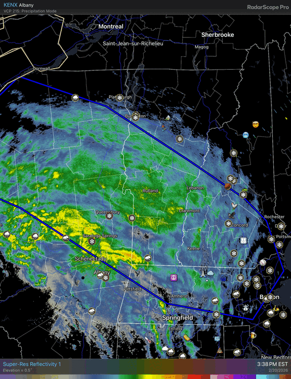
5.8”/0.50” 28.2° -SN
-
Weather willy…you don’t say…
-
Idiot
-
I really don’t want to delete more posts over stupid petty shit. Let’s have some fun and enjoy the tracking and snow.
-
Looks like Bryce’s 1-70” map
-
One over LI and one over the canal. lol
-
They call me thumpty IMG_8225.mov
-
Pounding right now despite radar looking meh
-
Ok ok ok let’s not go too far down this path. Back to weather.
-
Yeah thanks. What a first post though.
-
10% error tariff on all euro data
-
I feel like powderfreak viewing these.
-
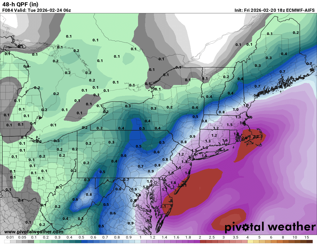
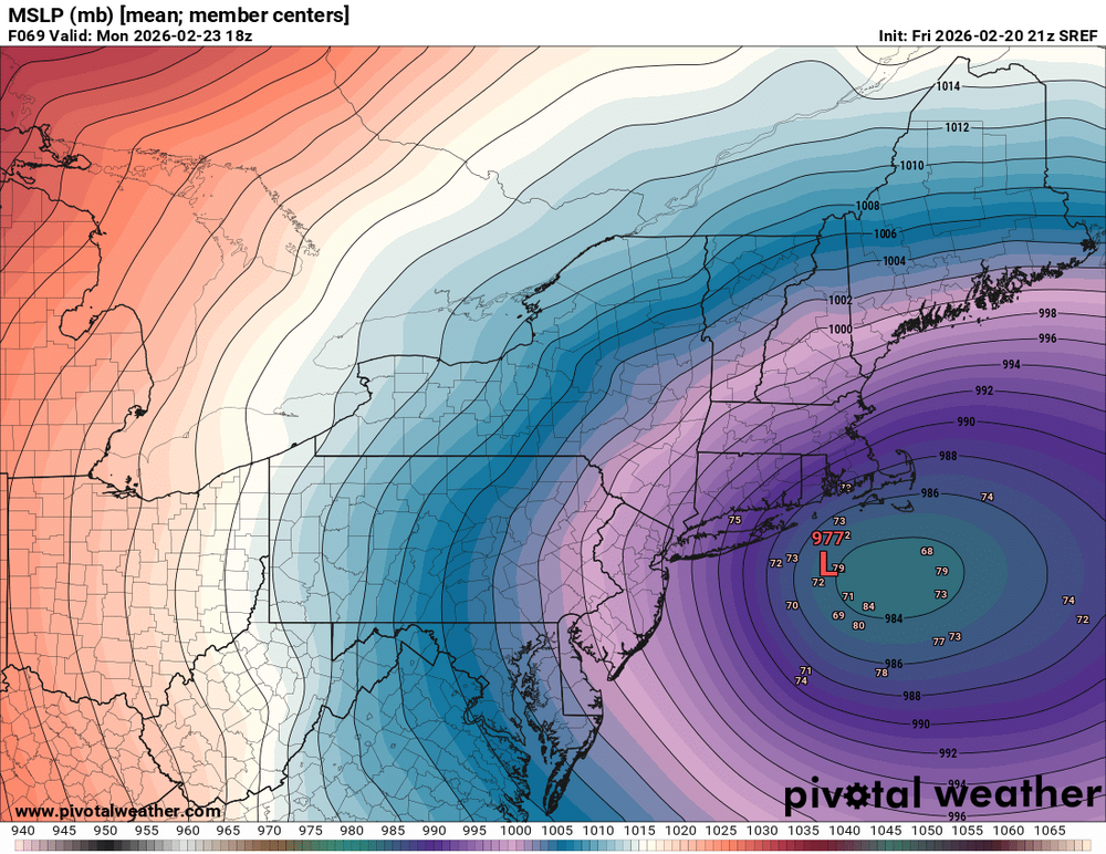
Your SREFs found the moonshine

-
I usually slow them down, but it was just the point that they all sucked
-
ICON ENS lol
-
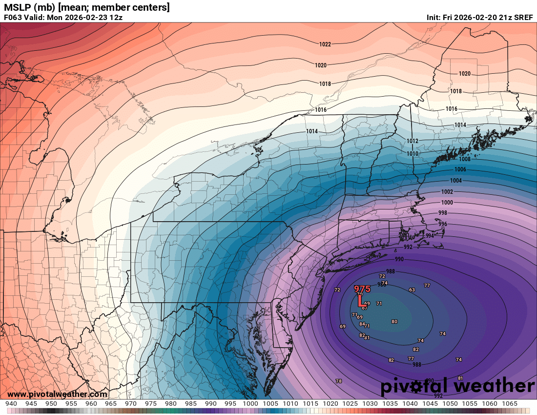
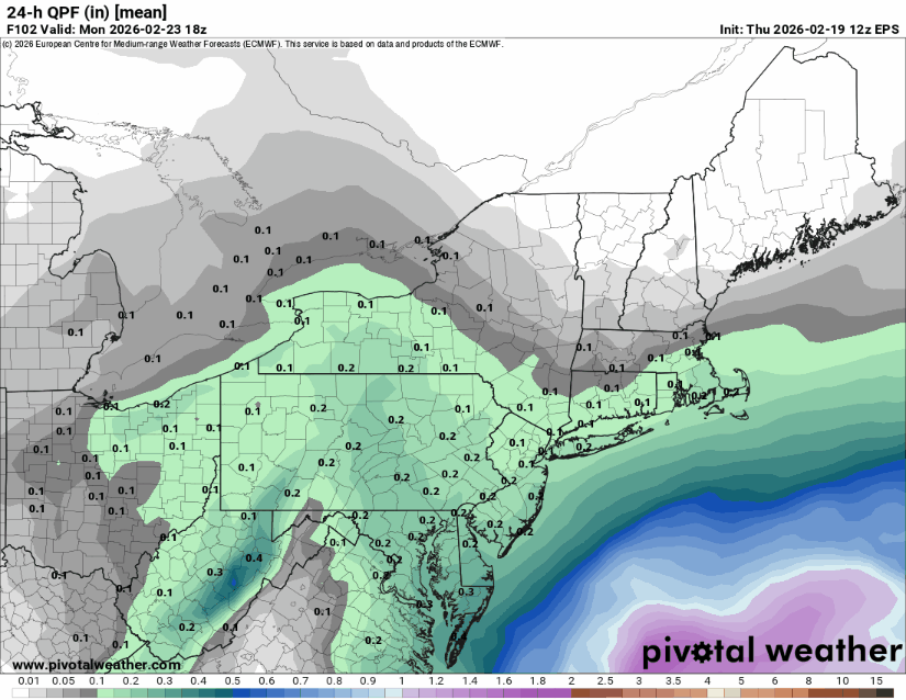
To be fair all of the models were way SE in that suite. GEFS barely had 0.50” to the Cape and they were NW.
-
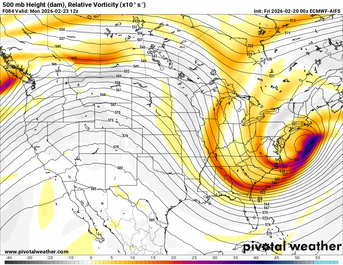
EP AI with another good NW move
-
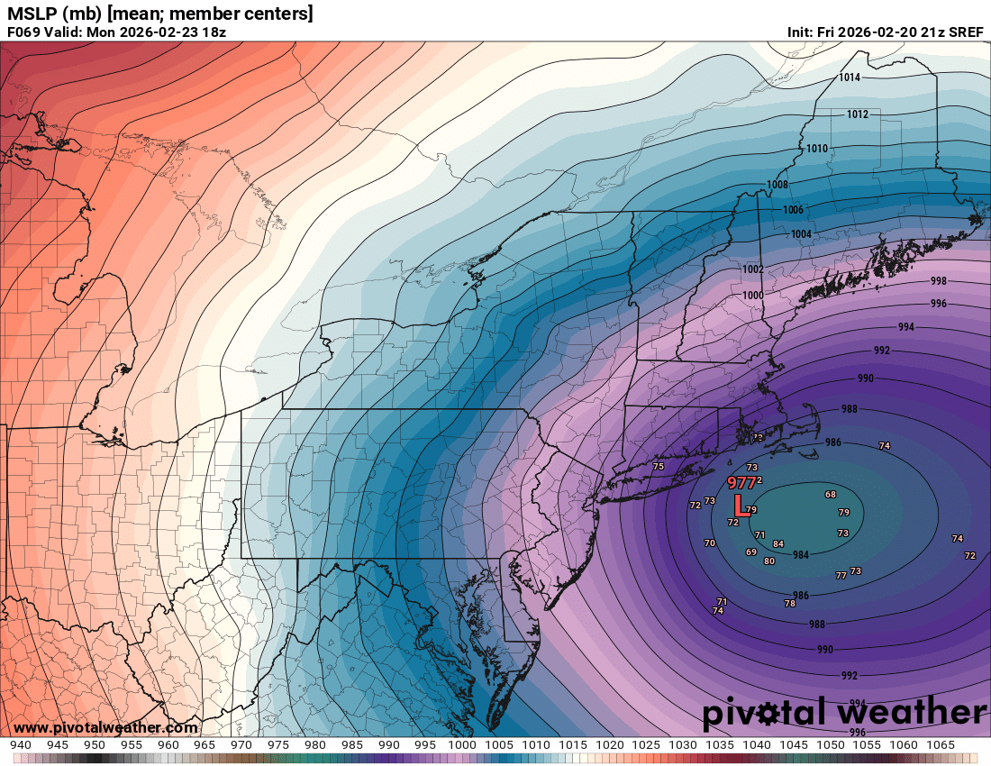
Getting closer. Hopefully purple pixels over the baby bottle at 00z.
-
Tip talked to him for 25 minutes
-
Pump up the jam
-
Let’s curl this vortmax into the police cruiser
-
Cory weenie Don’t get crazy
-
Ukie north finally
-
He’s lost and confused. He doesn’t know which side of Wey he leaves at anymore.
-
Just started and I’m not overly impressed