dendrite
-
Posts
64,395 -
Joined
Content Type
Profiles
Blogs
Forums
American Weather
Media Demo
Store
Gallery
Everything posted by dendrite
-
 That was measured by great great great grandpa Wood.
 -
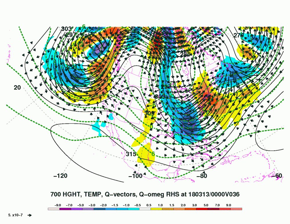
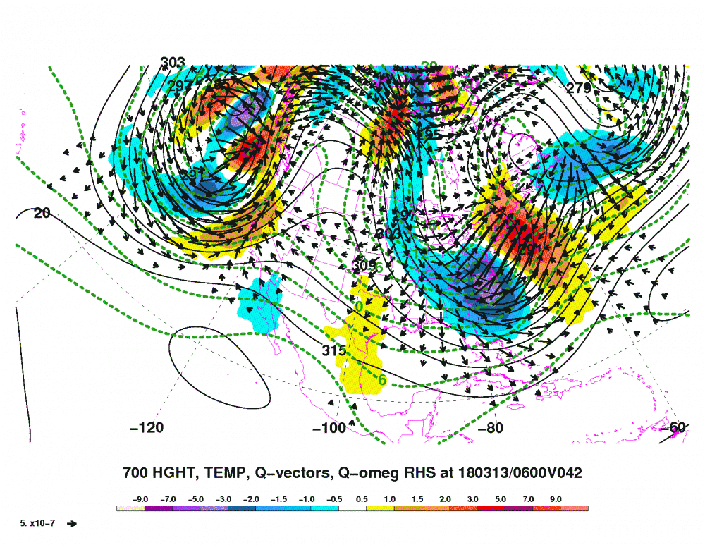
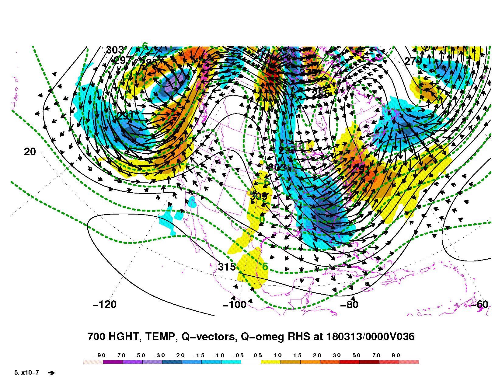
Well the satellite has different bands with different wavelengths that measure wv at different levels. I think the rule of thumb was that the more typically used wv images showed you wv around the 600mb level. I haven’t gotten enough into GOES-R to know what micrometer wavelengths they use for their lower, mid, and upper wv maps. I think the mid trop one is 6.9um. Plus there’s the fact you’re comparing vorticity to water vapor. I’m just not sure I would be hyperscrutinizing the two looking for comparisons or model error.
-
Be careful comparing WV to modeled H5 vorticity...it isn’t totally apples to apples.
-
Subby zone?

-
Kinda scares me seeing the CCB this close. If it stays just to our east we're screwed.
-
Flip phone?
-
Inbred fertilization
-
Yes, but I'm going to need more than 17 chickens to account for all of the models we have now.
-
By now hopefully everyone found a model run that they like for their backyard.
-
Corn on the cobb or corn in the crap? We shall see.
-
Welcome to 15 mins ago.
-
TT added H7 and H85 fronto and temp adv to most of their models.
-
Sometimes the best forcing with those bands end up higher up...H5-H7. I'll have to look at BUFKIT later as I have to head out. I'm sure Scoot can explain it more and better.
-
He has those fronto maps on TT now so he doesn't have to wait for a text from Shabbs. Of course that's just H7 so the banding could be a little west of the best H7 fronto. IOW, the NAM has it west of him. lol
-
Dom and Tip may get their subsidence
-
Chickens gasping for air
-
Congrats Mitch
-
Definitely not backing down.
-
Yeah I was worried about a later hook, but it looks pretty decent at 15hr.
-
That’s what I’ve been telling fam down in MHT. 6-12+
-
My hunch is the band is closer to you and not over Logan in NY.
-
PF just had a stroke
-
I’d wait until the 00z runs before backpedaling. The euro wasn’t great, but don’t change everything over a few 18z runs. Maybe everything ticks back west at 00z with new raob data.
-
After the other night, can you handle another storm?
-
Here’s the 12z GFS qg omega. The best qg convergence does shift offshore.