dendrite
-
Posts
75,078 -
Joined
Content Type
Profiles
Blogs
Forums
American Weather
Media Demo
Store
Gallery
Everything posted by dendrite
-

"Don’t do it" 2026 Blizzard obs, updates and pictures.
dendrite replied to Ginx snewx's topic in New England
Some of that has to be reaching you below the beam with N-NNE wind? -
"Don’t do it" 2026 Blizzard obs, updates and pictures.
dendrite replied to Ginx snewx's topic in New England
CWSU had 22.0” -
"Don’t do it" 2026 Blizzard obs, updates and pictures.
dendrite replied to Ginx snewx's topic in New England
There was 5” But they officially had 32.8” at the 37” depth (+32”) ob so another 1.5-2.4”/hr puts the official at 34-35” -
"Don’t do it" 2026 Blizzard obs, updates and pictures.
dendrite replied to Ginx snewx's topic in New England
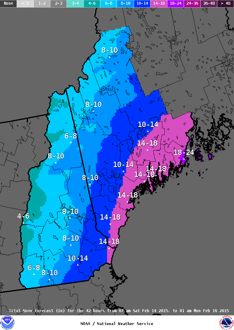
This was the first map I did alright here…over 13”
-
"Don’t do it" 2026 Blizzard obs, updates and pictures.
dendrite replied to Ginx snewx's topic in New England
-
"Don’t do it" 2026 Blizzard obs, updates and pictures.
dendrite replied to Ginx snewx's topic in New England
34-35ish -

-
"Don’t do it" 2026 Blizzard obs, updates and pictures.
dendrite replied to Ginx snewx's topic in New England
PVD SNINCR 2/39 -
"Don’t do it" 2026 Blizzard obs, updates and pictures.
dendrite replied to Ginx snewx's topic in New England
The rare winter storm where it was more wintry before than after. -
"Don’t do it" 2026 Blizzard obs, updates and pictures.
dendrite replied to Ginx snewx's topic in New England
Don’t cry for me. I’ve had plenty of good storms. At least it was so little that I don’t have any cleanup. -
"Don’t do it" 2026 Blizzard obs, updates and pictures.
dendrite replied to Ginx snewx's topic in New England
PVD got 8x more snow than me in 1 hour 0.5” final -
"Don’t do it" 2026 Blizzard obs, updates and pictures.
dendrite replied to Ginx snewx's topic in New England
2018 lol -
"Don’t do it" 2026 Blizzard obs, updates and pictures.
dendrite replied to Ginx snewx's topic in New England
If you’re on an iphone upload them at a smaller size. Add file>choose pic>click “…”>click options>choose large or medium….then try uploading -
"Don’t do it" 2026 Blizzard obs, updates and pictures.
dendrite replied to Ginx snewx's topic in New England
Does he have the yardstick upside down like zonties? -
"Don’t do it" 2026 Blizzard obs, updates and pictures.
dendrite replied to Ginx snewx's topic in New England
There will be a lot of bad total snow and water equiv measurements with this. -
"Don’t do it" 2026 Blizzard obs, updates and pictures.
dendrite replied to Ginx snewx's topic in New England
It might be May 10 with my luck -
"Don’t do it" 2026 Blizzard obs, updates and pictures.
dendrite replied to Ginx snewx's topic in New England
Tough to snow in dry air like this.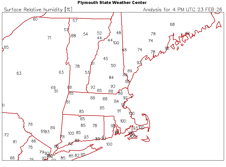
-
"Don’t do it" 2026 Blizzard obs, updates and pictures.
dendrite replied to Ginx snewx's topic in New England
Might be toast there…lots of dry low level air. I had some bands move through and it was just light, emaciated flakes. 24/13 59% RH right now. At least there’s nothing really to clean up. -
"Don’t do it" 2026 Blizzard obs, updates and pictures.
dendrite replied to Ginx snewx's topic in New England
Really bad luck there, but at least you pounded for the first half.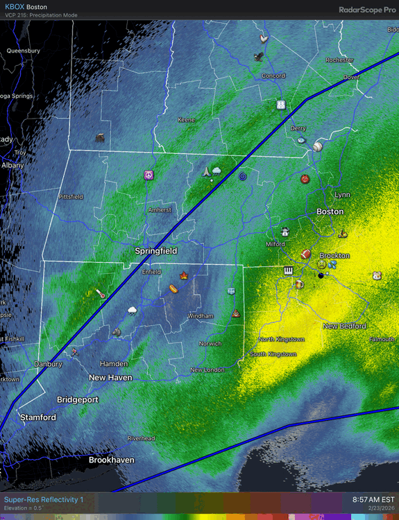
-
"Don’t do it" 2026 Blizzard obs, updates and pictures.
dendrite replied to Ginx snewx's topic in New England
3k had one more fronto push into NE MA. The toys in Methuen are on the line.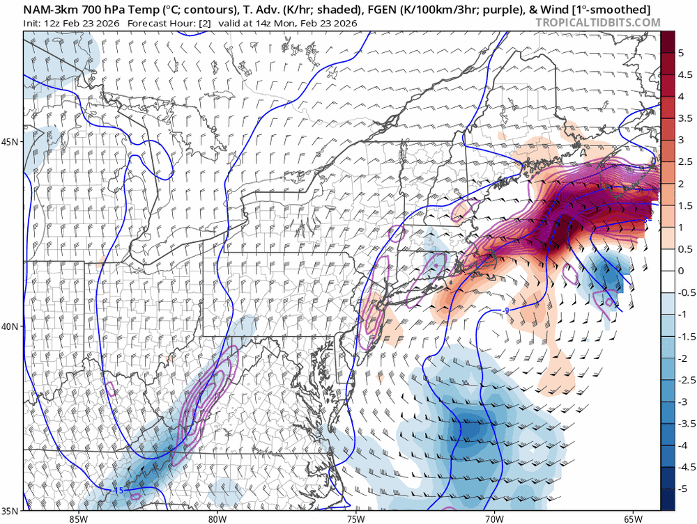
-
"Don’t do it" 2026 Blizzard obs, updates and pictures.
dendrite replied to Ginx snewx's topic in New England
Finally a steadier -SN. Let’s see if we can pull an inch. 24.1° -
"Don’t do it" 2026 Blizzard obs, updates and pictures.
dendrite replied to Ginx snewx's topic in New England
MHT was on the edge of the wind core…that late tickle SE took S NH out of the bigger gusts. Can’t win’em all. -
Sap isn’t flowing yet?
-
"Don’t do it" 2026 Blizzard obs, updates and pictures.
dendrite replied to Ginx snewx's topic in New England
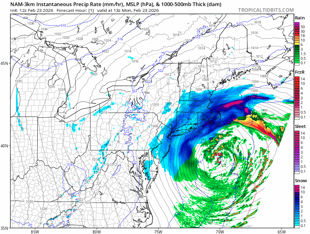
Here’s how the 3k nam plays it out the rest of the day
-
"Don’t do it" 2026 Blizzard obs, updates and pictures.
dendrite replied to Ginx snewx's topic in New England
0.5” here It may start picking up there in the next 30-60 mins