dendrite
-
Posts
75,078 -
Joined
Content Type
Profiles
Blogs
Forums
American Weather
Media Demo
Store
Gallery
Everything posted by dendrite
-
0.96". Radar filled in nicely A lot of this is low level so it looks more impressive as it approaches the radar. Small droplet sheet drizzle and rain here despite barely any echoes.
-
47.2° -RA 1.43” Not bad
-
1.34” RA/+RA Run is flooded already. lol
-
You guys should dump later
-
46° +RA 0.93”
-
I miss Stein
-
I didn’t see. MWN record or US?
-
Go back before that 19° and it’s -40° again. You can get those crazy RH swings once you get high enough into the upper air.
-
44.6° and dumping. Radar lookin good.
-
It’s not even close to snow.
-
Still rain. The point is that radar algorithm is wrong. It’s just taking temps in the mid 30s and painting blue with it. It’s a torch aloft.
-
Nah....S flow. MWN is 37F.
-
I may start bitching about too much rain after next weekend if the RGEM pans out for tomorrow.
-
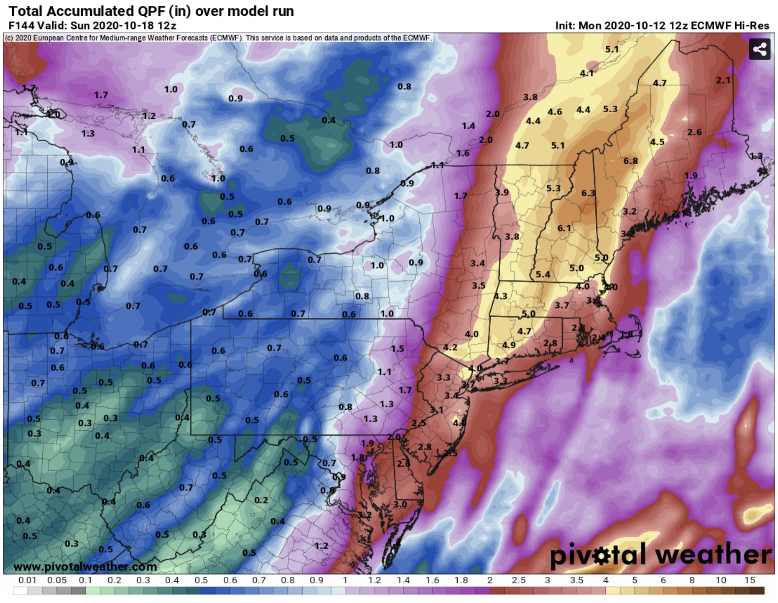
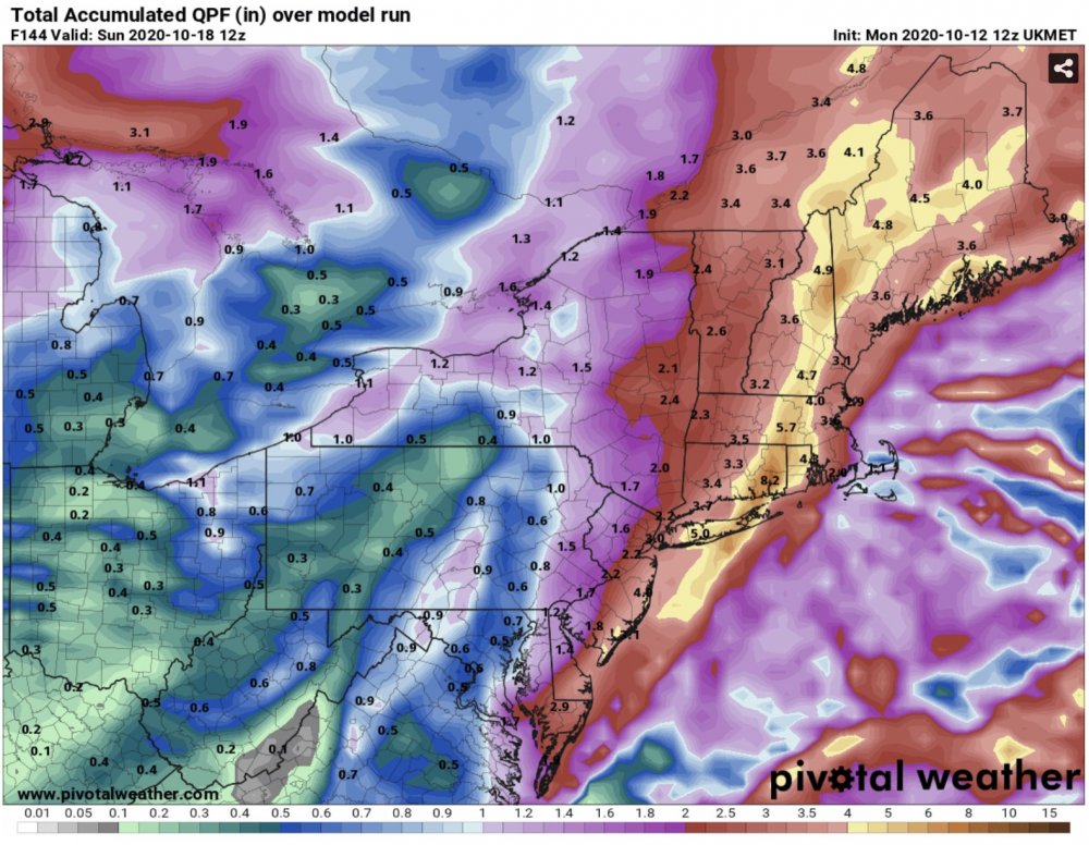
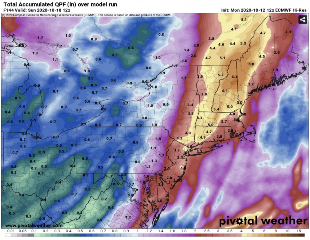
Euro and Ukie gone wild
-
Plants are going dormant too so not as much is getting taken in by roots.
-
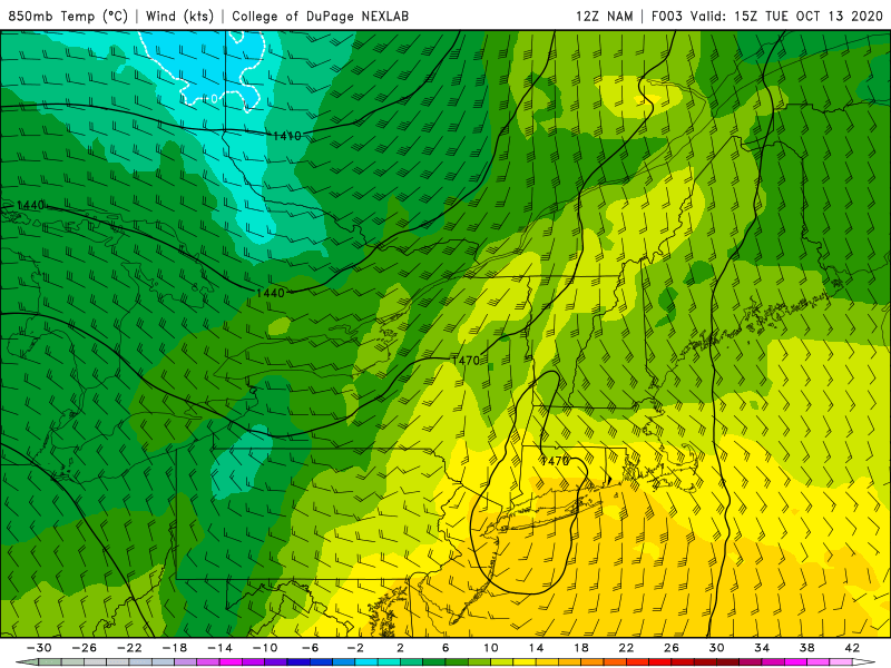
Yeah glad we don't live at H5.
-
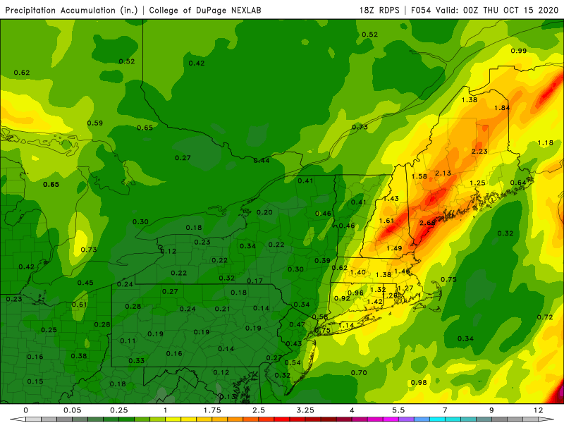
Depends on your persepctive. Kinda meh down there compared to most of the region on both the 3k and 12k. But around 0.50" is better than nothing.
-
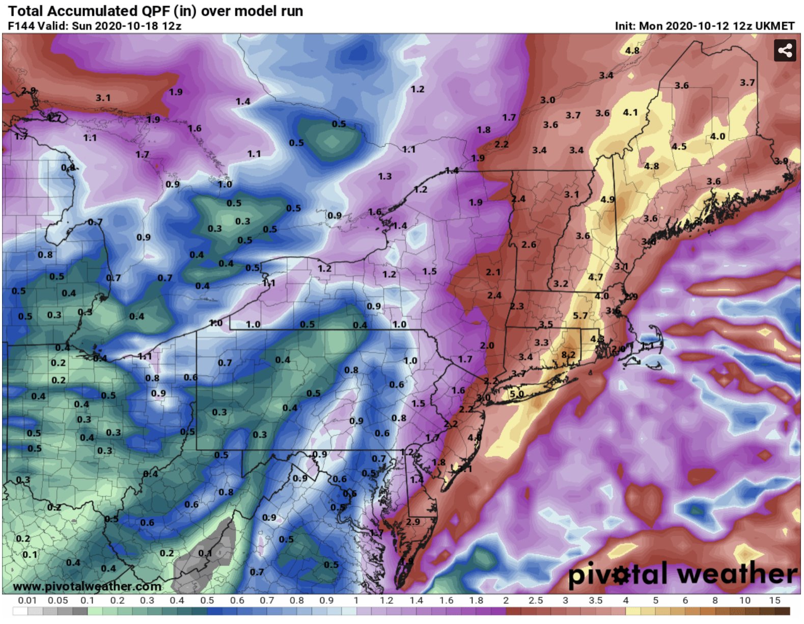
GFS is a nice soaker from Tol up through NH Tuesday...starting to look more like the euro and ukie.
-
Models coming in much wetter up here. Some will win. Some will lose. Some will sing the weenie blues.
-
Yup...NAM caving south. Stein lives on for NH.
-
NAM gone wild
-
Synoptic season. We’ll keep putting some dents into Stein.
-
Man that was a wild night. Snow to prolonged ZR and then back to TSSN. https://mesonet.agron.iastate.edu/cgi-bin/request/asos.py?station=MHT&data=metar&year1=1994&month1=1&day1=17&year2=1994&month2=1&day2=19&tz=Etc%2FUTC&format=onlycomma&latlon=no&missing=M&trace=T&direct=no&report_type=2
-
yup CON,1994-01-20 02:00,KCON 200200Z 19003KT 10SM CLR M27/M29 A3047 RMK SLP330 T12671289 CON,1994-01-20 03:00,KCON 200300Z 00000KT 10SM CLR M27/M29 A3048 RMK SLP333 T12721289 CON,1994-01-20 04:00,KCON 200400Z 00000KT 10SM CLR M27/M30 A3048 RMK SLP333 T12721300 CON,1994-01-20 05:00,KCON 200500Z 10003KT 10SM IC CLR M29/M31 A3048 RMK ICB30 SLP333 T12941311 CON,1994-01-20 06:00,KCON 200600Z 00000KT 10SM IC CLR M32/M34 A3047 RMK SLP330 60000 T13171339 CON,1994-01-20 07:00,KCON 200700Z 02004KT 10SM IC SCT005 M29/M32 A3049 RMK K LYR SCT SLP337 T12941322 CON,1994-01-20 08:00,KCON 200800Z 02004KT 10SM IC SCT005 M31/M33 A3049 RMK K5 SCT/ SLP338 T13061333 59085 CON,1994-01-20 09:00,KCON 200900Z 00000KT 10SM IC SCT005 M32/M35 A3049 RMK K5 SCT/ SLP337 T13171350 51007
-
Yup...thank goodness we found a place where we could rent a genny. It was their last one. It was well into the -20s when the power came back on around midnight of day 2. I think that's the last time I ever saw CON report IC.