dendrite
-
Posts
66,763 -
Joined
Content Type
Profiles
Blogs
Forums
American Weather
Media Demo
Store
Gallery
Everything posted by dendrite
-

March 12/13/14 Blizzard/Winter Storm/WWA etc
dendrite replied to Bostonseminole's topic in New England
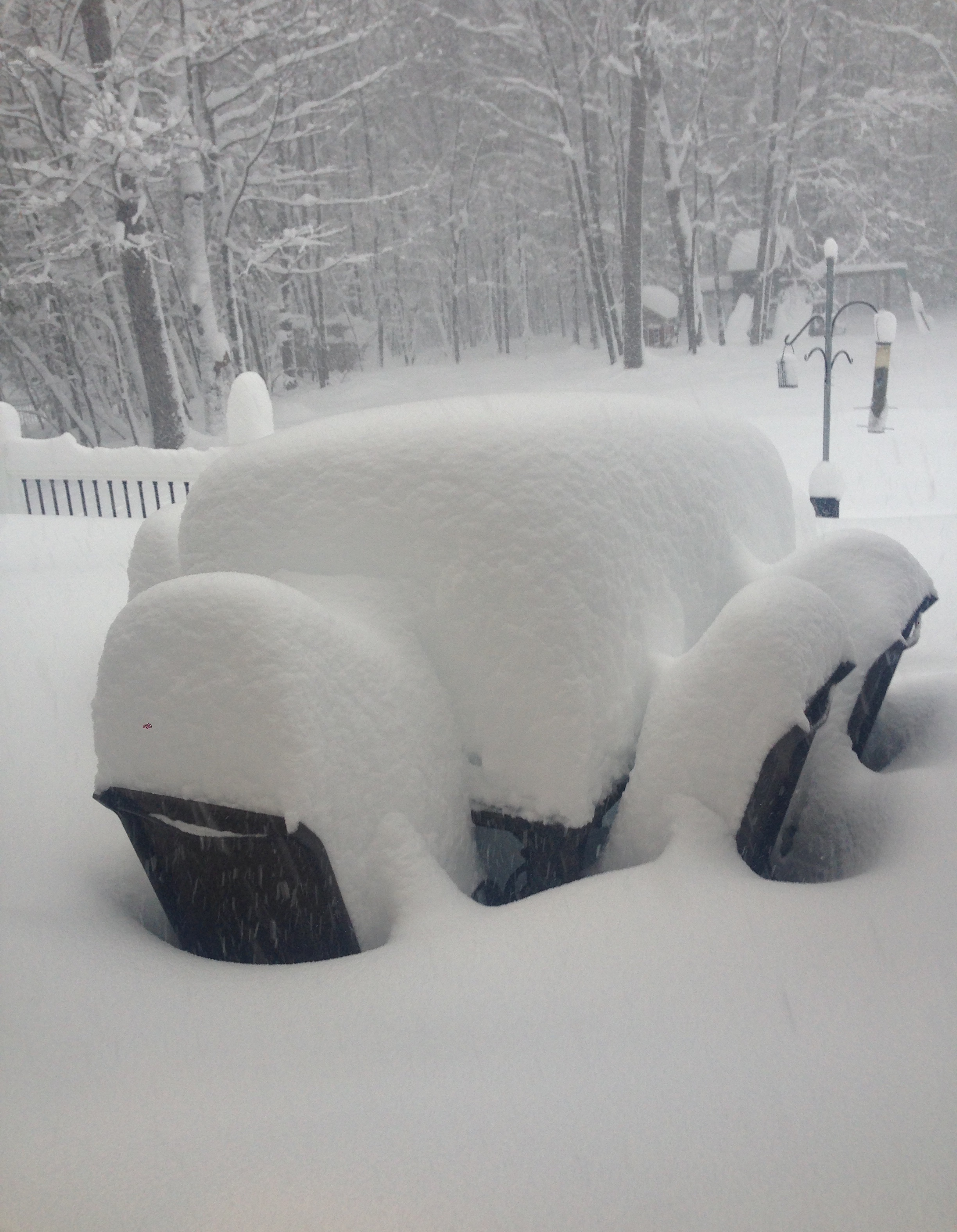
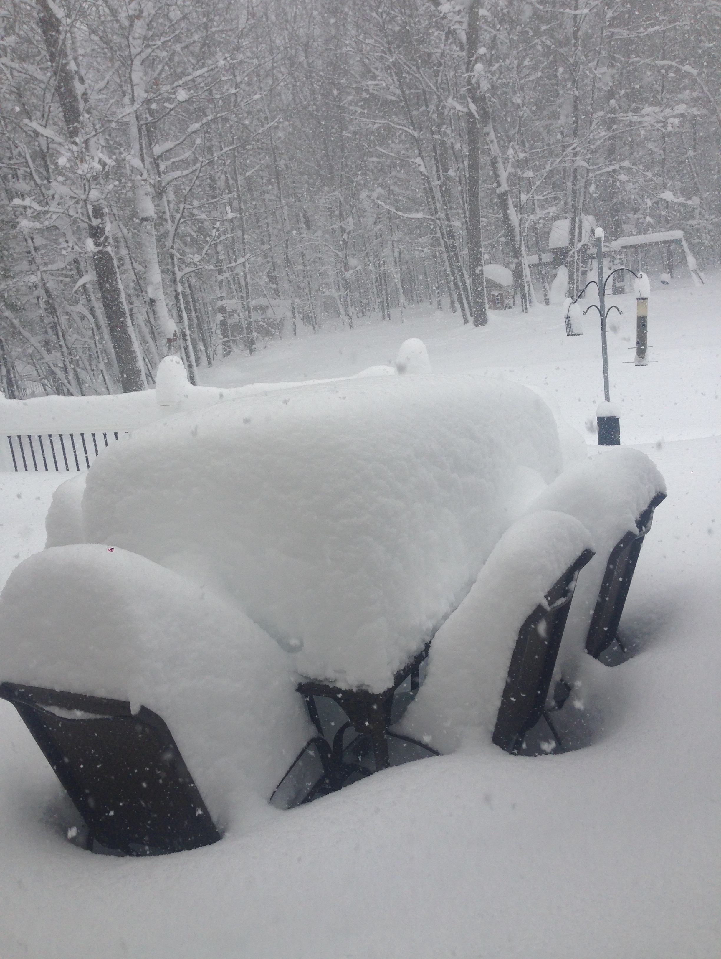
8.4”/0.68” from my last core Storm total 11.4”/1.00” so far. Still 28° with -SN -
March 12/13/14 Blizzard/Winter Storm/WWA etc
dendrite replied to Bostonseminole's topic in New England
Jesus. Did you recently clear? -
March 12/13/14 Blizzard/Winter Storm/WWA etc
dendrite replied to Bostonseminole's topic in New England
Nice storm for the 25th anni. -
March 12/13/14 Blizzard/Winter Storm/WWA etc
dendrite replied to Bostonseminole's topic in New England
My parents are near 2ft too without clearing. My dad is saying 23” new depth. Just taken...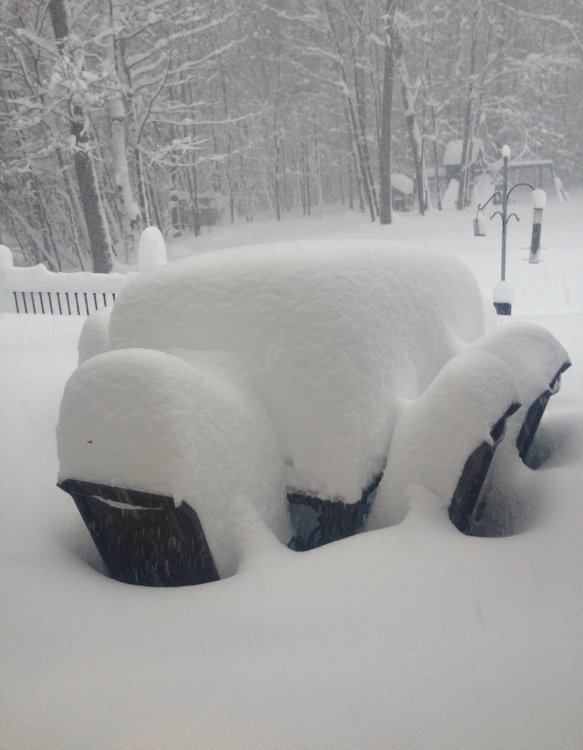
-
March 12/13/14 Blizzard/Winter Storm/WWA etc
dendrite replied to Bostonseminole's topic in New England
I’ve meh’d my way to almost 11” -
March 12/13/14 Blizzard/Winter Storm/WWA etc
dendrite replied to Bostonseminole's topic in New England
My coworker in Barnstead is getting destroyed. -
March 12/13/14 Blizzard/Winter Storm/WWA etc
dendrite replied to Bostonseminole's topic in New England
I’ll start to feel better when I’m snowblowing at 9pm and the snow isn’t going over the top of it. -
March 12/13/14 Blizzard/Winter Storm/WWA etc
dendrite replied to Bostonseminole's topic in New England
I try to keep telling myself that I don’t care. You’ll probably melt out before me too despite having double the pack. -
March 12/13/14 Blizzard/Winter Storm/WWA etc
dendrite replied to Bostonseminole's topic in New England
Days and days and hours and hours tracking sfc lows and QPF when as usual it comes down to nailing the mid level forcing <24hrs before the event. Hopefully someday we can toss most of those snow maps out the window. -
March 12/13/14 Blizzard/Winter Storm/WWA etc
dendrite replied to Bostonseminole's topic in New England
Your backyard must look like Lopstick right now.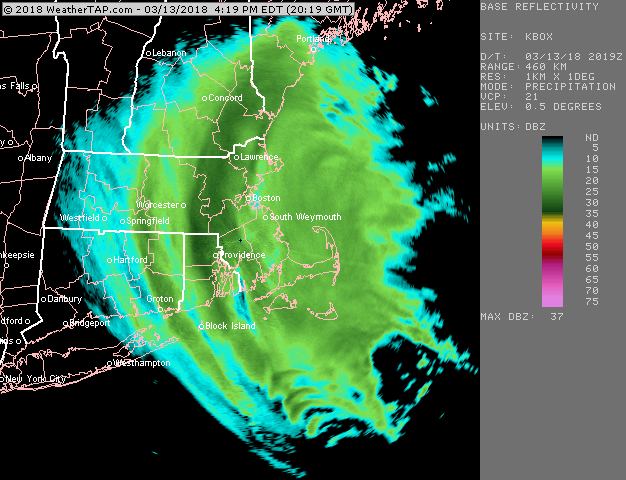
-
March 12/13/14 Blizzard/Winter Storm/WWA etc
dendrite replied to Bostonseminole's topic in New England
Solid push west of the band toward Meredith and North Conway now. -
March 12/13/14 Blizzard/Winter Storm/WWA etc
dendrite replied to Bostonseminole's topic in New England
Something like that here. Must be pushing 8” or so. -
March 12/13/14 Blizzard/Winter Storm/WWA etc
dendrite replied to Bostonseminole's topic in New England
Hardest snow of the day here right now despite the band slipping east. Hurts to miss 2ft by such a short distance, but lots of us were in the same boat today. You win some and you lose some. -
March 12/13/14 Blizzard/Winter Storm/WWA etc
dendrite replied to Bostonseminole's topic in New England
heh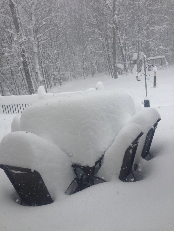
-
March 12/13/14 Blizzard/Winter Storm/WWA etc
dendrite replied to Bostonseminole's topic in New England
Mom in S Hooksett said my dad measured in 2 spots and got 18” and 19”. -
March 12/13/14 Blizzard/Winter Storm/WWA etc
dendrite replied to Bostonseminole's topic in New England
Only 0.11” in the can there for that 3hr period. -
March 12/13/14 Blizzard/Winter Storm/WWA etc
dendrite replied to Bostonseminole's topic in New England
Picking up here too, but probably only 1”/hr rates. I’d like at least an hour of the real deal before it moves out. -
March 12/13/14 Blizzard/Winter Storm/WWA etc
dendrite replied to Bostonseminole's topic in New England
Starting to get some flakes with better growth mixed in, but it’s like watching paint dry. -
March 12/13/14 Blizzard/Winter Storm/WWA etc
dendrite replied to Bostonseminole's topic in New England
Coworker in Barnstead said he’s pushing 12”. -
March 12/13/14 Blizzard/Winter Storm/WWA etc
dendrite replied to Bostonseminole's topic in New England
Getting another push west of the main band up into the Lakes Region of NH. Now or never.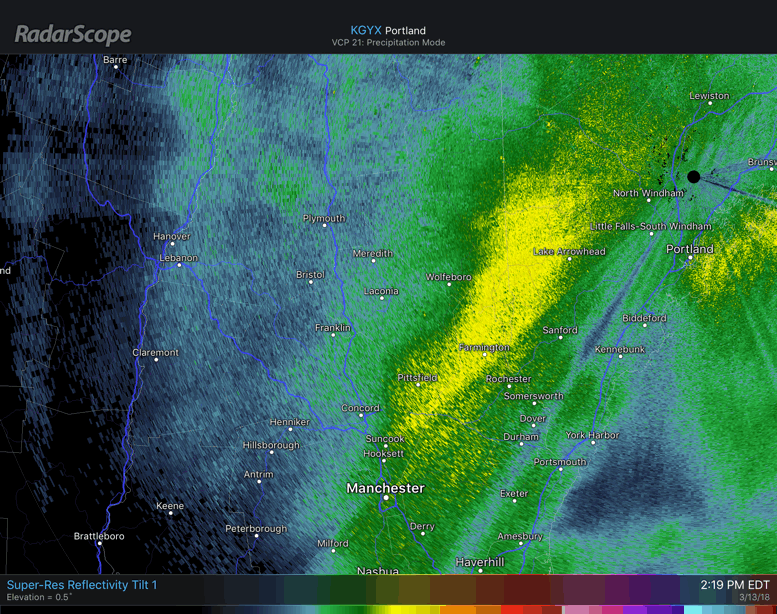
-
March 12/13/14 Blizzard/Winter Storm/WWA etc
dendrite replied to Bostonseminole's topic in New England
There are pulses, but it’s still quasistationary. -
March 12/13/14 Blizzard/Winter Storm/WWA etc
dendrite replied to Bostonseminole's topic in New England
Back to -SN now. Cheering on subsidence from this point on now. -
March 12/13/14 Blizzard/Winter Storm/WWA etc
dendrite replied to Bostonseminole's topic in New England
Creepily well. Those x-sections on TT are pretty sweet too. Maybe we can get one more biggie before Sping to really try them out. -
March 12/13/14 Blizzard/Winter Storm/WWA etc
dendrite replied to Bostonseminole's topic in New England
It’s looked terrible there for hours. -
March 12/13/14 Blizzard/Winter Storm/WWA etc
dendrite replied to Bostonseminole's topic in New England
Derry RWIS is down to 1/8SM...pretty extreme for those sensors.