

dendrite
-
Posts
66,763 -
Joined
Content Type
Profiles
Blogs
Forums
American Weather
Media Demo
Store
Gallery
Everything posted by dendrite
-
Looks like Wilmington will easily defeat Methuen.
-
looks like PVD is mixing.
-
lol
-
Where did Chris say they were measuring? Deer Island or Point Shirley?
-
-
Well 34° probably fits where they’re actually measuring.
-
0.66”/3hr at MQE. Probably a 10”+ spot in that time frame.
-
Past hourly water equivs... MQE 0.29” BOS 0.24” PVD 0.22” ORH 0.19”
-
BOS with 0.20” in the past 51 mins.
-
Be prepared to get angry
-
-
BOS 34° Watch them come in with like 4” of glop.
-
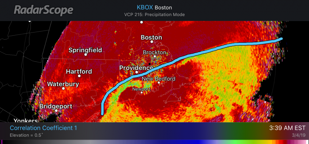
CC has the mix line approaching roughly a PVD-PYM line.
-
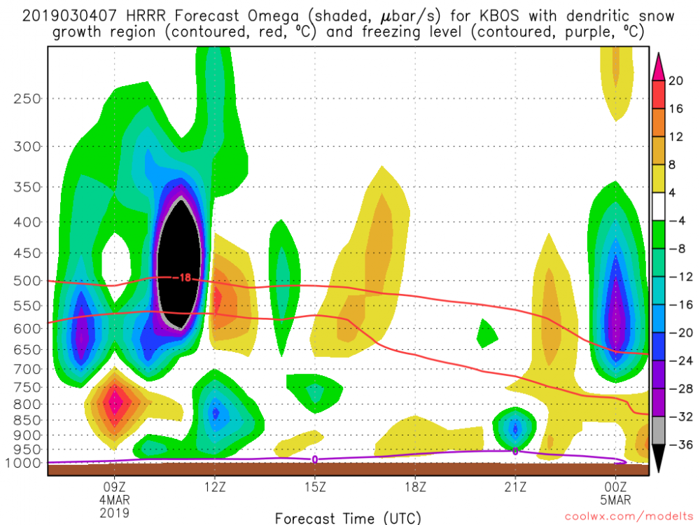
Yeah. That 850 fronto seems to be overwhelming everything else.
-
Looks like about 3” here on the railings so far.
-
ORH with 0.21” in the can past hour. 3-4”/hr?
-
IJD slamming down almost 0.20”/hr in those insane returns.
-
29.9° 3/4SM -SN
-
Snow has commenced. 30/25
-
26.2
-
Plenty of cold wetbulbs off the deck. There will be latent cooling for some like BDR where there's a little melting. 34/32 is nothing to worry about. It may be one of those 32.5F paste bombs for some.
-

Perhaps a Coastal Storm on March 2nd for SNE????
dendrite replied to USCAPEWEATHERAF's topic in New England
4” in Harwich in the PNS. -
Perhaps a Coastal Storm on March 2nd for SNE????
dendrite replied to USCAPEWEATHERAF's topic in New England
Some California mountain above 10kft. -
Perhaps a Coastal Storm on March 2nd for SNE????
dendrite replied to USCAPEWEATHERAF's topic in New England
Just so I don’t feel left out... 20.5° overcast BINOVC N...lol Congrats to those getting snow though that want it. -
Perhaps a Coastal Storm on March 2nd for SNE????
dendrite replied to USCAPEWEATHERAF's topic in New England
A lot of that is bright banding. Wet flakes.


