dendrite
-
Posts
66,763 -
Joined
Content Type
Profiles
Blogs
Forums
American Weather
Media Demo
Store
Gallery
Everything posted by dendrite
-
You guys make my 0.71” look like Yuma.
-
I'm not sure which one I have. These aren't my photos. I think I have the non-glossy version. I'll look when I get home.
-
Yeah this is more shrub/small tree like. It's not as bad as knotweed, but it's first to leaf out, last to drop leaves, and produces a ton of berries that drop seed. The berries aren't even good for wildlife...it just gives everything runs. https://www.michigan.gov/invasives/0,5664,7-324-68002_71240_73850-379574--,00.html
-
I'm so sick of that invasive buckthorn crap. Anyone have tips on how to get rid of it? I cut it all back in the spring before it seeds and in the fall, but that crap resprouts like 4ft after it first leafs out in the spring. I assume keep cutting it back until the roots run out of energy is the only option? That and making sure it doesn't go to seed?
-
No red thread here, but I’ve noticed those fungal spots showing up again on just the red maple leaves. Weird.
-
They're north of CON too. (big patch near exit 17), but I haven't seen them flower yet this year. The state usually lets them flower and then mows them back after they drop seed. Eek gave me some lupines a few years ago, but aphids did a big number on them. No problems with the echinacea he gave me.
-
I'll add that it should be a law that every yard has a patch of wildflowers growing like that. Feed the beneficial insects.
-
Lots of lupines in there. Nice.
-
Lava Rock just kicked his dog
-
Not mine. lol
-
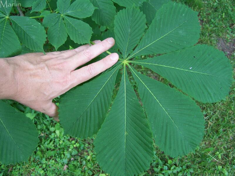
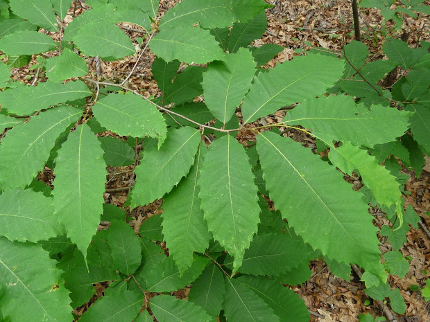
Pretty easy to distinguish horse chestnut american chestnut
-
Save room to replenish the american chestnut. https://theconversation.com/new-genetically-engineered-american-chestnut-will-help-restore-the-decimated-iconic-tree-52191 T-2 years if the estimate I've heard from the rumor mill.
-
Looks awesome Mike.
-
+1 Maybe throw in a few honeylocusts or bald cypress too.
-
We have a solid 10-14 day window of them here where 3-5 of those days are unbearable. It just must be coincidence that you haven't noticed them before because your area would be a nice breeding ground with the river and streams. Black flies love NNE.
-
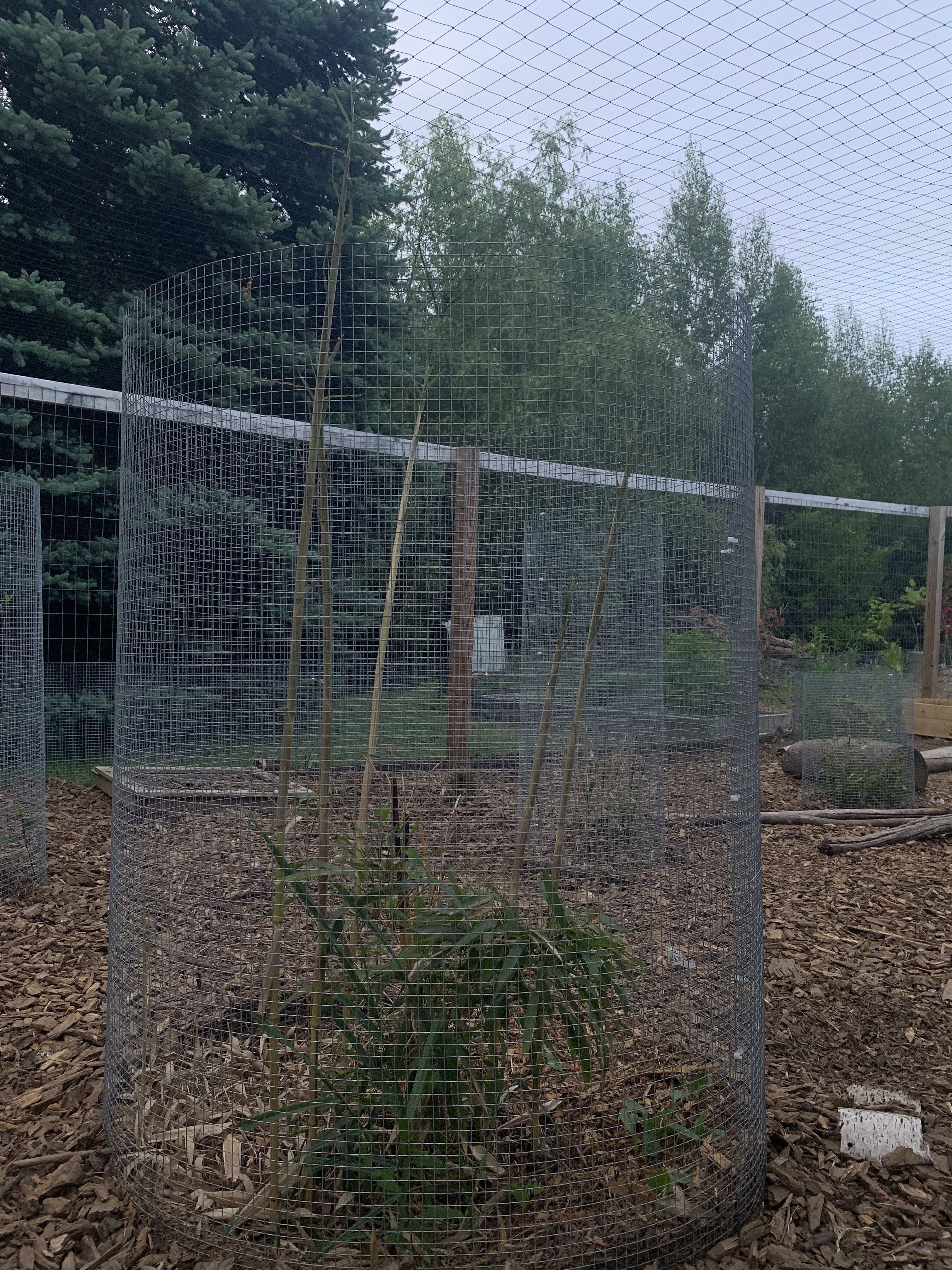
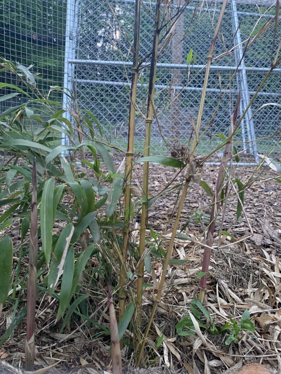
Shoots grew about a foot yesterday. This was last night. I’m interested to compare last night to today after almost an inch of rain.

-
CON just dropped about 10F in 30 minutes. 53F off of 80F there.
-
The hawks are loving the backyard chicken craze.
-
Nice. I'll keep a look out. My native red maples produces some very red samaras this year, but the one I got from the box store (atumn blaze from Lowes I believe) produced a more tan samara...not sure what that means. So should we be able to tell if the sugar ones are forming now or is it 3-4 weeks for that? I'll have to get my binoculars out and look at the crown of the sugar out from to see if there are any hanging.
-
These? https://www.boston.com/culture/growing-wisdom/2015/05/18/winter_moth_green_inch_worm_la
-
They don't usually fall until late summer though, correct?
-
I've heard that from people too, but we have a few. I think the red squirrel numbers are up and they are pretty territorial. Chippy and grey numbers are down, but of course the grey squirrels were committing suicide on the highways last fall.
-
Any forecast on the sugar maples? I wanted to collect some seed this year if it looked like a big year.
-
Anyone getting what seems to be more red maple samaras than usual this spring? Bumper crop?
-
We boo. You can see where the old culms were topkilled above the snow line. I’ll probably cover them next winter.