dendrite
-
Posts
66,871 -
Joined
Content Type
Profiles
Blogs
Forums
American Weather
Media Demo
Store
Gallery
Everything posted by dendrite
-
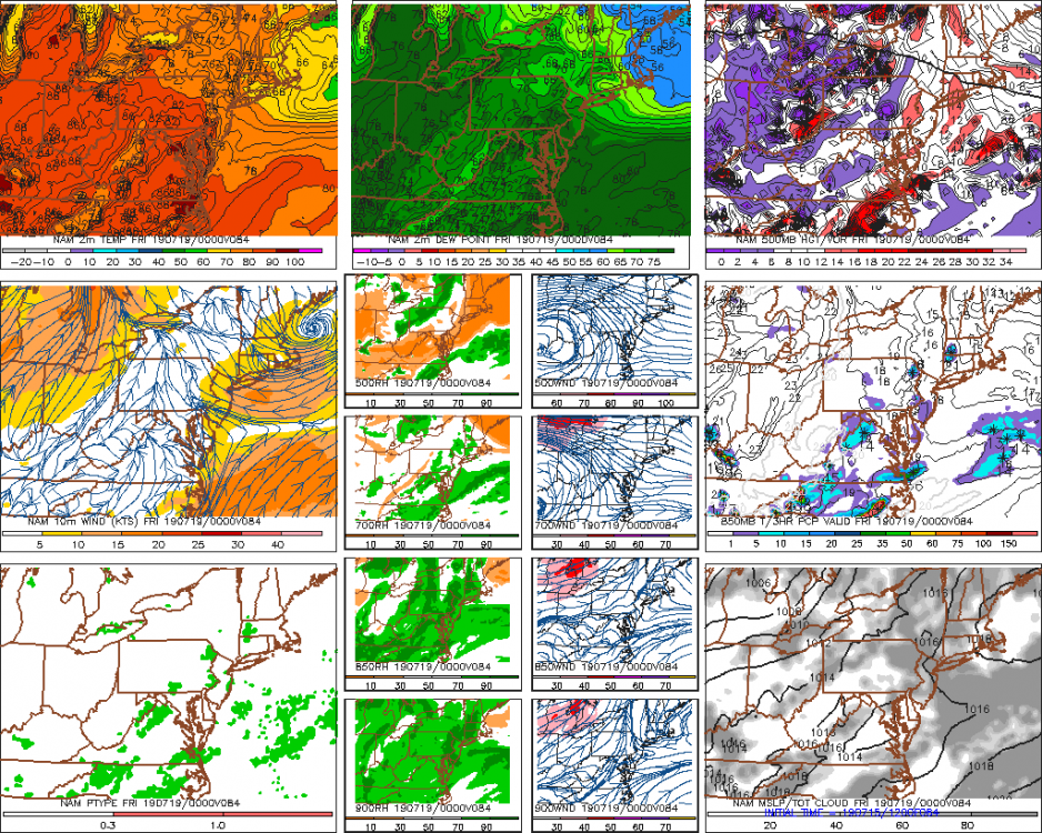
GFS looks similar to 6z for Friday... ~100F in the torch spots.
-
Yeah I think a lot of those are safe. Maybe PWM and an outside shot at BOS?
-
I think it still ends up 90s for most...I mean it's the LR NAM and it isn't exactly showing the scenario I threw out there. It's trying to throw sun up my way right through morning while advecting in the higher dews. I'm just saying it wouldn't shock me if it ends up a little murky to start in the usual wedge spots. Has a classic 5pm max temp look though as we continue to advect in high dews and warmer 850s throughout the day.
-
Records for Saturday. Hopefully CON is back up by then... CON 101 (1977) PVD 101 (1991) BDL 100 (1991) BOS 99 (1991) BTV 99 (1977) MQE 99 (1991) BGR 96 (1991) PWM 96 (1949) ORH 95 (1991) BDR 95 (1991) CAR 95 (1991)
-
The more raw and wet Thursday gets the more I fear we muck up a portion of Friday up here. Like one of those 70/68 overcast mornings that turns into an 87/75 in the afternoon. Nammy is still trying to wedge in 50s dews through 15z Fri while trying to advect mid 70s from WNE.
-
Not a good weekend to be in Loudon watching cars going around in a circle.
-
There will probably be a weenie hour or two where a weenie agricultural ASOS tickles 78-80 in the morning or evening at some point from Fri to Sun.
-
wb Euro incorporating Davis stations into their initialized data now
-
Hopefully we can get Mitch 90° on Saturday. #warmth4woodford
-
And yeah. Sell those afternoon temps. GFS chugging Scoot’s four loko.
-
Low 50s for highs?
-
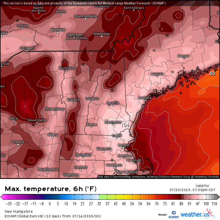
Looks like the euro tries to mix out the dews up here a bit Sat...hence the low 100s. Meanwhile it’s hitting NYC/SNE with dews of Jurassic yore in the low 80s. I’d lop off 3-5° on all of it. 100/65 for MHT and 96/76 for HFD.
-
Crooked Scoot? Lyin’ Kev? Little Wizzo?
-
So you’re telling me there’s a chance.
-
I’m not sure I’ve ever seen the euro 2m temps this high for us.
-
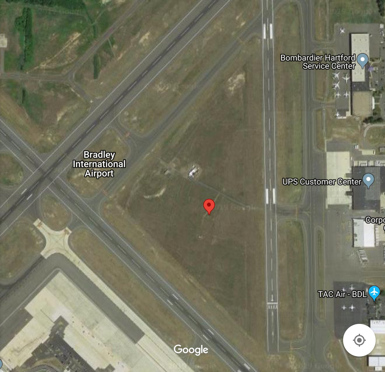
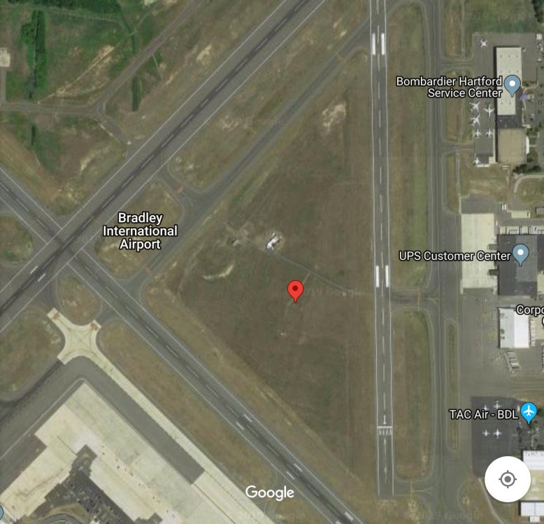
Eh..that’s zoomed out quite a bit. BDL isn’t that bad.
-
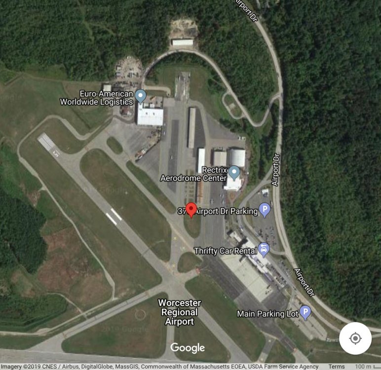
And here is the irony which is the ORH ASOS. Surrounded by more tarmac than BDL.
-
The ASOS is located at the marker.
-
-
Aluminum foil?
-
I thought you were the beaver expert?
-
And most of us have been saying the same thing for days?
-
Huh? He just posted it 10 minutes ago?
-
Maybe it's more of a weak "front" door...if you loop the images. http://mp1.met.psu.edu/~fxg1/ETANE9_12z/etaloop.html The return flow of high dews moves right back in. Probably just the NAM doing NAM things
-
It actually tries to move a shallow BD into ENE at the end of the run after that s/w trough passes north of us around d3. Tries to pull 70s over 50s Thu afternoon with onshore flow.