dendrite
-
Posts
66,889 -
Joined
Content Type
Profiles
Blogs
Forums
American Weather
Media Demo
Store
Gallery
Everything posted by dendrite
-
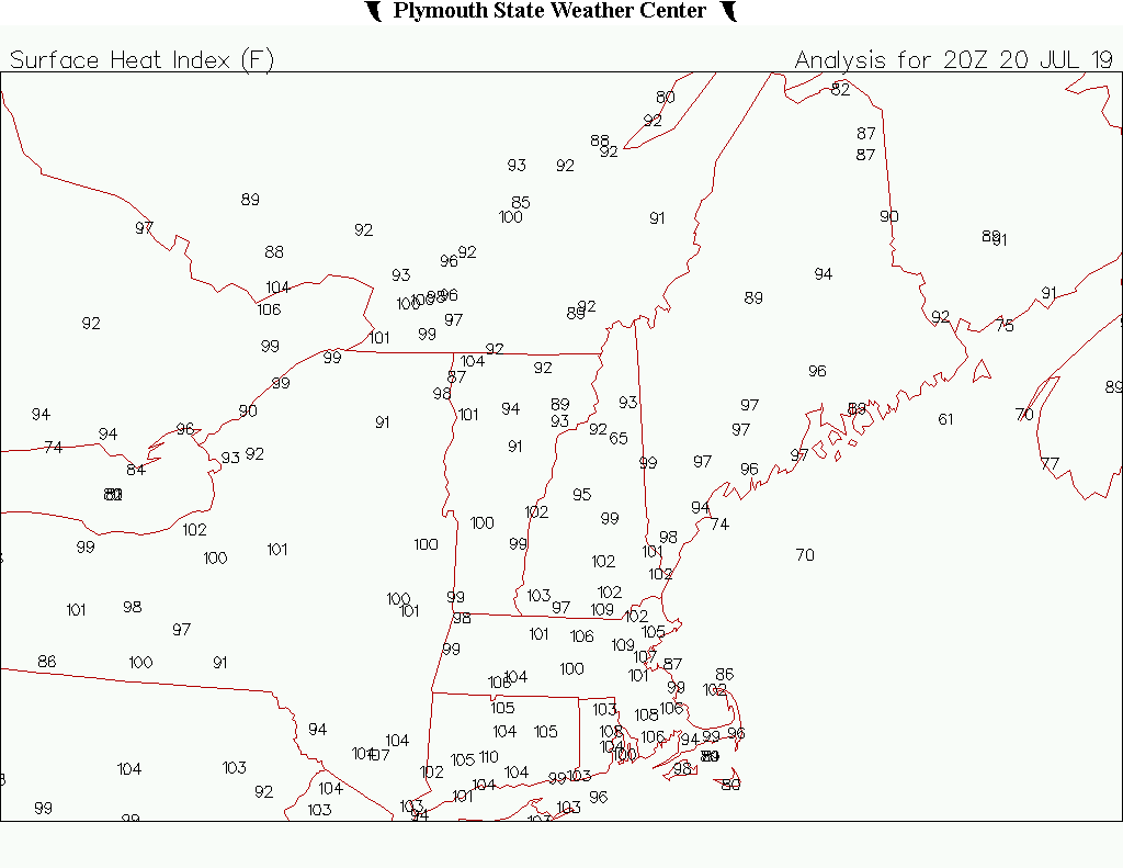
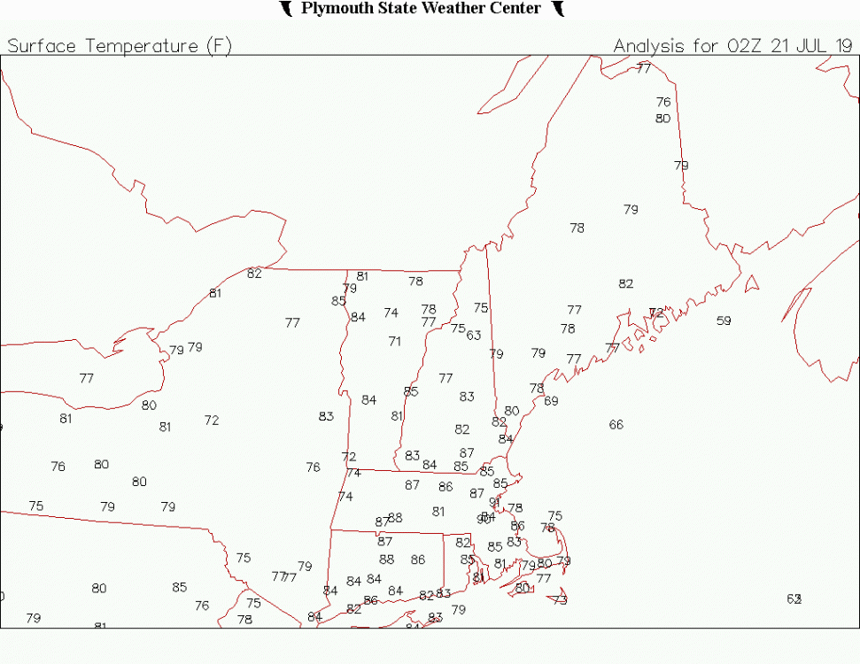
BDL 85 to 93 in 1hr.
-
Up to 88F here. 2F ahead of yesterday at this time.
-
Meanwhile...BOS is up to 91F. Same temp as this time yesterday except the dew is like 3F lower. Gusting out of the WSW at 22mph.
-
BDL 98 BED 98 OWD 98 BOS 97 TAN 97 MHT 97 FIT 97 I mean most MOS guidance had 97-100F. How is that a bust? I'm going to assume NWS zone forecasts were calling for upper 90s in the lower els? The decoupling example is usually when the forecast is -10F and calm and it ends up +5F with a 10mph wind.
-
Dew, you really want to hurt me Dew, you really want to make me cry
-
These are avg dews for given temps. You can see as you get near 100F and over it there's actually a trend toward lower dews versus mid 90s temps.
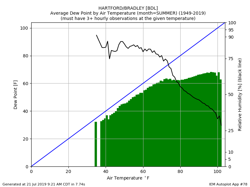
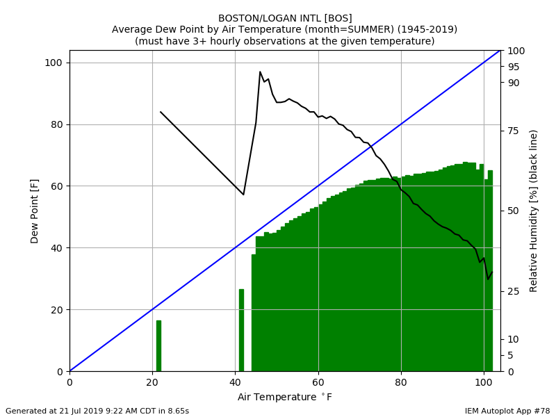
-
We've had worse, but that is pretty extreme. There's not a lot of mid/upper 90s with mid/upper 70s dews in our historical records.
-
Dews overperformed progs...I was a little worried about that late last week. But like we said, shave a couple degrees off the highs and lop them onto the dews and in the end it's the same heat indices.
-
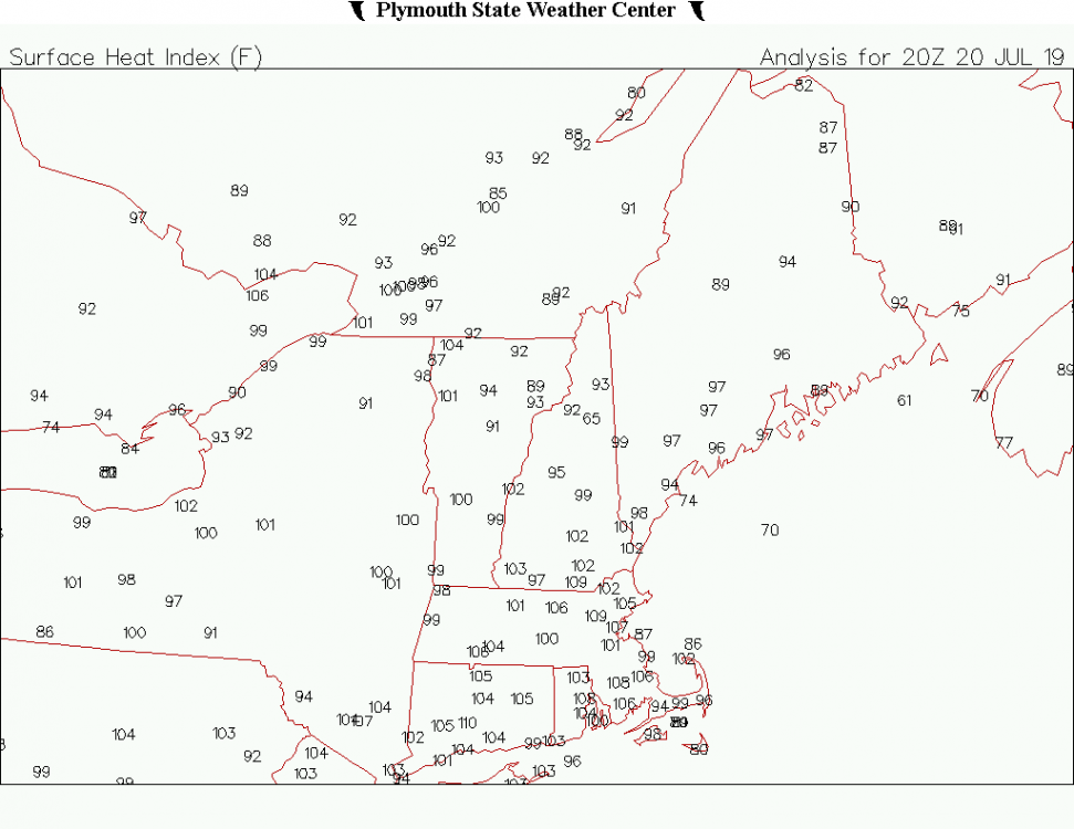
105-110F HIX for much of SNE yesterday afternoon. Seems pretty hot to me.
-
There's drier air working in from N to S. I think they'll slowly get eaten away. We'll see.
-
I think the heat recovers later today for eastern areas. Not sure about a hundo, but I think BOS-TAN-BDL pull a drier furnace this afternoon.
-
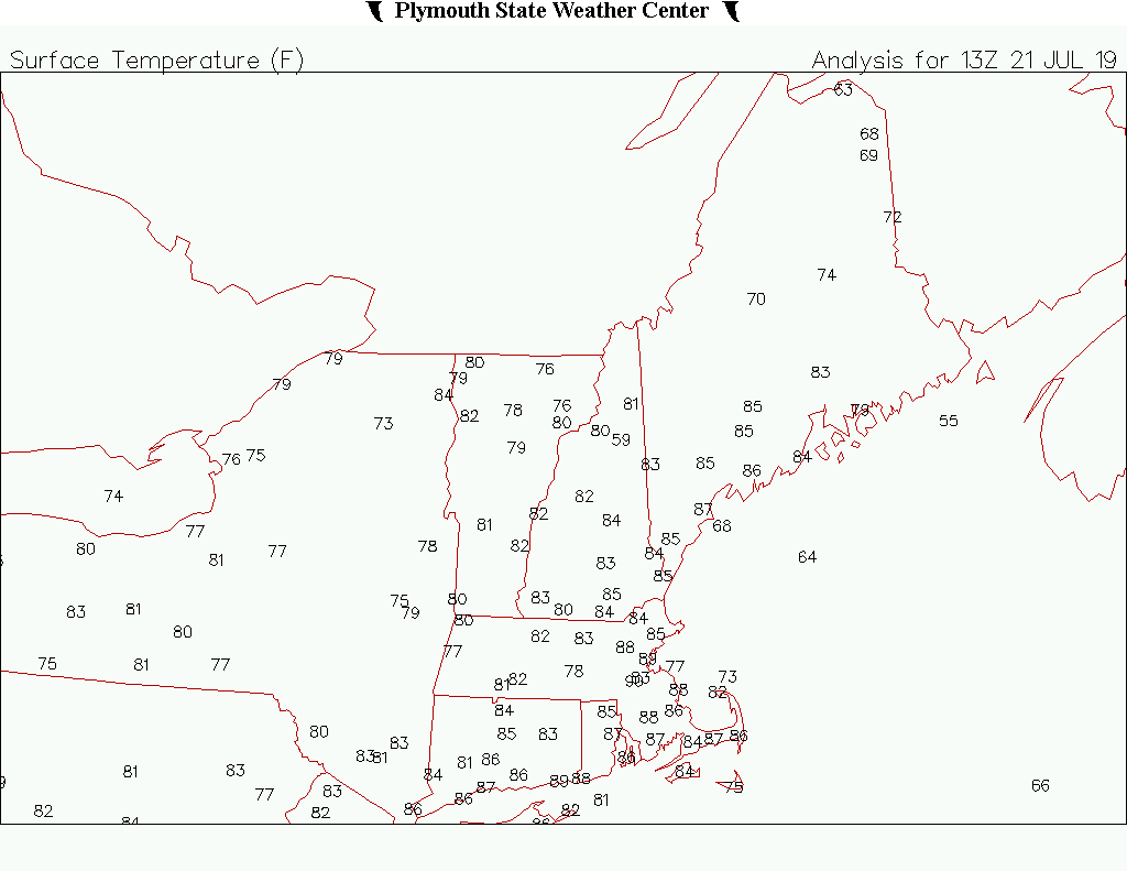
13z
-
9am obs OWD 90F BOS 89F BED 88F Just a torchy area
-
I feel like ORH often stands out more than BOS. lol Not saying it's wrong.
-
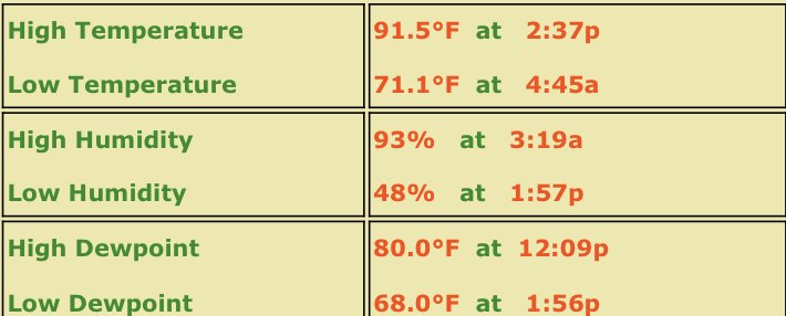
MHT with their first 80F min yesterday. Last night was a low of 79F. They're becoming BOS 2.0
-
Last July 24...lol Torchy times
-
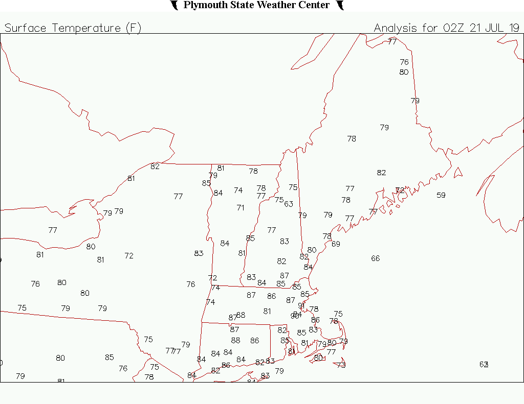
10pm...congrats everyone
-
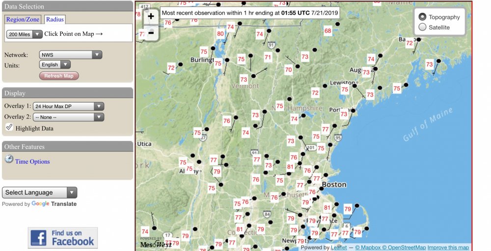
Max dews so far. Pretty gross. Basically another dew wave like last year. Tough to run big heat with big dews.
-
Trashua AWOS with an 80° dew.
-
PVD 90/79. Must be a beautiful tropical night with the 10kt wind.
-
Marshfield GHG 91/81
-
HFD with an 80° dew ftw.
-
More trash on it than the LCI AWOS after bike week.
-
Dead bug in the corner?