dendrite
-
Posts
75,078 -
Joined
Content Type
Profiles
Blogs
Forums
American Weather
Media Demo
Store
Gallery
Everything posted by dendrite
-
Looks like the melt is paying off.
-
Rusty coat hanger outside of the Dec system. Without that we'd probably be pushing futility. lol
-
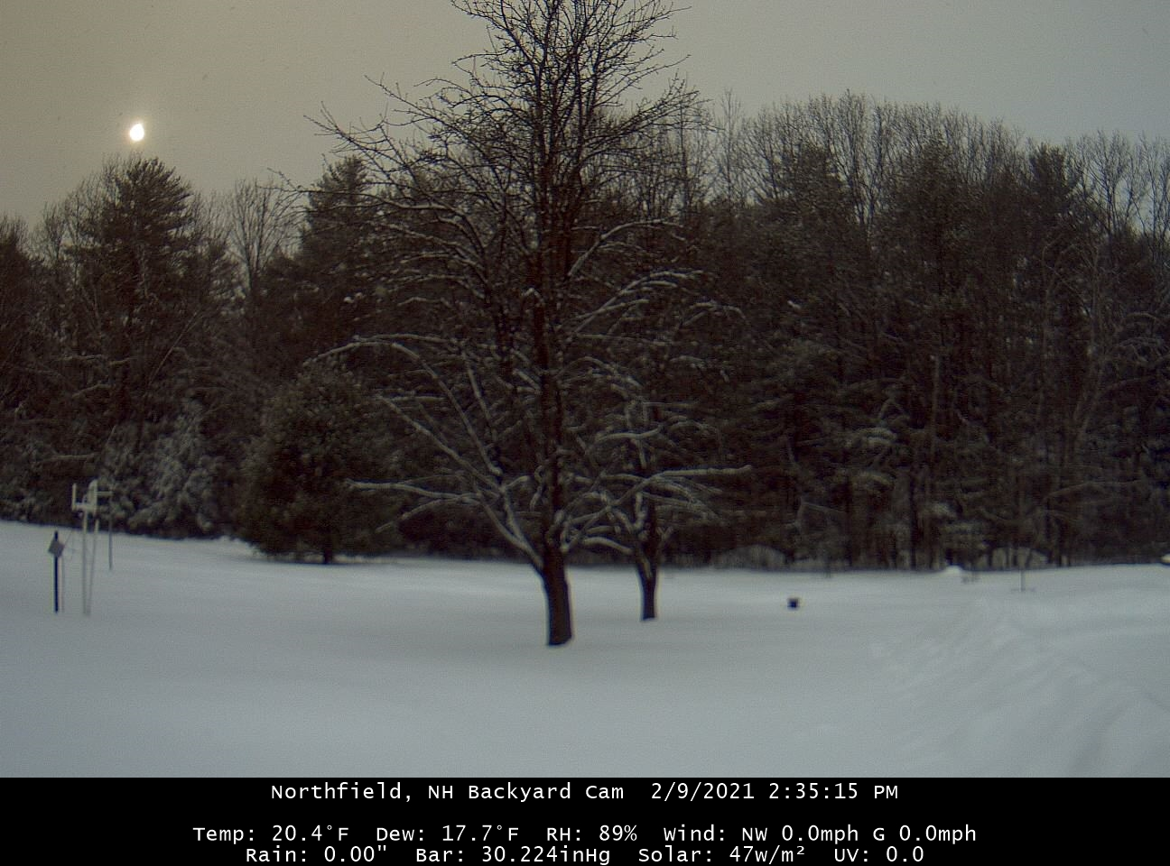
Dim sun

-
-SN > 1/2SM SN <= 1/2SM and > 1/4SM +SN <= 1/4SM
-
Not liking the height gradient. Probably shred city with that PV lobe orientation.
-
High was actually 50F. Damn Hadley cell finally overtook them.
-
I hear ya. I eventually went that route after my tripod tipped over.
-
tripod?
-
Huh? How much have you gotten? Is it mounted 5-6ft?
-
At least we have KBOB now.
-
It's tough to have a big bust when you're only progged for a couple tenths of liquid.
-
Mish is reporting rain in Falmouth.
-
Looks like Union-north was a good call.
-
Looks like it could be a contendah.
-
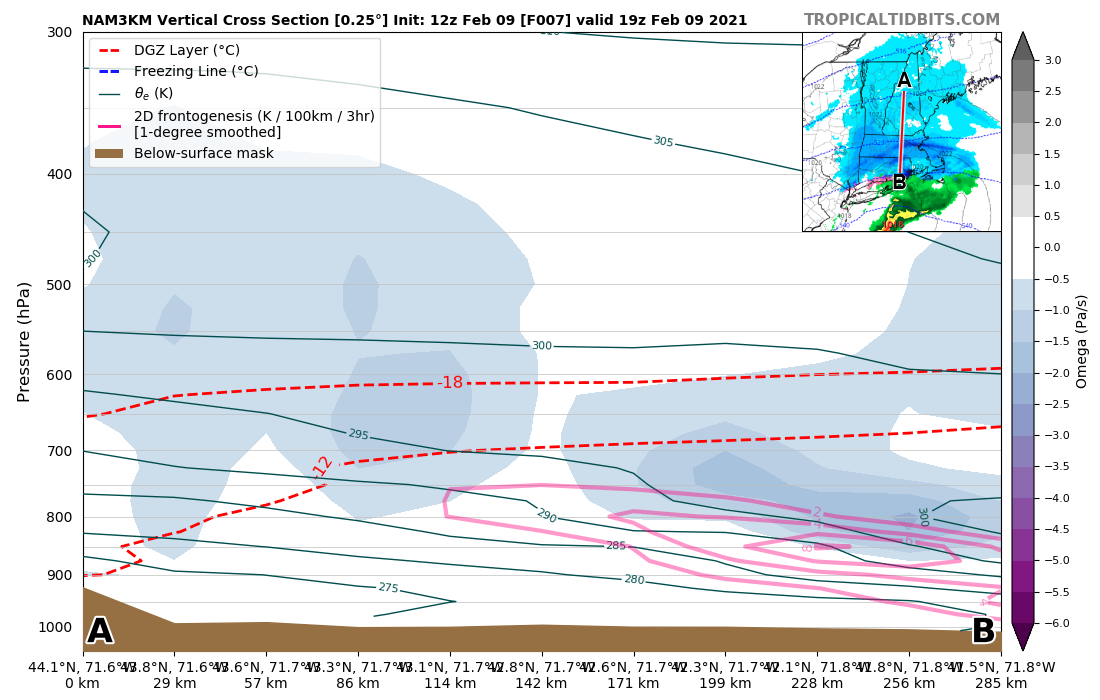
Cutting through the bands on the 12z 3k NAM and you can see most of the fronto and lift in SNE is below the DGZ, but it wouldn't surprise me if that band cutting through central MA is tickling some good lift up to the DGZ. Up here growth has been good, but just not enough precip.

-
I was surprised he lived as long as he did. The dude was never clean.
-
Some of the models had decent lift in the DGZ up here. I posted the 3k NAM last night. The larger growth may have more reflectivity to it. We'll probably get less liquid than SNE, but maybe we can fluff it out a bit more.
-
Yeah getting some bands coming back through at home. 15.2F
-
METAR KFMH 220755Z 28008KT 15SM BKN015 M20/M23 A3026 RMK SLP253 RCRNR METAR KFMH 220855Z 30006KT 10SM -SN BKN014 M20/M23 A3025 RMK SLP250 50003 RCRNR METAR KFMH 220955Z VRB02KT 10SM -SN BKN011 M21/M23 A3025 RMK SLP250 RCRNR METAR KFMH 221155Z 29002KT 10SM SCT011 M21/M22 A3026 RMK SLP253 60000 4/003 53003 RCRNR METAR KFMH 221255Z 25004KT 7SM FEW011 SCT250 M20/M21 A3026 RMK SLP253 RCRNR METAR KFMH 221355Z 25003KT 7SM FEW011 BKN250 M17/M19 A3025 RMK SLP250 RCRNR METAR KFMH 221455Z 00000KT 7SM FEW015 BKN250 M14/M18 A3024 RMK SLP245 60000 58007 RCRNR METAR KFMH 221555Z 00000KT 7SM FEW015 SCT160 OVC250 M10/M14 A3022 RMK SLP238 RCRNR METAR KFMH 221655Z VRB03KT 10SM SCT025 BKN250 M07/M12 A3018 RMK SLP224 RCRNR METAR KFMH 221755Z 11007KT 10SM SCT025 SCT100 OVC200 M07/M11 A3014 RMK SLP210 60000 58034 RCRNR METAR KFMH 221855Z 09010KT 10SM BKN021 BKN120 OVC200 M07/M10 A3010 RMK SLP197 RCRNR METAR KFMH 221955Z 09005KT 10SM BKN025 BKN100 OVC200 M06/M10 A3008 RMK SLP189 RCRNR METAR KFMH 222055Z 05004KT 7SM -SN SCT020 BKN030 OVC100 M06/M09 A3009 RMK SLP192 60000 55017 RCRNR METAR KFMH 222155Z 05011KT 1SM -SN BR SCT000 BKN008 OVC017 M06/M08 A3002 RMK SN SCT000 PRESFR SLP168 RCRNR METAR KFMH 222255Z 04009KT 2SM -SN BR BKN008 OVC014 M06/M08 A2997 RMK SLP151 RCRNR METAR KFMH 222355Z 06010KT 1 1/2SM -SN BR BKN008 OVC014 M06/M07 A2990 RMK PRESFR SLP151 60004 4/003 57064 RCRNR METAR KFMH 230055Z 07013G22KT 1 1/2SM -SN BR BKN008 OVC018 M04/M05 A2985 RMK SLP110 RCRNR METAR KFMH 230155Z 05013G24KT 3/4SM -SN BR SCT003 BKN008 OVC015 M03/M04 A2979 RMK PRESFR SLP128 SNINCR 1/4 RCRNR METAR KFMH 230255Z 05012G22KT 1/2SM SN BR BKN003 OVC008 M03/M04 A2974 RMK SLP073 SNINCR 2/6 60022 57054 RCRNR SPECI KFMH 230314Z 05017G24KT 1/4SM +SN FZFG VV002 M03/M04 A2972 RMK RCRNR METAR KFMH 230355Z 05015G22KT 1/4SM +SN FZFG VV002 M03/M04 A2969 RMK SLP056 SNINCR 2/8 RCRNR METAR KFMH 230455Z 04014G23KT 1/4SM +SN FZFG VV002 M03/M04 A2963 RMK PRESFR SLP036 SNINCR 2/10 RCRNR METAR KFMH 230555Z 04018G25KT 1/4SM +SN FZFG VV002 M02/M03 A2954 RMK PK WND 04027/44 PRESFR SLP006 SNINCR 2/12 60061 4/012 57068 RCRNR METAR KFMH 230655Z 03020G28KT 1/4SM +SN FZFG VV002 M02/M03 A2949 RMK PK WND 03029/39 SLP988 SNINCR 2/14 RCRNR METAR KFMH 230755Z 03023G29KT 1/4SM +SN FZFG VV001 M01/M02 A2940 RMK PK WND 02032/37 PRESFR SLP958 SNINCR 2/16 RCRNR METAR KFMH 230855Z 01021G35KT 1/4SM +SNBLSN FZFG VV001 M02/M02 A2938 RMK PRESFR SLP951 SNINCR 2/18 60055 57054 RCRNR METAR KFMH 230955Z 01025G38KT 1/2SM SN BLSN FZFG VV001 M02/M02 A2933 RMK SLP934 SNINCR 1/19 RCRNR METAR KFMH 231055Z 01026G40KT 1/4SM +SN BLSN FZFG VV001 M02/M03 A2933 RMK PK WND 36042/33 SLP934 RCRNR METAR KFMH 231155Z 01024G45KT 1/4SM +SN BLSN FZFG VV001 M03/M03 A2933 RMK VIS 0V1/2 SLP934 SNINCR 1/21 60075 70140 4/021 56017 RCRNR METAR KFMH 231255Z 36032G48KT 1/8SM +SN BLSN FZFG VV001 M03/M03 A2932 RMK VIS 0V1/2 SLP930 RCRNR METAR KFMH 231355Z 35030G46KT 1/8SM +SN BLSN FZFG VV001 M04/M04 A2932 RMK PK WND 35053/09 VIS 0V1/2 SLP930 RCRNR METAR KFMH 231455Z 35033G48KT 1/8SM +SN BLSN FZFG VV001 M04/M05 A2932 RMK PK WND 34054/14 VIS 0V1/2 SLP930 60011 56003 RCRNR METAR KFMH 231555Z 35031G44KT 1/8SM +SN BLSN FZFG VV001 M06/M07 A2937 RMK PK WND 35047/13 VIS 0V1/2 SLP947 RCRNR METAR KFMH 231655Z 34029G43KT 1/8SM +SN BLSN FZFG VV001 M07/M08 A2939 RMK PK WND 35049/42 VIS 0V1/2 SLP955 RCRNR METAR KFMH 231755Z 33030G41KT 1/8SM +SN BLSN FZFG VV001 M09/M09 A2943 RMK PK WND 35049/06 VIS 0V1/2 SLP969 60020 4/025 52037 RCRNR METAR KFMH 231855Z 32027G42KT 1/8SM +SN BLSN FZFG VV001 M09/M09 A2945 RMK PK WND 34046/08 VIS 0V1/2 SLP976 RCRNR METAR KFMH 231955Z 32030G36KT 1/4SM +SN BLSN FZFG VV001 M11/M11 A2950 RMK PK WND 34044/03 SLP993 RCRNR METAR KFMH 232055Z 32032G45KT 1/4SM +SN BLSN FZFG VV001 M11/M11 A2955 RMK SLP011 60007 52041 RCRNR METAR KFMH 232155Z 32028G39KT 1/4SM +SN BLSN FZFG VV001 M11/M11 A2961 RMK SLP030 RCRNR METAR KFMH 232255Z 31022G34KT 1/2SM SN BLSN FZFG VV002 M11/M11 A2965 RMK PK WND 32039/26 SLP044 RCRNR METAR KFMH 232355Z 31023G30KT 1/2SM SN BLSN FZFG VV002 M11/M11 A2970 RMK PK WND 31037/01 SLP061 60014 4/029 52051 RCRNR METAR KFMH 240055Z 31023G33KT 1 1/2SM -SN BLSN BR BKN003 BKN024 M11/M11 A2972 RMK SLP067 RCRNR METAR KFMH 240155Z 33019G30KT 1SM -SN BLSN BR SCT003 BKN005 OVC030 M13/M13 A2975 RMK SLP078 RCRNR METAR KFMH 240255Z 31018G28KT 6SM BLSN BR SCT003 SCT015 BKN030 M14/M14 A2976 RMK SLP081 60001 52020 RCRNR METAR KFMH 240355Z 30018KT 6SM BLSN BR FEW003 SCT015 BKN030 M15/M15 A2979 RMK SLP091 RCRNR METAR KFMH 240455Z 30016G25KT 10SM SCT015 BKN030 M16/M16 A2981 RMK SLP099 RCRNR METAR KFMH 240555Z 32017KT 10SM SCT015 BKN030 M16/M17 A2982 RMK SLP099 60001 4/029 52020 RCRNR METAR KFMH 240655Z 29014KT 10SM FEW015 SCT030 M17/M17 A2984 RMK SLP109 RCRNR METAR KFMH 240755Z 29017KT 10SM FEW015 SCT030 M18/M18 A2987 RMK SLP120 RCRNR
-
Could be decent Union northward
-
Was snowing pretty hard at home until I reached Canterbury. Just minor -SN the rest of the way into CON so the radar is showing reality.
-
Yeah really good dendritic growth right now. Pure fluff
-
10.6° Light Snow

-
7.8°F Clear