

dendrite
-
Posts
75,090 -
Joined
Content Type
Profiles
Blogs
Forums
American Weather
Media Demo
Store
Gallery
Everything posted by dendrite
-
Don't worry. We're piling up the d10 clown snow.
-
Probably peak insolation...mid afternoon. Then we may slip back a bit until the CAA this evening.
-
28.8° ZR Bamboo is in trouble. Hopefully it doesn’t take the whole net down.
-
1.5” snow and sleet when I left home. Turned to ZR around exit 18 in Canterbury. A little but further and everything was encased in ice. A little ZR in CON now, but nbd. Haven’t seen what the CON temp is yet. Roads were a nightmare in Northfield...the 93 portion too. Mostly wet 17-south. I see it’s up to 28° at home now so maybe just ZR. My bamboo is feeling the bend this morning so hopefully we get up to 32° soon.
-
Pinging up to the canadian border.
-
26.2° and pounding sleet.

-
24.8° Either -FZDZ or -SG...hard to tell the difference, but I lean droplets. The melting layer looks pretty far north already on ENX radar. Maybe we can seeder feed when the heavier echoes move in.
-
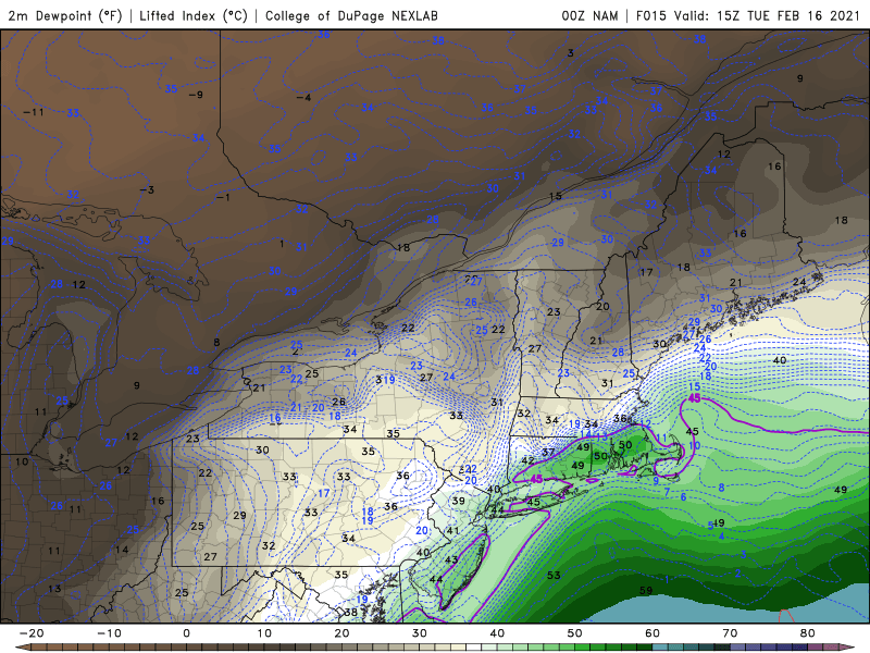
3k NAM turns the S VT cadavers into the ice castles. Decent icing here on both NAMs as well.
-
34/34 at ORH while it's cocktail parasols at 990ft a little to the SW?
-
Wish that was here
-
heh...nam is bringing 50F and dews into NE CT.
-
Not only that, but dews start dropping when the temps spike up a bit with the mixing so the wetbulbs stay a little lower. Like you said, it's not like it's a 40/40 rainfall for hours.
-
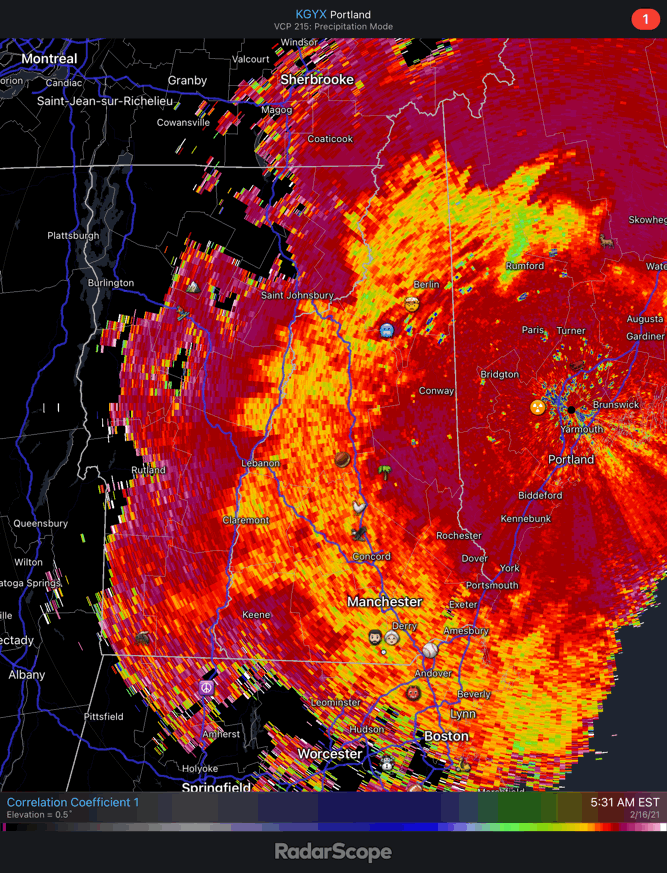
Look closely at this:
-
Not happening. We'll get some snow, a decent amount of sleet, and then a little ZR at the end.
-
It's not trolling you weenie. I'm questioning the tweet. The 3k temps look similar to current readings.
-
?
-
24.5F -SN Was moderate a little bit earlier.
-
Seems like a lot of convection over the SE...wonder if all of that latent heating pumped up the ridge more and kept the mid level warmth ticking northward.
-
I mentioned the tuck last night too. Seems like this system has overly stressed you. Maybe you need a break from the board.
-
25F -SN most of the day. Maybe a couple tenths.
-
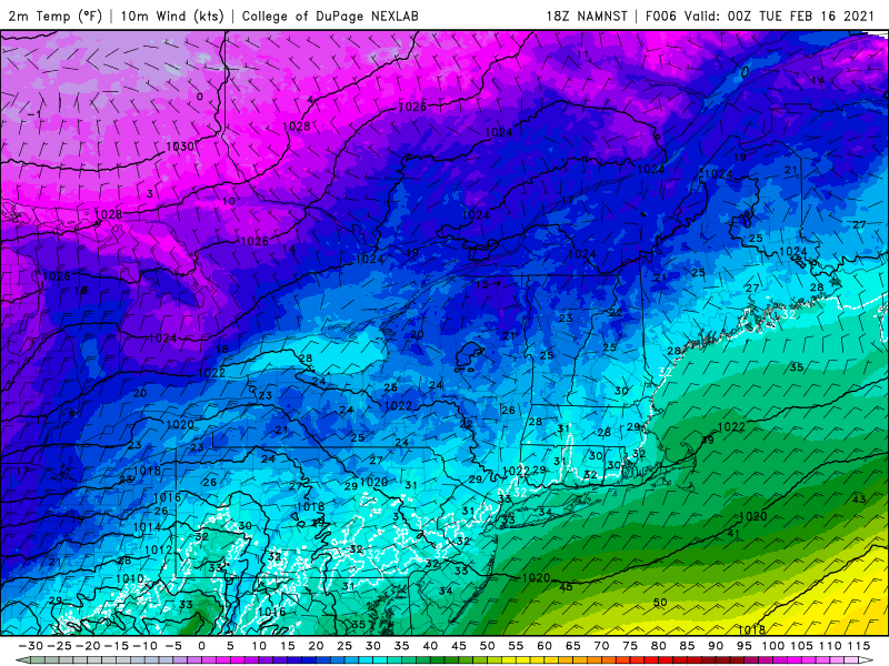
3k nam keeps you on the colder side. Maybe you tickle low 40s when the west winds kick in. Either way, it’s only frozen water. You’ll want it gone in a few weeks anyway.
-
Not this time. The warmth is coming in way aloft. It’ll be a south to north deal and not elevation dependent. If you stay snow it’ll be because the lift in the marginal layer was strong enough to cool the column enough to fight off the melting as the warmth advects in.
-
Congrats YUL on the NAM. Pinging up to Freak.
-
Maybe something like this happens?
-
fyp


