dendrite
-
Posts
75,090 -
Joined
Content Type
Profiles
Blogs
Forums
American Weather
Media Demo
Store
Gallery
Everything posted by dendrite
-
At least the goofus has been backing off on the cold next week. It'll be cold either way for a couple of days, but likely nothing exotic.
-
Low 29° Another torch morning.
-
At least it’s the d7 GFS so we can toss it further than George’s 90” call.
-
That 2007 cold shot a week into March was pretty impressive.
-
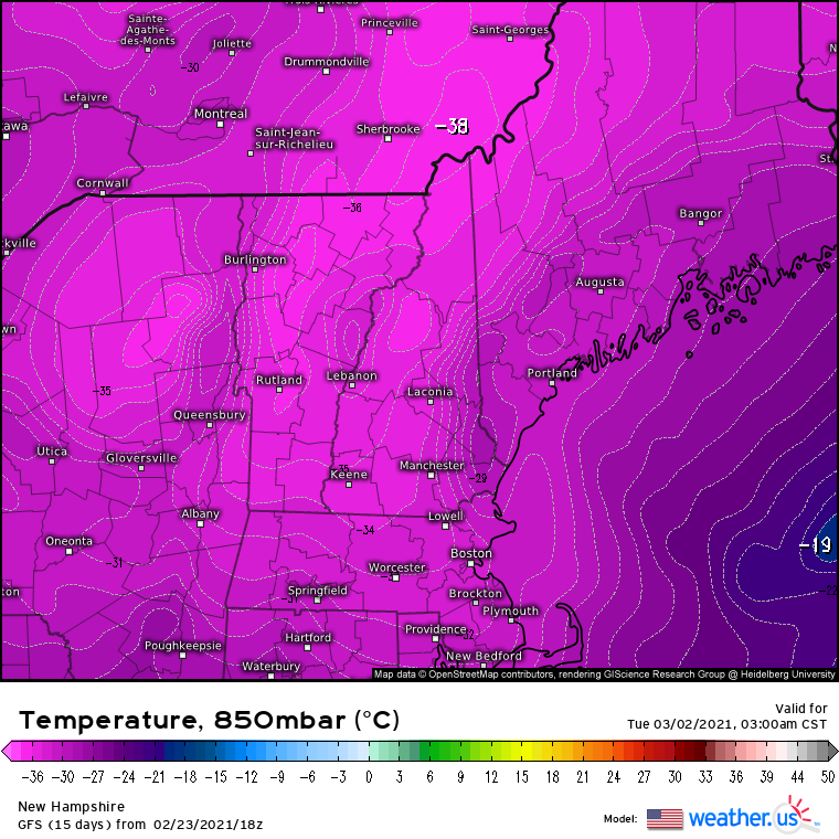
w t f -35C

-
If I get this far into the season with only -1° and then some rogue exotic -15° Comes blasting through here in March I’m going to be pissed.
-
We can get that in May and struggle to 50°.
-
It’s 2/23. There will be more snow here even if March torches.
-
Looking at CON now. Torch city for 3 days and the deep pack barely budged.
-
We were near 70F in Feb with full pack a few years ago.
-
This talk must get the milfs so hot. It may even knock them back out of menopause.
-
You know we're in a lull or nearing the end of winter when metfan continually has to resort back to d8 storms on obscure models.
-
Son of GFS isn't nearly that cold either.
-
Yeah...my wife has been on me for 4 years to put siding on it. May do some T1-11 this year.
-
lol...I did that from 8p-midnight last night. I've shoveled every event since 12/17. It's been a pretty good workout although I'm a little sore this morning.
-
Thanks. Do you lean bobcat too? I've never seen one on my property.
-
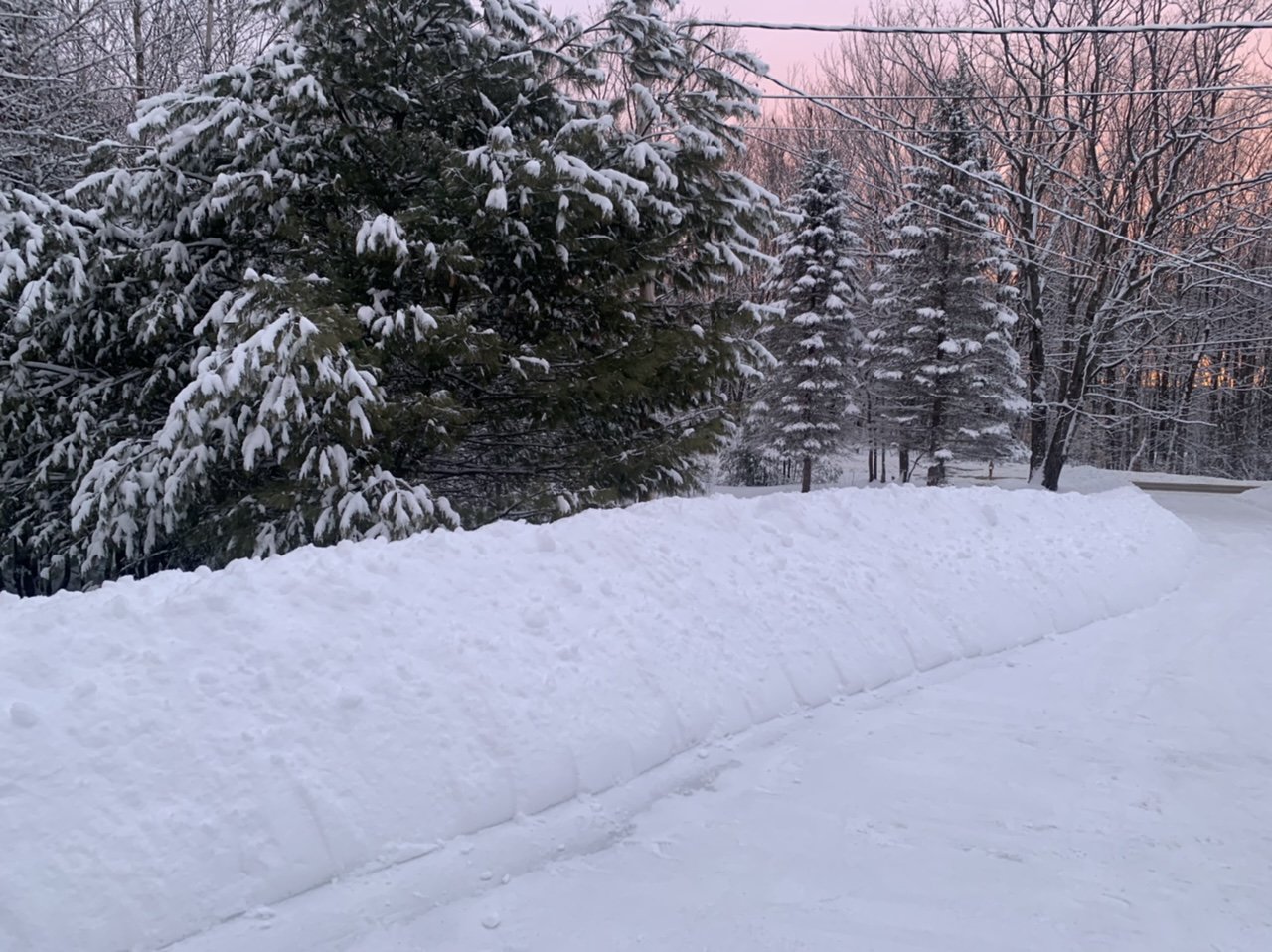
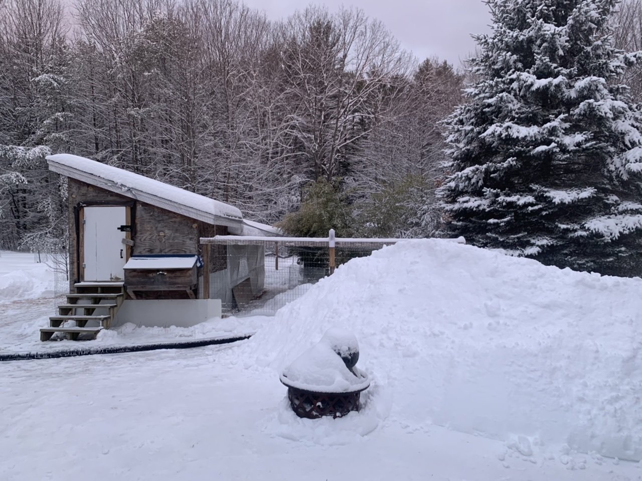
Snow banks are starting to get up there here too. They probably won’t drop too much the next 2 days. Maybe we can get another biggie to get them over the vehicles.

-
Had to do a double take when I got up and saw it’s up to 31.1°.
-
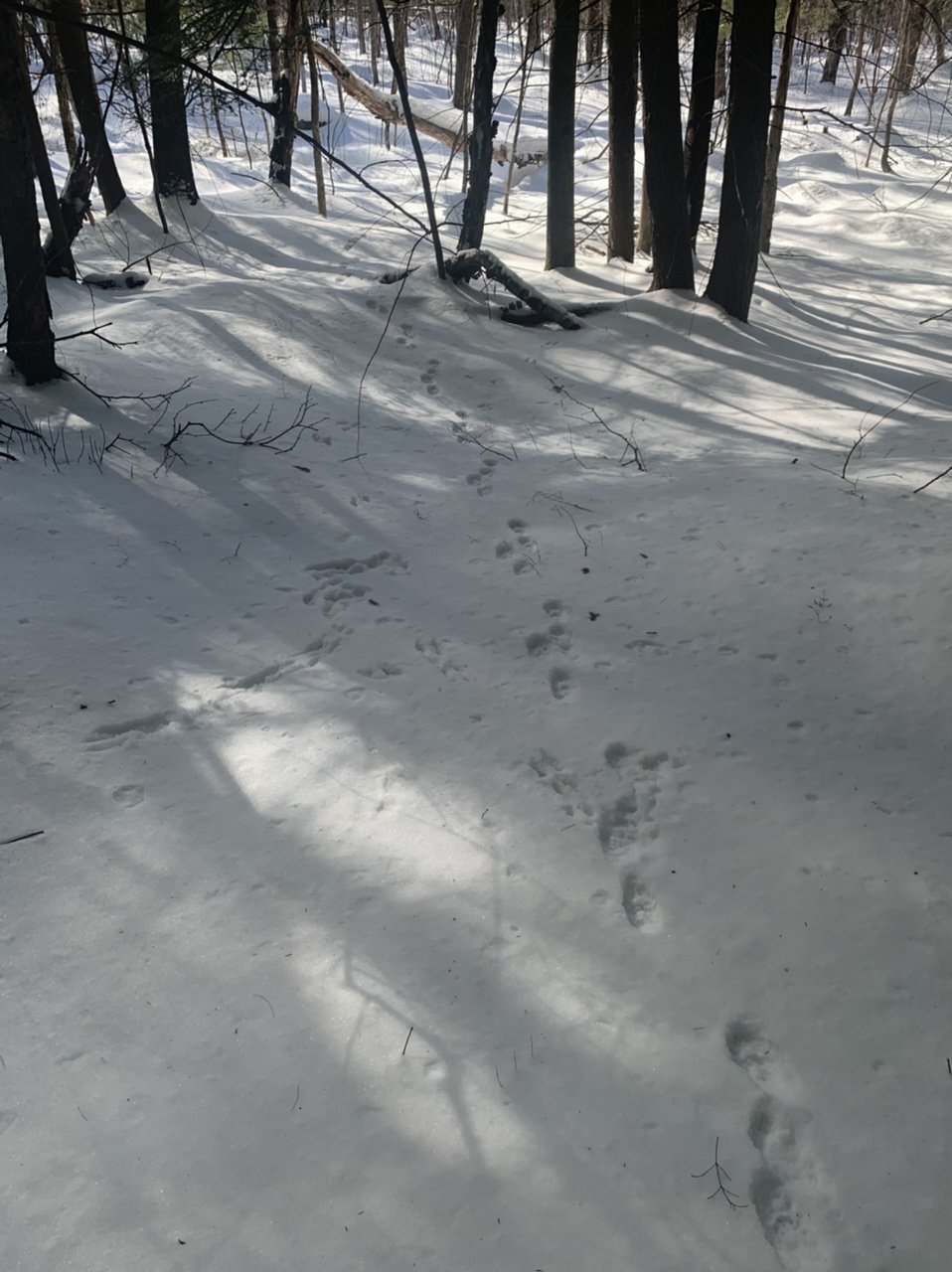
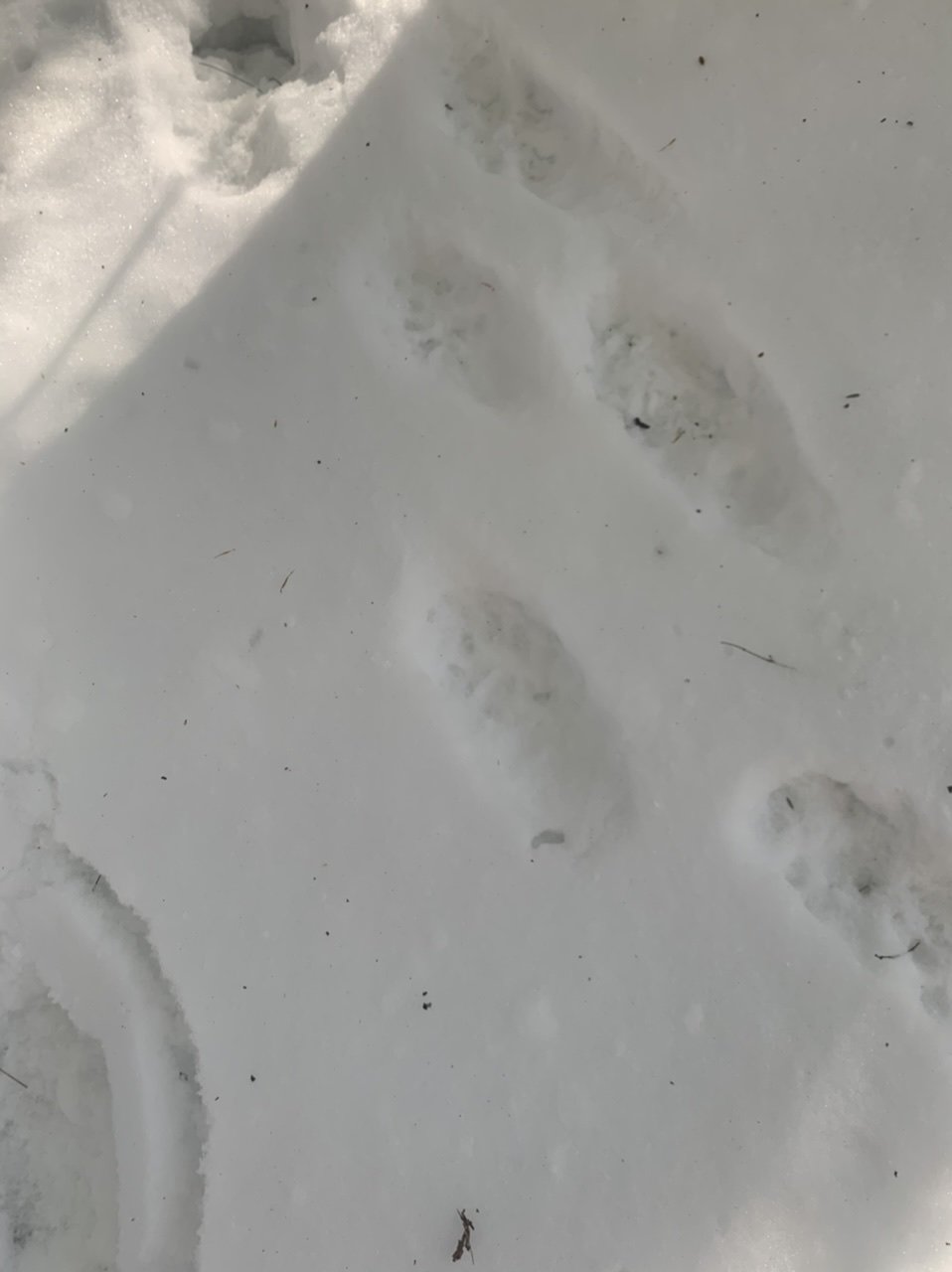
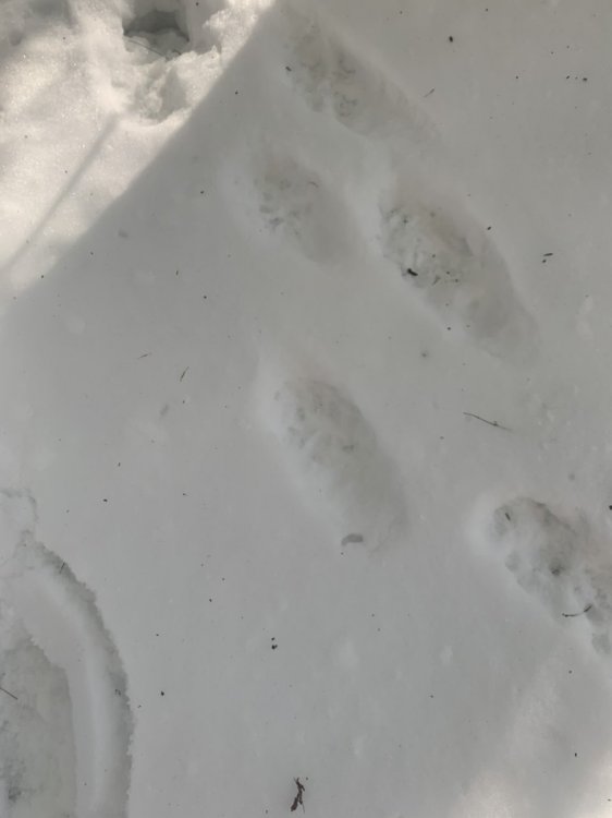
Thanks...had another person suggest a fisher and after looking those up I’m definitely concerned because those are in sets of 4 as well. Some kind of animal was out in the backyard making loud squeaking noises the other night...not the typical hideous fisher screeching, but more of a high pitched squeak. The first thing I thought of was a mink or weasel, but maybe fishers have some sort of squeaking call as well? I don’t need one of those mofos hanging around my coop. Hopefully those prints are a bobcat.
-
Up to 68.1" on the season. Half of that was 12/17.
-
3.7"/0.35" final Down to 25F off a high of 30F. Pack is up to 16".
-
Not the best photos, but saw these in the woods yesterday. Do the sets of 4 prints look like anything familiar?

-
Quick temp drop here with -SN continuing...down to 27.6F. Not really a big deal up here, but watch out further south where it's 32-34F.
-
My mom said maybe a couple inches in S Hooksett right now, but take that with a grain of salt. Still snowing hard down there though.
-
LCI ripped 1/4SM for 90 mins straight even with the 5min obs...up to 1/2SM now. Nice little event.