dendrite
-
Posts
66,900 -
Joined
Content Type
Profiles
Blogs
Forums
American Weather
Media Demo
Store
Gallery
Everything posted by dendrite
-
19.2” I think
-
Spores in the mulch?
-
Stunning betrayal by Scoot in just 24hrs. DIT didn't even know what him. Hammer hurt'im.

-
In and up
-
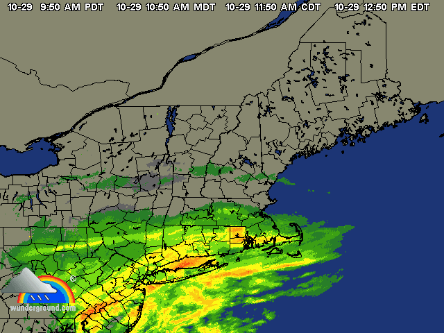
In for the win today. 74F here and pushing 80F at LEB. CAA from the NE seems to favor the coastal counties a bit more relative to average. My old stomping ground in Auburn, NH was 42F this morning. We would rad like crazy near Massabesic Lake when we'd decouple after NE flow.
-
Will be fun when DIT flips. Tag team partners becoming enemies
-
Glad we live here.
-
It was a pretty awesome summer up here (after June) despite being in the greens. I'd rathr be near normal with tons of sun instead of the mank swampazz rains of last August despite the torch temps. July was just days and days of 80s and sun.
-
On the flip side...I wonder how much of that orange shading north of the Pike would be yellow without the extra 1-2F anomalies at BDL, BOS, BED, etc. I haven't checked to see if ALB has been running warmer than normal too.
-
Some like to feel special like they live in this extreme weather spot that everyone else should be jealous of. You'd think his COOP equipment was at 1000ft and the valley thermo in a below sea level bowl. http://www1.ncdc.noaa.gov/pub/orders/IPS/IPS-228BF4B9-6130-4DFE-BA37-4C11781AF05F-wxc3.pdf
-
Pretty sure he’s a Trumper based on some of his tweets. Sensitive snowflake.
-
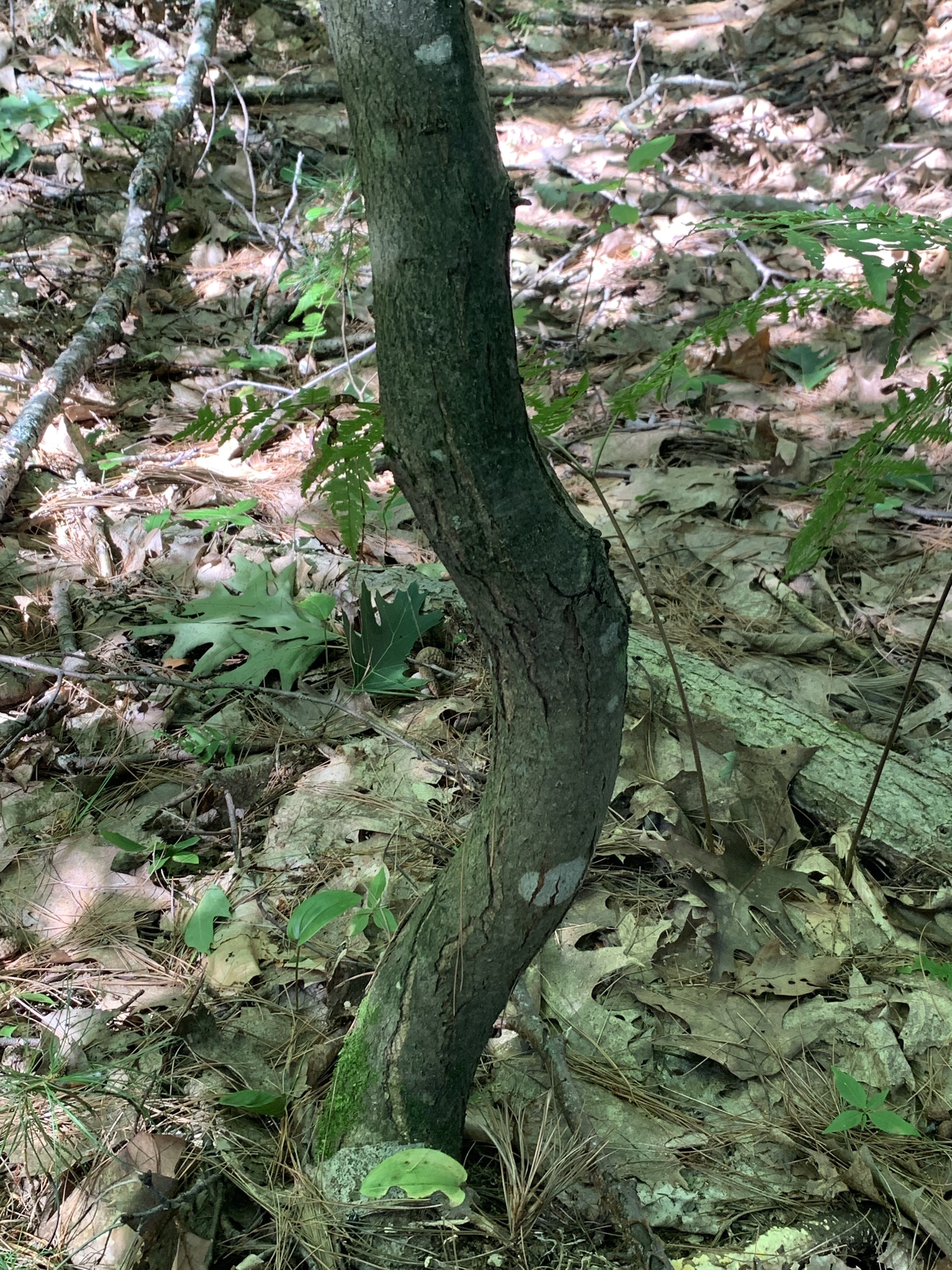
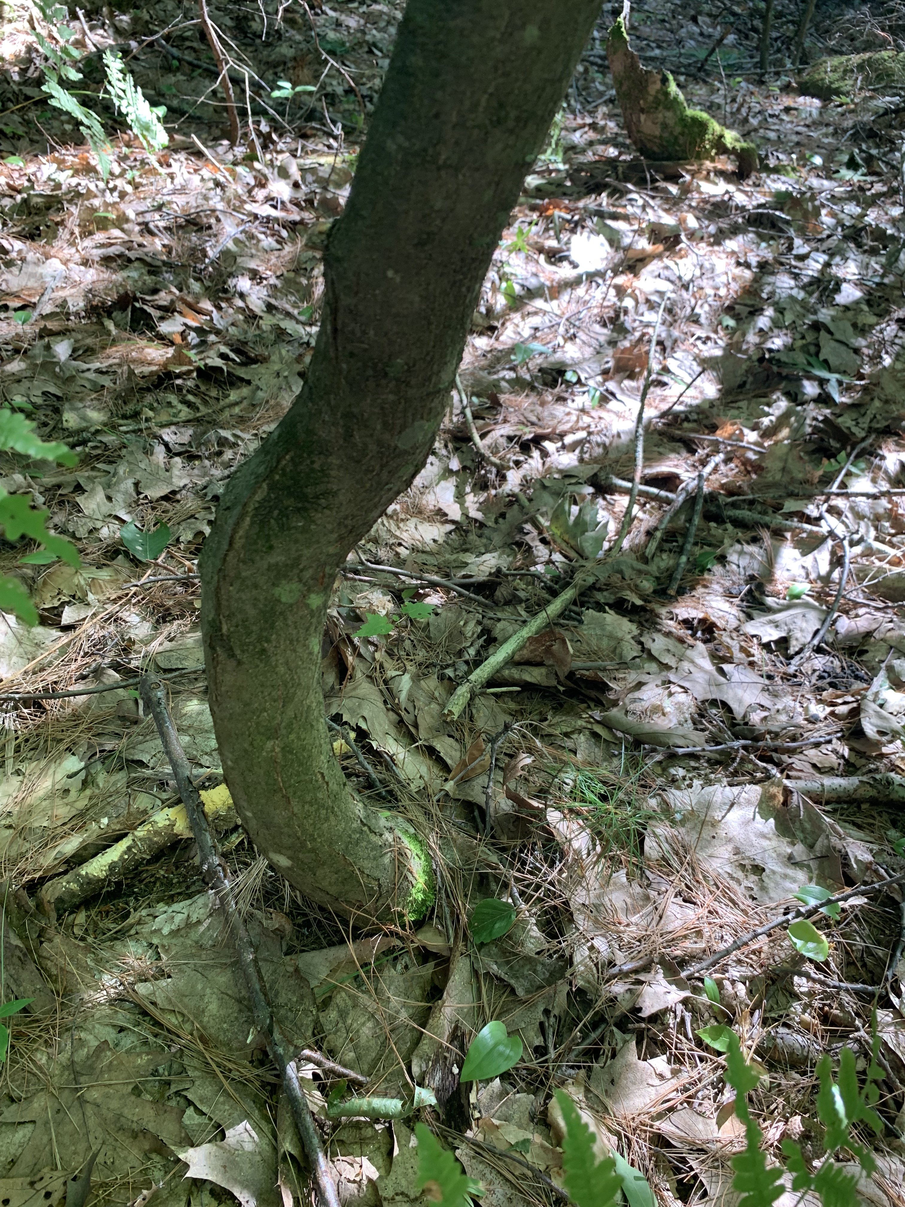
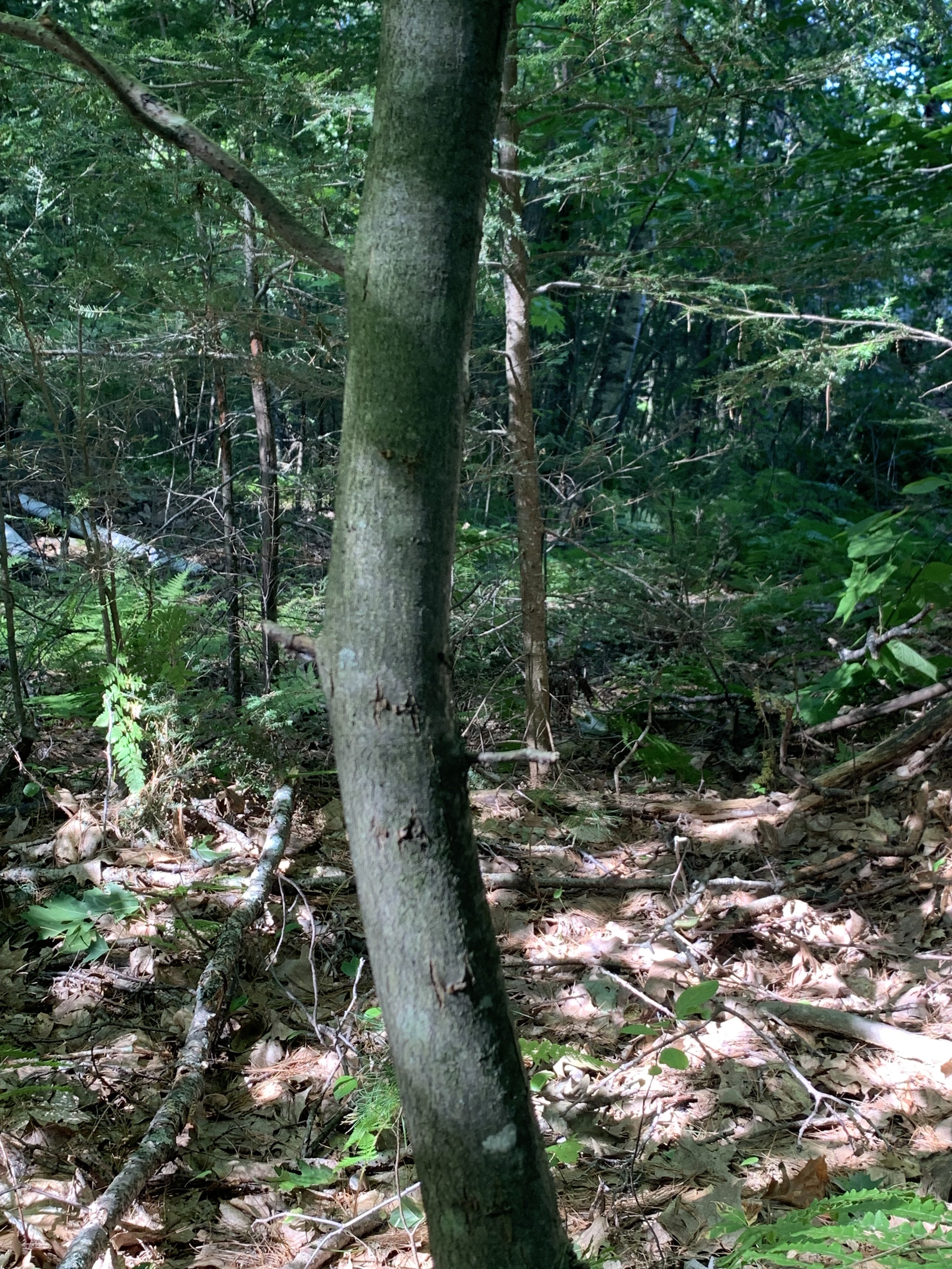
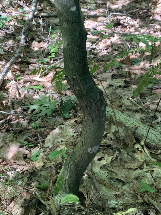
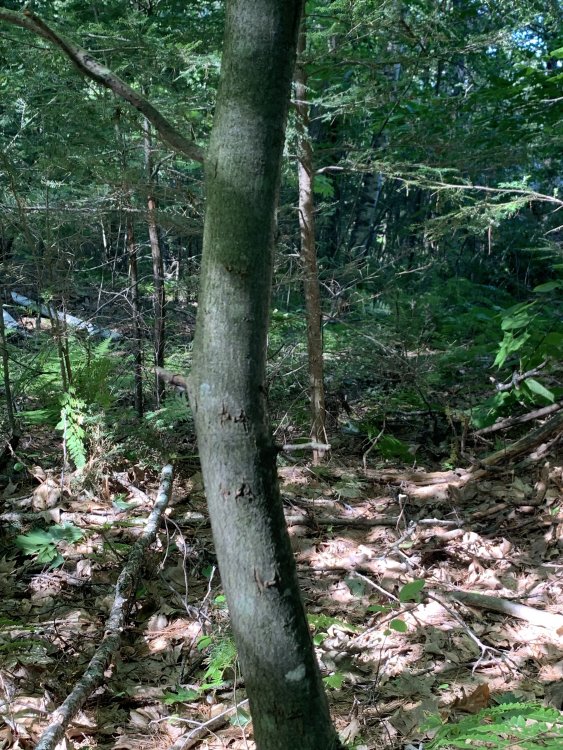
The bottom of the tree is a little rough looking. Do these look like the start of cankers?

-
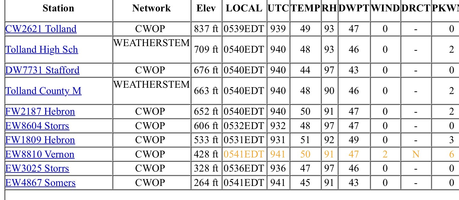
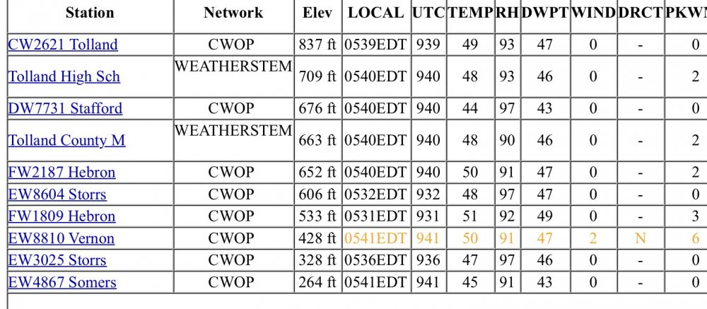
Probably 45F on his official COOP sensor. His raw COOP forms are always trip. He loves putting "temp in valley xF" whenever it's a torch day or a rad cooling night. Your shielded decade old sensor is probably more accurate than his unshielded max/min one.
-
lol
-
Alex had 34.7F https://www.wunderground.com/dashboard/pws/KNHCARRO4
-
I guess Ill have to catch it in the spring to see if it flowers. I was going to clear a few beeches around it, but it's doing pretty well on its own so I won't go messing with it until I start seeing some signs of cankers.
-
HIE 34F Congrats Alex
-
-
EEN 40 HIE 35
-
Congrats!
-
High was 68° yesterday. They’ve been stick at 50° for awhile with a breeze, but they should probably sneak some 40s in.
-
Literally just woke up to the rooster crowing...ugh. 46°
-
52/45 with 6kt sustained. Not bad.
-
Get any freezes out there?