dendrite
-
Posts
75,087 -
Joined
Content Type
Profiles
Blogs
Forums
American Weather
Media Demo
Store
Gallery
Everything posted by dendrite
-
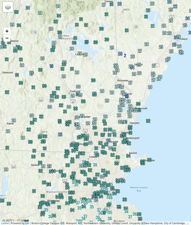
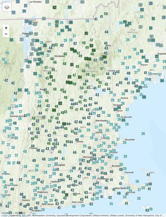
28.2° SN 0.8”
-
-
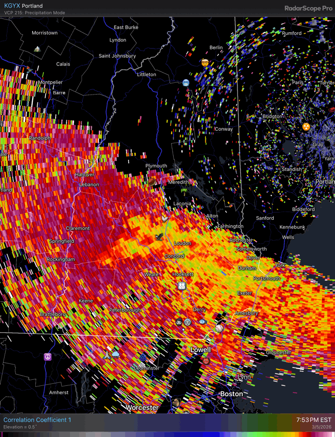
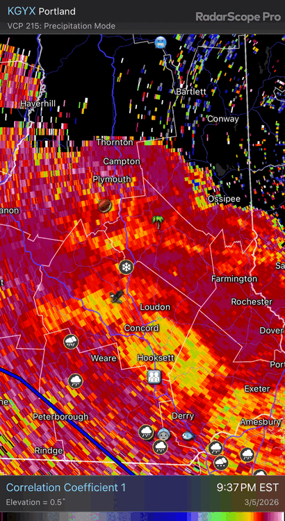
Still a lot of low CC on dual pol up here but we’ve been in the better lift and all snow for awhile.
-
29.0° SN Just talked to my mom and it’s snowing on the north end in Manch.
-
All snow 29.9° Should mix or flip at MHT within the next hour
-
Starting to flip from here to CON…CC climbing

-
Similar here. Mostly sleet, but a few slower falling flakes mixed in. 30.2°
-
HRRR is still trying to give CON/MHT 6”
-
Hopefully +3C
-
31° with light freezing rain and sleet
-
Hopefully his ceiling caves in
-
32/26 here after a high of 49°. Not bad. Hopefully it freezes up a bit so we don’t get a mucky refrozen layer on the bottom of the driveway.
-
You’ll be mostly frozen…may as well cheer on snow over sleet.
-
Radar looks okay but remember the reflectivities are mostly rain and some brightbanding aloft right now to our west. (ENX and OKX)
-
Good luck with Precious
-
He wants an icestorm
-
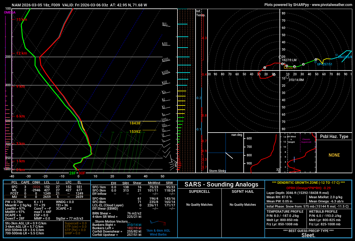
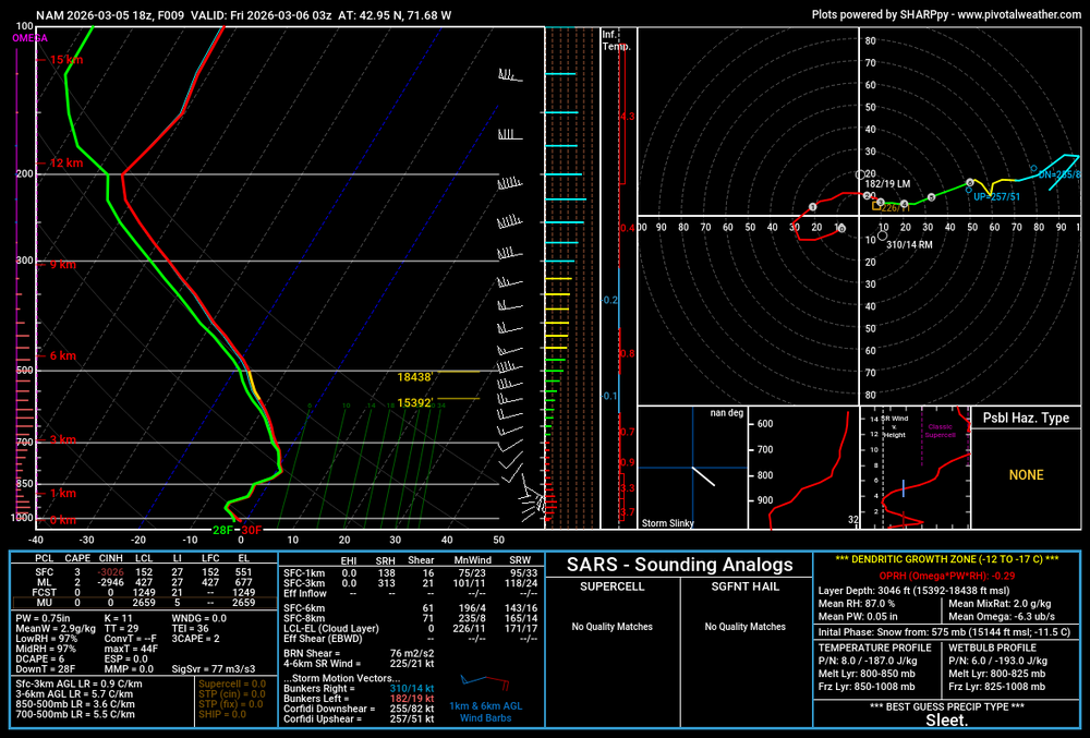
https://www.noaa.gov/jetstream/upperair/skew-t-log-p-diagrams On the left going up in white you have the pressure levels…sfc-1000mb up to 100mb. Horizontal axis is temp/dew in degC…temp is red…dew green. The temp lines slant up and to the right 45°. There’s a little nose of air a bit above 850mb that is higher than 0C.
-
3k is like 4-5” here
-
There’s your micro +1C layer. That’s dangerously close to a thump though.
-
Toss that
-
Christine sucking the life out of the air
-
They’re slowly advecting through Rockingham county now.
-
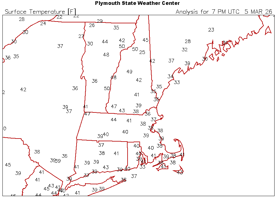
That’s a really bizarre sfc temp map for early March
-
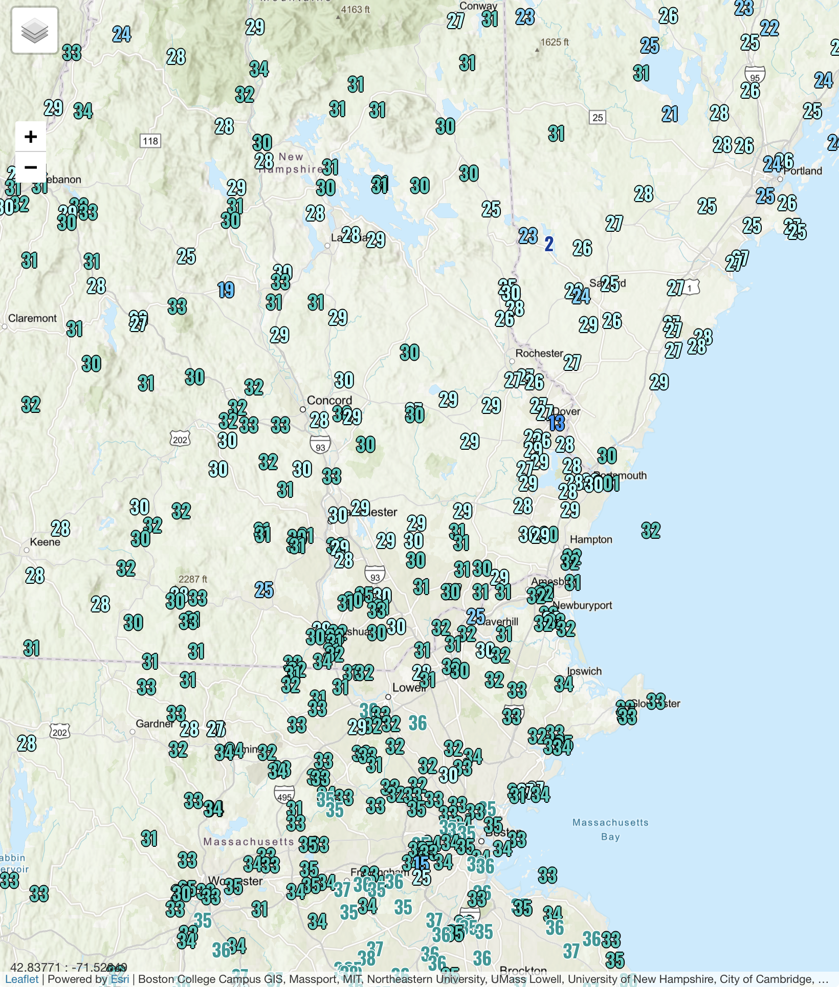
HIE 50…plymouth 49
-
Definitely getting an increase in ENE winds now despite similar sky conditions. Down to 44.7